Adrara San Rocco: Difference between revisions
RNLockwood (talk | contribs) mNo edit summary |
m Dating maintenance tags: {{Unreferencedsect}} |
||
| (33 intermediate revisions by 24 users not shown) | |||
| Line 1: | Line 1: | ||
{{multiple issues | |
|||
{{Expand Italian|topic=geo|date=December 2009|Adrara San Rocco}} |
|||
{{copyedit|date=November 2012}} |
|||
{{unref|date=November 2012}} |
|||
}} |
|||
{{Infobox Italian comune |
{{Infobox Italian comune |
||
| name = Adrara San Rocco |
| name = Adrara San Rocco |
||
| Line 12: | Line 7: | ||
| image_alt = |
| image_alt = |
||
| image_caption = |
| image_caption = |
||
| image_shield = Adrara_San_Rocco-Stemma. |
| image_shield = Adrara_San_Rocco-Stemma.svg |
||
| shield_alt = |
| shield_alt = |
||
| shield_size = |
| shield_size = |
||
| image_map = |
| image_map = |
||
| map_alt = |
| map_alt = |
||
| Line 20: | Line 15: | ||
| pushpin_label_position = |
| pushpin_label_position = |
||
| pushpin_map_alt = |
| pushpin_map_alt = |
||
| coordinates = {{coord|45|42|51|N|9|57|30|E|type:city(842)_region:IT|display=inline,title}} |
|||
| latd = 45 |latm = 42 |lats = 51 |latNS = N |
|||
| longd = 9 |longm = 57 |longs = 30 |longEW = E |
|||
| coordinates_type = type:city(842)_region:IT |
|||
| coordinates_display = title |
|||
| coordinates_footnotes = |
| coordinates_footnotes = |
||
| region = [[Lombardy]] |
| region = [[Lombardy]] |
||
| Line 29: | Line 21: | ||
| frazioni = |
| frazioni = |
||
| mayor_party = |
| mayor_party = |
||
| mayor = |
| mayor =Tiziano Piccioli Cappelli |
||
| area_footnotes = |
| area_footnotes = |
||
| area_total_km2 = 9. |
| area_total_km2 = 9.23 |
||
| population_footnotes = <ref name="istat">All demographics and other statistics: Italian statistical institute [[National Institute of Statistics (Italy)|Istat]].</ref> |
| population_footnotes = <ref name="istat">All demographics and other statistics: Italian statistical institute [[National Institute of Statistics (Italy)|Istat]].</ref> |
||
| population_total = |
| population_total = 820 |
||
| population_as_of = |
| population_as_of = 30 April 2017 |
||
| pop_density_footnotes = |
| pop_density_footnotes = |
||
| population_demonym = Sanrocchesi |
| population_demonym = Sanrocchesi |
||
| Line 49: | Line 41: | ||
}} |
}} |
||
'''Adrara San Rocco''' ( |
'''Adrara San Rocco''' ([[Bergamasque]]: {{lang|lmo|Dréra San Ròch}} or simply {{lang|lmo|San Ròch}}) is an Italian town in the province of Bergamo, in the administrative region of [[Lombardy]]. The town is located about {{convert|25|km|mi}} east of Bergamo and is situated in the [[Guerna]] river valley. The town is part of the Mountain Community of [[Monte Bronzone Sebino]]. |
||
The hills of San Fermo attract tourists for sports such as mountain biking, trekking and paragliding. |
|||
==History== |
==History== |
||
{{unreferencedsect|date=December 2022}} |
|||
| ⚫ | |||
| ⚫ | The province of Bergamo was devastated by fratricidal conflict between the [[Guelphs and Ghibellines|Guelph]] and [[Ghibelline]], which in turn created a large influx of refugees into Adrara from these remote and quiet areas. However, fighting broke out in Adrara as well and a castle was built to protect inhabitants from the incursions of violence among the villagers. |
||
| ⚫ | |||
| ⚫ | During the 14th century, the territory fell under the domination of the Calepio family, who took possession of most of the valley. In the following century the arrival of the [[Venetian Republic]] put a definitive end to the factional struggles. Adrara experienced a period of peace and economic prosperity, along with a corresponding increase in population. |
||
| ⚫ | |||
| ⚫ | |||
| ⚫ | During the |
||
| ⚫ | In 1668, the territory of Adrara was divided into two different entities: Adrara San Rocco and Adrara San Martino. Lingering disputes took a century to resolve. The division was formalized in 1754, ending with the awarding of five ninths of the land to the community of San Rocco and the remaining four ninths to San Martino. |
||
| ⚫ | |||
==Church== |
|||
| ⚫ | |||
| ⚫ | |||
| ⚫ | |||
| ⚫ | |||
== |
==People== |
||
| ⚫ | |||
The territory, located in a natural environment of some ecological depth, allows the country to exploit the considerable tourist potential of the hills of San Fermo. The area allows sports such as mountain biking, trekking, and paragliding. The food of the area is worth savoring.{{says who|date=November 2012}} |
|||
| ⚫ | |||
| ⚫ | |||
==Municipal government== |
|||
Mayor: Alfredo Mossali (Civic Party) since 30/05/2006 |
|||
==References== |
==References== |
||
| ⚫ | |||
{{commons category|Adrara San Rocco}} |
{{commons category|Adrara San Rocco}} |
||
| ⚫ | |||
{{Province of Bergamo}} |
{{Province of Bergamo}} |
||
{{authority control}} |
|||
Latest revision as of 01:55, 7 December 2022
Adrara San Rocco | |
|---|---|
| Comune di Adrara San Rocco | |
 | |
 Coat of arms | |
Location of Adrara San Rocco  | |
 Adrara San Rocco Location of Adrara San Rocco in Italy 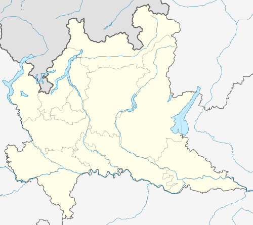 Adrara San Rocco Adrara San Rocco (Lombardy) | |
| Coordinates: 45°42′51″N 9°57′30″E / 45.71417°N 9.95833°E | |
| Country | Italy |
| Region | Lombardy |
| Province | Bergamo (BG) |
| Government | |
| • Mayor | Tiziano Piccioli Cappelli |
| Area | |
| • Total | 9.23 km2 (3.56 sq mi) |
| Elevation | 431 m (1,414 ft) |
| Population (30 April 2017)[2] | |
| • Total | 820 |
| • Density | 89/km2 (230/sq mi) |
| Demonym | Sanrocchesi |
| Time zone | UTC+1 (CET) |
| • Summer (DST) | UTC+2 (CEST) |
| Postal code | 24060 |
| Dialing code | 035 |
| Patron saint | St. Roch |
| Saint day | August 16 |
Adrara San Rocco (Bergamasque: Dréra San Ròch or simply San Ròch) is an Italian town in the province of Bergamo, in the administrative region of Lombardy. The town is located about 25 kilometres (16 mi) east of Bergamo and is situated in the Guerna river valley. The town is part of the Mountain Community of Monte Bronzone Sebino.
The hills of San Fermo attract tourists for sports such as mountain biking, trekking and paragliding.
History
[edit]The town dates from the Middle Ages, around the year 1000.[citation needed] The first documented evidence of settlement was the village of Adrara, which had not yet been divided into the two existing entities.
The province of Bergamo was devastated by fratricidal conflict between the Guelph and Ghibelline, which in turn created a large influx of refugees into Adrara from these remote and quiet areas. However, fighting broke out in Adrara as well and a castle was built to protect inhabitants from the incursions of violence among the villagers.
During the 14th century, the territory fell under the domination of the Calepio family, who took possession of most of the valley. In the following century the arrival of the Venetian Republic put a definitive end to the factional struggles. Adrara experienced a period of peace and economic prosperity, along with a corresponding increase in population.
After this time of peace, territorial conflicts emerged between the upstream parish of San Rocco and the downstream village of San Martino.
In 1668, the territory of Adrara was divided into two different entities: Adrara San Rocco and Adrara San Martino. Lingering disputes took a century to resolve. The division was formalized in 1754, ending with the awarding of five ninths of the land to the community of San Rocco and the remaining four ninths to San Martino.
Church
[edit]The parish church was dedicated to San Rocco, and dates from 1539. This church was restored during the seventeenth and nineteenth centuries. It has a long staircase outside that leads to the entrance. Inside are frescoes, among which are those made by the workshop of Francesco Capella.
The Shrine of Saint Faustino and Saint Giovita, better known as the sanctuary of the dead of Bondo, was built in the fourteenth century.
People
[edit]Literary critic and biographical author Eugenio Donadoni was born in San Rocco in 1870.
References
[edit]- ^ "Superficie di Comuni Province e Regioni italiane al 9 ottobre 2011". Italian National Institute of Statistics. Retrieved 16 March 2019.
- ^ All demographics and other statistics: Italian statistical institute Istat.