Bon Repos sur Blavet: Difference between revisions
Content deleted Content added
new munic. |
img, commonscat |
||
| Line 1: | Line 1: | ||
{{Infobox French commune |
{{Infobox French commune |
||
|name = Bon Repos sur Blavet |
|name = Bon Repos sur Blavet |
||
|image = |
|image = Abbaye Notre-Dame de Bon-Repos à Saint-Gelven - Côtes d'Armor (22) - France - 04.jpg |
||
|caption = |
|caption = The abbey of Notre-Dame of Bon-Repos, in Saint-Gelven |
||
|image coat of arms = |
|image coat of arms = |
||
|arrondissement = Guingamp |
|arrondissement = Guingamp |
||
| Line 25: | Line 25: | ||
== References == |
== References == |
||
{{commonscat|Bon Repos sur Blavet}} |
|||
{{Reflist}} |
{{Reflist}} |
||
Revision as of 17:08, 8 April 2017
Bon Repos sur Blavet | |
|---|---|
 The abbey of Notre-Dame of Bon-Repos, in Saint-Gelven | |
Location of Bon Repos sur Blavet  | |
 Bon Repos sur Blavet 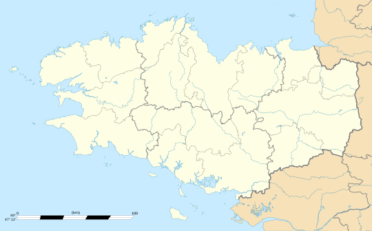 Bon Repos sur Blavet | |
| Coordinates: 48°14′31″N 3°07′19″W / 48.242°N 3.122°W | |
| Country | France |
| Region | Brittany |
| Department | Côtes-d'Armor |
| Arrondissement | Guingamp |
| Canton | Rostrenen |
| Intercommunality | Kreiz-Breizh |
| Area 1 | 53.91 km2 (20.81 sq mi) |
| Population (2014) | 1,276 |
| • Density | 24/km2 (61/sq mi) |
| Time zone | UTC+01:00 (CET) |
| • Summer (DST) | UTC+02:00 (CEST) |
| INSEE/Postal code | 22107 /22570 |
| 1 French Land Register data, which excludes lakes, ponds, glaciers > 1 km2 (0.386 sq mi or 247 acres) and river estuaries. | |
Bon Repos sur Blavet is a commune in the department of Côtes-d'Armor, western France. The municipality was established on 1 January 2017 by merger of the former communes of Laniscat (the seat), Perret and Saint-Gelven.[1]
See also
References
Wikimedia Commons has media related to Bon Repos sur Blavet.
- ^ Arrêté préfectoral 30 August 2016 Template:Fr
This Côtes-d'Armor geographical article is a stub. You can help Wikipedia by expanding it. |