Brech
Brech
Brec'h | |
|---|---|
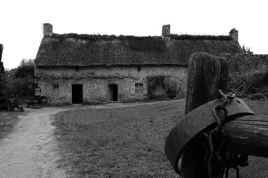 The museum of Saint-Dégan | |
Location of Brech  | |
 Brech 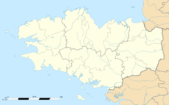 Brech | |
| Coordinates: 47°43′17″N 2°59′40″W / 47.7214°N 2.9944°W | |
| Country | France |
| Region | Brittany |
| Department | Morbihan |
| Arrondissement | Lorient |
| Canton | Pluvigner |
| Intercommunality | Auray Quiberon Terre Atlantique |
| Government | |
| • Mayor (2020–2026) | Fabrice Robelet[1] |
| Area 1 | 40.86 km2 (15.78 sq mi) |
| Population (2021)[2] | 6,924 |
| • Density | 170/km2 (440/sq mi) |
| Time zone | UTC+01:00 (CET) |
| • Summer (DST) | UTC+02:00 (CEST) |
| INSEE/Postal code | 56023 /56400 |
| Elevation | 0–66 m (0–217 ft) |
| 1 French Land Register data, which excludes lakes, ponds, glaciers > 1 km2 (0.386 sq mi or 247 acres) and river estuaries. | |
Brech (French pronunciation: [bʁɛk]; Breton: Brec'h, [ˈbrɛːx]) is a commune in the Morbihan department, region of Brittany, northwestern France.
Population
Inhabitants of Brec'h are called in French Brechois.
| Year | Pop. | ±% p.a. |
|---|---|---|
| 1968 | 2,909 | — |
| 1975 | 3,079 | +0.81% |
| 1982 | 3,554 | +2.07% |
| 1990 | 3,990 | +1.46% |
| 1999 | 4,500 | +1.35% |
| 2007 | 6,125 | +3.93% |
| 2012 | 6,616 | +1.55% |
| 2017 | 6,637 | +0.06% |
| Source: INSEE[3] | ||
Breton language
In 2008, 19.56% of primary-school children attended bilingual schools.[4]
See also
References
- ^ "Maires du Morbihan" (PDF). Préfecture du Morbihan. 7 July 2020.
- ^ "Populations légales 2021" (in French). The National Institute of Statistics and Economic Studies. 28 December 2023.
- ^ Population en historique depuis 1968, INSEE
- ^ (in French) Ofis ar Brezhoneg: Enseignement bilingue
External links
- Official site (in French)
- Base Mérimée: Search for heritage in the commune, Ministère français de la Culture. (in French)
- Mayors of Morbihan Association (in French)
Wikimedia Commons has media related to Brech.
| International | |
|---|---|
| National | |
This Morbihan geographical article is a stub. You can help Wikipedia by expanding it. |