Khnushinak: Difference between revisions
AntonSamuel (talk | contribs) Undid revision 1021948281 by ListeningBronco (talk) Restoring multiple-layer NKR/Artsakh location map changed without consensus, see relevant discussions on Talk:Stepanakert and Wikipedia:Administrators' noticeboard/Incidents for context |
m Removing Category:Populated places in Martuni Province per Wikipedia:Categories for discussion/Log/2024 June 22#Category:Populated places in the Republic of Artsakh |
||
| (26 intermediate revisions by 12 users not shown) | |||
| Line 1: | Line 1: | ||
{{short description|Village in Khojavend District, Nagorno-Karabakh}} |
|||
{{Infobox settlement |
{{Infobox settlement |
||
|name = Khnushinak |
|name = Khnushinak |
||
|native_name = Խնուշինակ |
|native_name = Խնուշինակ |
||
| |
|other_name = Xanoba |
||
|image_skyline = Գյուղատեղի «Խնուշինակ», 17-19 դդ.jpg |
|image_skyline = Գյուղատեղի «Խնուշինակ», 17-19 դդ.jpg |
||
|image_caption = Scenery around Khnushinak |
|image_caption = Scenery around Khnushinak |
||
| |
|image_size = 300px |
||
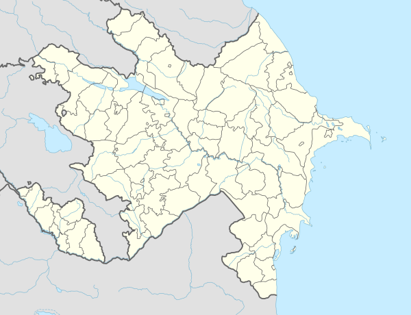
|pushpin_map = Azerbaijan |
|||
|pushpin_mapsize = 300 |
|pushpin_mapsize = 300 |
||
|subdivision_type = |
|subdivision_type = |
||
|subdivision_name = |
|subdivision_name = |
||
|subdivision_type1 = |
|subdivision_type1 = |
||
|subdivision_name1 = |
|subdivision_name1 = |
||
|subdivision_type2 = |
|subdivision_type2 = Country |
||
|subdivision_name2 = |
|subdivision_name2 = {{flag|Azerbaijan}} |
||
|subdivision_type3 = {{*}} [[Administrative divisions of Azerbaijan|District]] |
|||
|subdivision_name3 = [[Khojavend District|Khojavend]] |
|||
|leader_title = |
|leader_title = |
||
|leader_name = |
|leader_name = |
||
| Line 23: | Line 27: | ||
|population_total = 615 |
|population_total = 615 |
||
|population_density_km2 = |
|population_density_km2 = |
||
|timezone = [[ |
|timezone = [[Azerbaijan Time|AZT]] |
||
|utc_offset = +4 |
|utc_offset = +4 |
||
|timezone_DST = |
|timezone_DST = |
||
| Line 32: | Line 36: | ||
|website = |
|website = |
||
}} |
}} |
||
'''Khnushinak''' ({{lang-hy|Խնուշինակ}}) or '''Khanoba''' ({{lang-az|Xanoba}}) is a village |
'''Khnushinak''' ({{lang-hy|Խնուշինակ}}) or '''Khanoba''' ({{lang-az|Xanoba}}) is a village located in the [[Khojavend District]] of [[Azerbaijan]], in the region of [[Nagorno-Karabakh]]. The village had an ethnic [[Armenians|Armenian]] population before 2023 and in 1989.<ref>{{cite web |url=https://drugoivzgliad.com/karabach-mir-i-voina-a-zubov/ |title=Андрей Зубов. Карабах: Мир и Война |author=Андрей Зубов |website=drugoivzgliad.com}}</ref> |
||
== History == |
== History == |
||
During the Soviet period, the village was a part of the [[Martuni District (NKAO)|Martuni District]] of the [[Nagorno-Karabakh Autonomous Oblast]]. |
During the [[Soviet Union|Soviet]] period, the village was a part of the [[Martuni District (NKAO)|Martuni District]] of the [[Nagorno-Karabakh Autonomous Oblast]]. |
||
== Historical heritage sites == |
|||
Historical heritage sites in and around the village include the 19th-century church of ''Surb Astvatsatsin'' ({{lang-hy|Սուրբ Աստվածածին}}, {{lit|Holy Mother of God}}), and the 19th/20th-century village of ''Hin Khnushinak'' ({{lang-hy|Հին Խնուշինակ}}, {{lit|Old Khnushinak}})<ref name="2015statistics"/> |
|||
== Economy and culture == |
|||
The population is mainly engaged in [[agriculture]] and [[animal husbandry]]. As of 2015, the village has a municipal building, a house of culture, a secondary school, two shops, and a medical centre.<ref name="2015statistics"/> |
|||
== Demographics == |
== Demographics == |
||
| Line 41: | Line 52: | ||
== Gallery == |
== Gallery == |
||
<gallery mode="packed" heights=" |
<gallery mode="packed" heights="180"> |
||
Եկեղեցի «Սբ. Աստվածածին» |
Եկեղեցի «Սբ. Աստվածածին».jpg|St. Astvatsatsin Church |
||
Եկեղեցի «Սբ. Աստվածածին», Խնուշինակ.jpg|St. Astvatsatsin Church interior |
|||
Memorial, Khnushinak village.jpg|A monument for the fallen in the [[First Nagorno-Karabakh War]] |
Memorial, Khnushinak village.jpg|A monument for the fallen in the [[First Nagorno-Karabakh War]] |
||
Old village, Knushinak.jpg|The ruined village of Hin Khnushinak |
|||
</gallery> |
</gallery> |
||
| Line 51: | Line 64: | ||
== External links == |
== External links == |
||
{{Commons}} |
{{Commons}} |
||
*{{GEOnet2|32FA88150A413774E0440003BA962ED3}} |
* {{GEOnet2|32FA88150A413774E0440003BA962ED3}} |
||
{{Martuni Province}} |
{{Martuni Province}} |
||
{{Khojavend District}} |
{{Khojavend District}} |
||
{{Portal bar|Geography}} |
{{Portal bar|Geography}} |
||
| ⚫ | |||
{{Khojavend-geo-stub}} |
{{Khojavend-geo-stub}} |
||
{{Artsakh-geo-stub}} |
{{Artsakh-geo-stub}} |
||
| ⚫ | |||
[[Category:Populated places in Martuni province]] |
|||
[[Category:Populated places in the Republic of Artsakh]] |
|||
[[Category:Nagorno-Karabakh]] |
|||
Latest revision as of 19:58, 3 July 2024
Khnushinak
Խնուշինակ Xanoba | |
|---|---|
 Scenery around Khnushinak | |
 Khnushinak | |
| Coordinates: 39°45′51.8″N 47°02′25.8″E / 39.764389°N 47.040500°E | |
| Country | |
| • District | Khojavend |
| Population (2015)[1] | |
| • Total | 615 |
| Time zone | UTC+4 (AZT) |
Khnushinak (Armenian: Խնուշինակ) or Khanoba (Azerbaijani: Xanoba) is a village located in the Khojavend District of Azerbaijan, in the region of Nagorno-Karabakh. The village had an ethnic Armenian population before 2023 and in 1989.[2]
History
[edit]During the Soviet period, the village was a part of the Martuni District of the Nagorno-Karabakh Autonomous Oblast.
Historical heritage sites
[edit]Historical heritage sites in and around the village include the 19th-century church of Surb Astvatsatsin (Armenian: Սուրբ Աստվածածին, lit. 'Holy Mother of God'), and the 19th/20th-century village of Hin Khnushinak (Armenian: Հին Խնուշինակ, lit. 'Old Khnushinak')[1]
Economy and culture
[edit]The population is mainly engaged in agriculture and animal husbandry. As of 2015, the village has a municipal building, a house of culture, a secondary school, two shops, and a medical centre.[1]
Demographics
[edit]The village had 664 inhabitants in 2005,[3] and 615 inhabitants in 2015.[1]
Gallery
[edit]-
St. Astvatsatsin Church
-
St. Astvatsatsin Church interior
-
A monument for the fallen in the First Nagorno-Karabakh War
-
The ruined village of Hin Khnushinak


References
[edit]- ^ a b c d Hakob Ghahramanyan. "Directory of socio-economic characteristics of NKR administrative-territorial units (2015)".
- ^ Андрей Зубов. "Андрей Зубов. Карабах: Мир и Война". drugoivzgliad.com.
- ^ "The Results of the 2005 Census of the Nagorno-Karabakh Republic" (PDF). National Statistic Service of the Republic of Artsakh.
External links
[edit]Capital: Martuni | ||
| Urban communities |  | |
| Rural communities | ||
| Not under Artsakh control |
| |

This Khojavend District location article is a stub. You can help Wikipedia by expanding it. |
This Artsakh location article is a stub. You can help Wikipedia by expanding it. |