Kadaň: Difference between revisions
replace deprecated "geobox2 map" with location map-based map |
mNo edit summary |
||
| (42 intermediate revisions by 21 users not shown) | |||
| Line 1: | Line 1: | ||
{{Infobox settlement |
|||
{{for|the 13th century Mongol leader|Kadan}} |
|||
| name = Kadaň |
|||
{{Geobox | Settlement |
|||
| other_name = |
|||
<!-- *** Heading *** --> |
|||
| |
| settlement_type = [[Obec|Town]] |
||
<!-- images --> |
|||
| other_name = |
|||
| |
| image_skyline = Kadaň 2016-10-16.jpg |
||
| image_caption = Panorama of the town with the Ohře River |
|||
<!-- *** Image *** --> |
|||
| |
| image_flag = Flag of Kadaň.svg |
||
| |
| image_shield = Coat of arms of Kadaň.svg |
||
<!-- |
<!-- location --> |
||
| subdivision_type = Country |
|||
| flag = Flag of Kadan.svg | flag_border = 1 |
|||
| |
| subdivision_name = {{CZE}} |
||
| subdivision_type1 = [[Regions of the Czech Republic|Region]] |
|||
<!-- *** Name *** --> |
|||
| subdivision_name1 = [[Ústí nad Labem Region|Ústí nad Labem]] |
|||
| etymology = |
|||
| subdivision_type2 = [[Districts of the Czech Republic|District]] |
|||
| official_name = |
|||
| subdivision_name2 = [[Chomutov District|Chomutov]] |
|||
| motto = |
|||
<!-- maps and coordinates --> |
|||
| nickname = |
|||
| image_map = |
|||
<!-- *** Country etc. *** --> |
|||
| |
| map_caption = |
||
| |
| pushpin_map = Czech Republic |
||
| |
| pushpin_relief = 1 |
||
| pushpin_map_caption = Location in the Czech Republic |
|||
| region = [[Ústí nad Labem Region|Ústí nad Labem]] |
|||
| coordinates = {{coord|50|22|34|N|13|16|17|E|display=inline,title}} |
|||
| region_type = [[Regions of the Czech Republic|Region]] |
|||
| coordinates_footnotes = |
|||
| district = [[Chomutov District|Chomutov]] |
|||
<!-- government type, leaders --> |
|||
| district_type = [[Districts of the Czech Republic|District]] |
|||
| |
| leader_title = Mayor |
||
| |
| leader_name = Jan Losenický |
||
<!-- |
<!-- established --> |
||
| |
| established_title = First mentioned |
||
| |
| established_date = 1183 |
||
<!-- |
<!-- area --> |
||
| |
| area_footnotes = |
||
| |
| area_total_km2 = 65.62 |
||
<!-- elevation --> |
|||
| coordinates = {{coord|50|22|34|N|13|16|17|E|display=inline,title}} |
|||
| elevation_footnotes = |
|||
| capital_coordinates = |
|||
| |
| elevation_m = 300 |
||
<!-- population --> |
|||
| highest = |
|||
| population_as_of = 2024-01-01 |
|||
| highest_elevation = |
|||
| population_footnotes = <ref>{{cite web |title=Population of Municipalities – 1 January 2024|url=https://www.czso.cz/csu/czso/population-of-municipalities-qexb0dqr2d|publisher=[[Czech Statistical Office]]|date=2024-05-17}}</ref> |
|||
| lowest = |
|||
| |
| population_total = 18165 |
||
| population_density_km2 = auto |
|||
| area = 65.62 |
|||
<!-- time zone(s) --> |
|||
| area_round = 2 |
|||
| timezone1 = [[Central European Time|CET]] |
|||
<!-- *** Population *** --> |
|||
| |
| utc_offset1 = +1 |
||
| timezone1_DST = [[Central European Summer Time|CEST]] |
|||
| population_date = 2006-08-28 |
|||
| utc_offset1_DST = +2 |
|||
| population_density = auto |
|||
<!-- |
<!-- postal codes, area code --> |
||
| |
| postal_code_type = Postal code |
||
| |
| postal_code = 432 01 |
||
| |
| area_code_type = |
||
| area_code = |
|||
<!-- *** Codes *** --> |
|||
<!-- website, footnotes --> |
|||
| timezone = [[Central European Time|CET]] |
|||
| |
| website = {{URL|https://www.mesto-kadan.cz/}} |
||
| |
| footnotes = |
||
| utc_offset_DST = +2 |
|||
| postal_code = 432 01 |
|||
| area_code = |
|||
| code = |
|||
<!-- *** Maps *** --> |
|||
| pushpin_map = Czechia |
|||
| pushpin_map_relief = 1 |
|||
| pushpin_map_caption = Location in the Czech Republic |
|||
| map1 = Kadan CV CZ.png |
|||
| map1_caption = Location in [[Chomutov District]] |
|||
<!-- *** Websites *** --> |
|||
| commons = Kadaň |
|||
| statistics = [http://www.statnisprava.cz/ebe/ciselniky.nsf/i/563102 statnisprava.cz] |
|||
| website = [http://www.mesto-kadan.cz/ www.mesto-kadan.cz] |
|||
<!-- *** Footnotes *** --> |
|||
| footnotes = |
|||
}} |
}} |
||
'''Kadaň''' ({{IPA-cs|ˈkadaɲ|-|Cs-Kadan.ogg}}; {{lang-de|Kaaden}}) |
'''Kadaň''' ({{IPA-cs|ˈkadaɲ|-|Cs-Kadan.ogg}}; {{lang-de|Kaaden}}) is a town in [[Chomutov District]] in the [[Ústí nad Labem Region]] of the [[Czech Republic]]. It has about 18,000 inhabitants. It lies on the banks of the [[Ohře]] river. Kadaň is a tourist centre with highlights being the [[Franciscan Monastery in Kadaň|Franciscan Monastery]] and the historical square with late Gothic Town Hall Tower. The historic town centre is well preserved and is protected by law as an [[Cultural monument (Czech Republic)#Monument reservations|urban monument reservation]]. |
||
The city lies on the banks of the river [[Ohře]]. Although it is situated in an industrial part of the Czech Republic there is no major industry within the city and people usually work in offices or have to commute. There are two large power plants nearby (Tušimice and Prunéřov). Kadaň is a tourist centre with highlights being the Franciscan Monastery and the historical square with late Gothic Town Hall Tower. It is also a town with the narrowest lane in the Czech Republic - Katova ulička with only 66.1 cm. |
|||
==Administrative parts== |
|||
== History == |
|||
The villages of Brodce, Kadaňská Jeseň, Meziříčí, Nová Víska, Pokutice, Prunéřov, Tušimice, Úhošťany and Zásada u Kadaně are administrative parts of Kadaň. |
|||
==Etymology== |
|||
=== Early history until the Thirty Years' War === |
|||
The name is most likely derived from the personal name Kadan, meaning "Kadan's (court)".<ref name=history>{{cite web |title=Kadaň historická|url=https://kadan.eu/kadan-historicka/|publisher=Město Kadaň|language=cs|access-date=2023-06-13}}</ref> |
|||
There are legends accrediting the beginnings of the town to [[Celt]]ic tribes. In the 1st century A.D. Germanic tribes came, but moved on in the great Germanic migration to the west. In the 6th century the country was settled by Slavs. Some talk about a castle on ''Úhošť'' hill that might have been called [[Battle of Wogastisburg|Wogastisburg]] where a battle between [[Franks]] and [[Slavic peoples|Slavs]] occurred in 631. The battle of [[Canburg]] in 805 is also often mentioned in connection with the town, but is a mistake because locality of this name (Canburg - Kanina) is in Middle Bohemia. |
|||
==Geography== |
|||
The first written record is, though, of the end of the 12th century - the Czech prince granted the "market town" of Kadaň to the [[Knights of St. John]]. Slavic rulers called German settlers into the country, offering them freedom but gaining taxes at the same time. The Knights Hospitaller built the first church in Kadaň - [[St. John the Baptist]] - which still stands in the part of town called Hospitaller Suburb, but is now in the [[Baroque]] style. In the 13th century, the town was promoted to a "Royal City". It began to thrive and a new town was built on the heights above the river, with a castle and [[Franciscan Monastery in Kadaň|Franciscan monastery]]. There was a big fire in 1362. However, Emperor [[Charles IV, Holy Roman Emperor|Charles IV]] who twice visited the city (1367 and 1374) granted it several municipal rights (home rule, a vineyard, and an annual market) that made it flourish again. The reign of [[Wenceslaus IV]] (Václav IV) produced the skilled clockmaker [[Mikuláš of Kadaň]] (''Mikuláš z Kadaně''), who, together with mathematician and astronomer [[Jan Sindel|Jan Šindel]], designed the [[Prague Orloj]]. |
|||
[[File:Kadaň, Na Strážišti.JPG|thumb|Kadaň Reservoir]] |
|||
Kadaň is located about {{convert|13|km|0}} southwest of [[Chomutov]] and {{convert|31|km|abbr=on}} northeast of [[Karlovy Vary]]. It lies on the border between the [[Most Basin]] and [[Doupov Mountains]]. The northern tip of the municipal territory extends into the [[Ore Mountains]]. The highest point is the hill Dubový vrch at {{convert|691|m|ft|abbr=on}} above sea level, located on the southern border of the territory. A notable feature is also the [[Úhošť]] hill, which is together with its surroundings protected as a national nature reserve. |
|||
Kadaň is situated on the banks of the [[Ohře]] river. On the Ohře, there is Kadaň Reservoir with an area of {{convert|67.2|ha|abbr=on}}. It was completed in 1972. Its main purpose is to ensure a minimum flow under the reservoir, but it also serves for the energy use and for recreation and water sports.<ref>{{cite web |title=Vodní dílo Kadaň|url=https://www.poh.cz/vodni-dilo-kadan/d-2600|publisher=Povodí Ohře|language=cs|access-date=2021-07-12}}</ref> |
|||
The 15th century brought a new dimension to the history of Kadaň: the town and castle often used to be pledged to royal creditors. At the end of the rule of [[George of Poděbrady]] first the town and later the castle was captured by [[Jan Hasištejnský z Lobkovic]] (John of Lobkowicz and Hassenstein), who seemed to see Kadaň as a suitable capital for his dependent territories. The establishment and construction of the monastery of the [[Franciscans]] of strict observance, built as a family burial-place and later a pardon place of [[Fourteen Holy Helpers]], may reflect his ambitions for the town. Jan Hasištejnský died in 1517 and is buried in the Church of Fourteen Holy Helpers. His tomb is still on display in the Church, now part of the municipal museum. The same year saw the beginning of the [[Protestant Reformation|Reformation]] in Germany, which had an immediate impact on the atmosphere in German speaking Kadaň. In 1534, "Kadaň religious peace" was negotiated here between [[Württemberg]] Protestants and [[Ferdinand I, Holy Roman Emperor]] for the Catholic side. In the [[Thirty Years' War]] during the next century, Kadaň suffered from fires and plundering by various armies on their way to the battlefields of [[Bohemia]]. After the war, the formerly Czech-German town became a monolingual German domain. |
|||
===Climate=== |
|||
=== The Age of Enlightenment until the 19th century === |
|||
{{Weather box |
|||
[[File:Kadan river.jpg|thumb|right|Kadaň seen from the river]]During the [[Silesian Wars]] Kadaň was a foothold for the withdrawing French army that fortified in the Franciscan monastery and was besieged by Hungarian and Croatian units of the Austrian army. The door of the monastery church still shows the bullet holes from that battle on October 14, 1742. The town caught fire in 1746, providing a great opportunity for Kadaň's "Christopher Wren" - ''Johann Christoph Kosch''. He built many Baroque buildings, including the Church of the [[Elevation of the Holy Cross]], the Church of the Holy Family and the monastery of the [[Order of St. Elisabeth]]. The Castle of Kadaň was rebuilt to serve as a barracks in the time of [[Maria Theresa of Austria]]. Her son [[Joseph II, Holy Roman Emperor|Joseph II]] visited Kadaň in 1779. Joseph's reforms also affected town life. The monastery of [[Minorites]] was closed and thereafter became the premises of the first Grammar School under control of the [[Piarists]] from 1803 to 1823. 1788 saw the inauguration of the town municipal council. [[Jakob Marzel Sternberger]] was its first Mayor and held office until 1822. His great-grandson [[Jacob Sternberger]] emigrated to the United States in 1850 as part of the first wave of European immigrants of that time ([[Max Kade]] Institute). |
|||
|location = Tušimice (1991–2020) |
|||
|width = auto |
|||
|collapsed = yes |
|||
|metric first = yes |
|||
|single line = yes |
|||
|Jan record high C = 16.6 |
|||
|Feb record high C = 19.3 |
|||
|Mar record high C = 22.1 |
|||
|Apr record high C = 27.8 |
|||
|May record high C = 31.6 |
|||
|Jun record high C = 36.7 |
|||
|Jul record high C = 36.7 |
|||
|Aug record high C = 37.9 |
|||
|Sep record high C = 31.6 |
|||
|Oct record high C = 25.6 |
|||
|Nov record high C = 19.4 |
|||
|Dec record high C = 14.3 |
|||
|year record high C = 37.9 |
|||
|Jan high C = 2.4 |
|||
|Feb high C = 4.4 |
|||
|Mar high C = 9.0 |
|||
|Apr high C = 15.1 |
|||
|May high C = 19.5 |
|||
|Jun high C = 22.8 |
|||
|Jul high C = 25.1 |
|||
|Aug high C = 25.0 |
|||
|Sep high C = 19.6 |
|||
|Oct high C = 13.1 |
|||
|Nov high C = 6.8 |
|||
|Dec high C = 3.1 |
|||
|year high C = 13.8 |
|||
|Jan mean C = -0.2 |
|||
|Feb mean C = 0.8 |
|||
|Mar mean C = 4.3 |
|||
|Apr mean C = 9.3 |
|||
|May mean C = 13.8 |
|||
|Jun mean C = 17.2 |
|||
|Jul mean C = 19.1 |
|||
|Aug mean C = 18.5 |
|||
|Sep mean C = 13.7 |
|||
|Oct mean C = 8.6 |
|||
|Nov mean C = 4.0 |
|||
|Dec mean C = 0.7 |
|||
|year mean C = 9.1 |
|||
|Jan low C = -2.8 |
|||
|Feb low C = -2.3 |
|||
|Mar low C = 0.5 |
|||
|Apr low C = 3.8 |
|||
|May low C = 8.1 |
|||
|Jun low C = 11.6 |
|||
|Jul low C = 13.5 |
|||
|Aug low C = 13.0 |
|||
|Sep low C = 9.2 |
|||
|Oct low C = 5.1 |
|||
|Nov low C = 1.5 |
|||
|Dec low C = -1.7 |
|||
|year low C = 5.0 |
|||
|Jan record low C = -19.2 |
|||
|Feb record low C = -17.7 |
|||
|Mar record low C = -13.6 |
|||
|Apr record low C = -6.9 |
|||
|May record low C = -1.1 |
|||
|Jun record low C = 1.8 |
|||
|Jul record low C = 5.4 |
|||
|Aug record low C = 5.1 |
|||
|Sep record low C = -0.2 |
|||
|Oct record low C = -8.2 |
|||
|Nov record low C = -10.6 |
|||
|Dec record low C = -21.0 |
|||
|year record low C = -21.0 |
|||
|precipitation colour = green |
|||
|Jan precipitation mm = 23.4 |
|||
|Feb precipitation mm = 16.7 |
|||
|Mar precipitation mm = 24.6 |
|||
|Apr precipitation mm = 25.0 |
|||
|May precipitation mm = 49.4 |
|||
|Jun precipitation mm = 58.7 |
|||
|Jul precipitation mm = 64.6 |
|||
|Aug precipitation mm = 55.6 |
|||
|Sep precipitation mm = 42.1 |
|||
|Oct precipitation mm = 32.1 |
|||
|Nov precipitation mm = 30.4 |
|||
|Dec precipitation mm = 30.0 |
|||
|year precipitation mm = 452.5 |
|||
|unit precipitation days = 1.0 mm |
|||
|Jan precipitation days = 6.4 |
|||
|Feb precipitation days = 4.7 |
|||
|Mar precipitation days = 6.8 |
|||
|Apr precipitation days = 5.8 |
|||
|May precipitation days = 8.4 |
|||
|Jun precipitation days = 8.5 |
|||
|Jul precipitation days = 9.1 |
|||
|Aug precipitation days = 7.9 |
|||
|Sep precipitation days = 6.9 |
|||
|Oct precipitation days = 6.9 |
|||
|Nov precipitation days = 6.8 |
|||
|Dec precipitation days = 6.9 |
|||
|year precipitation days = 85.1 |
|||
|Jan sun = 46.9 |
|||
|Feb sun = 79.7 |
|||
|Mar sun = 122.0 |
|||
|Apr sun = 182.6 |
|||
|May sun = 208.3 |
|||
|Jun sun = 216.1 |
|||
|Jul sun = 229.2 |
|||
|Aug sun = 224.4 |
|||
|Sep sun = 157.8 |
|||
|Oct sun = 95.0 |
|||
|Nov sun = 44.3 |
|||
|Dec sun = 38.5 |
|||
|year sun = 1644.7 |
|||
|source=[[National Oceanic and Atmospheric Administration|NOAA]]<ref>{{cite web |title=World Meteorological Organization Climate Normals for 1991-2020 — Tušimice|url=https://www.nodc.noaa.gov/archive/arc0216/0253808/2.2/data/0-data/Region-6-WMO-Normals-9120/CzechRepublic/CSV/Tusimice_11438.csv|publisher=National Oceanic and Atmospheric Administration|access-date=2024-01-12}}</ref>}} |
|||
==History== |
|||
The last great fire damaged the town in 1811 and since then, the historic centre has retained its pattern. After the [[Revolution of 1848]] the letdown town became a district centre. The institute of the district town lasted in Kadaň for 110 years when it was affiliated with [[Chomutov]] district. In the second half of the 19th century homeland study activities developed and a number of institutions, clubs and societies were established. The national composition of the Kadaň population was very explicit - over 90% German and only 3% Czech, with a Jewish community as well. |
|||
In the Bronze Age, the plateau on the [[Úhošť]] hill was inhabited, on which there was a [[Celts|Celtic]] hillfort. According to some theories, the Wogastisburg Castle stood here, which was the scene of the [[Battle of Wogastisburg]] between [[Franks]] and [[Slavs]] in 631.<ref>{{cite web |title=Tabulová hora – Úhošť|url=https://www.kudyznudy.cz/aktivity/tabulova-hora-uhost|publisher=CzechTourism|language=cs|access-date=2023-06-13}}</ref> |
|||
=== |
===11th–18th centuries=== |
||
The first written mention of Kadaň is from 1183. it was probably founded as a market settlement during the colonization of the area at the turn of the 11th and 12th centuries. In 1186, Duke [[Frederick, Duke of Bohemia|Frederick]] donated the settlement to the [[Knights Hospitaller]]. Around 1260, Kadaň was promoted to a free royal town and the castle was built. An extensive fire in 1362 destroyed the town and the castle, but everything was restored and supplemented with better fortifications. However, King [[Charles IV, Holy Roman Emperor|Charles IV]] granted it several municipal rights (a vineyard, and an annual market) that made it flourish again.<ref name=history/> |
|||
At the start of the 20th century, the "Society of Friends of the Museum in Kaaden" decided to document the towns' history by opening a museum. |
|||
In 1421, during the [[Hussite Wars]], the town was conquered by the [[Hussites]], who controlled it until the end of the wars. From the mid-15th century, the town was pledged to various creditors of the royal chamber. The most notable of them was the [[Lobkowicz family]], who held the town from 1469 to 1519. [[Jan Hasištejnský of Lobkowicz]] founded the [[Franciscan Monastery in Kadaň|Franciscan Monastery]] and the Church of the [[Fourteen Holy Helpers]].<ref name=history/> |
|||
In the final weeks of [[World War I]], [[Czechoslovakia]] was established on 28 October 1918, its Bohemian, Moravian and Silesian component having been defined by the historic borders of the Czech (Bohemian) kingdom. However, most of the German border population, was not enthusiastic about becoming part of a new republic with a clearly Slavonic definition. Instead, four regional self-governed states emerged along the borderland, according to the right for [[self determination]] guaranteed by [[Woodrow Wilson]] in no. 10 of his [[Fourteen Points]]. Kaaden, (Kadaň in Czech), declared itself part of [[German Bohemia]]. On 4 March 1919, the first assembly of the [[German Austria]]n parliament was the occasion for both peaceful and violent demonstrations in the mostly German-populated border cities. In Kadaň, the curfew and martial law was declared and the Czechoslovak military forces were sent in. The demonstration in Kadaň for [[self determination]] was the bloodiest. According to Swiss [[Neue Zürcher Zeitung]] report of 7 March 1919, 17 persons were killed, 30 badly wounded, and 80 wounded there. Over all, 25 victims were buried in a memorial grave at the central cemetery. It was restored after the fall of communism in 1989. |
|||
In 1534, "Kadaň religious peace" was negotiated here between [[Württemberg]] Protestants and Emperor [[Ferdinand I, Holy Roman Emperor|Ferdinand I]] for the Catholic side. After the [[Battle of White Mountain]] in 1620, violent re-Catholicization began in Kadaň. During the [[Thirty Years' War]], in 1631, 1635 and 1648, Kadaň suffered from fires and plundering by various armies. The Kadaň Castle remained a ruin until the second half of the 18th century, when it was rebuilt into barracks by Empress [[Maria Theresa]].<ref name=history/> |
|||
After the [[Munich Agreement]] in later September 1938, Kaaden became part of Reichsgau [[Sudetenland]]. The local Czech people were forced to move to central Czechoslovakia, the remaining ones and the Jewish community was strongly oppressed. The synagogue was burnt down during the [[Kristallnacht]] of November 9, 1939. According to [[Beneš decrees]], after the [[Second World War]], all of the German population was transferred ([[Flight and expulsion of Germans from Czechoslovakia during and after World War II]]), and the area was re-settled by Czech people, many without roots in this region. |
|||
===19th–20th centuries=== |
|||
[[File:Prefab.jpg|thumb|left|165px|A prefabricated house after reconstruction]] |
|||
[[File:Kadan river.jpg|thumb|Kadaň seen from the river before 1923]] |
|||
From the 1950s, new prefabricated housing estates were built that reached the outer parts of the historical conurbation in the 1960s and 70s. This expansion was necessary because many people had moved in to get jobs in the region's thriving mining and electrical industries. The historical monuments were dilapidated and uncared-for. Before 1989 some parts of the historical centre were intended to be replaced by modern housing. Fortunately the [[Velvet Revolution]] changed the trend of development in the town and brought about a change in attitudes towards the cultural values of the past. The historical heart of Kadaň began to be repaired and after 15 years it has become a pearl of the region. There is now a new site on the bank of the Ohře River being planned and projected- [[Maxipes Fík]] Embankment with a lot of attractions both for children and adults. The town has been turning to be a tourist centre of the predominantly industrial region. The only drawback for tourism is the lack of a higher-capacity hotel in the town. |
|||
The last great fire damaged the town in 1811.<ref name=gymka>{{cite web |title=Historie|url=https://www.gymka.cz/historie/|publisher=Gymnázium Kadaň|language=cs|access-date=2023-06-13}}</ref> After the [[Revolution of 1848]], the town became a district centre. The institute of the district town lasted in Kadaň for 110 years when it was affiliated with [[Chomutov District]].<ref>{{cite web |title=Historický lexikon obcí České republiky 1869–2011|url=https://www.czso.cz/documents/10180/20537734/13008415abc.pdf/f10f868d-ba44-4595-90af-e68862927794?version=1.1|publisher=Czech Statistical Office|page=218|language=cs|date=2015-12-21}}</ref> |
|||
After [[Czechoslovakia]] was established in 1918 and Kadaň became its part, most of the [[Sudeten Germans|Sudeten German]] disagreed with this decision. On 4 March 1919, they demonstrated for [[self determination]] and joining Austria. The Czechoslovak military forces were sent in and tried to control the crowd by shooting. The result of the so-called Kadaň massacre was at least 25 dead and dozens injured.<ref name=history/> |
|||
== Places of interest == |
|||
* [[Franciscan Monastery in Kadaň|Franciscan Monastery]] (museum) |
|||
* Town Hall Tower |
|||
* The Castle |
|||
* The Old Square |
|||
* Holy Tower |
|||
* Barbican |
|||
* Lookout Tower on Svatý kopeček (Holy Hill) |
|||
After the [[Munich Agreement]] in 1938, Kadaň was annexed by [[Nazi Germany]] and administered as part of [[Reichsgau Sudetenland]]. The local Czechs were forced to move to central Czechoslovakia and the Jewish community was sent to concentration camps in Germany. The synagogue was burned down during the [[Kristallnacht]] of 9 November 1939. According to [[Beneš decrees]], after [[World War II]], the German population was [[Expulsion of Germans from Czechoslovakia|expelled]] and the area was re-settled by Czechs.<ref name=history/> |
|||
== Galleries == |
|||
[[File:Galerie Kisza.jpg|thumb|80px|left|U netopýra]] |
|||
* |
|||
* Městská galerie Josefa Lieslera ("pod věží" - ''under the tower'') |
|||
* Městská galerie Karla Havlíčka ("na hradě" - ''in the castle'') |
|||
* Galerie U Netopýra also called Kisza Gallery, is one of the largest private galleries with permanent exhibition in Central Europe |
|||
* Galerie U Adama (Jitka Gavendová and František Vlček) |
|||
* Galerie Na půdě - "on the attic" (of the Franciscan Monastery) |
|||
* Pictures and photographs for sale are usually in a lot of local restaurants and boarding houses |
|||
== |
==Demographics== |
||
{{historical populations |
|||
* Emperor's Day (on last August Sunday, takes place on the square with a lot of attractions) |
|||
|cols=3|align=none |
|||
<!-- Deleted image removed: [[File:Emperor-Day.jpg|thumb|right|Emperor's Day]] --> |
|||
|1869|8262 |
|||
* [[Maxipes Fik|Maxipes Fík]] Birthday |
|||
|1880|10368 |
|||
* [[Wenceslas Pantaleon Kirwitzer|Kirwitzer]] Astronomical Day |
|||
|1890|11081 |
|||
|1900|11999 |
|||
|1910|13186 |
|||
|1921|12974 |
|||
|1930|13480 |
|||
|1950|7908 |
|||
|1961|10010 |
|||
|1970|15624 |
|||
|1980|18614 |
|||
|1991|17796 |
|||
|2001|17579 |
|||
|2011|17604 |
|||
|2021|17386 |
|||
|source=Censuses<ref>{{cite web |title=Historický lexikon obcí České republiky 1869–2011 – Okres Chomutov|url=https://www.czso.cz/documents/10180/20537734/130084150422.pdf/78a7a0a6-8132-41db-87c1-4a9c4fc6a5f3?version=1.2|publisher=Czech Statistical Office|pages=5–6|language=cs|date=2015-12-21}}</ref><ref>{{cite web |title=Population Census 2021: Population by sex|url=https://vdb.czso.cz/vdbvo2/faces/en/index.jsf?page=vystup-objekt-parametry&z=T&f=TABULKA&sp=A&skupId=4429&katalog=33515&pvo=SLD21001-OB-OK|work=Public Database|publisher=[[Czech Statistical Office]]|date=2021-03-27}}</ref>}} |
|||
==Economy== |
|||
Although Kadaň is situated in an industrial part of the Czech Republic, there is no major industry within the town. Tourism and services play an important role in the town's economy. There are two large power plants in the outskirts of the town, [[Tušimice Power Station]] and [[Prunéřov Power Station]]. The largest employers based in the town are the Kadaň Hospital, [[Hunter Douglas]] (a manufacturer of window coverings) and SD – Kolejová doprava (transporter of coal by rail).<ref>{{cite web |title=Registr ekonomických subjektů|url=https://www.czso.cz/csu/res/registr_ekonomickych_subjektu|work=Business Register|publisher=Czech Statistical Office|language=cs|access-date=2023-06-13}}</ref> |
|||
==Transport== |
|||
Kadaň is served by four train stations and stops, located on the Kadaň–[[Děčín]] railway line.<ref>{{cite web |title=Detail stanice Kadaň|url=https://www.cd.cz/stanice/kada/5453799|publisher=[[České dráhy]]|language=cs|access-date=2023-06-13}}</ref> |
|||
==Culture== |
|||
[[File:Smetanovy sady.jpg|thumb|[[Bedřich Smetana|Smetanovy]] sady Park]] |
|||
The most popular annual cultural event in Kadaň is ''Císařský den'' ("Emperor's day"), which commemorates the arrival of Emperor Charles IV into the town in 1367 and 1374. The historically tuned festival is accompanied by a music and theatre program on stage, a show of crafts and period costumes, games for children and others.<ref>{{cite web |title=Císařský den v Kadani 2023|url=https://www.kudyznudy.cz/akce/cisarsky-den-1|publisher=CzechTourism|language=cs|access-date=2023-06-13}}</ref> |
|||
Other annual events held in the town include: |
|||
* Maxipes Fík Birthday |
|||
* [[Wenceslas Pantaleon Kirwitzer|Kirwitzer]] Day |
|||
* Old Czech Carnival |
* Old Czech Carnival |
||
* Franciscan Summer |
* Franciscan Summer |
||
* Vine Harvest Festival |
* Vine Harvest Festival |
||
* ''Vysmáté léto'' |
* ''Vysmáté léto'' – Summer Music Fest |
||
* Nativity Play |
* Nativity Play |
||
* Passion of Christ Play |
* Passion of Christ Play |
||
== |
==Religion== |
||
There are churches and chapels of four Christian denominations: [[Roman Catholic Church]], [[Czechoslovak Hussite Church]], [[Evangelical Church of Czech Brethren]] and [[Eastern Orthodox Church]]. |
|||
[[File:Zemedelska skola.jpg|thumb|120px|right|Agricultural School]][[File:Gymnasium in Kadaň.jpg|thumb|120px|left|Gymnasium]][[File:Prumyslova skola.jpg|thumb|120px|left|Industrial School]] |
|||
Kadaň is home to several secondary schools with a long history. |
|||
The oldest of them is the '''[[Gymnasium Kadaň|Gymnasium]]''' that was established in 1803 with 99 students and continued under the control of the [[Piarists]] until 1823. The seat of the old '''[[Gymnasium Kadaň|Gymnasium]]''' was a former [[Minorites]] Monastery (different from the Franciscan Monastery) near the square in a building which is now residence of the Regional Archives. The institute of '''[[Gymnasium Kadaň|Gymnasium]]''' was then reestablished in 1872 in a new building. The '''[[Gymnasium Kadaň|Gymnasium]]''' was again closed in 1951 and the new Industrial School moved to the building. It is still there today. A new '''[[Gymnasium Kadaň|Gymnasium]]''' was established in 1968 and has remained on the same premises since 1978. The Industrial School specialized at first on mining (because of the [[lignite]] and [[uranium]] mines in the surroundings), however since 1957 it has been specialized on building and finally in 2001 it added Commercial Academy to its educational program so now it is called '''Industrial Building School and Commercial Academy'''. The '''Agriculture School''' (now '''''SOŠS a SOU Amos''''') was established in 1862 as so-called ''Ackerbauschule''. In front of the building there are valuable statues of [[Albrecht Thaer|Albrecht Daniel Thaer]] and [[Justus von Liebig]] (restored in 2003). The teaching in all the schools was in German language until 1945. There are 4 Elementary Schools in Kadaň and a school for handicapped children. |
|||
== |
==Education== |
||
[[File:Kaaden-Gymnasium-1.jpg|thumb|Gymnasium]] |
|||
[[File:SPŠS a OA Kadaň.jpg|thumb|Industrial school]] |
|||
Kadaň is home to two secondary schools: [[Gymnasium Kadaň]], and Secondary Industrial School of Construction and Business Academy.<ref>{{cite web |title=Přehled škol a školských zařízení|url=https://rejstriky.msmt.cz/rejskol/|work=Rejstřík škol a školských zařízení – Kadaň, střední vzdělávání|publisher=[[Ministry of Education, Youth and Sports (Czech Republic)|Ministry of Education, Youth and Sports of the Czech Republic]]|language=cs|access-date=2023-06-13}}</ref> |
|||
The [[Gymnasium Kadaň]] was established in 1803 with 99 students and continued under the control of the [[Piarists]] until 1823. The seat of the old gymnasium was a former [[Minorites|Minorite]] monastery in a building which is now the seat of the Regional Archive. The institute of gymnasium was then reestablished in 1872 in a new building. The gymnasium was closed again in 1951 and the new Industrial School moved to the building. It is still there today. A new gymnasium was established in 1968 and has remained on the same premises since 1978.<ref name=gymka/> |
|||
=== History === |
|||
* [[Peter Georg Niger]] (Schwartz) (1434 - 1481 or 1484) - theologian |
|||
* [[Jan Hasištejnský z Lobkovic]] (1450 - 1517) - traveller, politician and writer |
|||
* Petr Štěrba ze Štěrbic (1517/18-1591) - scriber and translator |
|||
* Jan Sandel - translator from German ([[Wenceslaus Hájek]]'s ''[[Bohemian Chronicle]]'', 1543) |
|||
* [[Wenceslas Pantaleon Kirwitzer|Wenceslas (Václav) Pantaleon Kirwitzer]] (1588 - 1626 [[Macau]]) - astronomer |
|||
* [[Wilhelm Nigrinus]] (Schwartz) (1588 - 1638) ([[:de:Wilhelm Nigrinus]]), [[ethnologist]] |
|||
* [[Theodor Innitzer]] (1875 - 1955) - [[cardinal (Christianity)|cardinal]] [[archbishop]] of Vienna |
|||
* [[Hans Zeisel]] (1905 - 1992 [[Chicago]]), sociologist and economist |
|||
* [[Petr Klíma]] (1964 born to Kadaň parents in [[Chomutov]] hospital), ice hockey player, [[Stanley Cup]] winner (1990, [[Edmonton Oilers]]) |
|||
There are four primary schools and a school for handicapped children, managed by the town.<ref>{{cite web |title=Základní školy|url=https://www.mesto-kadan.cz/cs/organizace-a-sluzby/skoly-a-skolska-zarizeni/zakladni-skoly/|publisher=Město Kadaň|language=cs|access-date=2023-06-13}}</ref> |
|||
===Music=== |
|||
* [[Edward Goll]] (1884 - 1949, [[Melbourne]], [[Australia]]), pianist and music teacher |
|||
== |
==Sport== |
||
The town is home to an ice hockey club [[SK Trhači Kadaň|SK Kadaň]], which plays in the [[1st Czech Republic Hockey League]] (2nd tier). |
|||
[[File:Liesler.jpg|thumb|150px|A Picture by J. Liesler]] |
|||
* [[Karel Havlíček painter|Karel Havlíček]] (1907 - 1988) |
|||
* [[Josef Liesler]] (1912 Vidolice u Kadaně - August 6, 2005 Prague) |
|||
* Josef Kokeš (1906 - 1967) |
|||
* Rudolf Koblic (1933 - 2003) |
|||
* Herbert Kisza (*1943) |
|||
* Vojtěch Kraus |
|||
* František Vlček (*1947) |
|||
* Jitka Gavendová (*1946) |
|||
* Jitka Křivancová |
|||
* Pavel Wolf |
|||
* Dalibor Vajnar |
|||
* Kryštof Kisza |
|||
* Margo Paran (*1946) - an [[Israel]] artist and poet born in Kadaň |
|||
== |
==Sights== |
||
[[File:Hrad Kadaň.jpg|thumb|Kadaň Castle]] |
|||
* [[Josef Dvořák]] |
|||
[[File:MarktKaaden.jpg|thumb|Mírové Square with the Church of the Exaltation of the Holy Cross]] |
|||
* Kladivadlo |
|||
The [[Franciscan Monastery in Kadaň]] with the Church of the Fourteen Holy Helpers was founded in the 15th century by [[Jan Hasištejnský of Lobkowicz]], who is buried there. It is a national cultural monument with unique murals and rare cellar vault. It also includes gardens with a vineyard. Due to the uniqueness of world importance, an application was submitted for its inclusion in the list of UNESCO [[World Heritage Site]]s. The monastery complex is a centre of cultural events and also serves as a museum.<ref>{{cite web |title=Františkánský klášter|url=https://kadan.eu/pamatky/frantiskansky-klaster/|publisher=Město Kadaň|language=cs|access-date=2021-07-12}}</ref> |
|||
* Navenek |
|||
Kadaň Castle is a core of the preserved town fortifications, which surrounds the entire historic centre of the town. It was an early Gothic castle founded around 1260, rebuilt into late Gothic and Renaissance styles in the 16th century. It contains an exposition about its history.<ref>{{cite web |title=Kadaňský hrad|url=https://kadan.eu/pamatky/kadansky-hrad/|publisher=Město Kadaň|language=cs|access-date=2021-07-12}}</ref> Another part of the fortification is the [[barbican]] of the original Žatec Gate, one of the four main town gates. It was built in 1458 and is one of the oldest defensive structures of its kind in Central Europe.<ref>{{cite web |title=Barbakán Žatecké brány|url=https://kadan.eu/pamatky/barbakan-zatecke-brany/|publisher=Město Kadaň|language=cs|access-date=2021-07-12}}</ref> |
|||
===Sport=== |
|||
* [[Aneta Lédlová]] -Woman Hockey player with Czech National team, Robert Morris University (USA) |
|||
Mírové Square and its surroundings form the historical centre. The town hall was built in the second half of the 14th century. After 1500, it was rebuilt in the late Gothic style. In the mid-18th century, Baroque modifications were made. The building still serves its original purpose and is one of the best preserved Gothic town halls in the [[Lands of the Bohemian Crown]]. Since 2024, it has been protected as a [[Cultural monument (Czech Republic)|national cultural monument]].<ref>{{cite web |title=Radnice|url=https://pamatkovykatalog.cz/radnice-13341764|publisher=National Heritage Institute|language=cs|access-date=2024-03-27}}</ref> |
|||
=== Literature === |
|||
* [[Václav Řezáč]] |
|||
* [[Rudolf Čechura]] |
|||
One of the most known landmarks and symbols of the town is the Town Hall Tower. It was built in the 16th century and is the highest building in the town with {{convert|53.75|m|ft}}. It is open to the public as a lookout tower.<ref>{{cite web |title=Radniční věž|url=https://kadan.eu/pamatky/historicka-radnice-mesta/|publisher=Město Kadaň|language=cs|access-date=2021-07-12}}</ref> The town square also include the Church of the Exaltation of the Holy Cross, the Holy Trinity column and a Baroque fountain, which is called Šlikovský pond due to its size.<ref>{{cite web |title=Kadaň – Mírové náměstí|url=https://www.turistika.cz/mista/kadan-mirove-namesti/detail|publisher=Turistika.cz|language=cs|access-date=2021-07-12}}</ref> |
|||
== Churches == |
|||
There are churches and chapels of four Christian denominations: [[Roman Catholic Church]], [[Czechoslovak Hussite Church]], [[Evangelical Church of Czech Brethren]] and [[Orthodox Church]]. Roman Catholic Parish Church of the Elevation of the Holy Cross is situated in the square. |
|||
The Church of the Exaltation of the Holy Cross was founded in 1289. The originally Gothic church was rebuilt in the Baroque style in the second half of the 17th century. Its present appearance is the result of the reconstruction after the fire in 1811.<ref>{{cite web |title=Kostel Povýšení sv. Kříže|url=https://pamatkovykatalog.cz/kostel-povyseni-sv-krize-13296064|publisher=National Heritage Institute|language=cs|access-date=2023-06-13}}</ref> |
|||
== Parks and urban vegetation == |
|||
[[File:Smetanovy sady.jpg|thumb|left| [[Bedřich Smetana|Smetana]] Park]] Kadaň is situated at the edges of [[Doupovské hory|Doupov Mountains]] with mixed forests and [[Ore Mountains (Central Europe)|Ore Mountains]] with coniferous stand. There were three major parks in the 19th century enlarging town. The Municipal park - now ''Smetanovy sady'' - was founded by a Kadaň inhabitant and future Mayor Peter Prinzl in 1852. Landscape park was also established on the rocks over the Ohře river next to the Franciscan monastery. A new organisation ''Anpflanzungs- und Verschönerungsverein Kaaden'' concentrated its energy on park layout for so-called ''Svatá hora'' or ''Svatý kopeček'' - ''Holy Hill'' that was called "holy" (''heiliger berg'' since 1541) for its position above the ''holy'' pilgrimage monastery. The hill with abandoned rock vineyards became an English park with a lot of viewpoints, arbours and benches at the turn of the 20th century. [[Jaroslav Havlíček]] wrote in his novel ''"Vlčí kůže"'' about Svatá hora that it was a place for romantic walks of young couples. The park the area around was also referred to as ''Sommerfrische Kaaden'' - Kadaň summer resort. It was, however, not cared for in the times of World War II and Communists after 1948 left the park to be completely devastated and overgrown. However, the socialist planners projected the new residential areas with a lot of greenery inside. A new large park came to existence on the other side of the town on the left bank of Bystřice stream - now ''Rooseveltovy sady''. |
|||
From the square leads the narrowest lane in the Czech Republic, ''Katova ulička'' (meaning 'hangman's alley'). At its narrowest point, it is only {{convert|66|cm|ft}} wide. It is about {{convert|50|m|ft}} long.<ref>{{cite web |title=Katova ulička|url=https://kadan.eu/pamatky/katova-ulicka/|publisher=Město Kadaň|language=cs|access-date=2021-07-12}}</ref> |
|||
== Interesting facts == |
|||
* A Swiss-French writer [[Benjamin Constant]] set a part of his famous novel [[Adolphe]] (1816) in Kadaň, referring to it as ''Caden, petite ville de la Bohême''. [http://www.badosa.com/bin/obra.pl?id=n081-06] |
|||
* Václav Vanya from Kadaň [[Švejk]] Restaurant ''U Věžičky'' won the national [[Pilsner Urquell]] Master Bartender competition 2008.<ref>[http://www.homebrewing.cz/clanek/3431/Nejlepsim-vycepnim-v-Ceske-republice-je-Vaclav-Vanya-z-kadanskeho-Svejk-restaurantu-U-vezicky.htm] {{Cs icon}}</ref> |
|||
* There is a [[dive bar]] named Kadaň located in [[San Diego]], [[California]]. [http://www.kadanclub.com/] |
|||
==In literature== |
|||
== Environs and tips to visit == |
|||
[[Benjamin Constant]] set a part of his famous novel [[Adolphe]] (1816) in Kadaň, referring to it as ''Caden, petite ville de la Bohême''.<ref>{{cite book |title=Adolphe: Chapitre VI|url=https://www.badosa.com/bin/obra.pl?id=n081-06|publisher=Badosa.com|language=fr|access-date=2021-07-12}}</ref> |
|||
*<!-- Deleted image removed: [[File:Hasištejn.jpg|thumb|Hasištejn Castle]] -->[[Hasištejn]] Castle |
|||
* Úhošť hill |
|||
* [[Klášterec nad Ohří]] |
|||
* [[Krásný Dvůr]] |
|||
* ZOOpark [[Chomutov]] |
|||
* [[Nechranice]] reservoir |
|||
* Egerberk Castle |
|||
* Šumburk Castle |
|||
* [[Hauenštejn|Hauenštejn Castle]] / Horní Hrad |
|||
* [[Karlovy Vary]] - 44 km |
|||
==Notable people== |
|||
==International relations== |
|||
{{div col|colwidth=30em}} |
|||
{{Main|List of twin towns and sister cities in the Czech Republic}} |
|||
*[[Mikuláš of Kadaň]] (1350–1419), clockmaker |
|||
*[[Peter Nigri]] (1434–1481 or 1484), theologian |
|||
*[[Jan Hasištejnský of Lobkowicz]] (1450–1517), traveller, diplomat and writer |
|||
*[[Wenceslas Pantaleon Kirwitzer]] (1588–1626), astronomer |
|||
*[[Josef von Löschner]] (1809–1888), Austrian physician |
|||
*[[Anton Graf von Wolkenstein-Trostburg]] (1832–1913), Austro-Hungarian diplomat |
|||
*[[Theodor Innitzer]] (1875–1955), cardinal, [[Archbishop of Vienna]] |
|||
*[[Edward Goll]] (1884–1949), pianist and music teacher |
|||
*[[Hans Zeisel]] (1905–1992), German-American sociologist |
|||
*[[Karel Havlíček]] (1907–1988), painter |
|||
*[[Josef Dvořák]] (born 1942), actor |
|||
*[[Petr Klíma]] (born 1964), ice hockey player |
|||
*[[Ondřej Kaše]] (born 1995), ice hockey player |
|||
*[[Dominik Feri]] (born 1996), politician |
|||
*[[Aneta Lédlová]] (born 1996), ice hockey player |
|||
{{div col end}} |
|||
==Twin towns – sister cities== |
|||
{{See also|List of twin towns and sister cities in the Czech Republic}} |
|||
Kadaň is [[town twinning|twinned]] with: |
|||
Kadaň is [[Sister city|twinned]] with:<ref>{{cite web|title=Partnerská města|url=https://www.mesto-kadan.cz/cs/mesto/partnerska-mesta-2.html|publisher=Město Kadaň|language=cs|access-date=2022-09-13}}</ref> |
|||
* [[File:AueWappen.jpg|18px]] [[Aue]] ([[Saxony]], [[Germany]]) |
|||
*{{flagicon|GER}} [[Aue-Bad Schlema]], Germany |
|||
* [[File:Halle.svg|18px]] [[Halle, Belgium|Halle]] ([[Flanders]], [[Belgium]]) |
|||
*{{flagicon|BEL}} [[Halle, Belgium|Halle]], Belgium |
|||
*{{flagicon|SWE}} [[Vara Municipality|Vara]], Sweden |
|||
== |
==References== |
||
{{reflist}} |
|||
<references/> |
|||
== |
==External links== |
||
{{commons category|Kadaň}} |
{{commons category|Kadaň}} |
||
* |
*{{official|https://www.mesto-kadan.cz/}} |
||
*[https://kadan.eu/ Official tourist portal] |
|||
* [http://www.muzeumkadan.cz/ Municipal Museum] |
|||
* [http://www.gymnazium-kadan.cz/ Gymnasium] |
|||
* [http://www.galerieuadama.cz/ Galerie U Adama] |
|||
{{Chomutov District}} |
{{Chomutov District}} |
||
{{ |
{{authority control}} |
||
{{DEFAULTSORT:Kadan}} |
{{DEFAULTSORT:Kadan}} |
||
[[Category:Kadaň| |
[[Category:Kadaň| ]] |
||
[[Category:Populated places in Chomutov District]] |
[[Category:Populated places in Chomutov District]] |
||
[[Category:Cities and towns in the Czech Republic]] |
[[Category:Cities and towns in the Czech Republic]] |
||
Latest revision as of 12:02, 18 May 2024
Kadaň | |
|---|---|
 Panorama of the town with the Ohře River | |
 Flag  Coat of arms | |
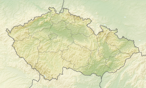 Kadaň Location in the Czech Republic | |
| Coordinates: 50°22′34″N 13°16′17″E / 50.37611°N 13.27139°E | |
| Country | |
| Region | Ústí nad Labem |
| District | Chomutov |
| First mentioned | 1183 |
| Government | |
| • Mayor | Jan Losenický |
| Area | |
| • Total | 65.62 km2 (25.34 sq mi) |
| Elevation | 300 m (1,000 ft) |
| Population (2024-01-01)[1] | |
| • Total | 18,165 |
| • Density | 280/km2 (720/sq mi) |
| Time zone | UTC+1 (CET) |
| • Summer (DST) | UTC+2 (CEST) |
| Postal code | 432 01 |
| Website | www |
Kadaň (Czech pronunciation: [ˈkadaɲ] ; German: Kaaden) is a town in Chomutov District in the Ústí nad Labem Region of the Czech Republic. It has about 18,000 inhabitants. It lies on the banks of the Ohře river. Kadaň is a tourist centre with highlights being the Franciscan Monastery and the historical square with late Gothic Town Hall Tower. The historic town centre is well preserved and is protected by law as an urban monument reservation.
Administrative parts[edit]
The villages of Brodce, Kadaňská Jeseň, Meziříčí, Nová Víska, Pokutice, Prunéřov, Tušimice, Úhošťany and Zásada u Kadaně are administrative parts of Kadaň.
Etymology[edit]
The name is most likely derived from the personal name Kadan, meaning "Kadan's (court)".[2]
Geography[edit]

Kadaň is located about 13 kilometres (8 mi) southwest of Chomutov and 31 km (19 mi) northeast of Karlovy Vary. It lies on the border between the Most Basin and Doupov Mountains. The northern tip of the municipal territory extends into the Ore Mountains. The highest point is the hill Dubový vrch at 691 m (2,267 ft) above sea level, located on the southern border of the territory. A notable feature is also the Úhošť hill, which is together with its surroundings protected as a national nature reserve.
Kadaň is situated on the banks of the Ohře river. On the Ohře, there is Kadaň Reservoir with an area of 67.2 ha (166 acres). It was completed in 1972. Its main purpose is to ensure a minimum flow under the reservoir, but it also serves for the energy use and for recreation and water sports.[3]
Climate[edit]
| Climate data for Tušimice (1991–2020) | |||||||||||||
|---|---|---|---|---|---|---|---|---|---|---|---|---|---|
| Month | Jan | Feb | Mar | Apr | May | Jun | Jul | Aug | Sep | Oct | Nov | Dec | Year |
| Record high °C (°F) | 16.6 (61.9) |
19.3 (66.7) |
22.1 (71.8) |
27.8 (82.0) |
31.6 (88.9) |
36.7 (98.1) |
36.7 (98.1) |
37.9 (100.2) |
31.6 (88.9) |
25.6 (78.1) |
19.4 (66.9) |
14.3 (57.7) |
37.9 (100.2) |
| Mean daily maximum °C (°F) | 2.4 (36.3) |
4.4 (39.9) |
9.0 (48.2) |
15.1 (59.2) |
19.5 (67.1) |
22.8 (73.0) |
25.1 (77.2) |
25.0 (77.0) |
19.6 (67.3) |
13.1 (55.6) |
6.8 (44.2) |
3.1 (37.6) |
13.8 (56.8) |
| Daily mean °C (°F) | −0.2 (31.6) |
0.8 (33.4) |
4.3 (39.7) |
9.3 (48.7) |
13.8 (56.8) |
17.2 (63.0) |
19.1 (66.4) |
18.5 (65.3) |
13.7 (56.7) |
8.6 (47.5) |
4.0 (39.2) |
0.7 (33.3) |
9.1 (48.4) |
| Mean daily minimum °C (°F) | −2.8 (27.0) |
−2.3 (27.9) |
0.5 (32.9) |
3.8 (38.8) |
8.1 (46.6) |
11.6 (52.9) |
13.5 (56.3) |
13.0 (55.4) |
9.2 (48.6) |
5.1 (41.2) |
1.5 (34.7) |
−1.7 (28.9) |
5.0 (41.0) |
| Record low °C (°F) | −19.2 (−2.6) |
−17.7 (0.1) |
−13.6 (7.5) |
−6.9 (19.6) |
−1.1 (30.0) |
1.8 (35.2) |
5.4 (41.7) |
5.1 (41.2) |
−0.2 (31.6) |
−8.2 (17.2) |
−10.6 (12.9) |
−21.0 (−5.8) |
−21.0 (−5.8) |
| Average precipitation mm (inches) | 23.4 (0.92) |
16.7 (0.66) |
24.6 (0.97) |
25.0 (0.98) |
49.4 (1.94) |
58.7 (2.31) |
64.6 (2.54) |
55.6 (2.19) |
42.1 (1.66) |
32.1 (1.26) |
30.4 (1.20) |
30.0 (1.18) |
452.5 (17.81) |
| Average precipitation days (≥ 1.0 mm) | 6.4 | 4.7 | 6.8 | 5.8 | 8.4 | 8.5 | 9.1 | 7.9 | 6.9 | 6.9 | 6.8 | 6.9 | 85.1 |
| Mean monthly sunshine hours | 46.9 | 79.7 | 122.0 | 182.6 | 208.3 | 216.1 | 229.2 | 224.4 | 157.8 | 95.0 | 44.3 | 38.5 | 1,644.7 |
| Source: NOAA[4] | |||||||||||||
History[edit]
In the Bronze Age, the plateau on the Úhošť hill was inhabited, on which there was a Celtic hillfort. According to some theories, the Wogastisburg Castle stood here, which was the scene of the Battle of Wogastisburg between Franks and Slavs in 631.[5]
11th–18th centuries[edit]
The first written mention of Kadaň is from 1183. it was probably founded as a market settlement during the colonization of the area at the turn of the 11th and 12th centuries. In 1186, Duke Frederick donated the settlement to the Knights Hospitaller. Around 1260, Kadaň was promoted to a free royal town and the castle was built. An extensive fire in 1362 destroyed the town and the castle, but everything was restored and supplemented with better fortifications. However, King Charles IV granted it several municipal rights (a vineyard, and an annual market) that made it flourish again.[2]
In 1421, during the Hussite Wars, the town was conquered by the Hussites, who controlled it until the end of the wars. From the mid-15th century, the town was pledged to various creditors of the royal chamber. The most notable of them was the Lobkowicz family, who held the town from 1469 to 1519. Jan Hasištejnský of Lobkowicz founded the Franciscan Monastery and the Church of the Fourteen Holy Helpers.[2]
In 1534, "Kadaň religious peace" was negotiated here between Württemberg Protestants and Emperor Ferdinand I for the Catholic side. After the Battle of White Mountain in 1620, violent re-Catholicization began in Kadaň. During the Thirty Years' War, in 1631, 1635 and 1648, Kadaň suffered from fires and plundering by various armies. The Kadaň Castle remained a ruin until the second half of the 18th century, when it was rebuilt into barracks by Empress Maria Theresa.[2]
19th–20th centuries[edit]

The last great fire damaged the town in 1811.[6] After the Revolution of 1848, the town became a district centre. The institute of the district town lasted in Kadaň for 110 years when it was affiliated with Chomutov District.[7]
After Czechoslovakia was established in 1918 and Kadaň became its part, most of the Sudeten German disagreed with this decision. On 4 March 1919, they demonstrated for self determination and joining Austria. The Czechoslovak military forces were sent in and tried to control the crowd by shooting. The result of the so-called Kadaň massacre was at least 25 dead and dozens injured.[2]
After the Munich Agreement in 1938, Kadaň was annexed by Nazi Germany and administered as part of Reichsgau Sudetenland. The local Czechs were forced to move to central Czechoslovakia and the Jewish community was sent to concentration camps in Germany. The synagogue was burned down during the Kristallnacht of 9 November 1939. According to Beneš decrees, after World War II, the German population was expelled and the area was re-settled by Czechs.[2]
Demographics[edit]
|
|
| ||||||||||||||||||||||||||||||||||||||||||||||||||||||
| Source: Censuses[8][9] | ||||||||||||||||||||||||||||||||||||||||||||||||||||||||
Economy[edit]
Although Kadaň is situated in an industrial part of the Czech Republic, there is no major industry within the town. Tourism and services play an important role in the town's economy. There are two large power plants in the outskirts of the town, Tušimice Power Station and Prunéřov Power Station. The largest employers based in the town are the Kadaň Hospital, Hunter Douglas (a manufacturer of window coverings) and SD – Kolejová doprava (transporter of coal by rail).[10]
Transport[edit]
Kadaň is served by four train stations and stops, located on the Kadaň–Děčín railway line.[11]
Culture[edit]

The most popular annual cultural event in Kadaň is Císařský den ("Emperor's day"), which commemorates the arrival of Emperor Charles IV into the town in 1367 and 1374. The historically tuned festival is accompanied by a music and theatre program on stage, a show of crafts and period costumes, games for children and others.[12]
Other annual events held in the town include:
- Maxipes Fík Birthday
- Kirwitzer Day
- Old Czech Carnival
- Franciscan Summer
- Vine Harvest Festival
- Vysmáté léto – Summer Music Fest
- Nativity Play
- Passion of Christ Play
Religion[edit]
There are churches and chapels of four Christian denominations: Roman Catholic Church, Czechoslovak Hussite Church, Evangelical Church of Czech Brethren and Eastern Orthodox Church.
Education[edit]


Kadaň is home to two secondary schools: Gymnasium Kadaň, and Secondary Industrial School of Construction and Business Academy.[13]
The Gymnasium Kadaň was established in 1803 with 99 students and continued under the control of the Piarists until 1823. The seat of the old gymnasium was a former Minorite monastery in a building which is now the seat of the Regional Archive. The institute of gymnasium was then reestablished in 1872 in a new building. The gymnasium was closed again in 1951 and the new Industrial School moved to the building. It is still there today. A new gymnasium was established in 1968 and has remained on the same premises since 1978.[6]
There are four primary schools and a school for handicapped children, managed by the town.[14]
Sport[edit]
The town is home to an ice hockey club SK Kadaň, which plays in the 1st Czech Republic Hockey League (2nd tier).
Sights[edit]


The Franciscan Monastery in Kadaň with the Church of the Fourteen Holy Helpers was founded in the 15th century by Jan Hasištejnský of Lobkowicz, who is buried there. It is a national cultural monument with unique murals and rare cellar vault. It also includes gardens with a vineyard. Due to the uniqueness of world importance, an application was submitted for its inclusion in the list of UNESCO World Heritage Sites. The monastery complex is a centre of cultural events and also serves as a museum.[15]
Kadaň Castle is a core of the preserved town fortifications, which surrounds the entire historic centre of the town. It was an early Gothic castle founded around 1260, rebuilt into late Gothic and Renaissance styles in the 16th century. It contains an exposition about its history.[16] Another part of the fortification is the barbican of the original Žatec Gate, one of the four main town gates. It was built in 1458 and is one of the oldest defensive structures of its kind in Central Europe.[17]
Mírové Square and its surroundings form the historical centre. The town hall was built in the second half of the 14th century. After 1500, it was rebuilt in the late Gothic style. In the mid-18th century, Baroque modifications were made. The building still serves its original purpose and is one of the best preserved Gothic town halls in the Lands of the Bohemian Crown. Since 2024, it has been protected as a national cultural monument.[18]
One of the most known landmarks and symbols of the town is the Town Hall Tower. It was built in the 16th century and is the highest building in the town with 53.75 metres (176.3 ft). It is open to the public as a lookout tower.[19] The town square also include the Church of the Exaltation of the Holy Cross, the Holy Trinity column and a Baroque fountain, which is called Šlikovský pond due to its size.[20]
The Church of the Exaltation of the Holy Cross was founded in 1289. The originally Gothic church was rebuilt in the Baroque style in the second half of the 17th century. Its present appearance is the result of the reconstruction after the fire in 1811.[21]
From the square leads the narrowest lane in the Czech Republic, Katova ulička (meaning 'hangman's alley'). At its narrowest point, it is only 66 centimetres (2.17 ft) wide. It is about 50 metres (160 ft) long.[22]
In literature[edit]
Benjamin Constant set a part of his famous novel Adolphe (1816) in Kadaň, referring to it as Caden, petite ville de la Bohême.[23]
Notable people[edit]
- Mikuláš of Kadaň (1350–1419), clockmaker
- Peter Nigri (1434–1481 or 1484), theologian
- Jan Hasištejnský of Lobkowicz (1450–1517), traveller, diplomat and writer
- Wenceslas Pantaleon Kirwitzer (1588–1626), astronomer
- Josef von Löschner (1809–1888), Austrian physician
- Anton Graf von Wolkenstein-Trostburg (1832–1913), Austro-Hungarian diplomat
- Theodor Innitzer (1875–1955), cardinal, Archbishop of Vienna
- Edward Goll (1884–1949), pianist and music teacher
- Hans Zeisel (1905–1992), German-American sociologist
- Karel Havlíček (1907–1988), painter
- Josef Dvořák (born 1942), actor
- Petr Klíma (born 1964), ice hockey player
- Ondřej Kaše (born 1995), ice hockey player
- Dominik Feri (born 1996), politician
- Aneta Lédlová (born 1996), ice hockey player
Twin towns – sister cities[edit]
Aue-Bad Schlema, Germany
Halle, Belgium
Vara, Sweden
References[edit]
- ^ "Population of Municipalities – 1 January 2024". Czech Statistical Office. 2024-05-17.
- ^ a b c d e f "Kadaň historická" (in Czech). Město Kadaň. Retrieved 2023-06-13.
- ^ "Vodní dílo Kadaň" (in Czech). Povodí Ohře. Retrieved 2021-07-12.
- ^ "World Meteorological Organization Climate Normals for 1991-2020 — Tušimice". National Oceanic and Atmospheric Administration. Retrieved 2024-01-12.
- ^ "Tabulová hora – Úhošť" (in Czech). CzechTourism. Retrieved 2023-06-13.
- ^ a b "Historie" (in Czech). Gymnázium Kadaň. Retrieved 2023-06-13.
- ^ "Historický lexikon obcí České republiky 1869–2011" (in Czech). Czech Statistical Office. 2015-12-21. p. 218.
- ^ "Historický lexikon obcí České republiky 1869–2011 – Okres Chomutov" (in Czech). Czech Statistical Office. 2015-12-21. pp. 5–6.
- ^ "Population Census 2021: Population by sex". Public Database. Czech Statistical Office. 2021-03-27.
- ^ "Registr ekonomických subjektů". Business Register (in Czech). Czech Statistical Office. Retrieved 2023-06-13.
- ^ "Detail stanice Kadaň" (in Czech). České dráhy. Retrieved 2023-06-13.
- ^ "Císařský den v Kadani 2023" (in Czech). CzechTourism. Retrieved 2023-06-13.
- ^ "Přehled škol a školských zařízení". Rejstřík škol a školských zařízení – Kadaň, střední vzdělávání (in Czech). Ministry of Education, Youth and Sports of the Czech Republic. Retrieved 2023-06-13.
- ^ "Základní školy" (in Czech). Město Kadaň. Retrieved 2023-06-13.
- ^ "Františkánský klášter" (in Czech). Město Kadaň. Retrieved 2021-07-12.
- ^ "Kadaňský hrad" (in Czech). Město Kadaň. Retrieved 2021-07-12.
- ^ "Barbakán Žatecké brány" (in Czech). Město Kadaň. Retrieved 2021-07-12.
- ^ "Radnice" (in Czech). National Heritage Institute. Retrieved 2024-03-27.
- ^ "Radniční věž" (in Czech). Město Kadaň. Retrieved 2021-07-12.
- ^ "Kadaň – Mírové náměstí" (in Czech). Turistika.cz. Retrieved 2021-07-12.
- ^ "Kostel Povýšení sv. Kříže" (in Czech). National Heritage Institute. Retrieved 2023-06-13.
- ^ "Katova ulička" (in Czech). Město Kadaň. Retrieved 2021-07-12.
- ^ Adolphe: Chapitre VI (in French). Badosa.com. Retrieved 2021-07-12.
- ^ "Partnerská města" (in Czech). Město Kadaň. Retrieved 2022-09-13.
External links[edit]
| International | |
|---|---|
| National | |
| Geographic | |