List of London Underground stations: Difference between revisions
→Stations: rationalise notes |
→Stations: Change station image for Tottenham Hale to show the new building |
||
| (22 intermediate revisions by 11 users not shown) | |||
| Line 21: | Line 21: | ||
! scope=col| Station |
! scope=col| Station |
||
! scope=col class="unsortable"| Photograph |
! scope=col class="unsortable"| Photograph |
||
! class="sortable" scope=col| Line(s){{ |
! class="sortable" scope=col| Line(s){{efn|Where more than one line serves a station, lines are listed in the order of opening. In some cases stations were first served by one underground line but later transferred to another.}} |
||
! scope=col| Local authority |
! scope=col| Local authority |
||
! scope=col| Zone{{ |
! scope=col| Zone{{efn|Some stations are assigned to multiple zones.}} |
||
! scope=col| Opened |
! scope=col| Opened<ref name=rose>{{cite book |last=Rose |first=Douglas |title=The London Underground, A Diagrammatic History |year=1999 |location=London|publisher=Douglas Rose/Capital Transport|isbn=1-85414-219-4|oclc= 59556887 }}</ref> |
||
!Resited |
!Resited |
||
! scope="col" | Main line opened |
! scope="col" | Main line opened |
||
! class="unsortable" scope=col| Other name(s){{ |
! class="unsortable" scope=col| Other name(s){{efn|The other names listed may have been used previously on station signage, on network maps, in advertisements or in planning material.}}<ref name="other">{{cite book |last=Harris |first=Cyril M. |title = What's in a name? |publisher = Capital Transport |orig-year=1977 |year=2006 |isbn=1-85414-241-0}}</ref>{{efn|In the early years, slightly different names were sometimes employed contemporaneously for different purposes or on different parts of a station. A number of stations continue to bear obsolete early names where these form part of the physical architecture. For example, the platform wall tiling at [[Arsenal tube station|Arsenal]], [[Hampstead tube station|Hampstead]], [[Marylebone station|Marylebone]] and [[Warren Street tube station|Warren Street]] still carries the original names of these stations.}} |
||
! scope=col | Annual usage (millions, {{tubeexits list|year}}) |
! scope=col | Annual usage (millions, {{tubeexits list|year}})<ref name="usage">{{Citation LU usage 2021}}</ref> |
||
!Area Served |
!Area Served |
||
|- |
|- |
||
| Line 37: | Line 37: | ||
|- |
|- |
||
!scope=row|[[Aldgate tube station|Aldgate]] |
!scope=row|[[Aldgate tube station|Aldgate]] |
||
|[[File:Aldgate-Station-Entrance.jpg|frameless|upright=0.5|alt=A light grey building with "M.R. ALDGATE STATION M.R." written in stone on the front face and a black car driving in the foreground|Aldgate]] || {{ubli|[[Metropolitan line|{{abbr|Met.|Metropolitan}}]]{{ref |
|[[File:Aldgate-Station-Entrance.jpg|frameless|upright=0.5|alt=A light grey building with "M.R. ALDGATE STATION M.R." written in stone on the front face and a black car driving in the foreground|Aldgate]] || {{ubli|[[Metropolitan line|{{abbr|Met.|Metropolitan}}]]{{efn|First served by Metropolitan line – Circle line services separately identified in 1949.<ref name=rose/>}} | [[Circle line (London Underground)|Circle]]}} || [[City of London]] || [[Travelcard Zone 1|1]] || {{dts|format=dmy|abbr=on|1876|November|18}} |
||
| {{sort|z|}} || {{sort|z|}} || {{sort|z|}} || {{tubeexits list|Aldgate tube station}} |
| {{sort|z|}} || {{sort|z|}} || {{sort|z|}} || {{tubeexits list|Aldgate tube station}} |
||
|[[Portsoken]] |
|[[Portsoken]] |
||
|- |
|- |
||
!scope=row|[[Aldgate East tube station|Aldgate East]] |
!scope=row|[[Aldgate East tube station|Aldgate East]] |
||
|[[File:London U-Bahn Aldgate East Eingang.jpg|frameless|upright=0.5|alt=A building flanked by green, wooden walls with three people standing outside and one person walking by all under a clear, blue sky|Aldgate East]] || {{ubli|[[Hammersmith & City line|{{abbr|H&C|Hammersmith & City}}]]{{ |
|[[File:London U-Bahn Aldgate East Eingang.jpg|frameless|upright=0.5|alt=A building flanked by green, wooden walls with three people standing outside and one person walking by all under a clear, blue sky|Aldgate East]] || {{ubli|[[Hammersmith & City line|{{abbr|H&C|Hammersmith & City}}]]{{efn|name=note_d|First served by Metropolitan line – Hammersmith & City line services separately identified in 1990.<ref name=rose/>}} | [[District line|District]]}} || [[London Borough of Tower Hamlets|Tower Hamlets]] || [[Travelcard Zone 1|1]] || {{dts|format=dmy|abbr=on|1884|October|6}} |
||
| {{dts|format=dmy|abbr=on|1938|October|31}} || {{sort|z|}} || Commercial Road: proposed before opening || {{tubeexits list|Aldgate East tube station}} |
| {{dts|format=dmy|abbr=on|1938|October|31}} || {{sort|z|}} || Commercial Road: proposed before opening || {{tubeexits list|Aldgate East tube station}} |
||
|[[Whitechapel]] |
|[[Whitechapel]] |
||
|- |
|- |
||
!scope=row|[[Alperton tube station|Alperton]] |
!scope=row|[[Alperton tube station|Alperton]] |
||
|[[File:Alperton station building.JPG|frameless|upright=0.5|alt=A red-bricked building with a grey-slabbed roof and "ALPERTON STATION" written in stone just under the roof all under a blue sky with white clouds|Alperton]] || [[Piccadilly line|Piccadilly]]{{ |
|[[File:Alperton station building.JPG|frameless|upright=0.5|alt=A red-bricked building with a grey-slabbed roof and "ALPERTON STATION" written in stone just under the roof all under a blue sky with white clouds|Alperton]] || [[Piccadilly line|Piccadilly]]{{efn|name=note_h|First served by District line – service transferred to Piccadilly line in 1933.<ref name=rose/>}} || [[London Borough of Brent|Brent]] || [[Travelcard Zone 4|4]] || {{dts|format=dmy|abbr=on|1903|June|28}} |
||
| {{sort|z|}} || {{sort|z|}} || Perivale-Alperton: 1903–1910 || {{tubeexits list|Alperton tube station}} |
| {{sort|z|}} || {{sort|z|}} || Perivale-Alperton: 1903–1910 || {{tubeexits list|Alperton tube station}} |
||
|[[Alperton]] |
|[[Alperton]] |
||
| Line 77: | Line 77: | ||
|- |
|- |
||
!scope=row|[[Baker Street tube station|Baker Street]] |
!scope=row|[[Baker Street tube station|Baker Street]] |
||
|[[File:BakerStEntrance.JPG|frameless|upright=0.5|alt=A street filled with people in front of a light grey building that has variously coloured signs protruding from it stating a variety of different things|Baker Street]] || {{ubli|[[Metropolitan line|{{abbr|Met.|Metropolitan}}]]{{ |
|[[File:BakerStEntrance.JPG|frameless|upright=0.5|alt=A street filled with people in front of a light grey building that has variously coloured signs protruding from it stating a variety of different things|Baker Street]] || {{ubli|[[Metropolitan line|{{abbr|Met.|Metropolitan}}]]{{efn|name=note_b|First served by Metropolitan line – Circle line services separately identified in 1949, Hammersmith & City line services separately identified in 1990.<ref name=rose/>}} | [[Bakerloo line|Bakerloo]] | [[Circle line (London Underground)|Circle]] | [[Jubilee line|Jubilee]] | [[Hammersmith & City line|{{abbr|H&C|Hammersmith & City}}]]}} || [[City of Westminster]] || [[Travelcard Zone 1|1]] || {{dts|format=dmy|abbr=on|1863|January|10}} |
||
| {{sort|z|}} || {{sort|z|}} || || {{tubeexits list|Baker Street tube station}} |
| {{sort|z|}} || {{sort|z|}} || || {{tubeexits list|Baker Street tube station}} |
||
|[[Marylebone]] |
|[[Marylebone]] |
||
| Line 88: | Line 88: | ||
!scope=row|[[Bank and Monument stations|Bank]] |
!scope=row|[[Bank and Monument stations|Bank]] |
||
| [[File:Bank station westbound Central look east.JPG|frameless|upright=0.5|alt=The interior of a building with a rounded roof and walls, a grey door on the left, a railway track on the right, and a man walking in the middle|Bank]] || {{ubli|[[Waterloo & City line|{{abbr|W&C|Waterloo & City}}]] | [[Northern line|Northern]] | [[Central line (London Underground)|Central]] }}|| [[City of London]] || [[Travelcard Zone 1|1]] || {{dts|format=dmy|abbr=on|1898|August|8}} |
| [[File:Bank station westbound Central look east.JPG|frameless|upright=0.5|alt=The interior of a building with a rounded roof and walls, a grey door on the left, a railway track on the right, and a man walking in the middle|Bank]] || {{ubli|[[Waterloo & City line|{{abbr|W&C|Waterloo & City}}]] | [[Northern line|Northern]] | [[Central line (London Underground)|Central]] }}|| [[City of London]] || [[Travelcard Zone 1|1]] || {{dts|format=dmy|abbr=on|1898|August|8}} |
||
| {{sort|z|}} || {{sort|z|}} || {{ubli| City [W&C]: 1898–1940 | Lombard Street [Northern]: proposed before opening }} || {{tubeexits list|Bank and Monument stations}} |
| {{sort|z|}} || {{sort|z|}} || {{ubli| City [W&C]: 1898–1940 | Lombard Street [Northern]: proposed before opening }} || {{tubeexits list|Bank and Monument stations}}{{efn|name="B&M"|Bank and Monument operate as a combined station with shared usage statistics.}} |
||
|[[City of London]] |
|[[City of London]] |
||
|- |
|- |
||
!scope=row|[[Barbican tube station|Barbican]] |
!scope=row|[[Barbican tube station|Barbican]] |
||
| [[File:Barbican.tube.onthecircle.london.arp.jpg|frameless|upright=0.5|alt=A red train with a grey top and a black sign that reads "CIRCLE LINE" in yellow letters is on railway tracks leading from the background to the foreground.|Barbican]] || {{ubli|[[Metropolitan line|{{abbr|Met.|Metropolitan}}]]{{ |
| [[File:Barbican.tube.onthecircle.london.arp.jpg|frameless|upright=0.5|alt=A red train with a grey top and a black sign that reads "CIRCLE LINE" in yellow letters is on railway tracks leading from the background to the foreground.|Barbican]] || {{ubli|[[Metropolitan line|{{abbr|Met.|Metropolitan}}]]{{efn|name=note_b}} | [[Circle line (London Underground)|Circle]] | [[Hammersmith & City line|{{abbr|H&C|Hammersmith & City}}]]}} || [[City of London]] || [[Travelcard Zone 1|1]] || {{dts|format=dmy|abbr=on|1865|December|23}} |
||
| {{sort|z|}} || {{sort|z|}} || {{ubli|Aldersgate Street: 1865–1910 | Aldersgate: 1910–1923 | Aldersgate & Barbican: 1923–1968 }} || {{tubeexits list|Barbican tube station}} |
| {{sort|z|}} || {{sort|z|}} || {{ubli|Aldersgate Street: 1865–1910 | Aldersgate: 1910–1923 | Aldersgate & Barbican: 1923–1968 }} || {{tubeexits list|Barbican tube station}} |
||
|[[Barbican Estate|Barbican]] |
|[[Barbican Estate|Barbican]] |
||
|- |
|- |
||
!scope=row|[[Barking station|Barking]] |
!scope=row|[[Barking station|Barking]] |
||
| [[File:Barkinglongview.jpg|frameless|upright=0.5|alt=A grey building with windows stands under a clear, blue sky as people mill about on the sidewalk in front of the building and vehicles traverse the foreground.|Barking]] || {{ubli|[[District line|District]]{{ |
| [[File:Barkinglongview.jpg|frameless|upright=0.5|alt=A grey building with windows stands under a clear, blue sky as people mill about on the sidewalk in front of the building and vehicles traverse the foreground.|Barking]] || {{ubli|[[District line|District]]{{efn|name=note_j|First served by District line – Metropolitan line service added in stages which was transferred to Hammersmith & City line in 1990.<ref name=rose/>}} | [[Hammersmith & City line|{{abbr|H&C|Hammersmith & City}}]]}} || [[London Borough of Barking and Dagenham|Barking and Dagenham]] || [[Travelcard Zone 4|4]] || {{dts|format=dmy|abbr=on|1902|June|2}} |
||
| || {{dts|format=dmy|abbr=on|1854|June|13}} || || {{tubeexits list|Barking station}} |
| || {{dts|format=dmy|abbr=on|1854|June|13}} || || {{tubeexits list|Barking station}} |
||
|[[Barking, London|Barking]] |
|[[Barking, London|Barking]] |
||
| Line 117: | Line 117: | ||
|- |
|- |
||
!scope=row|[[Bayswater tube station|Bayswater]] |
!scope=row|[[Bayswater tube station|Bayswater]] |
||
| [[File:Bayswater Station Exterior.jpg|frameless|upright=0.5|alt=A white-bricked building with a clear, sloped roof and a sign that reads "BAYSWATER STATION" in white letters on a blue background|Bayswater]] || {{ubli|[[District line|District]]{{ |
| [[File:Bayswater Station Exterior.jpg|frameless|upright=0.5|alt=A white-bricked building with a clear, sloped roof and a sign that reads "BAYSWATER STATION" in white letters on a blue background|Bayswater]] || {{ubli|[[District line|District]]{{efn|name=note_c|First served by Metropolitan line – District line service added in stages, Circle line services separately identified in 1949.<ref name=rose/>}} | [[Circle line (London Underground)|Circle]]}} || [[City of Westminster]] || [[Travelcard Zone 1|1]] || {{dts|format=dmy|abbr=on|1868|October|1}} |
||
| {{sort|z|}} || {{sort|z|}} || {{ubli|Bayswater: 1868–1923 | Bayswater (Queen's Road) & Westbourne Grove: 1923–1933 | Bayswater (Queen's Road): 1933–1946 | Bayswater (Queensway): 1946, suffix gradually dropped }} || {{tubeexits list|Bayswater tube station}} |
| {{sort|z|}} || {{sort|z|}} || {{ubli|Bayswater: 1868–1923 | Bayswater (Queen's Road) & Westbourne Grove: 1923–1933 | Bayswater (Queen's Road): 1933–1946 | Bayswater (Queensway): 1946, suffix gradually dropped }} || {{tubeexits list|Bayswater tube station}} |
||
|[[Bayswater]] |
|[[Bayswater]] |
||
| Line 142: | Line 142: | ||
|- |
|- |
||
!scope=row|[[Blackfriars station#London Underground|Blackfriars]] |
!scope=row|[[Blackfriars station#London Underground|Blackfriars]] |
||
| [[File:Blackfriars.tube.station.london.arp.jpg|frameless|upright=0.5|alt=A red and grey train with a black sign that reads "UPMINSTER" in yellow letters is on railway tracks leading from the background to the foreground.|Blackfriars]] || {{ubli|[[District line|District]]{{ |
| [[File:Blackfriars.tube.station.london.arp.jpg|frameless|upright=0.5|alt=A red and grey train with a black sign that reads "UPMINSTER" in yellow letters is on railway tracks leading from the background to the foreground.|Blackfriars]] || {{ubli|[[District line|District]]{{efn|name=note_i|First served by District line – Circle line services separately identified in 1949.<ref name=rose/>}}| [[Circle line (London Underground)|Circle]]}} || [[City of London]] || [[Travelcard Zone 1|1]] || {{dts|format=dmy|abbr=on|1870|May|30}} |
||
| {{sort|z|}} || {{sort|z|}} || || {{tubeexits list|Blackfriars station}} |
| {{sort|z|}} || {{sort|z|}} || || {{tubeexits list|Blackfriars station}} |
||
|[[Blackfriars, London|Blackfriars]] |
|[[Blackfriars, London|Blackfriars]] |
||
| Line 162: | Line 162: | ||
|- |
|- |
||
!scope=row|[[Boston Manor tube station|Boston Manor]] |
!scope=row|[[Boston Manor tube station|Boston Manor]] |
||
| [[File:Boston Manor stn building.JPG|frameless|upright=0.5|alt=A red-bricked building with a blue sign reading "BOSTON MANOR STATION" and a person in the foreground all under a blue sky with white clouds|Boston Manor]] || [[Piccadilly line|Piccadilly]]{{ |
| [[File:Boston Manor stn building.JPG|frameless|upright=0.5|alt=A red-bricked building with a blue sign reading "BOSTON MANOR STATION" and a person in the foreground all under a blue sky with white clouds|Boston Manor]] || [[Piccadilly line|Piccadilly]]{{efn|name=note_l|First served by District line – service transferred to Piccadilly line in 1964.<ref name=rose/>}} || {{ubli|[[London Borough of Hounslow|Hounslow]] }} || [[Travelcard Zone 4|4]] || {{dts|format=dmy|abbr=on|1883|May|1}} |
||
| {{sort|z|}} || {{sort|z|}} || Boston Road: 1883–1911 || {{tubeexits list|Boston Manor tube station}} |
| {{sort|z|}} || {{sort|z|}} || Boston Road: 1883–1911 || {{tubeexits list|Boston Manor tube station}} |
||
|[[Hanwell]] |
|[[Hanwell]] |
||
| Line 172: | Line 172: | ||
|- |
|- |
||
!scope=row|[[Bow Road tube station|Bow Road]] |
!scope=row|[[Bow Road tube station|Bow Road]] |
||
| [[File:Bow Road stn building.JPG|frameless|upright=0.5|alt=A red-bricked building with a blue sign reading "BOW ROAD STATION" in white letters and a tree in the foreground all under a blue sky with white clouds|Bow Road]] ||{{ubli| [[District line|District]]{{ |
| [[File:Bow Road stn building.JPG|frameless|upright=0.5|alt=A red-bricked building with a blue sign reading "BOW ROAD STATION" in white letters and a tree in the foreground all under a blue sky with white clouds|Bow Road]] ||{{ubli| [[District line|District]]{{efn|name=note_j}} | [[Hammersmith & City line|{{abbr|H&C|Hammersmith & City}}]] }}|| [[London Borough of Tower Hamlets|Tower Hamlets]] || [[Travelcard Zone 2|2]] || {{dts|format=dmy|abbr=on|1902|June|11}} |
||
| {{sort|z|}} || {{sort|z|}} || || {{tubeexits list|Bow Road tube station}} |
| {{sort|z|}} || {{sort|z|}} || || {{tubeexits list|Bow Road tube station}} |
||
|[[Bow, London|Bow]] |
|[[Bow, London|Bow]] |
||
| Line 187: | Line 187: | ||
|- |
|- |
||
!scope=row|[[Bromley-by-Bow tube station|Bromley-by-Bow]] |
!scope=row|[[Bromley-by-Bow tube station|Bromley-by-Bow]] |
||
| [[File:Bromley-by-Bow tube station 2005-12-10.jpg|frameless|upright=0.5|alt=Three people walking on a platform, the one on the left boarding a train, the one in the middle carrying bags, and the one on the right walking through a door|Bromley-by-Bow]] || {{ubli|[[District line|District]]{{ |
| [[File:Bromley-by-Bow tube station 2005-12-10.jpg|frameless|upright=0.5|alt=Three people walking on a platform, the one on the left boarding a train, the one in the middle carrying bags, and the one on the right walking through a door|Bromley-by-Bow]] || {{ubli|[[District line|District]]{{efn|name=note_j}} | [[Hammersmith & City line|{{abbr|H&C|Hammersmith & City}}]]}} || [[London Borough of Tower Hamlets|Tower Hamlets]] || {{sort|2.1|{{cslist|[[Travelcard Zone 2|2]]|[[Travelcard Zone 3|3]]}}}} || {{dts|format=dmy|abbr=on|1902|June|2}} |
||
| || {{dts|format=dmy|abbr=on|1858|March|31}} || Bromley: 1858–1968 || {{tubeexits list|Bromley-by-Bow tube station}} |
| || {{dts|format=dmy|abbr=on|1858|March|31}} || Bromley: 1858–1968 || {{tubeexits list|Bromley-by-Bow tube station}} |
||
|[[Bromley-by-Bow]] |
|[[Bromley-by-Bow]] |
||
| Line 227: | Line 227: | ||
|- |
|- |
||
!scope=row|[[Cannon Street station#London Underground|Cannon Street]] |
!scope=row|[[Cannon Street station#London Underground|Cannon Street]] |
||
| [[File:CannonStreet.jpg|frameless|upright=0.5|alt=A building with four people walking in front of it, one man in a white shirt sitting in front of it, and one white vehicle driving in front of it|Cannon Street]] || {{ubli|[[District line|District]]{{ |
| [[File:CannonStreet.jpg|frameless|upright=0.5|alt=A building with four people walking in front of it, one man in a white shirt sitting in front of it, and one white vehicle driving in front of it|Cannon Street]] || {{ubli|[[District line|District]]{{efn|name=note_i}} | [[Circle line (London Underground)|Circle]]}} || [[City of London]] || [[Travelcard Zone 1|1]] || {{dts|format=dmy|abbr=on|1884|October|6}} |
||
| {{sort|z|}} || {{sort|z|}} || || {{tubeexits list|Cannon Street station}} |
| {{sort|z|}} || {{sort|z|}} || || {{tubeexits list|Cannon Street station}} |
||
|[[City of London]] |
|[[City of London]] |
||
|- |
|- |
||
!scope=row|[[Canons Park tube station|Canons Park]] |
!scope=row|[[Canons Park tube station|Canons Park]] |
||
| [[File:Canons Park tube Station.JPG|frameless|upright=0.5|alt=A railway platform with a railway track running through it from the left portion of the background to the right portion of the foreground|Canons Park]] || [[Jubilee line|Jubilee]]{{ |
| [[File:Canons Park tube Station.JPG|frameless|upright=0.5|alt=A railway platform with a railway track running through it from the left portion of the background to the right portion of the foreground|Canons Park]] || [[Jubilee line|Jubilee]]{{efn|name=note_e|First served by Metropolitan line – service transferred to Bakerloo line in 1939 and then to the Jubilee line in 1979.<ref name=rose/>}} || [[London Borough of Harrow|Harrow]] || [[Travelcard Zone 5|5]] || {{dts|format=dmy|abbr=on|1932|December|10}} |
||
| {{sort|z|}} || {{sort|z|}} || Canons Park (Edgware): 1932–1933 || {{tubeexits list|Canons Park tube station}} |
| {{sort|z|}} || {{sort|z|}} || Canons Park (Edgware): 1932–1933 || {{tubeexits list|Canons Park tube station}} |
||
|[[Stanmore]] |
|[[Stanmore]] |
||
| Line 332: | Line 332: | ||
|- |
|- |
||
!scope=row|[[Dollis Hill tube station|Dollis Hill]] |
!scope=row|[[Dollis Hill tube station|Dollis Hill]] |
||
|[[File:Dollis Hill tube station 2005-12-10 02.jpg|frameless|upright=0.5|alt=People walking on a railway platform with a train on the right with white siding and red doors all under a blue sky with white clouds|Dollis Hill]]|| [[Jubilee line|Jubilee]]{{ |
|[[File:Dollis Hill tube station 2005-12-10 02.jpg|frameless|upright=0.5|alt=People walking on a railway platform with a train on the right with white siding and red doors all under a blue sky with white clouds|Dollis Hill]]|| [[Jubilee line|Jubilee]]{{efn|name=note_e}} || [[London Borough of Brent|Brent]] || [[Travelcard Zone 3|3]] || {{dts|format=dmy|abbr=on|1909|October|1}} |
||
| {{sort|z|}} || {{sort|z|}} || || {{tubeexits list|Dollis Hill tube station}} |
| {{sort|z|}} || {{sort|z|}} || || {{tubeexits list|Dollis Hill tube station}} |
||
|[[Dollis Hill]] |
|[[Dollis Hill]] |
||
| Line 362: | Line 362: | ||
|- |
|- |
||
!scope=row|[[East Ham tube station|East Ham]] |
!scope=row|[[East Ham tube station|East Ham]] |
||
|[[File:East ham tube station london.jpg|frameless|upright=0.5|alt=A red- and brown-bricked building with a blue sign reading "EAST HAM STATION" in white letters and people walking in front all under a white sky|East Ham]] || {{ubli|[[District line|District]]{{ |
|[[File:East ham tube station london.jpg|frameless|upright=0.5|alt=A red- and brown-bricked building with a blue sign reading "EAST HAM STATION" in white letters and people walking in front all under a white sky|East Ham]] || {{ubli|[[District line|District]]{{efn|name=note_j}} | [[Hammersmith & City line|{{abbr|H&C|Hammersmith & City}}]]}} || [[London Borough of Newham|Newham]] || {{sort|3.5|{{cslist|[[Travelcard Zone 3|3]]|[[Travelcard Zone 4|4]]}}}} || {{dts|format=dmy|abbr=on|1902|June|2}} |
||
| || {{dts|format=dmy|abbr=on|1858}} || || {{tubeexits list|East Ham tube station}} |
| || {{dts|format=dmy|abbr=on|1858}} || || {{tubeexits list|East Ham tube station}} |
||
|[[East Ham]] |
|[[East Ham]] |
||
| Line 372: | Line 372: | ||
|- |
|- |
||
!scope=row|[[Eastcote tube station|Eastcote]] |
!scope=row|[[Eastcote tube station|Eastcote]] |
||
|[[File:Eastcote tube station 1.jpg|frameless|upright=0.5|alt=A brown-bricked building with a blue sign reading "EASTCOTE STATION" in white letters and people walking in front all under a blue sky with white clouds|Eastcote]] || {{ubli|[[Metropolitan line|{{abbr|Met.|Metropolitan}}]] | [[Piccadilly line|Piccadilly]]{{ |
|[[File:Eastcote tube station 1.jpg|frameless|upright=0.5|alt=A brown-bricked building with a blue sign reading "EASTCOTE STATION" in white letters and people walking in front all under a blue sky with white clouds|Eastcote]] || {{ubli|[[Metropolitan line|{{abbr|Met.|Metropolitan}}]] | [[Piccadilly line|Piccadilly]]{{efn|name=note_k|First served by Metropolitan line – District line service added in 1910 which was transferred to Piccadilly line in 1933.<ref name=rose/>}}}} || [[London Borough of Hillingdon|Hillingdon]] || [[Travelcard Zone 5|5]] || {{dts|format=dmy|abbr=on|1906|May|26}} |
||
| {{sort|z|}} || {{sort|z|}} || || {{tubeexits list|Eastcote tube station}} |
| {{sort|z|}} || {{sort|z|}} || || {{tubeexits list|Eastcote tube station}} |
||
|[[Eastcote]] |
|[[Eastcote]] |
||
| Line 387: | Line 387: | ||
|- |
|- |
||
!scope=row|[[Edgware Road tube station (Circle, District and Hammersmith & City lines)|Edgware Road]] |
!scope=row|[[Edgware Road tube station (Circle, District and Hammersmith & City lines)|Edgware Road]] |
||
|[[File:EdgwareRdHammersmith.jpg|frameless|upright=0.5|alt=A tan-coloured building with brown-framed windows and a sign reading "METROPOLITAN EDGWARE ROAD STATION RAILWAY" in brown letters|Edgware Road]]|| {{ubli|[[Hammersmith & City line|{{abbr|H&C|Hammersmith & City}}]]{{ |
|[[File:EdgwareRdHammersmith.jpg|frameless|upright=0.5|alt=A tan-coloured building with brown-framed windows and a sign reading "METROPOLITAN EDGWARE ROAD STATION RAILWAY" in brown letters|Edgware Road]]|| {{ubli|[[Hammersmith & City line|{{abbr|H&C|Hammersmith & City}}]]{{efn|name=note_c}}{{efn|name=note_d}} | [[District line|District]] | [[Circle line (London Underground)|Circle]]}} || [[City of Westminster]] || [[Travelcard Zone 1|1]] || {{dts|format=dmy|abbr=on|1863|October|1}} |
||
| {{sort|z|}} || {{sort|z|}} || || {{tubeexits list|Edgware Road tube station (Circle, District and Hammersmith & City lines) }} |
| {{sort|z|}} || {{sort|z|}} || || {{tubeexits list|Edgware Road tube station (Circle, District and Hammersmith & City lines) }} |
||
|[[Paddington]] |
|[[Paddington]] |
||
| Line 402: | Line 402: | ||
|- |
|- |
||
!scope=row|[[Embankment tube station|Embankment]] |
!scope=row|[[Embankment tube station|Embankment]] |
||
|[[File:Embankment station.jpg|frameless|upright=0.5|alt=A grey building with a blue sign reading "EMBANKMENT STATION" in white letters and people standing in the foreground all under a white sky|Embankment]] || {{ubli|[[District line|District]]{{ |
|[[File:Embankment station.jpg|frameless|upright=0.5|alt=A grey building with a blue sign reading "EMBANKMENT STATION" in white letters and people standing in the foreground all under a white sky|Embankment]] || {{ubli|[[District line|District]]{{efn|name=note_i}}|[[Bakerloo line|Bakerloo]] | [[Northern line|Northern]] | [[Circle line (London Underground)|Circle]]}} || [[City of Westminster]] || [[Travelcard Zone 1|1]] || {{dts|format=dmy|abbr=on|1870|May|30}} |
||
| {{sort|z|}} || {{sort|z|}} || {{ubli|Charing Cross [District]: 1870–1915 | Embankment [Bakerloo]: 1906–1914| Charing Cross (Embankment) [Bakerloo & Northern]: 1914–1915 | Charing Cross: 1915–1974 | Charing Cross Embankment: 1974–1976 }}|| {{tubeexits list|Embankment tube station}} |
| {{sort|z|}} || {{sort|z|}} || {{ubli|Charing Cross [District]: 1870–1915 | Embankment [Bakerloo]: 1906–1914| Charing Cross (Embankment) [Bakerloo & Northern]: 1914–1915 | Charing Cross: 1915–1974 | Charing Cross Embankment: 1974–1976 }}|| {{tubeexits list|Embankment tube station}} |
||
|[[Charing Cross]] |
|[[Charing Cross]] |
||
| Line 417: | Line 417: | ||
|- |
|- |
||
!scope=row|[[Euston Square tube station|Euston Square]] |
!scope=row|[[Euston Square tube station|Euston Square]] |
||
|[[File:Euston Square stn south entrance.JPG|frameless|upright=0.5|alt=A building covered in windows with a blue sign reading "EUSTON SQUARE STATION" in white letters all under a blue sky with white clouds|Euston Square]] || {{ubli|[[Metropolitan line|{{abbr|Met.|Metropolitan}}]]{{ |
|[[File:Euston Square stn south entrance.JPG|frameless|upright=0.5|alt=A building covered in windows with a blue sign reading "EUSTON SQUARE STATION" in white letters all under a blue sky with white clouds|Euston Square]] || {{ubli|[[Metropolitan line|{{abbr|Met.|Metropolitan}}]]{{efn|name=note_b}} | [[Circle line (London Underground)|Circle]] | [[Hammersmith & City line|{{abbr|H&C|Hammersmith & City}}]]}} || [[London Borough of Camden|Camden]] || [[Travelcard Zone 1|1]] || {{dts|format=dmy|abbr=on|1863|January|10}} |
||
| {{sort|z|}} || {{sort|z|}} || Gower Street: 1863–1909 || {{tubeexits list|Euston Square tube station}} |
| {{sort|z|}} || {{sort|z|}} || Gower Street: 1863–1909 || {{tubeexits list|Euston Square tube station}} |
||
|[[Camden Town|Camden]] |
|[[Camden Town|Camden]] |
||
| Line 427: | Line 427: | ||
|- |
|- |
||
!scope=row|[[Farringdon station|Farringdon]] |
!scope=row|[[Farringdon station|Farringdon]] |
||
| [[File:Farringdon station exterior.jpg|frameless|upright=0.5|alt=A white building with a sign reading "FARRINGDON & HIGH HOLBORN STATION" in gold letters and people in front all under a blue sky with white clouds|Farringdon]]|| {{ubli|[[Metropolitan line|{{abbr|Met.|Metropolitan}}]]{{ |
| [[File:Farringdon station exterior.jpg|frameless|upright=0.5|alt=A white building with a sign reading "FARRINGDON & HIGH HOLBORN STATION" in gold letters and people in front all under a blue sky with white clouds|Farringdon]]|| {{ubli|[[Metropolitan line|{{abbr|Met.|Metropolitan}}]]{{efn|name=note_b}}|[[Circle line (London Underground)|Circle]]|[[Hammersmith & City line|{{abbr|H&C|Hammersmith & City}}]]}} || [[London Borough of Islington|Islington]] || [[Travelcard Zone 1|1]] || {{dts|format=dmy|abbr=on|1863|January|10}} |
||
| {{dts|format=dmy|abbr=on|1865|December|23}} || {{sort|z|}} || Farringdon Street: 1863–1922<br>Farringdon & High Holborn: 1922–1936|| {{tubeexits list|Farringdon station}} |
| {{dts|format=dmy|abbr=on|1865|December|23}} || {{sort|z|}} || Farringdon Street: 1863–1922<br>Farringdon & High Holborn: 1922–1936|| {{tubeexits list|Farringdon station}} |
||
|[[Clerkenwell]] |
|[[Clerkenwell]] |
||
| Line 437: | Line 437: | ||
|- |
|- |
||
!scope=row|[[Finchley Road tube station|Finchley Road]] |
!scope=row|[[Finchley Road tube station|Finchley Road]] |
||
| [[File:Finchley Road tube entrance.jpg|frameless|upright=0.5|alt=A white building with a blue-shingled roof and a blue sign reading "FINCHLEY ROAD STATION" in white letters all under a blue sky with white clouds|Finchley Road]]||{{ubli| [[Metropolitan line|{{abbr|Met.|Metropolitan}}]]|[[Jubilee line|Jubilee]]{{ |
| [[File:Finchley Road tube entrance.jpg|frameless|upright=0.5|alt=A white building with a blue-shingled roof and a blue sign reading "FINCHLEY ROAD STATION" in white letters all under a blue sky with white clouds|Finchley Road]]||{{ubli| [[Metropolitan line|{{abbr|Met.|Metropolitan}}]]|[[Jubilee line|Jubilee]]{{efn|name=note_f|First served by Metropolitan line – Bakerloo line service added in 1939 which was transferred to the Jubilee line in 1979.<ref name=rose/>}}}} || [[London Borough of Camden|Camden]] || [[Travelcard Zone 2|2]] || {{dts|format=dmy|abbr=on|1879|June|30}} |
||
| {{sort|z|}} || {{sort|z|}} || || {{tubeexits list|Finchley Road tube station}} |
| {{sort|z|}} || {{sort|z|}} || || {{tubeexits list|Finchley Road tube station}} |
||
|[[West Hampstead]] |
|[[West Hampstead]] |
||
| Line 457: | Line 457: | ||
|- |
|- |
||
!scope=row|[[Gloucester Road tube station|Gloucester Road]] |
!scope=row|[[Gloucester Road tube station|Gloucester Road]] |
||
|[[File: |
|[[File:GloucesterRoadTube.jpg|frameless|upright=0.5|alt=A beige-bricked building with a green sign reading "METROPOLITAN & DISTRICT RAILWAYS GLOUCESTER ROAD STATION" in white letters|Gloucester Road]] || {{ubli|[[District line|District]]{{efn|name=note_c}}|[[Piccadilly line|Piccadilly]]|[[Circle line (London Underground)|Circle]]}} || [[Royal Borough of Kensington and Chelsea|Kensington and Chelsea]] || [[Travelcard Zone 1|1]] || {{dts|format=dmy|abbr=on|1868|October|1}} |
||
| {{sort|z|}} || {{sort|z|}} || Brompton (Gloucester Road): 1868–1907 || {{tubeexits list|Gloucester Road tube station}} |
| {{sort|z|}} || {{sort|z|}} || Brompton (Gloucester Road): 1868–1907 || {{tubeexits list|Gloucester Road tube station}} |
||
|[[South Kensington]] |
|[[South Kensington]] |
||
| Line 467: | Line 467: | ||
|- |
|- |
||
!scope=row|[[Goldhawk Road tube station|Goldhawk Road]] |
!scope=row|[[Goldhawk Road tube station|Goldhawk Road]] |
||
|[[File:Goldhawk Road stn east entrance.JPG|frameless|upright=0.5|alt=A brown-bricked building with a blue sign reading "GOLDHAWK ROAD STATION" in white letters and two women walking in front all under a grey sky|Goldhawk Road]] || {{ubli|[[Hammersmith & City line|{{abbr|H&C|Hammersmith & City}}]]{{ref |
|[[File:Goldhawk Road stn east entrance.JPG|frameless|upright=0.5|alt=A brown-bricked building with a blue sign reading "GOLDHAWK ROAD STATION" in white letters and two women walking in front all under a grey sky|Goldhawk Road]] || {{ubli|[[Hammersmith & City line|{{abbr|H&C|Hammersmith & City}}]]{{efn|name=note_m|First served by Metropolitan line – Hammersmith & City line services separately identified in 1990,<ref name=rose/> Circle line service added in 2009.<ref>{{cite web |url=http://news.bbc.co.uk/1/hi/england/london/7926242.stm |title=Circle Line extended to the west |work=[[BBC News]] |date=5 March 2009 |access-date=4 April 2011 |url-status=live |archive-url=https://web.archive.org/web/20090310035950/http://news.bbc.co.uk/1/hi/england/london/7926242.stm |archive-date=10 March 2009 |df=dmy-all }}</ref>}}|[[Circle line (London Underground)|Circle]]}} || [[London Borough of Hammersmith and Fulham|Hammersmith and Fulham]] || [[Travelcard Zone 2|2]] || {{dts|format=dmy|abbr=on|1914|April|1}} |
||
| {{sort|z|}} || {{sort|z|}} || || {{tubeexits list|Goldhawk Road tube station}} |
| {{sort|z|}} || {{sort|z|}} || || {{tubeexits list|Goldhawk Road tube station}} |
||
|[[Shepherd's Bush]] |
|[[Shepherd's Bush]] |
||
| Line 482: | Line 482: | ||
|- |
|- |
||
!scope=row|[[Great Portland Street tube station|Great Portland Street]] |
!scope=row|[[Great Portland Street tube station|Great Portland Street]] |
||
|[[File:Great Portland St Tube Station.jpg|frameless|upright=0.5|alt=A beige-bricked building with a blue sign reading "GREAT PORTLAND STREET STATION" in white letters all under a blue sky with white clouds|Great Portland Street]] || {{ubli|[[Metropolitan line|{{abbr|Met.|Metropolitan}}]]{{ |
|[[File:Great Portland St Tube Station.jpg|frameless|upright=0.5|alt=A beige-bricked building with a blue sign reading "GREAT PORTLAND STREET STATION" in white letters all under a blue sky with white clouds|Great Portland Street]] || {{ubli|[[Metropolitan line|{{abbr|Met.|Metropolitan}}]]{{efn|name=note_b}}|[[Circle line (London Underground)|Circle]]|[[Hammersmith & City line|{{abbr|H&C|Hammersmith & City}}]]}} || [[City of Westminster]] || [[Travelcard Zone 1|1]] || {{dts|format=dmy|abbr=on|1863|January|10}} |
||
| {{sort|z|}} || {{sort|z|}} || {{ubli| Portland Road: 1863–1917 | Great Portland Street: 1917–1923 | Great Portland Street & Regent's Park: 1923–1933 }} || {{tubeexits list|Great Portland Street tube station}} |
| {{sort|z|}} || {{sort|z|}} || {{ubli| Portland Road: 1863–1917 | Great Portland Street: 1917–1923 | Great Portland Street & Regent's Park: 1923–1933 }} || {{tubeexits list|Great Portland Street tube station}} |
||
|[[Fitzrovia]] |
|[[Fitzrovia]] |
||
| Line 512: | Line 512: | ||
|- |
|- |
||
!scope=row|[[Hammersmith tube station (Circle and Hammersmith & City lines)|Hammersmith]] |
!scope=row|[[Hammersmith tube station (Circle and Hammersmith & City lines)|Hammersmith]] |
||
|[[File:Hammersmith (H & C line) station building.JPG|frameless|upright=0.5|alt=A brown-bricked building with a rectangular, blue sign reading "HAMMERSMITH STATION" in white letters all under a grey sky|Hammersmith (Hammersmith and City)]] || {{ubli|[[Hammersmith & City line|{{abbr|H&C|Hammersmith & City}}]]{{ |
|[[File:Hammersmith (H & C line) station building.JPG|frameless|upright=0.5|alt=A brown-bricked building with a rectangular, blue sign reading "HAMMERSMITH STATION" in white letters all under a grey sky|Hammersmith (Hammersmith and City)]] || {{ubli|[[Hammersmith & City line|{{abbr|H&C|Hammersmith & City}}]]{{efn|name=note_m}}|[[Circle line (London Underground)|Circle]] }}|| [[London Borough of Hammersmith and Fulham|Hammersmith and Fulham]] || [[Travelcard Zone 2|2]] || {{dts|format=dmy|abbr=on|1864|June|13}} |
||
| {{dts|format=dmy|abbr=on|1868|December|1}} || {{sort|z|}} || || {{tubeexits list|Hammersmith tube station (Circle and Hammersmith & City lines) }} |
| {{dts|format=dmy|abbr=on|1868|December|1}} || {{sort|z|}} || || {{tubeexits list|Hammersmith tube station (Circle and Hammersmith & City lines) }} |
||
|[[Hammersmith]] |
|[[Hammersmith]] |
||
| Line 553: | Line 553: | ||
!scope=row|[[Heathrow Terminal 4 tube station|Heathrow Terminal 4]] |
!scope=row|[[Heathrow Terminal 4 tube station|Heathrow Terminal 4]] |
||
|[[File:Heathrow Terminal 4 tube entrance.JPG|frameless|upright=0.5|alt=The dark interior of a building with a rectangular, blue sign reading "HEATHROW TERMINAL 4 STATION" in white letters and white flooring|Heathrow Terminal 4]] || [[Piccadilly line|Piccadilly]] || [[London Borough of Hillingdon|Hillingdon]] || [[Travelcard Zone 6|6]] || {{dts|format=dmy|abbr=on|1986|April|12}} |
|[[File:Heathrow Terminal 4 tube entrance.JPG|frameless|upright=0.5|alt=The dark interior of a building with a rectangular, blue sign reading "HEATHROW TERMINAL 4 STATION" in white letters and white flooring|Heathrow Terminal 4]] || [[Piccadilly line|Piccadilly]] || [[London Borough of Hillingdon|Hillingdon]] || [[Travelcard Zone 6|6]] || {{dts|format=dmy|abbr=on|1986|April|12}} |
||
| {{sort|z|}} || {{sort|z|}} || || {{tubeexits list|Heathrow Terminal 4 tube station}} |
| {{sort|z|}} || {{sort|z|}} || || {{tubeexits list|Heathrow Terminal 4 tube station}}{{efn|Heathrow Terminal 4 station was closed during the COVID national lockdown.}} |
||
|[[Heathrow Airport]] |
|[[Heathrow Airport]] |
||
|- |
|- |
||
| Line 582: | Line 582: | ||
|- |
|- |
||
!scope=row|[[High Street Kensington tube station|High Street Kensington]] |
!scope=row|[[High Street Kensington tube station|High Street Kensington]] |
||
| [[File:High Street Kensington station October 2013.jpg|frameless|upright=0.5|alt=A white many-windowed building and several people walking in front all under a white sky|High Street Kensington]] || {{ubli|[[District line|District]]{{ |
| [[File:High Street Kensington station October 2013.jpg|frameless|upright=0.5|alt=A white many-windowed building and several people walking in front all under a white sky|High Street Kensington]] || {{ubli|[[District line|District]]{{efn|name=note_c}}|[[Circle line (London Underground)|Circle]]}} || [[Royal Borough of Kensington and Chelsea|Kensington and Chelsea]] || [[Travelcard Zone 1|1]] || {{dts|format=dmy|abbr=on|1868|October|1}} |
||
| {{sort|z|}} || {{sort|z|}} || Kensington: proposed before opening || {{tubeexits list|High Street Kensington tube station}} |
| {{sort|z|}} || {{sort|z|}} || Kensington: proposed before opening || {{tubeexits list|High Street Kensington tube station}} |
||
|[[Kensington]] |
|[[Kensington]] |
||
|- |
|- |
||
!scope=row|[[Hillingdon tube station|Hillingdon]] |
!scope=row|[[Hillingdon tube station|Hillingdon]] |
||
|[[File:Hillingdon tube station inside entrance.jpg|alt=A white building.|frameless|upright=0.5|Hillingdon]]||{{ubli| [[Metropolitan line|{{abbr|Met.|Metropolitan}}]]|[[Piccadilly line|Piccadilly]]{{ |
|[[File:Hillingdon tube station inside entrance.jpg|alt=A white building.|frameless|upright=0.5|Hillingdon]]||{{ubli| [[Metropolitan line|{{abbr|Met.|Metropolitan}}]]|[[Piccadilly line|Piccadilly]]{{efn|name=note_k}}}} || [[London Borough of Hillingdon|Hillingdon]] || [[Travelcard Zone 6|6]] || {{dts|format=dmy|abbr=on|1923|December|10}} |
||
| {{dts|format=dmy|abbr=on|1992|December|6}} || {{sort|z|}} || {{ubli|Hillingdon: 1923–1934 | Hillingdon (Swakeleys): 1934, suffix gradually dropped }} || {{tubeexits list|Hillingdon tube station}} |
| {{dts|format=dmy|abbr=on|1992|December|6}} || {{sort|z|}} || {{ubli|Hillingdon: 1923–1934 | Hillingdon (Swakeleys): 1934, suffix gradually dropped }} || {{tubeexits list|Hillingdon tube station}} |
||
|[[Hillingdon]] |
|[[Hillingdon]] |
||
| Line 612: | Line 612: | ||
|- |
|- |
||
!scope=row|[[Hounslow Central tube station|Hounslow Central]] |
!scope=row|[[Hounslow Central tube station|Hounslow Central]] |
||
|[[File:Hounslow Central building.JPG|frameless|upright=0.5|alt=A brown-bricked building with a rectangular, blue sign reading "HOUNSLOW CENTRAL STATION" in white letters and a light post in front all under a white sky|Hounslow Central]] || [[Piccadilly line|Piccadilly]]{{ |
|[[File:Hounslow Central building.JPG|frameless|upright=0.5|alt=A brown-bricked building with a rectangular, blue sign reading "HOUNSLOW CENTRAL STATION" in white letters and a light post in front all under a white sky|Hounslow Central]] || [[Piccadilly line|Piccadilly]]{{efn|name=note_l}} || [[London Borough of Hounslow|Hounslow]] || [[Travelcard Zone 4|4]] || {{dts|format=dmy|abbr=on|1886|April|1}} |
||
| {{sort|z|}} || {{sort|z|}} || Heston Hounslow: 1886–1925 || {{tubeexits list|Hounslow Central tube station}} |
| {{sort|z|}} || {{sort|z|}} || Heston Hounslow: 1886–1925 || {{tubeexits list|Hounslow Central tube station}} |
||
|[[Hounslow]] |
|[[Hounslow]] |
||
|- |
|- |
||
!scope=row|[[Hounslow East tube station|Hounslow East]] |
!scope=row|[[Hounslow East tube station|Hounslow East]] |
||
| [[File:Hounslow East Station.JPG|frameless|upright=0.4|alt=A dark grey building with a green roof and a rectangular, blue sign reading "HOUNSLOW EAST STATION" in white letters all under a blue sky|Hounslow East]] || [[Piccadilly line|Piccadilly]]{{ |
| [[File:Hounslow East Station.JPG|frameless|upright=0.4|alt=A dark grey building with a green roof and a rectangular, blue sign reading "HOUNSLOW EAST STATION" in white letters all under a blue sky|Hounslow East]] || [[Piccadilly line|Piccadilly]]{{efn|name=note_l}} || [[London Borough of Hounslow|Hounslow]] || [[Travelcard Zone 4|4]] || {{dts|format=dmy|abbr=on|1909|May|2}} |
||
| {{sort|z|}} || {{sort|z|}} || Hounslow Town: 1909–1925|| {{tubeexits list|Hounslow East tube station}} |
| {{sort|z|}} || {{sort|z|}} || Hounslow Town: 1909–1925|| {{tubeexits list|Hounslow East tube station}} |
||
|[[Hounslow]] |
|[[Hounslow]] |
||
|- |
|- |
||
!scope=row|[[Hounslow West tube station|Hounslow West]] |
!scope=row|[[Hounslow West tube station|Hounslow West]] |
||
|[[File:Hounslow West tube station 07 July 2006.jpg|frameless|upright=0.5|alt=A light grey building with a long, rectangular, dark blue sign reading "HOUNSLOW WEST STATION" in white letters all under a cloudy sky|Hounslow West]] || [[Piccadilly line|Piccadilly]]{{ |
|[[File:Hounslow West tube station 07 July 2006.jpg|frameless|upright=0.5|alt=A light grey building with a long, rectangular, dark blue sign reading "HOUNSLOW WEST STATION" in white letters all under a cloudy sky|Hounslow West]] || [[Piccadilly line|Piccadilly]]{{efn|name=note_l}} || [[London Borough of Hounslow|Hounslow]] || [[Travelcard Zone 5|5]] || {{dts|format=dmy|abbr=on|1884|July|21}} |
||
| {{sort|z|}} || {{sort|z|}} || Hounslow Barracks: 1884–1925 || {{tubeexits list|Hounslow West tube station}} |
| {{sort|z|}} || {{sort|z|}} || Hounslow Barracks: 1884–1925 || {{tubeexits list|Hounslow West tube station}} |
||
|[[Hounslow]] |
|[[Hounslow]] |
||
| Line 632: | Line 632: | ||
|- |
|- |
||
!scope=row|[[Ickenham tube station|Ickenham]] |
!scope=row|[[Ickenham tube station|Ickenham]] |
||
|[[File:Ickenham tube station 1.jpg|frameless|upright=0.5|alt=A brown-bricked building with a rectangular, dark blue sign reading "ICKENHAM STATION" in white letters all under a light blue sky|Ickenham]] || {{ubli|[[Metropolitan line|{{abbr|Met.|Metropolitan}}]]|[[Piccadilly line|Piccadilly]]{{ |
|[[File:Ickenham tube station 1.jpg|frameless|upright=0.5|alt=A brown-bricked building with a rectangular, dark blue sign reading "ICKENHAM STATION" in white letters all under a light blue sky|Ickenham]] || {{ubli|[[Metropolitan line|{{abbr|Met.|Metropolitan}}]]|[[Piccadilly line|Piccadilly]]{{efn|name=note_k}} }} || [[London Borough of Hillingdon|Hillingdon]] || [[Travelcard Zone 6|6]] || {{dts|format=dmy|abbr=on|1905|September|25}} |
||
| {{sort|z|}} || {{sort|z|}} || || {{tubeexits list|Ickenham tube station}} |
| {{sort|z|}} || {{sort|z|}} || || {{tubeexits list|Ickenham tube station}} |
||
|[[Ickenham]] |
|[[Ickenham]] |
||
|- |
|- |
||
!scope=row|[[Kennington tube station|Kennington]] |
!scope=row|[[Kennington tube station|Kennington]] |
||
|[[File:Kennington Tube Station.jpg|frameless|upright=0.5|alt=A red-bricked building with a rectangular, dark blue sign reading "KENNINGTON STATION" in white letters all under a light blue sky|Kennington]] || [[Northern line|Northern]] || [[London Borough of Southwark|Southwark]] || {{cslist|[[Travelcard Zone 1|1]]|[[Travelcard Zone 2|2]]}} || {{dts|format=dmy|abbr=on|1890|December|18}} |
|[[File:Kennington Tube Station.jpg|frameless|upright=0.5|alt=A red-bricked building with a rectangular, dark blue sign reading "KENNINGTON STATION" in white letters all under a light blue sky|Kennington]] || [[Northern line|Northern]] || [[London Borough of Southwark|Southwark]] || {{sort|1.1|{{cslist|[[Travelcard Zone 1|1]]|[[Travelcard Zone 2|2]]}}}} || {{dts|format=dmy|abbr=on|1890|December|18}} |
||
| {{sort|z|}} || {{sort|z|}} || New Street: proposed before opening || {{tubeexits list|Kennington tube station}} |
| {{sort|z|}} || {{sort|z|}} || New Street: proposed before opening || {{tubeexits list|Kennington tube station}} |
||
|[[Kennington]] |
|[[Kennington]] |
||
| Line 657: | Line 657: | ||
|- |
|- |
||
!scope=row|[[Kenton station|Kenton]] |
!scope=row|[[Kenton station|Kenton]] |
||
|[[File:Kenton station building.JPG|frameless|upright=0.5|alt=A red-bricked building with a rectangular, dark blue sign reading "KENTON STATION" in white letters all under a blue sky with white clouds|Kenton]] || [[Bakerloo line|Bakerloo]] || [[London Borough of Brent|Brent |
|[[File:Kenton station building.JPG|frameless|upright=0.5|alt=A red-bricked building with a rectangular, dark blue sign reading "KENTON STATION" in white letters all under a blue sky with white clouds|Kenton]] || [[Bakerloo line|Bakerloo]] || [[London Borough of Brent|Brent]] || [[Travelcard Zone 4|4]] || {{dts|format=dmy|abbr=on|1917|April|16}} |
||
| || {{dts|format=dmy|abbr=on|1912|June|15}} || || {{tubeexits list|Kenton station}} |
| || {{dts|format=dmy|abbr=on|1912|June|15}} || || {{tubeexits list|Kenton station}} |
||
|[[Kenton, London|Kenton]] |
|[[Kenton, London|Kenton]] |
||
| Line 667: | Line 667: | ||
|- |
|- |
||
!scope=row|[[Kilburn tube station|Kilburn]] |
!scope=row|[[Kilburn tube station|Kilburn]] |
||
|[[File:Kilburn2.jpg|frameless|upright=0.5|alt=A man with a white shirt and white pants sitting on a brown bench facing the left with another bench behind him all under a light blue sky with white clouds|Kilburn]] || [[Jubilee line|Jubilee]]{{ |
|[[File:Kilburn2.jpg|frameless|upright=0.5|alt=A man with a white shirt and white pants sitting on a brown bench facing the left with another bench behind him all under a light blue sky with white clouds|Kilburn]] || [[Jubilee line|Jubilee]]{{efn|name=note_e}} || [[London Borough of Brent|Brent]] || [[Travelcard Zone 2|2]] || {{dts|format=dmy|abbr=on|1879|November|24}} |
||
| {{sort|z|}} || {{sort|z|}} || Kilburn and Brondesbury: 1879–1950 || {{tubeexits list|Kilburn tube station}} |
| {{sort|z|}} || {{sort|z|}} || Kilburn and Brondesbury: 1879–1950 || {{tubeexits list|Kilburn tube station}} |
||
|[[Kilburn, London|Kilburn]] |
|[[Kilburn, London|Kilburn]] |
||
| Line 677: | Line 677: | ||
|- |
|- |
||
!scope=row|[[Kingsbury tube station|Kingsbury]] |
!scope=row|[[Kingsbury tube station|Kingsbury]] |
||
|[[File:Kingsbury tube station.jpg|frameless|upright=0.5|alt=A brown-bricked building with a rectangular, dark blue sign reading "KINGSBURY STATION" in white letters all under a light blue sky|Kingsbury]] || [[Jubilee line|Jubilee]]{{ |
|[[File:Kingsbury tube station.jpg|frameless|upright=0.5|alt=A brown-bricked building with a rectangular, dark blue sign reading "KINGSBURY STATION" in white letters all under a light blue sky|Kingsbury]] || [[Jubilee line|Jubilee]]{{efn|name=note_e}} || [[London Borough of Brent|Brent]] || [[Travelcard Zone 4|4]] || {{dts|format=dmy|abbr=on|1932|December|10}} |
||
| {{sort|z|}} || {{sort|z|}} || || {{tubeexits list|Kingsbury tube station}} |
| {{sort|z|}} || {{sort|z|}} || || {{tubeexits list|Kingsbury tube station}} |
||
|[[Kingsbury, London|Kingsbury]] |
|[[Kingsbury, London|Kingsbury]] |
||
|- |
|- |
||
!scope=row|[[King's Cross St Pancras tube station|King's Cross St Pancras]] |
!scope=row|[[King's Cross St Pancras tube station|King's Cross St Pancras]] |
||
|[[File:King's Cross St Pancras tube stn Euston Rd NW entrance.JPG|frameless|upright=0.5|alt=A red-bricked building with a dark blue sign reading "KING'S CROSS ST. PANCRAS" in white letters and several entranceways all under a grey sky|King's Cross St Pancras]] ||{{ubli| [[Metropolitan line|{{abbr|Met.|Metropolitan}}]]{{ |
|[[File:King's Cross St Pancras tube stn Euston Rd NW entrance.JPG|frameless|upright=0.5|alt=A red-bricked building with a dark blue sign reading "KING'S CROSS ST. PANCRAS" in white letters and several entranceways all under a grey sky|King's Cross St Pancras]] ||{{ubli| [[Metropolitan line|{{abbr|Met.|Metropolitan}}]]{{efn|name=note_b}}|[[Northern line|Northern]]|[[Piccadilly line|Piccadilly]]|[[Circle line (London Underground)|Circle]]|[[Victoria line|Victoria]]|[[Hammersmith & City line|{{abbr|H&C|Hammersmith & City}}]] }} || [[London Borough of Camden|Camden]] || [[Travelcard Zone 1|1]] || {{dts|format=dmy|abbr=on|1863|January|10}} |
||
| {{dts|format=dmy|abbr=on|1941|March|9}} ({{abbr|Met.|Metropolitan}})|| {{sort|z|}} || {{ubli| King's Cross [Metropolitan]: 1863–1925 | King's Cross & St. Pancras [Metropolitan]: 1925–1933 | King's Cross [Piccadilly]: 1906–1927 | King's Cross for St. Pancras [Piccadilly]: 1927–1933 | King's Cross for St. Pancras [Northern]: 1907–1933 }} || {{tubeexits list|King's Cross St Pancras tube station}} |
| {{dts|format=dmy|abbr=on|1941|March|9}} ({{abbr|Met.|Metropolitan}})|| {{sort|z|}} || {{ubli| King's Cross [Metropolitan]: 1863–1925 | King's Cross & St. Pancras [Metropolitan]: 1925–1933 | King's Cross [Piccadilly]: 1906–1927 | King's Cross for St. Pancras [Piccadilly]: 1927–1933 | King's Cross for St. Pancras [Northern]: 1907–1933 }} || {{tubeexits list|King's Cross St Pancras tube station}} |
||
|[[King's Cross, London|King's Cross]] |
|[[King's Cross, London|King's Cross]] |
||
| Line 692: | Line 692: | ||
|- |
|- |
||
!scope=row|[[Ladbroke Grove tube station|Ladbroke Grove]] |
!scope=row|[[Ladbroke Grove tube station|Ladbroke Grove]] |
||
|[[File:Ladbroke Grove tube station 4.jpg|frameless|upright=0.5|alt=A brown-bricked building bordered in red bricks with a blue, rectangular sign reading "LADBROKE GROVE STATION" in white letters all under a blue sky|Ladbroke Grove]] || {{ubli|[[Hammersmith & City line|{{abbr|H&C|Hammersmith & City}}]]{{ |
|[[File:Ladbroke Grove tube station 4.jpg|frameless|upright=0.5|alt=A brown-bricked building bordered in red bricks with a blue, rectangular sign reading "LADBROKE GROVE STATION" in white letters all under a blue sky|Ladbroke Grove]] || {{ubli|[[Hammersmith & City line|{{abbr|H&C|Hammersmith & City}}]]{{efn|name=note_m}}|[[Circle line (London Underground)|Circle]] }}|| [[Royal Borough of Kensington and Chelsea|Kensington and Chelsea]] || [[Travelcard Zone 2|2]] || {{dts|format=dmy|abbr=on|1864|June|13}} |
||
| {{sort|z|}} || {{sort|z|}} || {{ubli| Notting Hill: 1864–1880 | Notting Hill & Ladbroke Grove: 1880–1919 | Ladbroke Grove (North Kensington): 1919–1938 }} || {{tubeexits list|Ladbroke Grove tube station}} |
| {{sort|z|}} || {{sort|z|}} || {{ubli| Notting Hill: 1864–1880 | Notting Hill & Ladbroke Grove: 1880–1919 | Ladbroke Grove (North Kensington): 1919–1938 }} || {{tubeexits list|Ladbroke Grove tube station}} |
||
|[[Ladbroke Grove]] |
|[[Ladbroke Grove]] |
||
| Line 707: | Line 707: | ||
|- |
|- |
||
!scope=row|[[Latimer Road tube station|Latimer Road]] |
!scope=row|[[Latimer Road tube station|Latimer Road]] |
||
| [[File:Latimer Road Tube.jpg|frameless|upright=0.4|alt=A beige-bricked building with a dark-blue, rectangular sign reading "LATIMER ROAD STATION" in white letters all under a white sky|Latimer Road]] ||{{ubli| [[Hammersmith & City line|{{abbr|H&C|Hammersmith & City}}]]{{ |
| [[File:Latimer Road Tube.jpg|frameless|upright=0.4|alt=A beige-bricked building with a dark-blue, rectangular sign reading "LATIMER ROAD STATION" in white letters all under a white sky|Latimer Road]] ||{{ubli| [[Hammersmith & City line|{{abbr|H&C|Hammersmith & City}}]]{{efn|name=note_m}}|[[Circle line (London Underground)|Circle]]}} || [[Royal Borough of Kensington and Chelsea|Kensington and Chelsea]] || [[Travelcard Zone 2|2]] || {{dts|format=dmy|abbr=on|1868|December|16}} |
||
| {{sort|z|}} || {{sort|z|}} || || {{tubeexits list|Lancaster Gate tube station}} |
| {{sort|z|}} || {{sort|z|}} || || {{tubeexits list|Lancaster Gate tube station}} |
||
|[[North Kensington]] |
|[[North Kensington]] |
||
| Line 727: | Line 727: | ||
|- |
|- |
||
!scope=row|[[Liverpool Street station#Underground stations|Liverpool Street]] |
!scope=row|[[Liverpool Street station#Underground stations|Liverpool Street]] |
||
|[[File:Liverpool Street Underground concourse entr.JPG|frameless|upright=0.5|alt=A white building with a dark blue, rectangular sign reading "LIVERPOOL STREET UNDERGROUND STATION" in white letters all under a white sky|Liverpool Street]] || {{ubli|[[Metropolitan line|{{abbr|Met.|Metropolitan}}]]{{ |
|[[File:Liverpool Street Underground concourse entr.JPG|frameless|upright=0.5|alt=A white building with a dark blue, rectangular sign reading "LIVERPOOL STREET UNDERGROUND STATION" in white letters all under a white sky|Liverpool Street]] || {{ubli|[[Metropolitan line|{{abbr|Met.|Metropolitan}}]]{{efn|name=note_b}}|[[Central line (London Underground)|Central]]|[[Circle line (London Underground)|Circle]]|[[Hammersmith & City line|{{abbr|H&C|Hammersmith & City}}]]}} || [[City of London]] || [[Travelcard Zone 1|1]] || {{dts|format=dmy|abbr=on|1875|February|1}} |
||
| {{dts|format=dmy|abbr=on|1875|July|12}} || {{sort|z|}} || Bishopsgate: 1875–1909 || {{tubeexits list|Liverpool Street station}} |
| {{dts|format=dmy|abbr=on|1875|July|12}} || {{sort|z|}} || Bishopsgate: 1875–1909 || {{tubeexits list|Liverpool Street station}} |
||
|[[Bishopsgate]] |
|[[Bishopsgate]] |
||
| Line 752: | Line 752: | ||
|- |
|- |
||
!scope=row|[[Mansion House tube station|Mansion House]] |
!scope=row|[[Mansion House tube station|Mansion House]] |
||
|[[File:Mansionhouse300.jpg|frameless|upright=0.5|alt=A beige-bricked building with a rectangular, dark blue sign reading "MANSION HOUSE STATION" in white letters and a yellow sign reading "OFFICES TO LET"|Mansion House]] || {{ubli|[[District line|District]]{{ |
|[[File:Mansionhouse300.jpg|frameless|upright=0.5|alt=A beige-bricked building with a rectangular, dark blue sign reading "MANSION HOUSE STATION" in white letters and a yellow sign reading "OFFICES TO LET"|Mansion House]] || {{ubli|[[District line|District]]{{efn|name=note_i}}|[[Circle line (London Underground)|Circle]]}} || [[City of London]] || [[Travelcard Zone 1|1]] || {{dts|format=dmy|abbr=on|1871|July|3}} |
||
| {{sort|z|}} || {{sort|z|}} || || {{tubeexits list|Mansion House tube station}} |
| {{sort|z|}} || {{sort|z|}} || || {{tubeexits list|Mansion House tube station}} |
||
|[[Castle Baynard]] |
|[[Castle Baynard]] |
||
| Line 767: | Line 767: | ||
|- |
|- |
||
!scope=row|[[Mile End tube station|Mile End]] |
!scope=row|[[Mile End tube station|Mile End]] |
||
|[[File:Mile End stn entrance.JPG|frameless|upright=0.5|alt=A grey-bricked building with a rectangular, dark blue sign reading "MILE END STATION" in white letters all under a light blue sky with white clouds|Mile End]] || {{ubli|[[District line|District]]{{ |
|[[File:Mile End stn entrance.JPG|frameless|upright=0.5|alt=A grey-bricked building with a rectangular, dark blue sign reading "MILE END STATION" in white letters all under a light blue sky with white clouds|Mile End]] || {{ubli|[[District line|District]]{{efn|name=note_j}}|[[Hammersmith & City line|{{abbr|H&C|Hammersmith & City}}]]|[[Central line (London Underground)|Central]]}} || [[London Borough of Tower Hamlets|Tower Hamlets]] || [[Travelcard Zone 2|2]] || {{dts|format=dmy|abbr=on|1902|June|2}} |
||
| {{sort|z|}} || {{sort|z|}} || || {{tubeexits list|Mile End tube station}} |
| {{sort|z|}} || {{sort|z|}} || || {{tubeexits list|Mile End tube station}} |
||
|[[Mile End]] |
|[[Mile End]] |
||
| Line 777: | Line 777: | ||
|- |
|- |
||
!scope=row|[[Bank and Monument stations|Monument]] |
!scope=row|[[Bank and Monument stations|Monument]] |
||
|[[File:Monument underground station.jpg|frameless|upright=0.5|alt=The interior of a building with a railway track running between white-tiled pillars upholding a white-and-black ceiling lit by electrical lights|Monument]] ||{{ubli| [[District line|District]]{{ |
|[[File:Monument underground station.jpg|frameless|upright=0.5|alt=The interior of a building with a railway track running between white-tiled pillars upholding a white-and-black ceiling lit by electrical lights|Monument]] ||{{ubli| [[District line|District]]{{efn|name=note_i}}|[[Circle line (London Underground)|Circle]] }} || [[City of London]] || [[Travelcard Zone 1|1]] || {{dts|format=dmy|abbr=on|1884|October|6}} |
||
| {{sort|z|}} || {{sort|z|}} || {{ubli| King William Street: proposed before opening | East Cheap: 1884 }} || {{tubeexits list|Bank and Monument stations}} |
| {{sort|z|}} || {{sort|z|}} || {{ubli| King William Street: proposed before opening | East Cheap: 1884 }} || {{tubeexits list|Bank and Monument stations}}{{efn|name="B&M"}} |
||
|[[City of London]] |
|[[City of London]] |
||
|- |
|- |
||
!scope=row|[[Moorgate station|Moorgate]] |
!scope=row|[[Moorgate station|Moorgate]] |
||
|[[File:Entrance to underground station, west side of Moorgate, London - geograph.org.uk - 1408534.jpg|frameless|upright=0.5|alt=A grey building with a rectangular, dark blue sign reading "MOORGATE STATION" in white letters and short, black, white-tipped posts in front|Moorgate]] ||{{ubli| [[Metropolitan line|{{abbr|Met.|Metropolitan}}]]{{ |
|[[File:Entrance to underground station, west side of Moorgate, London - geograph.org.uk - 1408534.jpg|frameless|upright=0.5|alt=A grey building with a rectangular, dark blue sign reading "MOORGATE STATION" in white letters and short, black, white-tipped posts in front|Moorgate]] ||{{ubli| [[Metropolitan line|{{abbr|Met.|Metropolitan}}]]{{efn|name=note_b}}|[[Northern line|Northern]]|[[Circle line (London Underground)|Circle]]|[[Hammersmith & City line|{{abbr|H&C|Hammersmith & City}}]]}} || [[City of London]] || [[Travelcard Zone 1|1]] || {{dts|format=dmy|abbr=on|1865|December|23}} |
||
| {{sort|z|}} || {{sort|z|}} || Moorgate Street [Metropolitan]: 1865–1924 || {{tubeexits list|Moorgate station}} |
| {{sort|z|}} || {{sort|z|}} || Moorgate Street [Metropolitan]: 1865–1924 || {{tubeexits list|Moorgate station}} |
||
|[[Moorgate]] |
|[[Moorgate]] |
||
| Line 802: | Line 802: | ||
|- |
|- |
||
!scope=row|[[Neasden tube station|Neasden]] |
!scope=row|[[Neasden tube station|Neasden]] |
||
|[[File:Neasden tube station exterior.jpg|frameless|upright=0.5|alt=A brown-bricked building with a rectangular, dark blue sign reading "NEASDEN STATION" in white letters all under a light blue sky with white clouds|Neasden]] || [[Jubilee line|Jubilee]]{{ |
|[[File:Neasden tube station exterior.jpg|frameless|upright=0.5|alt=A brown-bricked building with a rectangular, dark blue sign reading "NEASDEN STATION" in white letters all under a light blue sky with white clouds|Neasden]] || [[Jubilee line|Jubilee]]{{efn|name=note_e}} || [[London Borough of Brent|Brent]] || [[Travelcard Zone 3|3]] || {{dts|format=dmy|abbr=on|1880|August|2}} |
||
| {{sort|z|}} || {{sort|z|}} || Kingsbury & Neasden: 1880–1910<br>Neasden & Kingsbury: 1910–1932|| {{tubeexits list|Neasden tube station}} |
| {{sort|z|}} || {{sort|z|}} || Kingsbury & Neasden: 1880–1910<br>Neasden & Kingsbury: 1910–1932|| {{tubeexits list|Neasden tube station}} |
||
|[[Neasden]] |
|[[Neasden]] |
||
| Line 822: | Line 822: | ||
|- |
|- |
||
!scope=row|[[North Ealing tube station|North Ealing]] |
!scope=row|[[North Ealing tube station|North Ealing]] |
||
|[[File:North Ealing stn building.JPG|frameless|upright=0.5|alt=A speckled building with a rectangular, dark blue sign reading "NORTH EALING STATION" in white letters all under a blue sky with white clouds|North Ealing]] || [[Piccadilly line|Piccadilly]]{{ |
|[[File:North Ealing stn building.JPG|frameless|upright=0.5|alt=A speckled building with a rectangular, dark blue sign reading "NORTH EALING STATION" in white letters all under a blue sky with white clouds|North Ealing]] || [[Piccadilly line|Piccadilly]]{{efn|name=note_h}} || [[London Borough of Ealing|Ealing]] || [[Travelcard Zone 3|3]] || {{dts|format=dmy|abbr=on|1903|June|23}} |
||
| {{sort|z|}} || {{sort|z|}} || || {{tubeexits list|North Ealing tube station}} |
| {{sort|z|}} || {{sort|z|}} || || {{tubeexits list|North Ealing tube station}} |
||
|[[Ealing]] |
|[[Ealing]] |
||
| Line 842: | Line 842: | ||
|- |
|- |
||
!scope=row|[[Northfields tube station|Northfields]] |
!scope=row|[[Northfields tube station|Northfields]] |
||
|[[File:Northfields station.jpg|frameless|upright=0.5|alt=A red-bricked building with a rectangular, dark blue sign reading "NORTHFIELDS STATION" in white letters all under a light blue sky|Northfields]] || [[Piccadilly line|Piccadilly]]{{ |
|[[File:Northfields station.jpg|frameless|upright=0.5|alt=A red-bricked building with a rectangular, dark blue sign reading "NORTHFIELDS STATION" in white letters all under a light blue sky|Northfields]] || [[Piccadilly line|Piccadilly]]{{efn|name=note_l}} || [[London Borough of Ealing|Ealing]] || [[Travelcard Zone 3|3]] || {{dts|format=dmy|abbr=on|1908|April|16}} |
||
| {{dts|format=dmy|abbr=on|1932|May|19}} || {{sort|z|}} || {{ubli| Northfield Halt: 1908–1911 | Northfields & Little Ealing: 1911–1932 }} || {{tubeexits list|Northfields tube station}} |
| {{dts|format=dmy|abbr=on|1932|May|19}} || {{sort|z|}} || {{ubli| Northfield Halt: 1908–1911 | Northfields & Little Ealing: 1911–1932 }} || {{tubeexits list|Northfields tube station}} |
||
|[[Northfields, London|Northfields]] |
|[[Northfields, London|Northfields]] |
||
| Line 867: | Line 867: | ||
|- |
|- |
||
!scope=row|[[Notting Hill Gate tube station|Notting Hill Gate]] |
!scope=row|[[Notting Hill Gate tube station|Notting Hill Gate]] |
||
|[[File:NottingHillGate3.jpg|frameless|upright=0.5|alt=The interior of a building with a rounded ceiling from which ten round electrical lights are suspended, three lit and seven unlit|Notting Hill Gate]] || {{ubli|[[District line|District]]{{ |
|[[File:NottingHillGate3.jpg|frameless|upright=0.5|alt=The interior of a building with a rounded ceiling from which ten round electrical lights are suspended, three lit and seven unlit|Notting Hill Gate]] || {{ubli|[[District line|District]]{{efn|name=note_c}}|[[Central line (London Underground)|Central]]|[[Circle line (London Underground)|Circle]]}} || [[Royal Borough of Kensington and Chelsea|Kensington and Chelsea]] || {{sort|1.1|{{cslist|[[Travelcard Zone 1|1]]|[[Travelcard Zone 2|2]]}}}} || {{dts|format=dmy|abbr=on|1868|October|1}} |
||
| {{sort|z|}} || {{sort|z|}} || || {{tubeexits list|Notting Hill Gate tube station}} |
| {{sort|z|}} || {{sort|z|}} || || {{tubeexits list|Notting Hill Gate tube station}} |
||
|[[Notting Hill]] |
|[[Notting Hill]] |
||
| Line 882: | Line 882: | ||
|- |
|- |
||
!scope=row|[[Osterley tube station|Osterley]] |
!scope=row|[[Osterley tube station|Osterley]] |
||
|[[File:Osterley tube Station.jpg|frameless|upright=0.5|alt=A brown-bricked building with a rectangular, dark blue sign reading "OSTERLEY STATION" in white letters all under a dark sky with white clouds|Osterley]] || [[Piccadilly line|Piccadilly]]{{ |
|[[File:Osterley tube Station.jpg|frameless|upright=0.5|alt=A brown-bricked building with a rectangular, dark blue sign reading "OSTERLEY STATION" in white letters all under a dark sky with white clouds|Osterley]] || [[Piccadilly line|Piccadilly]]{{efn|name=note_l}} || [[London Borough of Hounslow|Hounslow]] || [[Travelcard Zone 4|4]] || {{dts|format=dmy|abbr=on|1883|May|1}} |
||
| {{dts|format=dmy|abbr=on|1934|March|25}} || {{sort|z|}} || Osterley & Spring Grove: 1883–1934 || {{tubeexits list|Osterley tube station}} |
| {{dts|format=dmy|abbr=on|1934|March|25}} || {{sort|z|}} || Osterley & Spring Grove: 1883–1934 || {{tubeexits list|Osterley tube station}} |
||
|[[Osterley]] |
|[[Osterley]] |
||
| Line 897: | Line 897: | ||
|- |
|- |
||
!scope=row|[[Paddington tube station (Bakerloo, Circle and District lines)|Paddington]] |
!scope=row|[[Paddington tube station (Bakerloo, Circle and District lines)|Paddington]] |
||
|[[File:Paddington District&Circle.jpg|frameless|upright=0.5|alt=A white building with signs reading "METROPOLITAN RAILWAY" and "PADDINGTON STATION" in large lettering cast into the stonework above the entrance|Paddington]] || [[District line|District]]{{ |
|[[File:Paddington District&Circle.jpg|frameless|upright=0.5|alt=A white building with signs reading "METROPOLITAN RAILWAY" and "PADDINGTON STATION" in large lettering cast into the stonework above the entrance|Paddington]] || [[District line|District]]{{efn|name=note_c}}<br>[[Circle line (London Underground)|Circle]]<br>[[Bakerloo line|Bakerloo]] || [[City of Westminster]] || [[Travelcard Zone 1|1]] || {{dts|format=dmy|abbr=on|1868|October|1}} |
||
| {{sort|z|}} || {{sort|z|}} || Paddington (Praed Street) [ Circle]: 1868–1947 || {{tubeexits list|Paddington tube station (Bakerloo, Circle and District lines) }} |
| {{sort|z|}} || {{sort|z|}} || Paddington (Praed Street) [ Circle]: 1868–1947 || {{tubeexits list|Paddington tube station (Bakerloo, Circle and District lines) }}{{efn|name="Paddington"|The two Paddington stations operate as a combined station with shared usage statistics.}} |
||
|[[Paddington]] |
|[[Paddington]] |
||
|- |
|- |
||
!scope=row|[[Paddington tube station (Circle and Hammersmith & City lines)|Paddington]] |
!scope=row|[[Paddington tube station (Circle and Hammersmith & City lines)|Paddington]] |
||
|[[File:New entrance to Paddington station (geograph 3745498).jpg|frameless|upright=0.5|alt=A large two-storey entrance with glazed facade. A sign reading "PADDINGTON STATION" is etched into the glass|Paddington]] || [[Hammersmith & City line|{{abbr|H&C|Hammersmith & City}}]]{{ |
|[[File:New entrance to Paddington station (geograph 3745498).jpg|frameless|upright=0.5|alt=A large two-storey entrance with glazed facade. A sign reading "PADDINGTON STATION" is etched into the glass|Paddington]] || [[Hammersmith & City line|{{abbr|H&C|Hammersmith & City}}]]{{efn|name=note_m}}<br>[[Circle line (London Underground)|Circle]] || [[City of Westminster]] || [[Travelcard Zone 1|1]] || {{dts|format=dmy|abbr=on|1863|January|10}} |
||
| {{sort|z|}} || {{sort|z|}} || Paddington (Bishop's Road): 1863–1933 || {{tubeexits list|Paddington tube station (Circle and Hammersmith & City lines) }} |
| {{sort|z|}} || {{sort|z|}} || Paddington (Bishop's Road): 1863–1933 || {{tubeexits list|Paddington tube station (Circle and Hammersmith & City lines) }}{{efn|name="Paddington"}} |
||
|[[Paddington]] |
|[[Paddington]] |
||
|- |
|- |
||
| Line 937: | Line 937: | ||
|- |
|- |
||
!scope=row|[[Plaistow tube station|Plaistow]] |
!scope=row|[[Plaistow tube station|Plaistow]] |
||
|[[File:Plaistow tube station 2005-12-10 01.jpg|frameless|upright=0.5|alt=A railway platform with various people walking in different directions on it and a black sign reading "Way out" in yellow letters|Plaistow]] || [[District line|District]]{{ |
|[[File:Plaistow tube station 2005-12-10 01.jpg|frameless|upright=0.5|alt=A railway platform with various people walking in different directions on it and a black sign reading "Way out" in yellow letters|Plaistow]] || [[District line|District]]{{efn|name=note_j}}<br>[[Hammersmith & City line|{{abbr|H&C|Hammersmith & City}}]] || [[London Borough of Newham|Newham]] || [[Travelcard Zone 3|3]] || {{dts|format=dmy|abbr=on|1902|June|2}} |
||
| || {{dts|format=dmy|abbr=on|1858|March|31}} || || {{tubeexits list|Plaistow tube station}} |
| || {{dts|format=dmy|abbr=on|1858|March|31}} || || {{tubeexits list|Plaistow tube station}} |
||
|[[Plaistow, Newham|Plaistow]] |
|[[Plaistow, Newham|Plaistow]] |
||
| Line 957: | Line 957: | ||
|- |
|- |
||
!scope=row|[[Queensbury tube station|Queensbury]] |
!scope=row|[[Queensbury tube station|Queensbury]] |
||
|[[File:Queensbury station entrance.JPG|frameless|upright=0.5|alt=A brown-bricked building with a rectangular, dark blue sign reading "QUEENSBURY STATION" in white letters all under a light blue sky|Queensbury]] || [[Jubilee line|Jubilee]]{{ |
|[[File:Queensbury station entrance.JPG|frameless|upright=0.5|alt=A brown-bricked building with a rectangular, dark blue sign reading "QUEENSBURY STATION" in white letters all under a light blue sky|Queensbury]] || [[Jubilee line|Jubilee]]{{efn|name=note_e}} || [[London Borough of Brent|Brent]] || [[Travelcard Zone 4|4]] || {{dts|format=dmy|abbr=on|1934|December|16}} |
||
| {{sort|z|}} || {{sort|z|}} || || {{tubeexits list|Queensbury tube station}} |
| {{sort|z|}} || {{sort|z|}} || || {{tubeexits list|Queensbury tube station}} |
||
|[[Queensbury, London|Queensbury]] |
|[[Queensbury, London|Queensbury]] |
||
| Line 972: | Line 972: | ||
|- |
|- |
||
!scope=row|[[Rayners Lane tube station|Rayners Lane]] |
!scope=row|[[Rayners Lane tube station|Rayners Lane]] |
||
|[[File:Rayners Lane stn building.JPG|frameless|upright=0.5|alt=A brown-bricked building with a rectangular, dark blue sign reading "RAYNERS LANE STATION" in white letters all under a dark blue sky|Rayners Lane]] || [[Metropolitan line|{{abbr|Met.|Metropolitan}}]]<br>[[Piccadilly line|Piccadilly]]{{ |
|[[File:Rayners Lane stn building.JPG|frameless|upright=0.5|alt=A brown-bricked building with a rectangular, dark blue sign reading "RAYNERS LANE STATION" in white letters all under a dark blue sky|Rayners Lane]] || [[Metropolitan line|{{abbr|Met.|Metropolitan}}]]<br>[[Piccadilly line|Piccadilly]]{{efn|name=note_k}} || [[London Borough of Harrow|Harrow]] || [[Travelcard Zone 5|5]] || {{dts|format=dmy|abbr=on|1906|May|26}} |
||
| {{sort|z|}} || {{sort|z|}} || || {{tubeexits list|Rayners Lane tube station}} |
| {{sort|z|}} || {{sort|z|}} || || {{tubeexits list|Rayners Lane tube station}} |
||
|[[Rayners Lane]] |
|[[Rayners Lane]] |
||
| Line 1,002: | Line 1,002: | ||
|- |
|- |
||
!scope=row|[[Royal Oak tube station|Royal Oak]] |
!scope=row|[[Royal Oak tube station|Royal Oak]] |
||
|[[File:Royal Oak tube station Entrance.jpg|frameless|upright=0.5|alt=A brown-bricked building with a rectangular, dark blue sign reading "ROYAL OAK STATION" in white letters all under a light blue sky|Royal Oak]] || [[Hammersmith & City line|{{abbr|H&C|Hammersmith & City}}]]{{ |
|[[File:Royal Oak tube station Entrance.jpg|frameless|upright=0.5|alt=A brown-bricked building with a rectangular, dark blue sign reading "ROYAL OAK STATION" in white letters all under a light blue sky|Royal Oak]] || [[Hammersmith & City line|{{abbr|H&C|Hammersmith & City}}]]{{efn|name=note_m}}<br>[[Circle line (London Underground)|Circle]] || [[City of Westminster]] || [[Travelcard Zone 2|2]] || {{dts|format=dmy|abbr=on|1871|October|30}} |
||
| || {{dts|format=dmy|abbr=on|1838|June|4}} || || {{tubeexits list|Royal Oak tube station}} |
| || {{dts|format=dmy|abbr=on|1838|June|4}} || || {{tubeexits list|Royal Oak tube station}} |
||
|[[Westbourne, London|Westbourne]] |
|[[Westbourne, London|Westbourne]] |
||
|- |
|- |
||
!scope=row|[[Ruislip tube station|Ruislip]] |
!scope=row|[[Ruislip tube station|Ruislip]] |
||
|[[File:Ruislip station building.JPG|frameless|upright=0.5|alt=A brown-bricked building with a rectangular, dark blue sign reading "RUISLIP STATION" in white letters all under a clear, white sky|Ruislip]] || [[Metropolitan line|{{abbr|Met.|Metropolitan}}]]<br>[[Piccadilly line|Piccadilly]]{{ |
|[[File:Ruislip station building.JPG|frameless|upright=0.5|alt=A brown-bricked building with a rectangular, dark blue sign reading "RUISLIP STATION" in white letters all under a clear, white sky|Ruislip]] || [[Metropolitan line|{{abbr|Met.|Metropolitan}}]]<br>[[Piccadilly line|Piccadilly]]{{efn|name=note_k}} || [[London Borough of Hillingdon|Hillingdon]] || [[Travelcard Zone 6|6]] || {{dts|format=dmy|abbr=on|1904|July|4}} |
||
| {{sort|z|}} || {{sort|z|}} || || {{tubeexits list|Ruislip tube station}} |
| {{sort|z|}} || {{sort|z|}} || || {{tubeexits list|Ruislip tube station}} |
||
|[[Ruislip]] |
|[[Ruislip]] |
||
| Line 1,017: | Line 1,017: | ||
|- |
|- |
||
!scope=row|[[Ruislip Manor tube station|Ruislip Manor]] |
!scope=row|[[Ruislip Manor tube station|Ruislip Manor]] |
||
|[[File:Ruislip Manor tube station 1.jpg|frameless|upright=0.5|alt=A brown-bricked building with a rectangular, dark blue sign reading "RUISLIP MANOR STATION" in white letters all under a light blue sky|Ruislip Manor]] || [[Metropolitan line|{{abbr|Met.|Metropolitan}}]]<br>[[Piccadilly line|Piccadilly]]{{ |
|[[File:Ruislip Manor tube station 1.jpg|frameless|upright=0.5|alt=A brown-bricked building with a rectangular, dark blue sign reading "RUISLIP MANOR STATION" in white letters all under a light blue sky|Ruislip Manor]] || [[Metropolitan line|{{abbr|Met.|Metropolitan}}]]<br>[[Piccadilly line|Piccadilly]]{{efn|name=note_k}} || [[London Borough of Hillingdon|Hillingdon]] || [[Travelcard Zone 6|6]] || {{dts|format=dmy|abbr=on|1912|August|5}} |
||
| {{sort|z|}} || {{sort|z|}} || || {{tubeexits list|Ruislip Manor tube station}} |
| {{sort|z|}} || {{sort|z|}} || || {{tubeexits list|Ruislip Manor tube station}} |
||
|[[Ruislip]] |
|[[Ruislip]] |
||
| Line 1,027: | Line 1,027: | ||
|- |
|- |
||
!scope=row|[[St James's Park tube station|St James's Park]] |
!scope=row|[[St James's Park tube station|St James's Park]] |
||
|[[File:St James's Park stn entrance Petty France.JPG|alt=A dirty, white-bricked building with three flagpoles on top of it and several lampposts in front of it all under a light blue sky with white clouds|frameless|upright=0.5|St. James's Park]]|| [[District line|District]]{{ |
|[[File:St James's Park stn entrance Petty France.JPG|alt=A dirty, white-bricked building with three flagpoles on top of it and several lampposts in front of it all under a light blue sky with white clouds|frameless|upright=0.5|St. James's Park]]|| [[District line|District]]{{efn|name=note_i}}<br>[[Circle line (London Underground)|Circle]] || [[City of Westminster]] || [[Travelcard Zone 1|1]] || {{dts|format=dmy|abbr=on|1868|December|24}} |
||
| {{sort|z|}} || {{sort|z|}} || || {{tubeexits list|St James's Park tube station}} |
| {{sort|z|}} || {{sort|z|}} || || {{tubeexits list|St James's Park tube station}} |
||
|[[St James's, London|St James's]] |
|[[St James's, London|St James's]] |
||
|- |
|- |
||
!scope=row|[[St John's Wood tube station|St John's Wood]] |
!scope=row|[[St John's Wood tube station|St John's Wood]] |
||
|[[File:StJohnsWood.jpg|frameless|upright=0.5|alt=A brown-bricked building with a rectangular, dark blue sign reading "ST. JOHN'S WOOD STATION" in white letters all under a light blue sky|St. John's Wood]] || [[Jubilee line|Jubilee]]{{ |
|[[File:StJohnsWood.jpg|frameless|upright=0.5|alt=A brown-bricked building with a rectangular, dark blue sign reading "ST. JOHN'S WOOD STATION" in white letters all under a light blue sky|St. John's Wood]] || [[Jubilee line|Jubilee]]{{efn|name=note_g|First served by Bakerloo line – service transferred to Jubilee line in 1979.<ref name=rose/>}} || [[City of Westminster]] || [[Travelcard Zone 2|2]] || {{dts|format=dmy|abbr=on|1939|November|20}} |
||
| {{sort|z|}} || {{sort|z|}} || Acacia Road: proposed before opening || {{tubeexits list|St John's Wood tube station}} |
| {{sort|z|}} || {{sort|z|}} || Acacia Road: proposed before opening || {{tubeexits list|St John's Wood tube station}} |
||
|[[St John's Wood]] |
|[[St John's Wood]] |
||
| Line 1,052: | Line 1,052: | ||
|- |
|- |
||
!scope=row|[[Shepherd's Bush Market tube station|Shepherd's Bush Market]] |
!scope=row|[[Shepherd's Bush Market tube station|Shepherd's Bush Market]] |
||
|[[File:Shepherdsbushbbc.jpg|frameless|upright=0.5|alt=A series of white satellite dishes on the roofs of buildings with a railway track in the foreground all under a light blue sky with white clouds|Shepherd's Bush Market]] || [[Hammersmith & City line|{{abbr|H&C|Hammersmith & City}}]]{{ |
|[[File:Shepherdsbushbbc.jpg|frameless|upright=0.5|alt=A series of white satellite dishes on the roofs of buildings with a railway track in the foreground all under a light blue sky with white clouds|Shepherd's Bush Market]] || [[Hammersmith & City line|{{abbr|H&C|Hammersmith & City}}]]{{efn|name=note_m}}<br>[[Circle line (London Underground)|Circle]] || [[London Borough of Hammersmith and Fulham|Hammersmith and Fulham]] || [[Travelcard Zone 2|2]] || {{dts|format=dmy|abbr=on|1864|June|13}} |
||
| {{dts|format=dmy|abbr=on|1914|April|1}} || {{sort|z|}} || Shepherd's Bush: 1864–2008 || {{tubeexits list|Shepherd's Bush Market tube station}} |
| {{dts|format=dmy|abbr=on|1914|April|1}} || {{sort|z|}} || Shepherd's Bush: 1864–2008 || {{tubeexits list|Shepherd's Bush Market tube station}} |
||
|[[Shepherd's Bush]] |
|[[Shepherd's Bush]] |
||
|- |
|- |
||
!scope=row|[[Sloane Square tube station|Sloane Square]] |
!scope=row|[[Sloane Square tube station|Sloane Square]] |
||
|[[File:River westbourne sloane square.jpg|frameless|upright=0.5|alt=Eight people walking towards an escalator on a railway platform next to a green-tiled wall on the left and a railway track on the right|Sloane Square]]|| [[District line|District]]{{ |
|[[File:River westbourne sloane square.jpg|frameless|upright=0.5|alt=Eight people walking towards an escalator on a railway platform next to a green-tiled wall on the left and a railway track on the right|Sloane Square]]|| [[District line|District]]{{efn|name=note_i}}<br>[[Circle line (London Underground)|Circle]] || [[Royal Borough of Kensington and Chelsea|Kensington and Chelsea]] || [[Travelcard Zone 1|1]] || {{dts|format=dmy|abbr=on|1868|December|24}} |
||
| {{sort|z|}} || {{sort|z|}} || || {{tubeexits list|Sloane Square tube station}} |
| {{sort|z|}} || {{sort|z|}} || || {{tubeexits list|Sloane Square tube station}} |
||
|[[Chelsea, London|Chelsea]] |
|[[Chelsea, London|Chelsea]] |
||
| Line 1,067: | Line 1,067: | ||
|- |
|- |
||
!scope=row|[[South Ealing tube station|South Ealing]] |
!scope=row|[[South Ealing tube station|South Ealing]] |
||
|[[File:South Ealing stn building.JPG|frameless|upright=0.5|alt=A brown-bricked building with a rectangular, dark blue sign reading "SOUTH EALING STATION" in white letters all under a light blue sky|South Ealing]] || [[Piccadilly line|Piccadilly]]{{ |
|[[File:South Ealing stn building.JPG|frameless|upright=0.5|alt=A brown-bricked building with a rectangular, dark blue sign reading "SOUTH EALING STATION" in white letters all under a light blue sky|South Ealing]] || [[Piccadilly line|Piccadilly]]{{efn|name=note_l}} || [[London Borough of Ealing|Ealing]] || [[Travelcard Zone 3|3]] || {{dts|format=dmy|abbr=on|1883|May|1}} |
||
| {{sort|z|}} || {{sort|z|}} || || {{tubeexits list|South Ealing tube station}} |
| {{sort|z|}} || {{sort|z|}} || || {{tubeexits list|South Ealing tube station}} |
||
|[[Ealing]] |
|[[Ealing]] |
||
|- |
|- |
||
!scope=row|[[South Harrow tube station|South Harrow]] |
!scope=row|[[South Harrow tube station|South Harrow]] |
||
|[[File:South Harrow station 2005-10-24 01.jpg|frameless|upright=0.5|alt=A railway platform with grey, illuminated lampposts on either side of the railway track all under a light blue sky with white-and-grey clouds|South Harrow]] || [[Piccadilly line|Piccadilly]]{{ |
|[[File:South Harrow station 2005-10-24 01.jpg|frameless|upright=0.5|alt=A railway platform with grey, illuminated lampposts on either side of the railway track all under a light blue sky with white-and-grey clouds|South Harrow]] || [[Piccadilly line|Piccadilly]]{{efn|name=note_h}} || [[London Borough of Harrow|Harrow]] || [[Travelcard Zone 5|5]] || {{dts|format=dmy|abbr=on|1903|June|28}} |
||
| {{dts|format=dmy|abbr=on|1935|July|5}} || {{sort|z|}} || || {{tubeexits list|South Harrow tube station}} |
| {{dts|format=dmy|abbr=on|1935|July|5}} || {{sort|z|}} || || {{tubeexits list|South Harrow tube station}} |
||
|[[Harrow, London|Harrow]] |
|[[Harrow, London|Harrow]] |
||
|- |
|- |
||
!scope=row|[[South Kensington tube station|South Kensington]] |
!scope=row|[[South Kensington tube station|South Kensington]] |
||
|[[File:South Kensington station.jpg|frameless|upright=0.5|alt=A white building with a rectangular, dark blue sign reading "SOUTH KENSINGTON STATION" in white letters all under a white sky|South Kensington]] || [[District line|District]]{{ |
|[[File:South Kensington station.jpg|frameless|upright=0.5|alt=A white building with a rectangular, dark blue sign reading "SOUTH KENSINGTON STATION" in white letters all under a white sky|South Kensington]] || [[District line|District]]{{efn|name=note_i}}<br>[[Piccadilly line|Piccadilly]]<br>[[Circle line (London Underground)|Circle]] || [[Royal Borough of Kensington and Chelsea|Kensington and Chelsea]] || [[Travelcard Zone 1|1]] || {{dts|format=dmy|abbr=on|1868|December|24}} |
||
| {{sort|z|}} || {{sort|z|}} || || {{tubeexits list|South Kensington tube station}} |
| {{sort|z|}} || {{sort|z|}} || || {{tubeexits list|South Kensington tube station}} |
||
|[[South Kensington]] |
|[[South Kensington]] |
||
| Line 1,122: | Line 1,122: | ||
|- |
|- |
||
!scope=row|[[Stanmore tube station|Stanmore]] |
!scope=row|[[Stanmore tube station|Stanmore]] |
||
|[[File:Stanmore station building 2020.jpg|alt=A brown-bricked building with four brown-bricked chimneys and a rectangular, dark blue sign reading "STANMORE STATION" in white letters|frameless|upright=0.5|Stanmore]]|| [[Jubilee line|Jubilee]]{{ |
|[[File:Stanmore station building 2020.jpg|alt=A brown-bricked building with four brown-bricked chimneys and a rectangular, dark blue sign reading "STANMORE STATION" in white letters|frameless|upright=0.5|Stanmore]]|| [[Jubilee line|Jubilee]]{{efn|name=note_e}} || [[London Borough of Harrow|Harrow]] || [[Travelcard Zone 5|5]] || {{dts|format=dmy|abbr=on|1932|December|10}} |
||
| {{sort|z|}} || {{sort|z|}} || || {{tubeexits list|Stanmore tube station}} |
| {{sort|z|}} || {{sort|z|}} || || {{tubeexits list|Stanmore tube station}} |
||
|[[Stanmore]] |
|[[Stanmore]] |
||
|- |
|- |
||
!scope=row|[[Stepney Green tube station|Stepney Green]] |
!scope=row|[[Stepney Green tube station|Stepney Green]] |
||
|[[File:Stepney Green Tube Station 2007.jpg|frameless|upright=0.5|alt=A red-bricked building with a rectangular, dark blue sign reading "STEPNEY GREEN STATION" in white letters and a man walking in front|Stepney Green]] || [[District line|District]]{{ |
|[[File:Stepney Green Tube Station 2007.jpg|frameless|upright=0.5|alt=A red-bricked building with a rectangular, dark blue sign reading "STEPNEY GREEN STATION" in white letters and a man walking in front|Stepney Green]] || [[District line|District]]{{efn|name=note_j}}<br>[[Hammersmith & City line|{{abbr|H&C|Hammersmith & City}}]] || [[London Borough of Tower Hamlets|Tower Hamlets]] || [[Travelcard Zone 2|2]] || {{dts|format=dmy|abbr=on|1902|June|23}} |
||
| {{sort|z|}} || {{sort|z|}} || || {{tubeexits list|Stepney Green tube station}} |
| {{sort|z|}} || {{sort|z|}} || || {{tubeexits list|Stepney Green tube station}} |
||
|[[Stepney]] |
|[[Stepney]] |
||
| Line 1,147: | Line 1,147: | ||
|- |
|- |
||
!scope=row|[[Sudbury Hill tube station|Sudbury Hill]] |
!scope=row|[[Sudbury Hill tube station|Sudbury Hill]] |
||
|[[File:Sudbury Hill stn building.JPG|frameless|upright=0.5|alt=A red-bricked building with a rectangular, grey sign reading "SUDBURY HILL STATION" in black letters all und er a blue sky with white clouds|Sudbury Hill]] || [[Piccadilly line|Piccadilly]]{{ |
|[[File:Sudbury Hill stn building.JPG|frameless|upright=0.5|alt=A red-bricked building with a rectangular, grey sign reading "SUDBURY HILL STATION" in black letters all und er a blue sky with white clouds|Sudbury Hill]] || [[Piccadilly line|Piccadilly]]{{efn|name=note_h}} || [[London Borough of Harrow|Harrow]] || [[Travelcard Zone 4|4]] || {{dts|format=dmy|abbr=on|1903|June|28}} |
||
| {{sort|z|}} || {{sort|z|}} || || {{tubeexits list|Sudbury Hill tube station}} |
| {{sort|z|}} || {{sort|z|}} || || {{tubeexits list|Sudbury Hill tube station}} |
||
|[[Sudbury, London|Sudbury]] |
|[[Sudbury, London|Sudbury]] |
||
|- |
|- |
||
!scope=row|[[Sudbury Town tube station|Sudbury Town]] |
!scope=row|[[Sudbury Town tube station|Sudbury Town]] |
||
|[[File:Sudbury Town tube station.jpg|frameless|upright=0.5|alt=A red-bricked building with a rectangular, grey sign reading "SUDBURY TOWN STATION" in black letters all under a blue sky|Sudbury Town]] || [[Piccadilly line|Piccadilly]]{{ |
|[[File:Sudbury Town tube station.jpg|frameless|upright=0.5|alt=A red-bricked building with a rectangular, grey sign reading "SUDBURY TOWN STATION" in black letters all under a blue sky|Sudbury Town]] || [[Piccadilly line|Piccadilly]]{{efn|name=note_h}} || [[London Borough of Brent|Brent]]<br>[[London Borough of Ealing|Ealing]] || [[Travelcard Zone 4|4]] || {{dts|format=dmy|abbr=on|1903|June|28}} |
||
| {{sort|z|}} || {{sort|z|}} || || {{tubeexits list|Sudbury Town tube station}} |
| {{sort|z|}} || {{sort|z|}} || || {{tubeexits list|Sudbury Town tube station}} |
||
|[[Sudbury, London|Sudbury]] |
|[[Sudbury, London|Sudbury]] |
||
|- |
|- |
||
!scope=row|[[Swiss Cottage tube station|Swiss Cottage]] |
!scope=row|[[Swiss Cottage tube station|Swiss Cottage]] |
||
| [[File:Swiss Cottage stn east entrance.JPG|frameless|upright=0.4|alt=Two black-bricked pillars on a sidewalk with a rectangular, dark blue sign connecting them reading "SWISS COTTAGE STATION" in white letters|Swiss Cottage]] || [[Jubilee line|Jubilee]]{{ |
| [[File:Swiss Cottage stn east entrance.JPG|frameless|upright=0.4|alt=Two black-bricked pillars on a sidewalk with a rectangular, dark blue sign connecting them reading "SWISS COTTAGE STATION" in white letters|Swiss Cottage]] || [[Jubilee line|Jubilee]]{{efn|name=note_g}} || [[London Borough of Camden|Camden]] || [[Travelcard Zone 2|2]] || {{dts|format=dmy|abbr=on|1939|November|20}} |
||
| {{sort|z|}} || {{sort|z|}} || || {{tubeexits list|Swiss Cottage tube station}} |
| {{sort|z|}} || {{sort|z|}} || || {{tubeexits list|Swiss Cottage tube station}} |
||
|[[Swiss Cottage]] |
|[[Swiss Cottage]] |
||
| Line 1,163: | Line 1,163: | ||
|- |
|- |
||
!scope=row|[[Temple tube station|Temple]] |
!scope=row|[[Temple tube station|Temple]] |
||
|[[File:Templetube.jpg|frameless|upright=0.5|alt=A grey building with a rectangular, white sign on a rounded corner reading "TEMPLE STATION" in black letters all under a blue sky|Temple]] || [[District line|District]]{{ |
|[[File:Templetube.jpg|frameless|upright=0.5|alt=A grey building with a rectangular, white sign on a rounded corner reading "TEMPLE STATION" in black letters all under a blue sky|Temple]] || [[District line|District]]{{efn|name=note_i}}<br>[[Circle line (London Underground)|Circle]] || [[City of Westminster]] || [[Travelcard Zone 1|1]] || {{dts|format=dmy|abbr=on|1870|May|30}} |
||
| {{sort|z|}} || {{sort|z|}} || || {{tubeexits list|Temple tube station}} |
| {{sort|z|}} || {{sort|z|}} || || {{tubeexits list|Temple tube station}} |
||
|[[Temple, London|Temple]] |
|[[Temple, London|Temple]] |
||
| Line 1,188: | Line 1,188: | ||
|- |
|- |
||
!scope=row|[[Tottenham Hale station|Tottenham Hale]] |
!scope=row|[[Tottenham Hale station|Tottenham Hale]] |
||
|[[File:Tottenham Hale |
|[[File:Tottenham Hale stn new building2.jpg|frameless|upright=0.5|alt=A white rectangular box of a building with a glazed screen bearing the National Rail and London Underground symbols and a blue band with the words "TOTTENHAM HALE STATION" above the wide entrance|Tottenham Hale]] || [[Victoria line|Victoria]] || [[London Borough of Haringey|Haringey]] || [[Travelcard Zone 3|3]] || {{dts|format=dmy|abbr=on|1968|September|1}} |
||
| {{sort|z|}} || {{sort|z|}} || || {{tubeexits list|Tottenham Hale station}} |
| {{sort|z|}} || {{sort|z|}} || || {{tubeexits list|Tottenham Hale station}} |
||
|[[Tottenham Hale]] |
|[[Tottenham Hale]] |
||
| Line 1,198: | Line 1,198: | ||
|- |
|- |
||
!scope=row|[[Tower Hill tube station|Tower Hill]] |
!scope=row|[[Tower Hill tube station|Tower Hill]] |
||
|[[File:Tower hill entrance.jpg|frameless|upright=0.5|alt=A grey, many-windowed castle with flags flying from its turrets in the background, several people walking in the foreground, and a bright sky above|Tower Hill]] || [[District line|District]]{{ |
|[[File:Tower hill entrance.jpg|frameless|upright=0.5|alt=A grey, many-windowed castle with flags flying from its turrets in the background, several people walking in the foreground, and a bright sky above|Tower Hill]] || [[District line|District]]{{efn|name=note_i}}<br>[[Circle line (London Underground)|Circle]] || [[London Borough of Tower Hamlets|Tower Hamlets]] || [[Travelcard Zone 1|1]] || {{dts|format=dmy|abbr=on|1882|September|25}} |
||
| {{ubli|{{dts|format=dmy|abbr=on|1884|October|12}}|{{dts|format=dmy|abbr=on|1967|February|5}}}} || {{sort|z|}} || {{ubli| Tower of London: 1882–1884 | Mark Lane: 1884–1946 }} || {{tubeexits list|Tower Hill tube station}} |
| {{ubli|{{dts|format=dmy|abbr=on|1884|October|12}}|{{dts|format=dmy|abbr=on|1967|February|5}}}} || {{sort|z|}} || {{ubli| Tower of London: 1882–1884 | Mark Lane: 1884–1946 }} || {{tubeexits list|Tower Hill tube station}} |
||
|[[Tower Hill]] |
|[[Tower Hill]] |
||
| Line 1,233: | Line 1,233: | ||
|- |
|- |
||
!scope=row|[[Upton Park tube station|Upton Park]] |
!scope=row|[[Upton Park tube station|Upton Park]] |
||
|[[File:Upton Park tube station 1.jpg|frameless|upright=0.5|alt=A red-and-brown bricked building with a rectangular, dark blue sign reading "UPTON PARK STATION" in white letters all under a light blue sky|Upton Park]] || [[District line|District]]{{ |
|[[File:Upton Park tube station 1.jpg|frameless|upright=0.5|alt=A red-and-brown bricked building with a rectangular, dark blue sign reading "UPTON PARK STATION" in white letters all under a light blue sky|Upton Park]] || [[District line|District]]{{efn|name=note_j}}<br>[[Hammersmith & City line|{{abbr|H&C|Hammersmith & City}}]] || [[London Borough of Newham|Newham]] || [[Travelcard Zone 3|3]] || {{dts|format=dmy|abbr=on|1902|June|2}} |
||
| || {{dts|format=dmy|abbr=on|1877}} || || {{tubeexits list|Upton Park tube station}} |
| || {{dts|format=dmy|abbr=on|1877}} || || {{tubeexits list|Upton Park tube station}} |
||
|[[Upton Park, London|Upton Park]] |
|[[Upton Park, London|Upton Park]] |
||
|- |
|- |
||
!scope=row|[[Uxbridge tube station|Uxbridge]] |
!scope=row|[[Uxbridge tube station|Uxbridge]] |
||
|[[File:Uxbridge tube station.jpg|frameless|upright=0.5|alt=A brown-bricked building with a rectangular, light blue sign reading "METROPOLITAN & PICCADILLY LINES" in white letters all under a blue sky|Uxbridge]] || [[Metropolitan line|{{abbr|Met.|Metropolitan}}]]<br>[[Piccadilly line|Piccadilly]]{{ |
|[[File:Uxbridge tube station.jpg|frameless|upright=0.5|alt=A brown-bricked building with a rectangular, light blue sign reading "METROPOLITAN & PICCADILLY LINES" in white letters all under a blue sky|Uxbridge]] || [[Metropolitan line|{{abbr|Met.|Metropolitan}}]]<br>[[Piccadilly line|Piccadilly]]{{efn|name=note_k}} || [[London Borough of Hillingdon|Hillingdon]] || [[Travelcard Zone 6|6]] || {{dts|format=dmy|abbr=on|1904|July|4}} |
||
| {{dts|format=dmy|abbr=on|1938|December|4}} || {{sort|z|}} || || {{tubeexits list|Uxbridge tube station}} |
| {{dts|format=dmy|abbr=on|1938|December|4}} || {{sort|z|}} || || {{tubeexits list|Uxbridge tube station}} |
||
|[[Uxbridge]] |
|[[Uxbridge]] |
||
| Line 1,248: | Line 1,248: | ||
|- |
|- |
||
!scope=row|[[London Victoria station#London Underground station|Victoria]] |
!scope=row|[[London Victoria station#London Underground station|Victoria]] |
||
|[[File:London Victoria station -14Oct2008.jpg|frameless|upright=0.5|alt=A grey building with three rectangular, white signs reading "London Victoria Station" in black letters all under a clear, white sky|Victoria]] || [[District line|District]]{{ |
|[[File:London Victoria station -14Oct2008.jpg|frameless|upright=0.5|alt=A grey building with three rectangular, white signs reading "London Victoria Station" in black letters all under a clear, white sky|Victoria]] || [[District line|District]]{{efn|name=note_i}}<br>[[Circle line (London Underground)|Circle]]<br>[[Victoria line|Victoria]] || [[City of Westminster]] || [[Travelcard Zone 1|1]] || {{dts|format=dmy|abbr=on|1868|December|24}} |
||
| {{sort|z|}} || {{sort|z|}} || || {{tubeexits list|London Victoria station}} |
| {{sort|z|}} || {{sort|z|}} || || {{tubeexits list|London Victoria station}} |
||
|[[Belgravia]] |
|[[Belgravia]] |
||
| Line 1,288: | Line 1,288: | ||
|- |
|- |
||
!scope=row|[[Wembley Park tube station|Wembley Park]] |
!scope=row|[[Wembley Park tube station|Wembley Park]] |
||
|[[File:Wembley Park tube station extension.jpg|frameless|upright=0.5|alt=A terracotta-coloured building with a rectangular, light blue sign reading "WEMBLEY PARK STATION" in white letters all under a cloudy sky|Wembley Park]] || [[Metropolitan line|{{abbr|Met.|Metropolitan}}]]<br>[[Jubilee line|Jubilee]]{{ |
|[[File:Wembley Park tube station extension.jpg|frameless|upright=0.5|alt=A terracotta-coloured building with a rectangular, light blue sign reading "WEMBLEY PARK STATION" in white letters all under a cloudy sky|Wembley Park]] || [[Metropolitan line|{{abbr|Met.|Metropolitan}}]]<br>[[Jubilee line|Jubilee]]{{efn|name=note_f}} || [[London Borough of Brent|Brent]] || [[Travelcard Zone 4|4]] || {{dts|format=dmy|abbr=on|1894|May|12}} |
||
| {{sort|z|}} || {{sort|z|}} || || {{tubeexits list|Wembley Park tube station}} |
| {{sort|z|}} || {{sort|z|}} || || {{tubeexits list|Wembley Park tube station}} |
||
|[[Wembley Park]] |
|[[Wembley Park]] |
||
| Line 1,308: | Line 1,308: | ||
|- |
|- |
||
!scope=row|[[West Ham station|West Ham]] |
!scope=row|[[West Ham station|West Ham]] |
||
|[[File:West Ham stn entrance.JPG|frameless|upright=0.5|alt=A brown-bricked building with a large, grey sign reading "WEST HAM" in white letters and four people in front all under a light grey sky|West Ham]] || [[District line|District]]{{ |
|[[File:West Ham stn entrance.JPG|frameless|upright=0.5|alt=A brown-bricked building with a large, grey sign reading "WEST HAM" in white letters and four people in front all under a light grey sky|West Ham]] || [[District line|District]]{{efn|name=note_j}}<br>[[Hammersmith & City line|{{abbr|H&C|Hammersmith & City}}]]<br>[[Jubilee line|Jubilee]] || [[London Borough of Newham|Newham]] || {{sort|2.1|{{cslist|[[Travelcard Zone 2|2]]|[[Travelcard Zone 3|3]]}}}} || {{dts|format=dmy|abbr=on|1902|June|2}} |
||
| || {{dts|format=dmy|abbr=on|1901}} || {{ubli| West Ham: 1901–1924 | West Ham (Manor Road): 1924–1969 }} || {{tubeexits list|West Ham station}} |
| || {{dts|format=dmy|abbr=on|1901}} || {{ubli| West Ham: 1901–1924 | West Ham (Manor Road): 1924–1969 }} || {{tubeexits list|West Ham station}} |
||
|[[West Ham]] |
|[[West Ham]] |
||
|- |
|- |
||
!scope=row|[[West Hampstead tube station|West Hampstead]] |
!scope=row|[[West Hampstead tube station|West Hampstead]] |
||
| [[File:West Hampstead Tube.jpg|frameless|upright=0.4|alt=A brown-bricked building with a rectangular, dark blue sign reading "WEST HAMPSTEAD STATION" in white letters all under a blue sky|West Hampstead]] || [[Jubilee line|Jubilee]]{{ |
| [[File:West Hampstead Tube.jpg|frameless|upright=0.4|alt=A brown-bricked building with a rectangular, dark blue sign reading "WEST HAMPSTEAD STATION" in white letters all under a blue sky|West Hampstead]] || [[Jubilee line|Jubilee]]{{efn|name=note_e}} || [[London Borough of Camden|Camden]] || [[Travelcard Zone 2|2]] || {{dts|format=dmy|abbr=on|1879|June|30}} |
||
| {{sort|z|}} || {{sort|z|}} || || {{tubeexits list|West Hampstead tube station}} |
| {{sort|z|}} || {{sort|z|}} || || {{tubeexits list|West Hampstead tube station}} |
||
|[[West Hampstead]] |
|[[West Hampstead]] |
||
| Line 1,333: | Line 1,333: | ||
|- |
|- |
||
!scope=row|[[Westbourne Park tube station|Westbourne Park]] |
!scope=row|[[Westbourne Park tube station|Westbourne Park]] |
||
|[[File:Westbourne Park tube station 1.jpg|frameless|upright=0.5|alt=A dirty, white-bricked building with a rectangular, dark blue sign reading "WESTBOURNE PARK STATION" in white letters all under a blue sky|Westbourne Park]] || [[Hammersmith & City line|{{abbr|H&C|Hammersmith & City}}]]{{ |
|[[File:Westbourne Park tube station 1.jpg|frameless|upright=0.5|alt=A dirty, white-bricked building with a rectangular, dark blue sign reading "WESTBOURNE PARK STATION" in white letters all under a blue sky|Westbourne Park]] || [[Hammersmith & City line|{{abbr|H&C|Hammersmith & City}}]]{{efn|name=note_m}}<br>[[Circle line (London Underground)|Circle]] || [[City of Westminster]] || [[Travelcard Zone 2|2]] || {{dts|format=dmy|abbr=on|1866|February|1}} |
||
| {{dts|format=dmy|abbr=on|1871|November|1}} || {{sort|z|}} || || {{tubeexits list|Westbourne Park tube station}} |
| {{dts|format=dmy|abbr=on|1871|November|1}} || {{sort|z|}} || || {{tubeexits list|Westbourne Park tube station}} |
||
|[[Notting Hill]] |
|[[Notting Hill]] |
||
|- |
|- |
||
!scope=row|[[Westminster tube station|Westminster]] |
!scope=row|[[Westminster tube station|Westminster]] |
||
|[[File:Westminster station entrance Portcullis House.JPG|frameless|upright=0.5|alt=A large crowd of people walking on a grey sidewalk next to a black road where two vehicles are driving from the left to the right|Westminster]] || [[District line|District]]{{ |
|[[File:Westminster station entrance Portcullis House.JPG|frameless|upright=0.5|alt=A large crowd of people walking on a grey sidewalk next to a black road where two vehicles are driving from the left to the right|Westminster]] || [[District line|District]]{{efn|name=note_i}}<br>[[Circle line (London Underground)|Circle]]<br>[[Jubilee line|Jubilee]] || [[City of Westminster]] || [[Travelcard Zone 1|1]] || {{dts|format=dmy|abbr=on|1868|December|24}} |
||
| {{sort|z|}} || {{sort|z|}} || Westminster Bridge: 1868–1907 || {{tubeexits list|Westminster tube station}} |
| {{sort|z|}} || {{sort|z|}} || Westminster Bridge: 1868–1907 || {{tubeexits list|Westminster tube station}} |
||
|[[Westminster]] |
|[[Westminster]] |
||
| Line 1,348: | Line 1,348: | ||
|- |
|- |
||
!scope=row|[[Whitechapel station|Whitechapel]] |
!scope=row|[[Whitechapel station|Whitechapel]] |
||
|[[File:Whitechapel station.jpg|frameless|upright=0.5|alt=A beige-bricked building with a rectangular, dark blue sign reading "WHITECHAPEL STATION" in white letters all under a white sky|Whitechapel]] || [[District line|District]]{{ |
|[[File:Whitechapel station.jpg|frameless|upright=0.5|alt=A beige-bricked building with a rectangular, dark blue sign reading "WHITECHAPEL STATION" in white letters all under a white sky|Whitechapel]] || [[District line|District]]{{efn|name=note_j}}<br>[[Hammersmith & City line|{{abbr|H&C|Hammersmith & City}}]] || [[London Borough of Tower Hamlets|Tower Hamlets]] || [[Travelcard Zone 2|2]] || {{dts|format=dmy|abbr=on|1884|October|1}} |
||
| || {{dts|format=dmy|abbr=on|1876|April|10}} || Whitechapel (Mile End): 1884–1901 || {{tubeexits list|Whitechapel station}} |
| || {{dts|format=dmy|abbr=on|1876|April|10}} || Whitechapel (Mile End): 1884–1901 || {{tubeexits list|Whitechapel station}} |
||
|[[Whitechapel]] |
|[[Whitechapel]] |
||
|- |
|- |
||
!scope=row|[[Willesden Green tube station|Willesden Green]] |
!scope=row|[[Willesden Green tube station|Willesden Green]] |
||
|[[File:Willesden Green stn building.JPG|frameless|upright=0.5|alt=A white-bricked building with a rectangular, dark blue sign reading "WILLESDEN GREEN STATION" in white letters all under a light blue sky|Willesden Green]] || [[Jubilee line|Jubilee]]{{ |
|[[File:Willesden Green stn building.JPG|frameless|upright=0.5|alt=A white-bricked building with a rectangular, dark blue sign reading "WILLESDEN GREEN STATION" in white letters all under a light blue sky|Willesden Green]] || [[Jubilee line|Jubilee]]{{efn|name=note_e}} || [[London Borough of Brent|Brent]] || {{sort|2.1|{{cslist|[[Travelcard Zone 2|2]]|[[Travelcard Zone 3|3]]}}}} || {{dts|format=dmy|abbr=on|1879|November|24}} |
||
| {{sort|z|}} || {{sort|z|}} || || {{tubeexits list|Willesden Green tube station}} |
| {{sort|z|}} || {{sort|z|}} || || {{tubeexits list|Willesden Green tube station}} |
||
|[[Willesden]] |
|[[Willesden]] |
||
| Line 1,392: | Line 1,392: | ||
|[[Woodside Park]] |
|[[Woodside Park]] |
||
|} |
|} |
||
| ⚫ | |||
==Fictional stations== |
==Fictional stations== |
||
| Line 1,409: | Line 1,408: | ||
==Notes== |
==Notes== |
||
| ⚫ | |||
:'''*''' {{note label|note01|*|^}}Where more than one line serves a station, lines are listed in the order of opening. In some cases stations were first served by one underground line but later transferred to another: |
|||
::a {{note label|a|a|^}} First served by Metropolitan line – Circle line services separately identified in 1949.<ref name=rose/> |
|||
::b {{note label|b|b|1}}{{note label|b|b|2}}{{note label|b|b|3}}{{note label|b|b|4}}{{note label|b|b|5}}{{note label|b|b|6}}{{note label|b|b|7}}{{note label|b|b|8}} First served by Metropolitan line – Circle line services separately identified in 1949, Hammersmith & City line services separately identified in 1990.<ref name=rose/> |
|||
::c {{note label|c|c|1}}{{note label|c|c|2}}{{note label|c|c|3}}{{note label|c|c|4}}{{note label|c|c|5}} First served by Metropolitan line – District line service added in stages, Circle line services separately identified in 1949.<ref name=rose/> |
|||
::d {{note label|d|d|1}}{{note label|d|d|2}}{{note label|d|d|3}} First served by Metropolitan line – Hammersmith & City line services separately identified in 1990.<ref name=rose/> |
|||
::e {{note label|e|e|1}}{{note label|e|e|2}}{{note label|e|e|3}}{{note label|e|e|4}}{{note label|e|e|5}}{{note label|e|e|6}}{{note label|e|e|7}}{{note label|e|e|8}}{{note label|e|e|9}} First served by Metropolitan line – service transferred to Bakerloo line in 1939 and then to the Jubilee line in 1979.<ref name=rose/> |
|||
::f {{note label|f|f|1}}{{note label|f|f|2}} First served by Metropolitan line – Bakerloo line service added in 1939 which was transferred to the Jubilee line in 1979.<ref name=rose/> |
|||
::g {{note label|g|g|1}}{{note label|g|g|2}} First served by Bakerloo line – service transferred to Jubilee line in 1979.<ref name=rose/> |
|||
::h {{note label|h|h|1}}{{note label|h|h|2}}{{note label|h|h|3}}{{note label|h|h|4}}{{note label|h|h|5}} First served by District line – service transferred to Piccadilly line in 1933.<ref name=rose/> |
|||
::i {{note label|i|i|1}}{{note label|i|i|2}}{{note label|i|i|3}}{{note label|i|i|4}}{{note label|i|i|5}}{{note label|i|i|6}}{{note label|i|i|7}}{{note label|i|i|8}}{{note label|i|i|9}}{{note label|i|i|10}}{{note label|i|i|11}}{{note label|i|i|12}} First served by District line – Circle line services separately identified in 1949.<ref name=rose/> |
|||
::j {{note label|j|j|1}}{{note label|j|j|2}}{{note label|j|j|3}}{{note label|j|j|4}}{{note label|j|j|5}}{{note label|j|j|6}}{{note label|j|j|7}}{{note label|j|j|8}}{{note label|j|j|9}}{{note label|j|j|10}} First served by District line – Metropolitan line service added in stages which was transferred to Hammersmith & City line in 1990.<ref name=rose/> |
|||
::k {{note label|k|k|1}}{{note label|k|k|2}}{{note label|k|k|3}}{{note label|k|k|4}}{{note label|k|k|5}}{{note label|k|k|6}}{{note label|k|k|7}} First served by Metropolitan line – District line service added in 1910 which was transferred to Piccadilly line in 1933.<ref name=rose/> |
|||
::l {{note label|l|l|1}}{{note label|l|l|2}}{{note label|l|l|3}}{{note label|l|l|4}}{{note label|l|l|5}}{{note label|l|l|6}}{{note label|l|l|7}} First served by District line – service transferred to Piccadilly line in 1964.<ref name=rose/> |
|||
::m {{note label|m|m|1}}{{note label|m|m|2}}{{note label|m|m|3}}{{note label|m|m|4}}{{note label|m|m|5}}{{note label|m|m|6}}{{note label|m|m|7}} First served by Metropolitan line – Hammersmith & City line services separately identified in 1990,<ref name=rose/> Circle line service added in 2009.<ref>{{cite web |url=http://news.bbc.co.uk/1/hi/england/london/7926242.stm |title=Circle Line extended to the west |work=[[BBC News]] |date=5 March 2009 |access-date=4 April 2011 |url-status=live |archive-url=https://web.archive.org/web/20090310035950/http://news.bbc.co.uk/1/hi/england/london/7926242.stm |archive-date=10 March 2009 |df=dmy-all }}</ref> |
|||
::n {{note label|n|n|1}}{{note label|n|n|2}} First served by Bakerloo line – service withdrawn in 1982.<ref name=rose/> |
|||
:'''<sup>†</sup>''' {{note label|note02|†|^}}Some stations are assigned to multiple zones. People travelling through these stations may treat the station as in whatever zone makes their fare the least expensive. |
|||
{{reflist|group=note}} |
|||
==References== |
==References== |
||
| Line 1,446: | Line 1,429: | ||
==External links== |
==External links== |
||
{{Commons category|London Underground stations}} |
{{Commons category|London Underground stations}} |
||
* [http://www.tfl.gov.uk/modes/tube/ Tube – Transport for London] |
* [http://www.tfl.gov.uk/modes/tube/ Tube – Transport for London] {{Webarchive|url=https://web.archive.org/web/20201212171159/http://www.tfl.gov.uk/modes/tube/ |date=12 December 2020 }} |
||
* {{youtube|TH9a-yJm71c|Video of every London Underground Station}} |
* {{youtube|TH9a-yJm71c|Video of every London Underground Station}} |
||
{{featured list}} |
{{featured list}} |
||
Revision as of 21:00, 16 June 2024

The London Underground is a metro system in the United Kingdom that serves Greater London and the home counties of Buckinghamshire, Essex and Hertfordshire. Its first section opened in 1863,[1] making it the oldest underground metro system in the world – although approximately 55% of the current network is above ground,[2] as it generally runs on the surface in outlying suburbs.
The system is composed of 11 lines – Bakerloo, Central, Circle, District, Hammersmith & City, Jubilee, Metropolitan, Northern, Piccadilly, Victoria, and Waterloo & City – serving 272 stations.[3] It is operated by Transport for London (TfL).
Most of the system is north of the River Thames, with six of the 32 London boroughs in the south of the city not served by the Underground. The London Borough of Hackney, to the north, has two stations on its border. Some stations at the north-eastern end of the Central line are in the Epping Forest district of Essex and some stations at the north-western end of the Metropolitan line are in the Three Rivers and Watford districts of Hertfordshire, and Buckinghamshire.
There are two instances where two separate stations share the same name: there is one Edgware Road station on the Circle, District, and Hammersmith & City lines and another on the Bakerloo line; and there is one Hammersmith station on the District and Piccadilly lines and another on the Circle and Hammersmith & City lines. Although the Circle and Hammersmith & City lines station at Paddington is on the other side of the main line station to the Bakerloo, Circle and District lines station, it is shown as a single station on the current Tube map, but still counted as two in the official station count. It has been shown as two separate stations at different times in the past.
The opening of the Northern line extension to Battersea in September 2021 added two new stations to the network (Battersea Power Station and Nine Elms), bringing the total to 272.[4]
Stations
Listed for each of the 272 stations are the lines serving it, local authority, the fare zone in which it is located, the date it and any earlier main line service opened, previous names and passenger usage statistics in millions per year.
| Station | Photograph | Line(s)[a] | Local authority | Zone[b] | Opened[5] | Resited | Main line opened | Other name(s)[c][6][d] | Annual usage (millions, 2022)[7] | Area Served |
|---|---|---|---|---|---|---|---|---|---|---|
| Acton Town |  |
Ealing | 3 | 1 Jul 1879 | Mill Hill Park: 1879–1910 | 4.93 | Acton | |||
| Aldgate |  |
City of London | 1 | 18 Nov 1876 | 6.90 | Portsoken | ||||
| Aldgate East |  |
Tower Hamlets | 1 | 6 Oct 1884 | 31 Oct 1938 | Commercial Road: proposed before opening | 10.23 | Whitechapel | ||
| Alperton |  |
Piccadilly[g] | Brent | 4 | 28 Jun 1903 | Perivale-Alperton: 1903–1910 | 2.30 | Alperton | ||
| Amersham |  |
Met. | Buckinghamshire | 9 | 1 Sep 1892 |
|
1.66 | Amersham | ||
| Angel |  |
Northern | Islington | 1 | 17 Nov 1901 | 12.37 | Angel | |||
| Archway |  |
Northern | Islington | 22 Jun 1907 |
|
6.80 | Archway | |||
| Arnos Grove |  |
Piccadilly | Enfield | 4 | 19 Sep 1932 | Bowes Road: proposed before opening[8] | 3.30 | Arnos Grove | ||
| Arsenal |  |
Piccadilly | Islington | 2 | 15 Dec 1906 |
|
2.12 | Highbury | ||
| Baker Street |  |
City of Westminster | 1 | 10 Jan 1863 | 20.52 | Marylebone | ||||
| Balham | 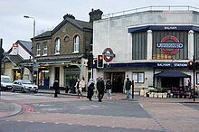 |
Northern | Wandsworth | 3 | 6 Dec 1926 | 9.22 | Balham | |||
| Bank |  |
City of London | 1 | 8 Aug 1898 |
|
34.41[i] | City of London | |||
| Barbican |  |
City of London | 1 | 23 Dec 1865 |
|
5.36 | Barbican | |||
| Barking |  |
Barking and Dagenham | 4 | 2 Jun 1902 | 13 Jun 1854 | 14.56 | Barking | |||
| Barkingside |  |
Central | Redbridge | 4 | 31 May 1948 | 1 May 1903 | 1.12 | Barkingside | ||
| Barons Court |  |
Hammersmith and Fulham | 2 | 9 Oct 1905 | 5.11 | West Kensington | ||||
| Battersea Power Station |  |
Northern | Wandsworth | 1 | 20 Sep 2021 [4] |
Battersea: proposed | 8.65 | Battersea | ||
| Bayswater |  |
City of Westminster | 1 | 1 Oct 1868 |
|
3.34 | Bayswater | |||
| Becontree |  |
District | Barking and Dagenham | 5 | 18 Jul 1932 | 28 Jun 1926 | Gale Street: 1926–1932 | 2.67 | Becontree | |
| Belsize Park |  |
Northern | Camden | 2 | 22 Jun 1907 | Belsize: proposed before opening | 4.59 | Belsize Park | ||
| Bermondsey |  |
Jubilee | Southwark | 2 | 17 Sep 1999 | 6.68 | Bermondsey | |||
| Bethnal Green |  |
Central | Tower Hamlets | 2 | 4 Dec 1946 | Bethnal: proposed before opening | 10.20 | Bethnal Green | ||
| Blackfriars |  |
City of London | 1 | 30 May 1870 | 9.41 | Blackfriars | ||||
| Blackhorse Road |  |
Victoria | Waltham Forest | 3 | 1 Sep 1968 | 8.51 | Walthamstow | |||
| Bond Street |  |
City of Westminster | 1 | 24 Sep 1900 |
|
35.41 | Mayfair | |||
| Borough |  |
Northern | Southwark | 1 | 18 Dec 1890 | 3.74 | Southwark | |||
| Boston Manor |  |
Piccadilly[m] | 4 | 1 May 1883 | Boston Road: 1883–1911 | 1.49 | Hanwell | |||
| Bounds Green | 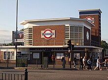 |
Piccadilly | Haringey | 19 Sep 1932 | Brownlow Road: proposed before opening | 4.15 | Bounds Green | |||
| Bow Road |  |
Tower Hamlets | 2 | 11 Jun 1902 | 3.83 | Bow | ||||
| Brent Cross |  |
Northern | Barnet | 3 | 19 Nov 1923 | Brent: 1923–1976 | 2.04 | Brent Cross | ||
| Brixton |  |
Victoria | Lambeth | 2 | 23 Jul 1971 | 21.32 | Brixton | |||
| Bromley-by-Bow |  |
Tower Hamlets | 2 Jun 1902 | 31 Mar 1858 | Bromley: 1858–1968 | 3.43 | Bromley-by-Bow | |||
| Buckhurst Hill |  |
Central | Epping Forest | 5 | 21 Nov 1948 | 22 Aug 1856 | 1.68 | Buckhurst Hill | ||
| Burnt Oak |  |
Northern | Barnet | 4 | 27 Oct 1924 |
|
3.11 | Burnt Oak | ||
| Caledonian Road |  |
Piccadilly | Islington | 2 | 15 Dec 1906 | Barnsbury: proposed before opening | 4.18 | Holloway | ||
| Camden Town |  |
Northern | Camden | 2 | 22 Jun 1907 | Camden Road: proposed before opening | 17.34 | Camden Town | ||
| Canada Water |  |
Jubilee | Southwark | 2 | 17 Sep 1999 | 10.57 | Canada Water | |||
| Canary Wharf |  |
Jubilee | Tower Hamlets | 2 | 17 Sep 1999 | 30.68 | Canary Wharf | |||
| Canning Town |  |
Jubilee | Newham | 14 May 1999 | 14 Jun 1847 | 11.59 | Canning Town | |||
| Cannon Street |  |
City of London | 1 | 6 Oct 1884 | 3.79 | City of London | ||||
| Canons Park |  |
Jubilee[n] | Harrow | 5 | 10 Dec 1932 | Canons Park (Edgware): 1932–1933 | 2.06 | Stanmore | ||
| Chalfont & Latimer |  |
Met. | Buckinghamshire | 8 | 8 Jul 1889 | Chalfont Road: 1889–1915 | 1.30 | Little Chalfont | ||
| Chalk Farm |  |
Northern | Camden | 2 | 22 Jun 1907 | Adelaide Road: proposed before opening | 4.00 | Chalk Farm | ||
| Chancery Lane |  |
Central | 1 | 30 Jul 1900 |
|
8.53 | Holborn | |||
| Charing Cross |  |
City of Westminster | 1 | 10 Mar 1906 |
|
13.66 | Charing Cross | |||
| Chesham |  |
Met. | Buckinghamshire | 9 | 8 Jul 1889 | 0.87 | Chesham | |||
| Chigwell |  |
Central | Epping Forest | 4 | 21 Nov 1948 | 1 May 1903 | 0.31 | Chigwell | ||
| Chiswick Park | 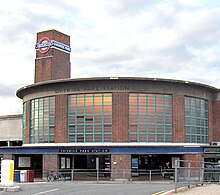 |
District | Ealing | 3 | 1 Jul 1879 |
|
1.90 | Chiswick | ||
| Chorleywood |  |
Met. | Three Rivers | 7 | 8 Jul 1889 |
|
1.34 | Chorleywood | ||
| Clapham Common |  |
Northern | Lambeth | 2 | 3 Jun 1900 | 7.71 | Clapham | |||
| Clapham North |  |
Northern | Lambeth | 2 | 3 Jun 1900 | Clapham Road: 1900–1926 | 5.22 | Clapham | ||
| Clapham South |  |
Northern | Wandsworth | 13 Sep 1926 | Nightingale Lane: proposed before opening | 6.13 | Clapham | |||
| Cockfosters |  |
Piccadilly | Enfield | 5 | 31 Jul 1933 | Trent Park: proposed before opening | 1.41 | Cockfosters | ||
| Colindale |  |
Northern | Barnet | 4 | 18 Aug 1924 | 5.95 | Colindale | |||
| Colliers Wood |  |
Northern | Merton | 3 | 13 Sep 1926 | 4.99 | Colliers Wood | |||
| Covent Garden |  |
Piccadilly | City of Westminster | 1 | 11 Apr 1907 | 12.99 | Covent Garden | |||
| Croxley |  |
Met. | Three Rivers | 7 | 2 Nov 1925 | Croxley Green: 1925–1949 | 0.81 | Croxley Green | ||
| Dagenham East |  |
District | Barking and Dagenham | 5 | 2 Jun 1902 | 1885 | Dagenham: 1888–1949 | 2.33 | Dagenham | |
| Dagenham Heathway |  |
District | Barking and Dagenham | 5 | 12 Sep 1932 | Heathway: 1932–1949 | 4.45 | Dagenham | ||
| Debden |  |
Central | Epping Forest | 6 | 25 Sep 1949 | 24 Apr 1865 |
|
1.77 | Debden | |
| Dollis Hill |  |
Jubilee[n] | Brent | 3 | 1 Oct 1909 | 2.93 | Dollis Hill | |||
| Ealing Broadway |  |
Ealing | 3 | 1 Jul 1879 | 13.43 | Ealing | ||||
| Ealing Common |  |
Ealing | 3 | 1 Jul 1879 |
|
2.02 | Ealing | |||
| Earl's Court |  |
Kensington and Chelsea | 30 Oct 1871 | 1 Feb 1878 | 15.18 | Earl's Court | ||||
| East Acton |  |
Central | Hammersmith and Fulham | 2 | 3 Aug 1920 | 2.71 | Acton | |||
| East Finchley |  |
Northern | Barnet | 3 | 3 Jul 1939 | 22 Aug 1867 | 4.95 | Finchley | ||
| East Ham |  |
Newham | 2 Jun 1902 | 1858 | 9.89 | East Ham | ||||
| East Putney |  |
District | Wandsworth | 3 Jun 1889 | 5.02 | Putney | ||||
| Eastcote |  |
Hillingdon | 5 | 26 May 1906 | 1.99 | Eastcote | ||||
| Edgware |  |
Northern | Barnet | 5 | 18 Aug 1924 | 3.93 | Edgware | |||
| Edgware Road |  |
Bakerloo | City of Westminster | 1 | 15 Jun 1907 | 3.51 | Paddington | |||
| Edgware Road |  |
City of Westminster | 1 | 1 Oct 1863 | 5.07 | Paddington | ||||
| Elephant & Castle |  |
Southwark | 18 Dec 1890 | 13.30 | Elephant & Castle | |||||
| Elm Park |  |
District | Havering | 6 | 13 May 1935 | 2.23 | Elm Park | |||
| Embankment |  |
City of Westminster | 1 | 30 May 1870 |
|
15.13 | Charing Cross | |||
| Epping |  |
Central | Epping Forest | 6 | 25 Sep 1949 | 24 Apr 1865 | 3.02 | Epping | ||
| Euston | 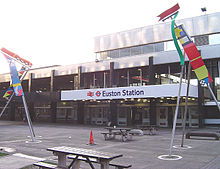 |
Camden | 1 | 22 Jun 1907 | Melton Street: proposed before opening | 27.69 | Camden | |||
| Euston Square | 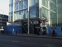 |
Camden | 1 | 10 Jan 1863 | Gower Street: 1863–1909 | 10.33 | Camden | |||
| Fairlop |  |
Central | Redbridge | 4 | 31 May 1948 | 1 May 1903 | 0.87 | Fairlop | ||
| Farringdon |  |
Islington | 1 | 10 Jan 1863 | 23 Dec 1865 | Farringdon Street: 1863–1922 Farringdon & High Holborn: 1922–1936 |
30.07 | Clerkenwell | ||
| Finchley Central |  |
Northern | Barnet | 4 | 14 Apr 1940 | 22 Aug 1867 |
|
6.00 | Finchley | |
| Finchley Road |  |
Camden | 2 | 30 Jun 1879 | 6.68 | West Hampstead | ||||
| Finsbury Park |  |
Islington | 2 | 15 Dec 1906 | 23.40 | Finsbury Park | ||||
| Fulham Broadway |  |
District | Hammersmith and Fulham | 2 | 1 Mar 1880 | Walham Green: 1880–1952 | 6.52 | Walham Green | ||
| Gants Hill |  |
Central | Redbridge | 4 | 14 Dec 1947 |
|
4.75 | Gants Hill | ||
| Gloucester Road |  |
Kensington and Chelsea | 1 | 1 Oct 1868 | Brompton (Gloucester Road): 1868–1907 | 10.49 | South Kensington | |||
| Golders Green |  |
Northern | Barnet | 3 | 22 Jun 1907 | 5.79 | Golders Green | |||
| Goldhawk Road |  |
Hammersmith and Fulham | 2 | 1 Apr 1914 | 1.68 | Shepherd's Bush | ||||
| Goodge Street |  |
Northern | Camden | 1 | 22 Jun 1907 | Tottenham Court Road: 1907–1908 | 5.15 | Fitzrovia | ||
| Grange Hill |  |
Central | Epping Forest | 4 | 21 Nov 1948 | 1 May 1903 | 0.37 | Chigwell | ||
| Great Portland Street |  |
City of Westminster | 1 | 10 Jan 1863 |
|
5.16 | Fitzrovia | |||
| Greenford |  |
Central | Ealing | 4 | 30 Jun 1947 | 1 Oct 1904 | 3.29 | Greenford | ||
| Green Park |  |
City of Westminster | 1 | 15 Dec 1906 | Dover Street: 1906–1933 | 28.42 | Westminster | |||
| Gunnersbury |  |
District | Hounslow | 3 | 1 Jun 1877 | 1 Jan 1869 | Brentford Road: 1869–1871 | 3.87 | Gunnersbury | |
| Hainault |  |
Central | Redbridge | 4 | 31 May 1948 | 1 May 1903 | 2.80 | Hainault | ||
| Hammersmith |  |
Hammersmith and Fulham | 2 | 9 Sep 1874 | 20.06 | Hammersmith | ||||
| Hammersmith |  |
Hammersmith and Fulham | 2 | 13 Jun 1864 | 1 Dec 1868 | 8.04 | Hammersmith | |||
| Hampstead | 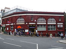 |
Northern | Camden | 22 Jun 1907 | Heath Street: proposed before opening | 3.61 | Hampstead | |||
| Hanger Lane |  |
Central | Ealing | 3 | 30 Jun 1947 | 2.58 | Hanger Hill | |||
| Harlesden |  |
Bakerloo | Brent | 3 | 16 Apr 1917 | 15 Jun 1912 | 2.33 | Harlesden | ||
| Harrow & Wealdstone |  |
Bakerloo | Harrow | 5 | 16 Apr 1917 | 20 Jul 1837 | Harrow: 1837–1897 | 3.23 | Wealdstone | |
| Harrow-on-the-Hill |  |
Met. | Harrow | 5 | 2 Aug 1880 | 15 Mar 1899 | Harrow: 1880–1894 | 8.22 | Harrow | |
| Hatton Cross |  |
Piccadilly | Hillingdon | 19 Jul 1975 | 2.63 | Hatton | ||||
| Heathrow Terminals 2 & 3 |  |
Piccadilly | Hillingdon | 6 | 16 Dec 1977 |
|
5.73 | Heathrow Airport | ||
| Heathrow Terminal 4 |  |
Piccadilly | Hillingdon | 6 | 12 Apr 1986 | 1.23[r] | Heathrow Airport | |||
| Heathrow Terminal 5 |  |
Piccadilly | Hillingdon | 6 | 27 Mar 2008 | 3.63 | Heathrow Airport | |||
| Hendon Central |  |
Northern | Barnet | 19 Nov 1923 | 4.94 | Hendon | ||||
| High Barnet |  |
Northern | Barnet | 5 | 14 Apr 1940 | 1 Apr 1872 | 3.17 | Chipping Barnet | ||
| Highbury & Islington |  |
Victoria | Islington | 2 | 1 Sep 1968 | 28 Jun 1904 | Highbury: 1867–1922 | 13.76 | Highbury | |
| Highgate |  |
Northern | Haringey | 3 | 19 Jan 1941 | 22 Aug 1867 | 4.24 | Highgate | ||
| High Street Kensington | 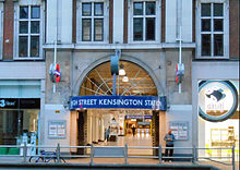 |
Kensington and Chelsea | 1 | 1 Oct 1868 | Kensington: proposed before opening | 8.54 | Kensington | |||
| Hillingdon |  |
Hillingdon | 6 | 10 Dec 1923 | 6 Dec 1992 |
|
1.33 | Hillingdon | ||
| Holborn |  |
Camden | 1 | 15 Dec 1906 |
|
21.06 | Holborn | |||
| Holland Park |  |
Central | Kensington and Chelsea | 2 | 30 Jul 1900 | Lansdown Road: proposed before opening | 2.65 | Holland Park | ||
| Holloway Road |  |
Piccadilly | Islington | 2 | 15 Dec 1906 | Holloway: proposed before opening | 5.23 | Holloway | ||
| Hornchurch |  |
District | Havering | 6 | 2 Jun 1902 | 1 May 1885 | 1.47 | Hornchurch | ||
| Hounslow Central |  |
Piccadilly[m] | Hounslow | 4 | 1 Apr 1886 | Heston Hounslow: 1886–1925 | 2.88 | Hounslow | ||
| Hounslow East |  |
Piccadilly[m] | Hounslow | 4 | 2 May 1909 | Hounslow Town: 1909–1925 | 3.22 | Hounslow | ||
| Hounslow West |  |
Piccadilly[m] | Hounslow | 5 | 21 Jul 1884 | Hounslow Barracks: 1884–1925 | 2.88 | Hounslow | ||
| Hyde Park Corner | 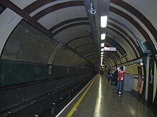 |
Piccadilly | City of Westminster | 1 | 15 Dec 1906 | 4.74 | Knightsbridge | |||
| Ickenham |  |
Hillingdon | 6 | 25 Sep 1905 | 0.82 | Ickenham | ||||
| Kennington |  |
Northern | Southwark | 18 Dec 1890 | New Street: proposed before opening | 4.41 | Kennington | |||
| Kensal Green |  |
Bakerloo | Brent | 2 | 1 Oct 1916 | 1.81 | Kensal Green | |||
| Kensington (Olympia) |  |
District | Kensington and Chelsea | 2 | 1 Jul 1864 | 27 May 1844 |
|
2.10 | Kensington | |
| Kentish Town |  |
Northern | Camden | 2 | 22 Jun 1907 | 6.30 | Kentish Town | |||
| Kenton |  |
Bakerloo | Brent | 4 | 16 Apr 1917 | 15 Jun 1912 | 1.52 | Kenton | ||
| Kew Gardens |  |
District | Richmond | 1 Jun 1877 | 1 Jul 1869 | 3.97 | Kew | |||
| Kilburn |  |
Jubilee[n] | Brent | 2 | 24 Nov 1879 | Kilburn and Brondesbury: 1879–1950 | 5.52 | Kilburn | ||
| Kilburn Park |  |
Bakerloo | Brent | 2 | 31 Jan 1915 | 2.43 | Kilburn | |||
| Kingsbury |  |
Jubilee[n] | Brent | 4 | 10 Dec 1932 | 3.37 | Kingsbury | |||
| King's Cross St Pancras |  |
Camden | 1 | 10 Jan 1863 | 9 Mar 1941 (Met.) |
|
69.94 | King's Cross | ||
| Knightsbridge |  |
Piccadilly | Kensington and Chelsea | 1 | 15 Dec 1906 | Sloane Street: proposed before opening | 13.27 | Knightsbridge | ||
| Ladbroke Grove |  |
Kensington and Chelsea | 2 | 13 Jun 1864 |
|
5.10 | Ladbroke Grove | |||
| Lambeth North |  |
Bakerloo | Lambeth | 1 | 10 Mar 1906 |
|
2.57 | Lambeth | ||
| Lancaster Gate |  |
Central | City of Westminster | 1 | 30 Jul 1900 | Westbourne: proposed before opening | 3.65 | Paddington | ||
| Latimer Road |  |
Kensington and Chelsea | 2 | 16 Dec 1868 | 3.65 | North Kensington | ||||
| Leicester Square |  |
City of Westminster | 1 | 15 Dec 1906 | Cranbourn Street: proposed before opening | 29.39 | West End | |||
| Leyton |  |
Central | Waltham Forest | 3 | 5 May 1947 | 22 Aug 1856 | Low Leyton: 1856–1868 | 8.36 | Leyton | |
| Leytonstone |  |
Central | Waltham Forest | 5 May 1947 | 22 Aug 1856 | 6.70 | Leytonstone | |||
| Liverpool Street |  |
City of London | 1 | 1 Feb 1875 | 12 Jul 1875 | Bishopsgate: 1875–1909 | 55.84 | Bishopsgate | ||
| London Bridge |  |
Southwark | 1 | 25 Feb 1900 | 56.20 | Southwark | ||||
| Loughton | 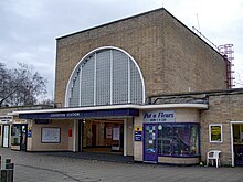 |
Central | Epping Forest | 6 | 21 Nov 1948 | 22 Aug 1856 | 2.65 | Loughton | ||
| Maida Vale |  |
Bakerloo | City of Westminster | 2 | 6 Jun 1915 | Elgin Avenue: proposed before opening | 2.50 | Maida Vale | ||
| Manor House |  |
Piccadilly | 19 Sep 1932 | 6.02 | Manor House | |||||
| Mansion House |  |
City of London | 1 | 3 Jul 1871 | 4.14 | Castle Baynard | ||||
| Marble Arch |  |
Central | City of Westminster | 1 | 30 Jul 1900 | 9.60 | Marylebone | |||
| Marylebone |  |
Bakerloo | City of Westminster | 1 | 27 Mar 1907 | Great Central: 1907–1917 | 8.72 | Marylebone | ||
| Mile End | 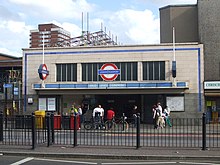 |
Tower Hamlets | 2 | 2 Jun 1902 | 11.36 | Mile End | ||||
| Mill Hill East |  |
Northern | Barnet | 4 | 18 May 1941 | 22 Aug 1867 |
|
1.41 | Mill Hill | |
| Monument |  |
City of London | 1 | 6 Oct 1884 |
|
34.41[i] | City of London | |||
| Moorgate |  |
City of London | 1 | 23 Dec 1865 | Moorgate Street [Metropolitan]: 1865–1924 | 20.01 | Moorgate | |||
| Moor Park |  |
Met. | Three Rivers | 9 May 1910 |
|
0.73 | Moor Park | |||
| Morden |  |
Northern | Merton | 4 | 13 Sep 1926 | North Morden: proposed before opening | 7.68 | Morden | ||
| Mornington Crescent |  |
Northern | Camden | 2 | 22 Jun 1907 | Seymour Street: proposed before opening | 2.67 | Camden Town | ||
| Neasden |  |
Jubilee[n] | Brent | 3 | 2 Aug 1880 | Kingsbury & Neasden: 1880–1910 Neasden & Kingsbury: 1910–1932 |
2.49 | Neasden | ||
| Newbury Park |  |
Central | Redbridge | 4 | 14 Dec 1947 | 1 May 1903 | 3.53 | Newbury Park | ||
| Nine Elms |  |
Northern | Wandsworth | 1 | 20 Sep 2021 [4] |
3.47 | Nine Elms | |||
| North Acton |  |
Central | Ealing | 5 Nov 1923 | 5.23 | Acton | ||||
| North Ealing |  |
Piccadilly[g] | Ealing | 3 | 23 Jun 1903 | 0.59 | Ealing | |||
| North Greenwich |  |
Jubilee | Greenwich | 14 May 1999 | 21.20 | Greenwich | ||||
| North Harrow |  |
Met. | Harrow | 5 | 22 Mar 1915 | 1.31 | Harrow | |||
| North Wembley |  |
Bakerloo | Brent | 4 | 16 Apr 1917 | 15 Jun 1912 | 1.20 | North Wembley | ||
| Northfields |  |
Piccadilly[m] | Ealing | 3 | 16 Apr 1908 | 19 May 1932 |
|
2.63 | Northfields | |
| Northolt |  |
Central | Ealing | 5 | 21 Nov 1948 | 3.96 | Northolt | |||
| Northwick Park |  |
Met. | Brent | 4 | 28 Jun 1923 | Northwick Park & Kenton: 1923–1933 | 3.17 | Kenton | ||
| Northwood |  |
Met. | Hillingdon | 6 | 1 Sep 1887 | 2.04 | Northwood | |||
| Northwood Hills |  |
Met. | Hillingdon | 6 | 13 Nov 1933 | 1.34 | Northwood | |||
| Notting Hill Gate |  |
Kensington and Chelsea | 1 Oct 1868 | 11.69 | Notting Hill | |||||
| Oakwood |  |
Piccadilly | Enfield | 5 | 13 Mar 1933 |
|
2.23 | Oakwood | ||
| Old Street |  |
Northern | Islington Hackney |
1 | 17 Nov 1901 | 16.18 | St Luke's | |||
| Osterley |  |
Piccadilly[m] | Hounslow | 4 | 1 May 1883 | 25 Mar 1934 | Osterley & Spring Grove: 1883–1934 | 1.74 | Osterley | |
| Oval |  |
Northern | Lambeth | 2 | 18 Dec 1890 |
|
5.36 | Oval | ||
| Oxford Circus |  |
Central Bakerloo Victoria |
City of Westminster | 1 | 30 Jul 1900 | 54.02 | West End | |||
| Paddington | District[k] Circle Bakerloo |
City of Westminster | 1 | 1 Oct 1868 | Paddington (Praed Street) [ Circle]: 1868–1947 | 46.65[s] | Paddington | |||
| Paddington |  |
H&C[q] Circle |
City of Westminster | 1 | 10 Jan 1863 | Paddington (Bishop's Road): 1863–1933 | 46.65[s] | Paddington | ||
| Park Royal |  |
Piccadilly | Ealing | 3 | 23 Jun 1903 | 6 Jul 1931 |
|
1.65 | Park Royal | |
| Parsons Green |  |
District | Hammersmith and Fulham | 2 | 1 Mar 1880 | 5.03 | Parsons Green | |||
| Perivale |  |
Central | Ealing | 4 | 30 Jun 1947 | 2 May 1904 | Perivale Halt: 1904–1947 | 1.69 | Perivale | |
| Piccadilly Circus |  |
Bakerloo Piccadilly |
City of Westminster | 1 | 10 Mar 1906 | 27.68 | West End | |||
| Pimlico |  |
Victoria | City of Westminster | 1 | 14 Sep 1972 | 6.93 | Pimlico | |||
| Pinner |  |
Met. | Harrow | 5 | 25 May 1885 | 2.11 | Pinner | |||
| Plaistow |  |
District[j] H&C |
Newham | 3 | 2 Jun 1902 | 31 Mar 1858 | 4.01 | Plaistow | ||
| Preston Road |  |
Met. | Brent | 4 | 21 May 1908 | 3 Jan 1932 | 2.30 | Preston | ||
| Putney Bridge |  |
District | Hammersmith and Fulham | 2 | 1 Mar 1880 |
|
4.81 | Fulham | ||
| Queen's Park |  |
Bakerloo | Brent | 2 | 11 Feb 1915 | 2 Jun 1879 | Queen's Park (West Kilburn): 1879–1915 | 4.15 | Queen's Park | |
| Queensbury |  |
Jubilee[n] | Brent | 4 | 16 Dec 1934 | 3.07 | Queensbury | |||
| Queensway |  |
Central | City of Westminster | 1 | 30 Jul 1900 | Queen's Road: 1900–1946 | 6.52 | Bayswater | ||
| Ravenscourt Park |  |
District | Hammersmith and Fulham | 2 | 1 Jun 1877 | 1 Jan 1873 | Shaftesbury Road: 1877–1888 | 2.58 | Hammersmith | |
| Rayners Lane |  |
Met. Piccadilly[o] |
Harrow | 5 | 26 May 1906 | 3.04 | Rayners Lane | |||
| Redbridge |  |
Central | Redbridge | 4 | 14 Dec 1947 |
|
2.04 | Redbridge | ||
| Regent's Park |  |
Bakerloo | City of Westminster | 1 | 10 Mar 1906 | 2.15 | Marylebone | |||
| Richmond |  |
District | Richmond | 4 | 1 Jun 1877 | 1 Jan 1869 | 3.74 | Richmond | ||
| Rickmansworth |  |
Met. | Three Rivers | 7 | 1 Sep 1887 | 1.77 | Rickmansworth | |||
| Roding Valley |  |
Central | Epping Forest Redbridge |
4 | 21 Nov 1948 | 3 Feb 1936 | 0.26 | Buckhurst Hill | ||
| Royal Oak |  |
H&C[q] Circle |
City of Westminster | 2 | 30 Oct 1871 | 4 Jun 1838 | 1.98 | Westbourne | ||
| Ruislip |  |
Met. Piccadilly[o] |
Hillingdon | 6 | 4 Jul 1904 | 1.37 | Ruislip | |||
| Ruislip Gardens |  |
Central | Hillingdon | 5 | 29 Nov 1948 | 9 Jul 1934 | 0.77 | Ruislip | ||
| Ruislip Manor |  |
Met. Piccadilly[o] |
Hillingdon | 6 | 5 Aug 1912 | 1.35 | Ruislip | |||
| Russell Square |  |
Piccadilly | Camden | 1 | 15 Dec 1906 | 8.59 | Bloomsbury | |||
| St James's Park |  |
District[l] Circle |
City of Westminster | 1 | 24 Dec 1868 | 8.54 | St James's | |||
| St John's Wood |  |
Jubilee[t] | City of Westminster | 2 | 20 Nov 1939 | Acacia Road: proposed before opening | 5.63 | St John's Wood | ||
| St Paul's |  |
Central | City of London | 1 | 30 Jul 1900 |
|
9.13 | Smithfield | ||
| Seven Sisters |  |
Victoria | Haringey | 3 | 1 Sep 1968 | 16.72 | Seven Sisters | |||
| Shepherd's Bush |  |
Central | Hammersmith and Fulham | 2 | 30 Jul 1900 | 13.13 | Shepherd's Bush | |||
| Shepherd's Bush Market |  |
H&C[q] Circle |
Hammersmith and Fulham | 2 | 13 Jun 1864 | 1 Apr 1914 | Shepherd's Bush: 1864–2008 | 2.89 | Shepherd's Bush | |
| Sloane Square |  |
District[l] Circle |
Kensington and Chelsea | 1 | 24 Dec 1868 | 12.77 | Chelsea | |||
| Snaresbrook |  |
Central | Redbridge | 4 | 14 Dec 1947 | 22 Aug 1856 | Snaresbrook & Wanstead: 1856–1947 | 1.67 | Snaresbrook | |
| South Ealing |  |
Piccadilly[m] | Ealing | 3 | 1 May 1883 | 2.51 | Ealing | |||
| South Harrow |  |
Piccadilly[g] | Harrow | 5 | 28 Jun 1903 | 5 Jul 1935 | 1.67 | Harrow | ||
| South Kensington |  |
District[l] Piccadilly Circle |
Kensington and Chelsea | 1 | 24 Dec 1868 | 24.33 | South Kensington | |||
| South Kenton |  |
Bakerloo | Brent | 4 | 3 Jul 1933 | 1.01 | Kenton | |||
| South Ruislip |  |
Central | Hillingdon | 5 | 23 Nov 1948 | 1 May 1908 |
|
1.41 | South Ruislip | |
| South Wimbledon |  |
Northern | Merton | 13 Sep 1926 |
|
3.30 | Wimbledon | |||
| South Woodford |  |
Central | Redbridge | 4 | 14 Dec 1947 | 22 Aug 1856 |
|
3.79 | South Woodford | |
| Southfields |  |
District | Wandsworth | 3 | 3 Jun 1889 | 4.45 | Southfields | |||
| Southgate |  |
Piccadilly | Enfield | 4 | 13 Mar 1933 | Chase Side: proposed before opening | 3.78 | Southgate | ||
| Southwark |  |
Jubilee | Southwark | 1 | 24 Sep 1999 | 8.92 | Bankside | |||
| Stamford Brook |  |
District | Hammersmith and Fulham | 2 | 1 Feb 1912 | 2.11 | Chiswick | |||
| Stanmore |  |
Jubilee[n] | Harrow | 5 | 10 Dec 1932 | 2.90 | Stanmore | |||
| Stepney Green |  |
District[j] H&C |
Tower Hamlets | 2 | 23 Jun 1902 | 4.69 | Stepney | |||
| Stockwell |  |
Northern Victoria |
Lambeth | 2 | 18 Dec 1890 | 7.46 | Stockwell | |||
| Stonebridge Park |  |
Bakerloo | Brent | 3 | 16 Apr 1917 | 15 Jun 1912 | 2.20 | Tokyngton | ||
| Stratford | 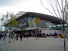 |
Central Jubilee |
Newham | 4 Dec 1946 | 1839 | 47.88 | Stratford | |||
| Sudbury Hill | 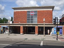 |
Piccadilly[g] | Harrow | 4 | 28 Jun 1903 | 1.51 | Sudbury | |||
| Sudbury Town |  |
Piccadilly[g] | Brent Ealing |
4 | 28 Jun 1903 | 1.39 | Sudbury | |||
| Swiss Cottage |  |
Jubilee[t] | Camden | 2 | 20 Nov 1939 | 4.94 | Swiss Cottage | |||
| Temple |  |
District[l] Circle |
City of Westminster | 1 | 30 May 1870 | 6.37 | Temple | |||
| Theydon Bois |  |
Central | Epping Forest | 6 | 25 Sep 1949 | 24 Apr 1865 | Theydon: 1865 | 0.68 | Theydon Bois | |
| Tooting Bec |  |
Northern | Wandsworth | 3 | 13 Sep 1926 | Trinity Road (Tooting Bec): 1926–1950 | 5.94 | Tooting | ||
| Tooting Broadway |  |
Northern | Wandsworth | 3 | 13 Sep 1926 | 11.62 | Tooting | |||
| Tottenham Court Road |  |
Central Northern |
Camden | 1 | 30 Jul 1900 | Oxford Street [Northern]: 1907–1908 | 48.95 | St Giles | ||
| Tottenham Hale |  |
Victoria | Haringey | 3 | 1 Sep 1968 | 12.49 | Tottenham Hale | |||
| Totteridge & Whetstone |  |
Northern | Barnet | 4 | 14 Apr 1940 | 1 Apr 1872 | Totteridge: 1872–1874 | 1.81 | Whetstone | |
| Tower Hill |  |
District[l] Circle |
Tower Hamlets | 1 | 25 Sep 1882 |
|
|
15.40 | Tower Hill | |
| Tufnell Park |  |
Northern | Islington | 2 | 22 Jun 1907 | 2.97 | Tufnell Park | |||
| Turnham Green |  |
District Piccadilly |
Hounslow | 1 Jun 1877 | 1 Jan 1869 | 4.68 | Chiswick | |||
| Turnpike Lane |  |
Piccadilly | Haringey | 3 | 19 Sep 1932 |
|
7.89 | Noel Park | ||
| Upminster |  |
District | Havering | 6 | 2 Jun 1902 | 1 May 1885 | 3.77 | Upminster | ||
| Upminster Bridge |  |
District | Havering | 6 | 17 Dec 1934 | 0.74 | Upminster Bridge | |||
| Upney |  |
District | Barking and Dagenham | 4 | 12 Sep 1932 | 1.94 | Barking | |||
| Upton Park |  |
District[j] H&C |
Newham | 3 | 2 Jun 1902 | 1877 | 7.69 | Upton Park | ||
| Uxbridge |  |
Met. Piccadilly[o] |
Hillingdon | 6 | 4 Jul 1904 | 4 Dec 1938 | 5.76 | Uxbridge | ||
| Vauxhall |  |
Victoria | Lambeth | 23 Jul 1971 | 20.88 | Vauxhall | ||||
| Victoria |  |
District[l] Circle Victoria |
City of Westminster | 1 | 24 Dec 1868 | 56.43 | Belgravia | |||
| Walthamstow Central |  |
Victoria | Waltham Forest | 3 | 1 Sep 1968 | 12.81 | Walthamstow | |||
| Wanstead |  |
Central | Redbridge | 4 | 14 Dec 1947 | 1.88 | Wanstead | |||
| Warren Street |  |
Northern Victoria |
Camden | 1 | 22 Jun 1907 | Euston Road: 1907–1908 | 13.01 | Fitzrovia | ||
| Warwick Avenue |  |
Bakerloo | City of Westminster | 2 | 31 Jan 1915 | Warrington Crescent: proposed before opening | 2.87 | Little Venice | ||
| Waterloo |  |
W&C Bakerloo Northern Jubilee |
Lambeth | 1 | 10 Mar 1906 | 68.72 | Waterloo | |||
| Watford |  |
Met. | Watford | 7 | 2 Nov 1925 | 1.68 | Cassiobury | |||
| Wembley Central |  |
Bakerloo | Brent | 4 | 16 Apr 1917 | 1842 |
|
4.37 | Wembley | |
| Wembley Park |  |
Met. Jubilee[p] |
Brent | 4 | 12 May 1894 | 15.00 | Wembley Park | |||
| West Acton |  |
Central | Ealing | 3 | 5 Nov 1923 | 1.10 | Acton | |||
| West Brompton |  |
District | Kensington and Chelsea | 2 | 12 Apr 1869 | Richmond Road: proposed before opening | 4.42 | West Brompton | ||
| West Finchley |  |
Northern | Barnet | 4 | 14 Apr 1940 | 1 Mar 1933 | 1.20 | Finchley | ||
| West Ham |  |
District[j] H&C Jubilee |
Newham | 2 Jun 1902 | 1901 |
|
4.51 | West Ham | ||
| West Hampstead |  |
Jubilee[n] | Camden | 2 | 30 Jun 1879 | 7.10 | West Hampstead | |||
| West Harrow |  |
Met. | Harrow | 5 | 17 Nov 1913 | 0.94 | Harrow | |||
| West Kensington |  |
District | Hammersmith and Fulham | 2 | 9 Sep 1874 | North End (Fulham): 1874–1877 | 3.61 | West Kensington | ||
| West Ruislip |  |
Central | Hillingdon | 6 | 21 Nov 1948 | 2 Apr 1906 |
|
1.14 | Ruislip | |
| Westbourne Park |  |
H&C[q] Circle |
City of Westminster | 2 | 1 Feb 1866 | 1 Nov 1871 | 3.21 | Notting Hill | ||
| Westminster |  |
District[l] Circle Jubilee |
City of Westminster | 1 | 24 Dec 1868 | Westminster Bridge: 1868–1907 | 17.98 | Westminster | ||
| White City |  |
Central | Hammersmith and Fulham | 2 | 23 Nov 1947 | 7.39 | White City | |||
| Whitechapel |  |
District[j] H&C |
Tower Hamlets | 2 | 1 Oct 1884 | 10 Apr 1876 | Whitechapel (Mile End): 1884–1901 | 14.27 | Whitechapel | |
| Willesden Green |  |
Jubilee[n] | Brent | 24 Nov 1879 | 5.35 | Willesden | ||||
| Willesden Junction |  |
Bakerloo | Brent | 10 May 1915 | 4.41 | Harlesden | ||||
| Wimbledon |  |
District | Merton | 3 | 3 Jun 1889 | 11.52 | Wimbledon | |||
| Wimbledon Park |  |
District | Merton | 3 | 3 Jun 1889 | 1.70 | Wimbledon | |||
| Wood Green |  |
Piccadilly | Haringey | 3 | 19 Sep 1932 | Lordship Lane: proposed before opening | 9.12 | Wood Green | ||
| Wood Lane |  |
H&C Circle |
Hammersmith and Fulham | 2 | 12 Oct 2008 | 4.13 | Shepherd's Bush | |||
| Woodford |  |
Central | Redbridge | 4 | 14 Dec 1947 | 22 Aug 1856 | 4.24 | Woodford | ||
| Woodside Park |  |
Northern | Barnet | 4 | 12 Apr 1940 | 1 Apr 1872 |
|
3.47 | Woodside Park |
Fictional stations
See also
|

- List of London railway stations
- List of Docklands Light Railway stations
- List of former and unopened London Underground stations
- List of busiest London Underground stations
- London Underground stations that are listed buildings
- Timeline of the London Underground
Notes
- ^ Where more than one line serves a station, lines are listed in the order of opening. In some cases stations were first served by one underground line but later transferred to another.
- ^ Some stations are assigned to multiple zones.
- ^ The other names listed may have been used previously on station signage, on network maps, in advertisements or in planning material.
- ^ In the early years, slightly different names were sometimes employed contemporaneously for different purposes or on different parts of a station. A number of stations continue to bear obsolete early names where these form part of the physical architecture. For example, the platform wall tiling at Arsenal, Hampstead, Marylebone and Warren Street still carries the original names of these stations.
- ^ First served by Metropolitan line – Circle line services separately identified in 1949.[5]
- ^ a b First served by Metropolitan line – Hammersmith & City line services separately identified in 1990.[5]
- ^ a b c d e First served by District line – service transferred to Piccadilly line in 1933.[5]
- ^ a b c d e f g h First served by Metropolitan line – Circle line services separately identified in 1949, Hammersmith & City line services separately identified in 1990.[5]
- ^ a b Bank and Monument operate as a combined station with shared usage statistics.
- ^ a b c d e f g h i j First served by District line – Metropolitan line service added in stages which was transferred to Hammersmith & City line in 1990.[5]
- ^ a b c d e f First served by Metropolitan line – District line service added in stages, Circle line services separately identified in 1949.[5]
- ^ a b c d e f g h i j k l First served by District line – Circle line services separately identified in 1949.[5]
- ^ a b c d e f g First served by District line – service transferred to Piccadilly line in 1964.[5]
- ^ a b c d e f g h i First served by Metropolitan line – service transferred to Bakerloo line in 1939 and then to the Jubilee line in 1979.[5]
- ^ a b c d e f g First served by Metropolitan line – District line service added in 1910 which was transferred to Piccadilly line in 1933.[5]
- ^ a b First served by Metropolitan line – Bakerloo line service added in 1939 which was transferred to the Jubilee line in 1979.[5]
- ^ a b c d e f g h First served by Metropolitan line – Hammersmith & City line services separately identified in 1990,[5] Circle line service added in 2009.[9]
- ^ Heathrow Terminal 4 station was closed during the COVID national lockdown.
- ^ a b The two Paddington stations operate as a combined station with shared usage statistics.
- ^ a b First served by Bakerloo line – service transferred to Jubilee line in 1979.[5]
References
- ^ "A brief history of the Underground". Transport for London. Archived from the original on 19 August 2014. Retrieved 11 August 2014.
- ^ "Facts & Figures". Transport for London. Archived from the original on 27 September 2014. Retrieved 11 August 2014.
- ^ "London Underground". Transport for London. Archived from the original on 29 July 2014. Retrieved 11 August 2014.
- ^ a b c "New Northern line stations open today as Tube extends to Battersea Power Station". Transport for London. 20 September 2021. Archived from the original on 20 September 2021. Retrieved 20 September 2021.
- ^ a b c d e f g h i j k l m n Rose, Douglas (1999). The London Underground, A Diagrammatic History. London: Douglas Rose/Capital Transport. ISBN 1-85414-219-4. OCLC 59556887.
- ^ Harris, Cyril M. (2006) [1977]. What's in a name?. Capital Transport. ISBN 1-85414-241-0.
- ^ "Station Usage Data" (XLSX). Usage Statistics for London Stations, 2021. Transport for London. 12 July 2022. Retrieved 7 September 2022.
- ^ Dumayne, Alan (1998). Southgate. Sutton Publishing Limited. p. 44. ISBN 0-7509-2000-9.
- ^ "Circle Line extended to the west". BBC News. 5 March 2009. Archived from the original on 10 March 2009. Retrieved 4 April 2011.
Further reading
- Connor, J.E. (1999). London's Disused Underground Stations. Capital Transport. ISBN 1-85414-250-X. OCLC 57630283.
- Gillham, John C. (2001). The Waterloo & City Railway. Oakwood Press. ISBN 978-0-85361-525-5. OCLC 59402958.
- Leboff, David (1994). ABC London Underground Stations. Ian Allan. ISBN 0-7110-2226-7.
- Lee, Charles E. (1973). The Bakerloo line, a Brief History. London: London Transport. OCLC 59998073.
- Lee, Charles E. The Central line, a Brief History. London: London Transport. OCLC 3470185.
- Lee, Charles E. (1973). The District line, a Brief History. London: London Transport. OCLC 59998301.
- Lee, Charles E. (1976). The East London Line and the Thames Tunnel, a Brief History. London: London Transport. OCLC 24459581.
- Lee, Charles E. (1972). The Metropolitan line, a Brief History. London: London Transport. OCLC 59998061.
- Lee, Charles E. (1973). The Northern line, a Brief History. London: London Transport. OCLC 59998137.
- Lee, Charles E. (1973). The Piccadilly line, a Brief History. London: London Transport. OCLC 59998126.
- Menear, Laurence (1983). London's Underground Stations: a social and architectural study. Midas Books. ISBN 978-0-85936-124-8. OCLC 12695214.
- Wolmar, Christian (2004). The Subterranean Railway: How the London Underground Was Built and How It Changed the City Forever. Atlantic Books. ISBN 1-84354-023-1. OCLC 60794863.
External links
- Tube – Transport for London Archived 12 December 2020 at the Wayback Machine
- Video of every London Underground Station on YouTube