Loon op Zand: Difference between revisions
JJMC89 bot (talk | contribs) Migrate {{Infobox settlement}} coordinates parameters to {{Coord}}, see Wikipedia:Coordinates in infoboxes |
No edit summary |
||
| (27 intermediate revisions by 18 users not shown) | |||
| Line 1: | Line 1: | ||
{{Infobox settlement |
{{Infobox settlement |
||
<!-- See Template:Infobox settlement for additional fields and descriptions --> |
<!-- See Template:Infobox settlement for additional fields and descriptions --> |
||
<!-- Name and transliteration --> |
<!-- Name and transliteration -->| name = Loon op Zand |
||
| settlement_type = [[List of municipalities of the Netherlands|Municipality]] |
|||
| name = Loon op Zand |
|||
<!-- Images, nickname, motto -->| image_skyline = Kaatsheuvel molen De Eendragt.jpg |
|||
| settlement_type = [[List of municipalities of the Netherlands|Municipality]] |
|||
| image_alt = |
|||
<!-- Images, nickname, motto --> |
|||
| |
| image_caption = Windmill in [[Kaatsheuvel]] |
||
| |
| image_flag = Flag of Loon op Zand.svg |
||
| |
| flag_size = 100x67px |
||
| |
| flag_alt = |
||
| |
| image_shield = Loon op Zand-wapen.svg |
||
| |
| shield_size = 100x80px |
||
| |
| shield_alt = <!-- Maps, coordinates --> |
||
| |
| image_map = Map - NL - Municipality code 0809 (2009).svg |
||
| map_alt = Highlighted position of Loon op Zand in a municipal map of North Brabant |
|||
| shield_alt = |
|||
| map_caption = Location in North Brabant |
|||
<!-- Maps, coordinates --> |
|||
| coordinates = {{coord|51|40|N|5|2|E|region:NL|display=inline,title}} |
|||
| image_map = Map - NL - Municipality code 0809 (2009).svg |
|||
| coordinates_footnotes = |
|||
| map_alt = Highlighted position of Loon op Zand in a municipal map of North Brabant |
|||
| subdivision_type = [[List of sovereign states|Country]] |
|||
| map_caption = Location in North Brabant |
|||
| subdivision_name = [[Netherlands]] |
|||
| coordinates = {{coord|51|40|N|5|2|E|region:NL|display=inline,title}} |
|||
| subdivision_type1 = [[Provinces of the Netherlands|Province]] |
|||
| coordinates_footnotes = |
|||
| subdivision_name1 = [[North Brabant]] |
|||
| subdivision_type = [[List of sovereign states|Country]] |
|||
| government_footnotes = <ref name="mayor_now">{{cite web |
|||
| subdivision_name = [[Netherlands]] |
|||
|url = https://www.loonopzand.nl/bestuur/college-van-burgemeester-en-wethouders/wim-luijendijk |
|||
| subdivision_type1 = [[Provinces of the Netherlands|Province]] |
|||
|title = Burgemeester dhr. W.C. Luijendijk |
|||
| subdivision_name1 = [[North Brabant]] |
|||
|language = Dutch |
|||
| government_footnotes = <ref name="mayor_now">{{cite web |
|||
|publisher = Gemeente Loon op Zand |
|||
|url = https://www.loonopzand.nl/bestuur/college-van-burgemeester-en-wethouders/wim-luijendijk/ |
|||
|accessdate = 29 May 2014 |
|||
|title = Burgemeester dhr. W.C. Luijendijk |
|||
| |
|url-status = dead |
||
|archiveurl = https://web.archive.org/web/20140530035442/https://www.loonopzand.nl/bestuur/college-van-burgemeester-en-wethouders/wim-luijendijk/ |
|||
|language = Dutch |
|||
|archivedate = 30 May 2014 |
|||
|author = |
|||
}}</ref> |
|||
|date = |
|||
| governing_body = [[Municipal council (Netherlands)|Municipal council]] |
|||
|work = |
|||
| leader_party = [[People's Party for Freedom and Democracy|VVD]] |
|||
|publisher = Gemeente Loon op Zand |
|||
| leader_title = [[Burgemeester|Mayor]] |
|||
|accessdate = 29 May 2014}}</ref> |
|||
| |
| leader_name = [[Hanne van Aart]] |
||
<!-- Geographic information -->| unit_pref = Metric |
|||
| leader_party = [[Labour Party (Netherlands)|PvdA]] |
|||
| leader_title = [[Burgemeester|Mayor]] |
|||
| leader_name = [[Wim Luijendijk]] |
|||
<!-- Geographic information --> |
|||
| unit_pref = Metric |
|||
<!-- ALL fields with measurements have automatic unit conversion --> |
<!-- ALL fields with measurements have automatic unit conversion --> |
||
<!-- for references: use <ref> tags --> |
<!-- for references: use <ref> tags -->| area_footnotes = <ref>{{Dutch municipality total area|dataref}}</ref> |
||
<!-- square kilometers -->| area_total_km2 = {{Dutch municipality total area|Loon op Zand}} |
|||
| area_land_km2 = {{Dutch municipality land area|Loon op Zand}} |
|||
<!-- square kilometers --> |
|||
| |
| area_water_km2 = {{Dutch municipality water area|Loon op Zand}} |
||
| elevation_footnotes = <ref name="AHN">{{cite web |
|||
| area_land_km2 = {{Dutch municipality land area|Loon op Zand}} |
|||
|url=http://www.ahn.nl/postcodetool |
|||
| area_water_km2 = {{Dutch municipality water area|Loon op Zand}} |
|||
|title=Postcodetool for 5171EJ |
|||
| elevation_footnotes = <ref name="AHN">{{cite web |
|||
|language=Dutch |
|||
|url = http://www.ahn.nl/postcodetool |
|||
|work=Actueel Hoogtebestand Nederland |
|||
|title = Postcodetool for 5171EJ |
|||
|publisher=Het Waterschapshuis |
|||
|trans_title = |
|||
|accessdate=29 May 2014 |
|||
|language = Dutch |
|||
|url-status=dead |
|||
|author = <!--Staff writer(s); no by-line.--> |
|||
|archiveurl=https://web.archive.org/web/20130921053543/http://www.ahn.nl/postcodetool |
|||
|date = |
|||
|archivedate=21 September 2013 |
|||
|work = Actueel Hoogtebestand Nederland |
|||
}}</ref> |
|||
|publisher = Het Waterschapshuis |
|||
| elevation_m = 5 |
|||
|accessdate = 29 May 2014}}</ref> |
|||
| elevation_m = 5 |
|||
| elevation_max_footnotes = <!-- for references: use <ref> tags --> |
| elevation_max_footnotes = <!-- for references: use <ref> tags --> |
||
| elevation_max_m |
| elevation_max_m = |
||
| elevation_min_footnotes = <!-- for references: use <ref> tags --> |
| elevation_min_footnotes = <!-- for references: use <ref> tags --> |
||
| elevation_min_m |
| elevation_min_m = <!-- Population, demographics --> |
||
| population_footnotes = <ref>{{Dutch municipality population|dataref}}</ref> |
|||
<!-- Population, demographics --> |
|||
| |
| population_total = {{Dutch municipality population|Loon op Zand}} |
||
| |
| population_as_of = {{MONTHNAME|{{Dutch municipality population|popbasemonth}}}} {{Dutch municipality population|popbaseyear}} |
||
| |
| population_density_km2 = {{Dutch municipality population density|Loon op Zand}} <!-- For automatic calculation: auto--> |
||
| population_demonym = <!-- Other information --> |
|||
| population_density_km2 = {{Dutch municipality population density|Loon op Zand}} <!-- For automatic calculation: auto--> |
|||
| timezone = [[Central European Time|CET]] |
|||
| population_demonym = |
|||
| utc_offset = +1 |
|||
<!-- Other information --> |
|||
| |
| timezone_DST = [[Central European Summer Time|CEST]] |
||
| |
| utc_offset_DST = +2 |
||
| postal_code_type = [[Postal codes in the Netherlands|Postcode]] |
|||
| timezone_DST = [[Central European Summer Time|CEST]] |
|||
| |
| postal_code = 5170–5176 |
||
| |
| area_code_type = [[Telephone numbers in the Netherlands|Area code]] |
||
| |
| area_code = 013, 0416 |
||
| |
| website = {{Official URL}} |
||
| |
| footnotes = |
||
| website = {{URL|1=http://www.loonopzand.nl}} |
|||
| footnotes = |
|||
}} |
}} |
||
[[File:Loon op Zand, sculptuur Doctor van Kesselstraat-Kerkstraat foto6 2015-08-13 16.45.jpg|Loon op Zand, sculpture in the street|thumb|280px|right]] |
[[File:Loon op Zand, sculptuur Doctor van Kesselstraat-Kerkstraat foto6 2015-08-13 16.45.jpg|Loon op Zand, sculpture in the street|thumb|280px|right]] |
||
'''Loon op Zand''' ({{IPA-nl|ˈloːn ɔp ˈsɑnt|-| |
'''Loon op Zand''' ({{IPA-nl|ˈloːn ɔp ˈsɑnt|-|nl-Loon op Zand.ogg}}){{efn|''Zand'' in isolation is {{IPA-nl|ˈzɑnt|}}.}} is a [[Municipalities of the Netherlands|municipality]] and a village in the southern [[Netherlands]]. It had a population of {{formatnum:{{Dutch municipality population|Loon op Zand}}}} in {{YEAR|{{Dutch municipality population|popbaseyear}}}}. |
||
The western part of national park the [[Loonse en Drunense Duinen]] is located in the municipality of Loon op Zand. |
|||
== Population centres == |
|||
*[[De Moer]] |
|||
*[[Heikant, Loon op Zand|Heikant]] |
|||
*[[Kaatsheuvel]] |
|||
*Loon op Zand |
|||
== Population centres == |
|||
{{columns-list|colwidth=12em| |
|||
* De Moer |
|||
* [[Heikant, Loon op Zand|Heikant]] |
|||
* [[Kaatsheuvel]] |
|||
* Loon op Zand |
|||
}} |
|||
===Topography=== |
===Topography=== |
||
[[File:Gem-LoonopZand-OpenTopo.jpg| |
[[File:Gem-LoonopZand-OpenTopo.jpg|475px|]] |
||
''Dutch Topographic map of the municipality of Loon op Zand, June 2015.'' |
''Dutch Topographic map of the municipality of Loon op Zand, June 2015.'' |
||
| Line 98: | Line 94: | ||
=== Loon op Zand === |
=== Loon op Zand === |
||
[[File:Akte van Belening van Loon op Zand.jpg|left|thumb|The charter from 1269 that loans the land from [[John I, Duke of Brabant]] to Willem van Horne. Namesake of Loon op Zand.]] |
|||
Loon op Zand is the oldest village of the municipality. Somewhere around the year 1000, this village was founded in a very wet and swampy area. There was also a lot of drift-sand whose origin, according to geological experts, dates back to the last ice age. As of this moment, Loon op Zand has the biggest driftsand area in all of western Europe. The presence of this driftsand explains the name of Loon op Zand. It means Village build on sand. Historically, the presence of this driftsand has caused the relocation of the village on several times. Hinerland farmers build many sandy embankments or levies to protect their land against the ceaseless drifting sand. |
|||
Loon op Zand is the oldest village of the municipality. Somewhere around the year 1000, this village was founded in a very wet and swampy area. There was also a lot of drift-sand whose origin, according to geological experts, dates back to the last ice age. As of this moment, Loon op Zand has the biggest driftsand area in all of western Europe. Historically, the presence of this driftsand has caused the relocation of the village on several times. Hinerland farmers build many sandy embankments or levies to protect their land against the ceaseless drifting sand. |
|||
The presence of this driftsand explains the name of Loon op Zand. Before 1391, a village called 'Venloon' was situated just a few hundred metres to the north-east of the current village of Loon op Zand. After the villagers relocated in 1391, they called their new village 'Venloon op 't Zant' (Venloon on the Sand), which over the years changed to 'Loon op Zand'.<ref>https://www.brabantserfgoed.nl/page/11359/venloon-en-het-oprukkende-stuifzand</ref> |
|||
For 200 years, Loon op Zand and Kaatsheuvel were the centre of the leather tanning and shoe manufacturing industry of the region. There were a lot of factories; most of these were in people's backyards. There were some big shoe manufacturers, such as Van Lier. This world-famous shoe brand originated in Loon op Zand. Just prior to the new millennium, Van Lier abandoned their factory in Loon op Zand and moved to a bigger factory in Breda. |
|||
== Notable people == |
|||
[[File:Jacqueline Govaert Krezip.jpg|125px|thumb|Jacqueline Govaert, 2005]] |
|||
* [[Paul Litjens]] (born 1947 in Loon op Zand) a former field hockey player |
|||
* [[Ton Masseurs]] (born 1947 in Kaatsheuvel) a Dutch [[pedal steel guitar]] player |
|||
* [[Ben Knapen]] (born 1951 in Kaatsheuvel) a Dutch politician, the CDA parliamentary leader in the Senate |
|||
* [[Mark van Loosdrecht]] (born 1959 in Loon op Zand) an academic and inventor of [[Nereda]], a wastewater treatment technology |
|||
* [[Ilse Broeders]] (born 1977 in Loon op Zand) a Dutch bobsledder, competed in the [[2002 Winter Olympics|2002]] and [[2006 Winter Olympics]] |
|||
* [[Jacqueline Govaert]] (born 1982 in Kaatsheuvel) a Dutch singer, songwriter, and pianist<ref> [https://www.imdb.com/name/nm1828091/ IMDb Database] retrieved 26 November 2019 </ref> |
|||
== Gallery == |
|||
<gallery mode=packed> |
|||
File:515255 Kasteel Loon op Zand.jpg|[[Loon op Zand Castle]] |
|||
File:Nationaalpark Loonse en Drunense Duinen.jpg| [[Loonse en Drunense Duinen | Nationaalpark Loonse en Drunense Duinen]] |
|||
File:Kaatsheuvel - Raadhuisstraat.jpg|Kaatsheuvel - Raadhuisstraat |
|||
File:Fietspad P1360176.jpg|Fietspad |
|||
</gallery> |
|||
==Notes== |
|||
For 200 years, Loon op Zand and Kaatsheuvel were the centre of the leather tanning and shoe manufacturing industry of the region. There were a lot of factories; most of these were in people's backyards. There were some big shoe manufacturers like Van Lier. This world-famous shoe brand originated in Loon op Zand. Just prior to the new millennium, Van Lier abandoned their factory in Loon op Zand and moved to a bigger factory in Breda. |
|||
{{notelist}} |
|||
==References== |
==References== |
||
| Line 107: | Line 126: | ||
== External links == |
== External links == |
||
{{Commons category|Loon op Zand}} |
{{Commons category|Loon op Zand}} |
||
*{{ |
* {{Official website}} {{in lang|nl}} |
||
{{Geographic location |
{{Geographic location |
||
| Line 117: | Line 136: | ||
}} |
}} |
||
{{North Brabant Province}} |
{{North Brabant Province}} |
||
{{Authority control}} |
|||
{{DEFAULTSORT:Loon Op Zand}} |
{{DEFAULTSORT:Loon Op Zand}} |
||
Latest revision as of 09:50, 11 April 2024
Loon op Zand | |
|---|---|
 Windmill in Kaatsheuvel | |
 Flag  Coat of arms | |
 Location in North Brabant | |
| Coordinates: 51°40′N 5°2′E / 51.667°N 5.033°E | |
| Country | Netherlands |
| Province | North Brabant |
| Government | |
| • Body | Municipal council |
| • Mayor | Hanne van Aart (VVD) |
| Area | |
| • Total | 50.71 km2 (19.58 sq mi) |
| • Land | 49.94 km2 (19.28 sq mi) |
| • Water | 0.77 km2 (0.30 sq mi) |
| Elevation | 5 m (16 ft) |
| Population (January 2021)[4] | |
| • Total | 23,504 |
| • Density | 471/km2 (1,220/sq mi) |
| Time zone | UTC+1 (CET) |
| • Summer (DST) | UTC+2 (CEST) |
| Postcode | 5170–5176 |
| Area code | 013, 0416 |
| Website | www |

Loon op Zand (Dutch pronunciation: [ˈloːn ɔp ˈsɑnt] )[a] is a municipality and a village in the southern Netherlands. It had a population of 23,504 in 2021.
The western part of national park the Loonse en Drunense Duinen is located in the municipality of Loon op Zand.
Population centres
[edit]- De Moer
- Heikant
- Kaatsheuvel
- Loon op Zand
Topography
[edit]
Dutch Topographic map of the municipality of Loon op Zand, June 2015.
Kaatsheuvel
[edit]Kaatsheuvel is the location of the amusement park Efteling.
Loon op Zand
[edit]
Loon op Zand is the oldest village of the municipality. Somewhere around the year 1000, this village was founded in a very wet and swampy area. There was also a lot of drift-sand whose origin, according to geological experts, dates back to the last ice age. As of this moment, Loon op Zand has the biggest driftsand area in all of western Europe. Historically, the presence of this driftsand has caused the relocation of the village on several times. Hinerland farmers build many sandy embankments or levies to protect their land against the ceaseless drifting sand.
The presence of this driftsand explains the name of Loon op Zand. Before 1391, a village called 'Venloon' was situated just a few hundred metres to the north-east of the current village of Loon op Zand. After the villagers relocated in 1391, they called their new village 'Venloon op 't Zant' (Venloon on the Sand), which over the years changed to 'Loon op Zand'.[5]
For 200 years, Loon op Zand and Kaatsheuvel were the centre of the leather tanning and shoe manufacturing industry of the region. There were a lot of factories; most of these were in people's backyards. There were some big shoe manufacturers, such as Van Lier. This world-famous shoe brand originated in Loon op Zand. Just prior to the new millennium, Van Lier abandoned their factory in Loon op Zand and moved to a bigger factory in Breda.
Notable people
[edit]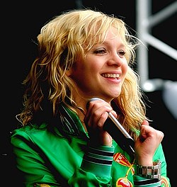
- Paul Litjens (born 1947 in Loon op Zand) a former field hockey player
- Ton Masseurs (born 1947 in Kaatsheuvel) a Dutch pedal steel guitar player
- Ben Knapen (born 1951 in Kaatsheuvel) a Dutch politician, the CDA parliamentary leader in the Senate
- Mark van Loosdrecht (born 1959 in Loon op Zand) an academic and inventor of Nereda, a wastewater treatment technology
- Ilse Broeders (born 1977 in Loon op Zand) a Dutch bobsledder, competed in the 2002 and 2006 Winter Olympics
- Jacqueline Govaert (born 1982 in Kaatsheuvel) a Dutch singer, songwriter, and pianist[6]
Gallery
[edit]-
-
-
Kaatsheuvel - Raadhuisstraat
-
Fietspad


Notes
[edit]References
[edit]- ^ "Burgemeester dhr. W.C. Luijendijk" (in Dutch). Gemeente Loon op Zand. Archived from the original on 30 May 2014. Retrieved 29 May 2014.
- ^ "Kerncijfers wijken en buurten 2020" [Key figures for neighbourhoods 2020]. StatLine (in Dutch). CBS. 24 July 2020. Retrieved 19 September 2020.
- ^ "Postcodetool for 5171EJ". Actueel Hoogtebestand Nederland (in Dutch). Het Waterschapshuis. Archived from the original on 21 September 2013. Retrieved 29 May 2014.
- ^ "Bevolkingsontwikkeling; regio per maand" [Population growth; regions per month]. CBS Statline (in Dutch). CBS. 1 January 2021. Retrieved 2 January 2022.
- ^ https://www.brabantserfgoed.nl/page/11359/venloon-en-het-oprukkende-stuifzand
- ^ IMDb Database retrieved 26 November 2019
External links
[edit]- Official website
(in Dutch)

| Authority control databases: Geographic |
|---|
This North Brabant location article is a stub. You can help Wikipedia by expanding it. |