La Paz, Honduras: Difference between revisions
| [accepted revision] | [accepted revision] |
m Configured pending changes settings for La Paz, Honduras: long-forgotten page protected on an old issue; dropping to PC. [Auto-accept: require "autoconfirmed" permission] |
No edit summary Tags: Manual revert Mobile edit Mobile web edit |
||
| (31 intermediate revisions by 15 users not shown) | |||
| Line 1: | Line 1: | ||
{{For|the department|La Paz Department (Honduras)}} |
{{For|the department|La Paz Department (Honduras)}} |
||
{{ |
{{pp-pc1}} |
||
{{ |
{{more citations needed|date=July 2014}} |
||
{{Infobox settlement |
{{Infobox settlement |
||
|official_name = La Paz |
|official_name = La Paz |
||
| Line 53: | Line 53: | ||
|area_metro = |
|area_metro = |
||
|MetroArea_sq_mi = |
|MetroArea_sq_mi = |
||
|population_as_of = |
|population_as_of = 2023 projection |
||
|population_footnotes = <ref>[https://www.citypopulation.de/en/honduras/admin/ Citypopulation.de] Population of departments and municipalities in Honduras</ref> |
|||
|population_note = |
|||
|settlement_type = Municipality<!--For Town or Village (Leave blank for the default City)--> |
|settlement_type = Municipality<!--For Town or Village (Leave blank for the default City)--> |
||
|population_total = |
|population_total = 55,776 |
||
|population_density = |
|population_density = |
||
|population_density_km2 = auto |
|population_density_km2 = auto |
||
| Line 62: | Line 62: | ||
|population_density_metro_km2 = |
|population_density_metro_km2 = |
||
|population_density_metro_mi2 = |
|population_density_metro_mi2 = |
||
|population_urban = |
|population_urban = 34504 |
||
|timezone = |
|timezone = |
||
|utc_offset = |
|utc_offset = |
||
| Line 76: | Line 76: | ||
}} |
}} |
||
'''La Paz''' ({{IPA-es|la ˈpas}}) is the capital city of the [[La Paz Department (Honduras)|La Paz Department]] of [[Honduras]]. The town, founded in 1792{{citation needed|date=July 2014}} |
'''La Paz''' ({{IPA-es|la ˈpas}}) is the capital city of the [[La Paz Department (Honduras)|La Paz Department]] of [[Honduras]]. The town, founded in 1792,{{citation needed|date=July 2014}} has a population of 32,450 (2023 est.).<ref>{{Cite web|title=Honduras: Departments & Major Cities - Population Statistics, Maps, Charts, Weather and Web Information|url=https://www.citypopulation.de/en/honduras/cities/|access-date=2020-12-17|website=www.citypopulation.de}}</ref> |
||
La Paz is located 750[[metres|m]] (2461 [[foot (unit)|feet]]) above [[sea level]] on the Comayagua River near the Cordillera de Montecillos in an area that has mountainous terrain with thick [[tropical rain forest|jungle]] cover. |
|||
==History== |
==History== |
||
The town dates back to 1750 when two Spanish colonies existed in the area. The town's title was given on 14 September 1848 when the name "La Paz" was officially recognized |
The town dates back to 1750 when two Spanish colonies existed in the area. The town's title was given on 14 September 1848, when the name "La Paz" was officially recognized by a decree from [[Comayagua]]; in 1861, it was given the status of a city, and in 1869 it was made a departmental seat.{{cn|date=January 2023}} |
||
==Demographics== |
|||
At the time of the 2013 Honduras census, La Paz municipality had a population of 43,980. Of these, 91.32% were [[Mestizo]], 4.78% [[White Latin Americans|White]], 2.42% [[Indigenous peoples of the Americas|Indigenous]] (2.19% [[Lenca]]), 1.32% [[Afro-Hondurans|Black or Afro-Honduran]] and 0.16% others.<ref>[https://www.ine.gob.hn/V3/baseine/ Instituto Nacional de Estadística (INE), bases de datos en línea]</ref> |
|||
==Economy== |
==Economy== |
||
Major industries in and around the city include [[henequen]] and [[coffee]] farming, [[cattle]] raising, [[sawmill|timber processing]], [[tannery|tanning]], [[distilling]] and some [[mining]].{{citation needed|date=July 2014}} |
|||
==Culture== |
==Culture== |
||
The festival of the "Virgen de los Dolores" is held in November. |
The festival of the "Virgen de los Dolores" is held in November. |
||
The local [[cultural center]] is located in a 19th-century house and has a collection of paintings and cultural objects that date to the 19th century period. It also organizes activities throughout the year. |
The local [[cultural center]] is located in a 19th-century house and has a collection of paintings and cultural objects that date to the 19th century period. It also organizes activities throughout the year.{{cn|date=January 2023}} |
||
==Sports== |
==Sports== |
||
| Line 97: | Line 100: | ||
{{Reflist}} |
{{Reflist}} |
||
{{La Paz (Honduran department)}} |
{{La Paz (Honduran department)}} |
||
{{Authority control}} |
|||
{{ |
{{Coord|14.317|N|87.683|W|display=title|source:eswiki}} |
||
[[Category:Populated places in Honduras]] |
|||
[[Category:Municipalities of the La Paz Department (Honduras)]] |
[[Category:Municipalities of the La Paz Department (Honduras)]] |
||
Latest revision as of 14:09, 18 May 2023
This article needs additional citations for verification. (July 2014) |
La Paz | |
|---|---|
Municipality | |
 La Paz Location in Honduras | |
| Coordinates: 14°19′6″N 87°40′6″W / 14.31833°N 87.66833°W | |
| Country | Honduras |
| Department | La Paz |
| Founded | 1792 |
| Area | |
| • Municipality | 162 km2 (63 sq mi) |
| Elevation | 750 m (2,461 ft) |
| Population (2023 projection)[1] | |
| • Municipality | 55,776 |
| • Density | 340/km2 (890/sq mi) |
| • Urban | 34,504 |
La Paz (Spanish pronunciation: [la ˈpas]) is the capital city of the La Paz Department of Honduras. The town, founded in 1792,[citation needed] has a population of 32,450 (2023 est.).[2]
La Paz is located 750m (2461 feet) above sea level on the Comayagua River near the Cordillera de Montecillos in an area that has mountainous terrain with thick jungle cover.
History
[edit]The town dates back to 1750 when two Spanish colonies existed in the area. The town's title was given on 14 September 1848, when the name "La Paz" was officially recognized by a decree from Comayagua; in 1861, it was given the status of a city, and in 1869 it was made a departmental seat.[citation needed]
Demographics
[edit]At the time of the 2013 Honduras census, La Paz municipality had a population of 43,980. Of these, 91.32% were Mestizo, 4.78% White, 2.42% Indigenous (2.19% Lenca), 1.32% Black or Afro-Honduran and 0.16% others.[3]
Economy
[edit]Major industries in and around the city include henequen and coffee farming, cattle raising, timber processing, tanning, distilling and some mining.[citation needed]
Culture
[edit]The festival of the "Virgen de los Dolores" is held in November.
The local cultural center is located in a 19th-century house and has a collection of paintings and cultural objects that date to the 19th century period. It also organizes activities throughout the year.[citation needed]
Sports
[edit]The local football team, Municipal Paceño, play their home games at the Estadio Roberto Suazo Cordoba. In summer 2013, they were relegated to the third tier of Honduran football.
References
[edit]- ^ Citypopulation.de Population of departments and municipalities in Honduras
- ^ "Honduras: Departments & Major Cities - Population Statistics, Maps, Charts, Weather and Web Information". www.citypopulation.de. Retrieved 2020-12-17.
- ^ Instituto Nacional de Estadística (INE), bases de datos en línea
Capital: La Paz | ||
| Municipalities | 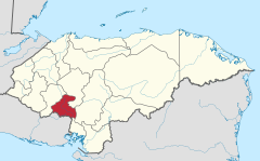 | |
| International | |
|---|---|
| National | |
14°19′01″N 87°40′59″W / 14.317°N 87.683°W
This Honduras location article is a stub. You can help Wikipedia by expanding it. |