Golbazar, Siraha: Difference between revisions
Content deleted Content added
m decapitalise |
m Typo fix (via WP:JWB) |
||
| (6 intermediate revisions by 5 users not shown) | |||
| Line 3: | Line 3: | ||
{{Infobox settlement |
{{Infobox settlement |
||
<!--See the table at Infobox settlement for all fields and descriptions of usage--> |
<!--See the table at Infobox settlement for all fields and descriptions of usage--> |
||
<!-- Basic info -->| name |
<!-- Basic info -->| name = Golbazar Municipality |
||
| other_name |
| other_name = Golbazar |
||
| native_name |
| native_name = गोलबजार नगरपालिका |
||
| nicknتتتame |
| nicknتتتame = |
||
| settlement_type |
| settlement_type = [[Municipality]] |
||
| motto |
| motto = <!-- images and maps --> |
||
| image_skyline |
| image_skyline = |
||
| image_caption |
| image_caption = |
||
| image_flag |
| image_flag = |
||
| image_seal |
| image_seal = |
||
| image_map |
| image_map = |
||
| mapsize |
| mapsize = |
||
| map_caption |
| map_caption = |
||
| pushpin_map |
| pushpin_map = Nepal |
||
| pushpin_label_position |
| pushpin_label_position = bottom |
||
| pushpin_mapsize |
| pushpin_mapsize = 300 |
||
| pushpin_map_caption |
| pushpin_map_caption = Location in Nepal |
||
<!-- Location -->| subdivision_type |
<!-- Location -->| subdivision_type = Country |
||
| subdivision_name |
| subdivision_name = {{flag|Nepal}} |
||
| subdivision_type1 |
| subdivision_type1 = [[Provinces of Nepal|province]] |
||
| subdivision_name1 |
| subdivision_name1 = [[Madhesh Province|Madhesh]] |
||
| subdivision_type2 |
| subdivision_type2 = [[Districts of Nepal|District]] |
||
| subdivision_name2 |
| subdivision_name2 = [[Siraha District|Siraha]]|<!-- Politics --> |
||
| government_footnotes |
| government_footnotes = |
||
| government_type |
| government_type = |
||
| leader_title |
| leader_title = [[Mayor]] |
||
| leader_name |
| leader_name = Devnath Sah ([[Nepal Communist Party|NCP]]) |
||
| leader_title1 |
| leader_title1 = [[Deputy Mayor]] |
||
| leader_name1 |
| leader_name1 = Reshma Kumari Thapa ([[Nepal Communist Party|NCP]]) |
||
| established_title |
| established_title = <!-- Settled --> |
||
| established_date |
| established_date = <!-- Area --> |
||
| unit_pref |
| unit_pref = <!--Enter: Imperial, if Imperial (metric) is desired--> |
||
| area_footnotes |
| area_footnotes = |
||
| area_total_km2 |
| area_total_km2 = <!-- ALL fields dealing with a measurements are subject to automatic unit conversion--> |
||
<!-- Population -->| population_as_of |
<!-- Population -->| population_as_of = 2011 |
||
| population_footnotes |
| population_footnotes = |
||
| population_note |
| population_note = |
||
| population_total |
| population_total = 47763 |
||
| population_density_km2 |
| population_density_km2 = 457 |
||
| population_blank1_title |
| population_blank1_title = Ethnicities |
||
<!-- General information -->| timezone |
<!-- General information -->| timezone = [[Nepal Time]] |
||
| utc_offset |
| utc_offset = +5:45 |
||
| timezone_DST |
| timezone_DST = |
||
| utc_offset_DST |
| utc_offset_DST = |
||
| coordinates |
| coordinates = {{coord|26.79|86.33|type:adm2nd_region:NP_source:unmaps-enwiki|display=inline,title}} |
||
| elevation_footnotes |
| elevation_footnotes = <!--for references: use<ref> </ref> tags--> |
||
| elevation_m |
| elevation_m = <!-- Area/postal codes & others --> |
||
| postal_code_type |
| postal_code_type = [[Postal code]] |
||
| postal_code |
| postal_code = 56508 |
||
| area_code |
| area_code = 033 |
||
| blank_name |
| blank_name = |
||
| blank_info |
| blank_info = |
||
| website |
| website = http://golbazarmun.gov.np |
||
| footnotes |
| footnotes = |
||
}} |
}} |
||
'''Golbazar''' is a [[municipality]] in [[Siraha District]] in the |
'''Golbazar''' is a [[municipality]] in [[Siraha District]] in the Madhesh Province of south-eastern [[Nepal]]. Golbazar Municipality was formed by merging former VDCs of [[Asanpur]], [[Jamadaha]], [[Ashokpur Balkawa]], [[Betauna]], [[Durgapur, Nepal|Durgapur]], [[Lalpur, Sagarmatha|Lalpur]], [[Muksar]], [[Chandraudyapur]], and [[Chandralalpur]] under a new local administrative structure implemented by the Government of Nepal. As per the [[2011 Nepal census]] it had a population of 47763 people living in 2500 individual households. |
||
Golbazar Municipality covers an area of 104.5 km<sup>2</sup>. There are 13 wards under Golbazar Municipality. The office of Golbazar Municipality lies in Golbazar (Main Market). |
|||
Golbazar Municipality covers an area of 104.5 km² with the total population of 47763 (Census 2011). There are all together 13 Wards under Golbazar Municipality. The office of Golbazar Municipality lies in Golbazar (Main Market). Golbazar is one of the important and on going market for people living in Siraha district. There are many supermarkets, shopping complex, wholesellers and manymore. Some of the market are: Old Mini Market, New Mini Market, Big Bazar Shopping Center, AB Mall, China Shopping complex, gorkha suppliers, Fashion Plaza and soon. It is one of the big market of siraha district where people from different place comes here for buying clothes, goods, house making equipments, banking services, education and soon. The main market days are Tuesday and Saturday where market remain closed on Wednesday. Golbazar is highly packed market. Golbazar municipality is packed with all the banking features, automobile features, electronic market, clothing stores, food and cafe, etc. Different caste and ethnic groups share same space with unity. The famous temples & mosque of Golbazar are: Dhamini Temple, Shiva Temple, Krishna Temple, Ram Temple, Mosque (more than 20 in number) Durga Temple (old) and Durga Temple (New) and few church. There are numerous tourist area for indoor and outdoor tourist like Aakash Ganga, Khumbi-khadi, Kamaldaha, etc. This economic center makes annual profit over; Nepalese Rupees 50,000,000,00 ($500,000,00). The only cinema hall in Golbazar municipality is Galaxy Movies which is located behind the old mini market. |
|||
==References== |
==References== |
||
| Line 67: | Line 67: | ||
==External links== |
==External links== |
||
*[http://www.un.org.np/maps/district-constituency-maps/eastern/Siraha.pdf UN map of the municipalities of Siraha District] |
* [http://www.un.org.np/maps/district-constituency-maps/eastern/Siraha.pdf UN map of the municipalities of Siraha District] |
||
* [http://p2.gov.np/ Madhesh Province] |
|||
{{Siraha District}} |
{{Siraha District}} |
||
| Line 73: | Line 74: | ||
[[Category:Populated places in Siraha District]] |
[[Category:Populated places in Siraha District]] |
||
[[Category:Nepal municipalities established in 2014]] |
[[Category:Nepal municipalities established in 2014]] |
||
[[Category:Municipalities in Madhesh Province]] |
|||
Latest revision as of 07:44, 30 March 2024
Golbazar Municipality
गोलबजार नगरपालिका Golbazar | |
|---|---|
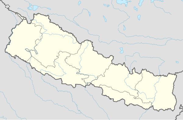 Golbazar Municipality Location in Nepal | |
| Coordinates: 26°47′N 86°20′E / 26.79°N 86.33°E | |
| Country | |
| province | Madhesh |
| District | Siraha |
| Government | |
| • Mayor | Devnath Sah (NCP) |
| • Deputy Mayor | Reshma Kumari Thapa (NCP) |
| Population (2011) | |
| • Total | 47,763 |
| • Density | 457/km2 (1,180/sq mi) |
| Time zone | UTC+5:45 (Nepal Time) |
| Postal code | 56508 |
| Area code | 033 |
| Website | http://golbazarmun.gov.np |
Golbazar is a municipality in Siraha District in the Madhesh Province of south-eastern Nepal. Golbazar Municipality was formed by merging former VDCs of Asanpur, Jamadaha, Ashokpur Balkawa, Betauna, Durgapur, Lalpur, Muksar, Chandraudyapur, and Chandralalpur under a new local administrative structure implemented by the Government of Nepal. As per the 2011 Nepal census it had a population of 47763 people living in 2500 individual households.
Golbazar Municipality covers an area of 104.5 km2. There are 13 wards under Golbazar Municipality. The office of Golbazar Municipality lies in Golbazar (Main Market).
References[edit]
External links[edit]
Headquarters: Siraha | ||
| Municipalities: 8 |  | |
| Rural municipalities: 9 | ||
This article about a location in Siraha District, Nepal is a stub. You can help Wikipedia by expanding it. |