Hà Đông district: Difference between revisions
No edit summary |
|||
| (44 intermediate revisions by 28 users not shown) | |||
| Line 2: | Line 2: | ||
<!--See Template:Infobox Settlement for additional fields that may be available--> |
<!--See Template:Infobox Settlement for additional fields that may be available--> |
||
<!--See the Table at Infobox Settlement for all fields and descriptions of usage--> |
<!--See the Table at Infobox Settlement for all fields and descriptions of usage--> |
||
<!-- Basic info ----------------> |
<!-- Basic info ---------------->| name = Hà Đông District |
||
| official_name = |
|||
|name = Hà Đông District |
|||
| |
| other_name = |
||
| |
| native_name = Quận Hà Đông |
||
| |
| nickname = |
||
| settlement_type = [[List of urban districts of Vietnam|Urban district]] |
|||
|nickname = |
|||
| total_type = <!-- to set a non-standard label for total area and population rows --> |
|||
|settlement_type = [[List of urban districts of Vietnam|Urban district]] |
|||
| |
| motto = <!-- images and maps -----------> |
||
| |
| image_skyline = Quận Hà Đông về đêm.jpg |
||
| imagesize = |
|||
<!-- images and maps -----------> |
|||
| image_caption = Trần Phú Street, Hà Đông at night |
|||
|image_skyline = Hanoi_metro_L2_construction.jpg |
|||
| |
| image_flag = |
||
| flag_size = |
|||
|image_caption = A [[Line 2A, Hanoi Metro|metro line]] running above an avenue in Hà Đông |
|||
| image_seal = Biểu trưng quận Hà Đông, thủ đô Hà Nội, Việt Nam.svg |
|||
|image_flag = |
|||
| |
| seal_size = |
||
| |
| image_shield = |
||
| |
| shield_size = |
||
| image_blank_emblem = |
|||
|image_shield = |
|||
| blank_emblem_type = |
|||
|shield_size = |
|||
| blank_emblem_size = |
|||
|image_blank_emblem = |
|||
| image_map = {{Infobox mapframe|zoom=11|frame-width=280}} |
|||
|blank_emblem_type = |
|||
| |
| mapsize = |
||
| |
| map_caption = |
||
| |
| image_map1 = |
||
| |
| mapsize1 = |
||
| |
| map_caption1 = |
||
| |
| image_dot_map = |
||
| |
| dot_mapsize = |
||
| dot_map_caption = |
|||
|image_dot_map = |
|||
| |
| dot_x = |
||
| |
| dot_y = |
||
| pushpin_map = Vietnam |
|||
|dot_x = |dot_y = |
|||
| pushpin_map_alt = |
|||
<!-- Location ------------------> |
|||
| pushpin_map_caption = |
|||
|subdivision_type = Country |
|||
| pushpin_label_position = Location in Vietnam |
|||
|subdivision_name = {{flag|Vietnam}} |
|||
<!-- Location ------------------>| subdivision_type = Country |
|||
|subdivision_type1 = [[Provinces of Vietnam|Province]] |
|||
| subdivision_name = {{flag|Vietnam}} |
|||
|subdivision_name1 = [[Hanoi]] |
|||
| subdivision_type1 = [[Provinces of Vietnam|Province]] |
|||
|subdivision_type2 = |
|||
| subdivision_name1 = [[Hanoi]] |
|||
|subdivision_name2 = |
|||
| subdivision_type2 = |
|||
|seat_type = |
|||
| subdivision_name2 = |
|||
|seat = |
|||
| seat_type = |
|||
| seat = Hà Cầu ward |
|||
| parts_type = [[Ward (Vietnam)|Wards]] |
|||
| parts = 17 wards<ref name=tk/> |
|||
<!-- Politics ----------------->| government_footnotes = |
|||
| government_type = |
|||
| leader_title = |
|||
| leader_name = |
|||
| leader_title1 = <!-- for places with, say, both a mayor and a city manager --> |
|||
| leader_name1 = |
|||
| established_title = <!-- Settled --> |
|||
| established_date = <!-- Area ---------------------> |
|||
| area_magnitude = |
|||
| unit_pref = <!--Enter: Imperial, to display imperial before metric--> |
|||
| area_total_km2 = 49.64 |
|||
| area_footnotes = <ref name=tk>{{cite web|url=http://thongkehanoi.gov.vn/a/nien-giam-thong-ke-nam-2018-1579246656-5e216440c9d28/|access-date=2021-02-21|title=Niên giám thống kê năm 2018}}</ref> |
|||
| area_land_km2 = <!--See table @ Template:Infobox Settlement for details on unit conversion--> |
|||
| area_water_km2 = |
|||
| area_total_sq_mi = |
|||
| area_land_sq_mi = |
|||
| area_water_sq_mi = |
|||
| area_water_percent = <!-- Elevation --------------------------> |
|||
| elevation_footnotes = <!--for references: use <ref> tags--> |
|||
| elevation_m = |
|||
| elevation_ft = |
|||
| elevation_max_m = |
|||
| elevation_max_ft = |
|||
| elevation_min_m = |
|||
| elevation_min_ft = <!-- Population -----------------------> |
|||
| population_as_of = 2019 |
|||
| population_footnotes = <ref name=census2019>{{cite book |
|||
| author = [[General Statistics Office of Vietnam]] | year = 2019 | url = https://www.gso.gov.vn/wp-content/uploads/2019/12/Ket-qua-toan-bo-Tong-dieu-tra-dan-so-va-nha-o-2019.pdf | title = "Completed Results of the 2019 Viet Nam Population and Housing Census" | publisher = Statistical Publishing House (Vietnam) | isbn= 978-604-75-1532-5 }}</ref> |
|||
| population_total = 397,854 |
|||
| population_density_km2 = auto |
|||
| population_density_sq_mi = <!-- General information ---------------> |
|||
| timezone = ICT |
|||
| utc_offset = +7 |
|||
| timezone_DST = |
|||
| utc_offset_DST = |
|||
| coor_type = <!-- can be used to specify what the coordinates refer to --> |
|||
| coordinates = {{coord|20|58|N|105|46|E|region:VN|display=inline,title}} |
|||
<!-- Area/postal codes & others -------->| postal_code_type = <!-- enter ZIP code, Postcode, Post code, Postal code... --> |
|||
| postal_code = |
|||
| area_code = 24 |
|||
| blank_name = [[Köppen climate classification|Climate]] |
|||
| blank_info = [[Humid subtropical climate|Cwa]] |
|||
| website = [http://hadong.hanoi.gov.vn] |
|||
| footnotes = |
|||
}} |
|||
'''Hà Đông''' (literally ''East of the river'') is an [[Urban district (Vietnam)|urban district]] (''quận'') of [[Hanoi]], the capital city of [[Vietnam]].<ref>{{cite web|url=https://vnexpress.net/ha-noi-co-them-nam-quan-moi-vao-nam-2025-4004736.html|title=Hà Nội có thêm năm quận mới vào năm 2025|publisher=[[VnExpress]]|date=2019-10-30}}</ref> The district currently has 17 [[Ward (Vietnam)|wards]], covering a total area of 49.64 square kilometers.<ref name=tk/> As of 2019,<ref name=census2019/> there were 397,854 people residing in the district, the third highest of all districts in Hanoi, after [[Hoàng Mai district|Hoàng Mai]]. The district borders [[Thanh Trì district]], [[Thanh Xuân district]], [[Nam Từ Liêm district]], [[Hoài Đức district]], [[Quốc Oai district]], [[Chương Mỹ district]], [[Thanh Oai district]]. |
|||
<!-- Politics -----------------> |
|||
|government_footnotes = |
|||
Hà Đông has a large number of monuments, landmarks, relics, traditional festivals and craft villages.<ref name=hnm>{{cite web|url= http://hanoimoi.com.vn/Tin-tuc/Du-lich/568890/phat-trien-san-pham-du-lich-quan-ha-dong|title= Phát triển sản phẩm du lịch quận Hà Đông|date=2012-12-10}}</ref> It is an important transport hub and is also home to various government offices and universities. |
|||
|government_type = |
|||
|leader_title = |
|||
Hà Đông was once the capital [[Provincial city (Vietnam)|city]] of former [[Hà Tây province]]. In 2009, it became an urban district of Hanoi due to the incorporation of Hà Tây Province to Hanoi. |
|||
|leader_name = |
|||
|leader_title1 = <!-- for places with, say, both a mayor and a city manager --> |
|||
|leader_name1 = |
|||
|established_title = <!-- Settled --> |
|||
|established_date = |
|||
<!-- Area ---------------------> |
|||
|area_magnitude = |
|||
|unit_pref = <!--Enter: Imperial, to display imperial before metric--> |
|||
|area_footnotes = |
|||
|area_total_km2 = <!-- ALL fields with measurements are subject to automatic unit conversion--> |
|||
|area_land_km2 = <!--See table @ Template:Infobox Settlement for details on unit conversion--> |
|||
|area_water_km2 = |
|||
|area_total_sq_mi = |
|||
|area_land_sq_mi = |
|||
|area_water_sq_mi = |
|||
|area_water_percent = |
|||
<!-- Elevation --------------------------> |
|||
|elevation_footnotes = <!--for references: use <ref> tags--> |
|||
|elevation_m = |
|||
|elevation_ft = |
|||
|elevation_max_m = |
|||
|elevation_max_ft = |
|||
|elevation_min_m = |
|||
|elevation_min_ft = |
|||
<!-- Population -----------------------> |
|||
|population_as_of = 2018 |
|||
|population_footnotes = |
|||
|population_note = |
|||
|population_total = 352,002 |
|||
|population_density_km2 = <!--For automatic calculation, any density field may contain: auto --> |
|||
|population_density_sq_mi = |
|||
<!-- General information ---------------> |
|||
|timezone = |
|||
|utc_offset = |
|||
|timezone_DST = |
|||
|utc_offset_DST = |
|||
|coor_type = <!-- can be used to specify what the coordinates refer to --> |
|||
|coordinates = {{coord|20|58|N|105|46|E|region:VN|display=inline}} |
|||
<!-- Area/postal codes & others --------> |
|||
|postal_code_type = <!-- enter ZIP code, Postcode, Post code, Postal code... --> |
|||
|postal_code = |
|||
|area_code = |
|||
|website = [http://hadong.hanoi.gov.vn] |
|||
|footnotes = |
|||
}} |
|||
'''Hà Đông''' (literally ''East of the river'') is the former capital city of [[Hà Tây Province]] in [[Vietnam]], now an urban district of [[Hanoi]]. As of 2018, it had a population of 352,002, the highest of all districts in Hanoi. |
|||
==Wards== |
==Wards== |
||
Hà Đông district is subdivided to 17 wards, including: |
|||
* Biên Giang |
* Biên Giang |
||
* Dương Nội |
* Dương Nội |
||
| Line 105: | Line 110: | ||
* Phú La |
* Phú La |
||
* Phú Lãm |
* Phú Lãm |
||
* Phú Lương |
* [[:vi:Phú Lương (phường)|Phú Lương]] |
||
* Phúc La |
* Phúc La |
||
* Quang Trung |
* Quang Trung |
||
| Line 113: | Line 118: | ||
* Yên Nghĩa |
* Yên Nghĩa |
||
* Yết Kiêu |
* Yết Kiêu |
||
==Climate== |
|||
{{Weather box |
|||
|width = auto |
|||
| location = [[Hà Đông District]] |
|||
| metric first = Y |
|||
| single line = Y |
|||
| collapsed = Y |
|||
| Jan record high C = 32.4 |
|||
| Feb record high C = 34.9 |
|||
| Mar record high C = 38.9 |
|||
| Apr record high C = 39.9 |
|||
| May record high C = 40.0 |
|||
| Jun record high C = 42.5 |
|||
| Jul record high C = 40.0 |
|||
| Aug record high C = 39.6 |
|||
| Sep record high C = 37.1 |
|||
| Oct record high C = 34.9 |
|||
| Nov record high C = 35.0 |
|||
| Dec record high C = 30.7 |
|||
|year record high C = 42.5 |
|||
| Jan high C = 19.9 |
|||
| Feb high C = 20.8 |
|||
| Mar high C = 23.3 |
|||
| Apr high C = 27.5 |
|||
| May high C = 31.5 |
|||
| Jun high C = 33.4 |
|||
| Jul high C = 33.2 |
|||
| Aug high C = 32.4 |
|||
| Sep high C = 31.3 |
|||
| Oct high C = 29.2 |
|||
| Nov high C = 25.8 |
|||
| Dec high C = 22.1 |
|||
|year high C = 27.5 |
|||
| Jan mean C = 16.5 |
|||
| Feb mean C = 17.8 |
|||
| Mar mean C = 20.3 |
|||
| Apr mean C = 24.0 |
|||
| May mean C = 27.1 |
|||
| Jun mean C = 29.0 |
|||
| Jul mean C = 29.1 |
|||
| Aug mean C = 28.4 |
|||
| Sep mean C = 27.2 |
|||
| Oct mean C = 24.9 |
|||
| Nov mean C = 21.6 |
|||
| Dec mean C = 18.0 |
|||
|year mean C = 23.7 |
|||
| Jan low C = 14.3 |
|||
| Feb low C = 15.8 |
|||
| Mar low C = 18.4 |
|||
| Apr low C = 21.7 |
|||
| May low C = 24.3 |
|||
| Jun low C = 26.0 |
|||
| Jul low C = 26.3 |
|||
| Aug low C = 25.8 |
|||
| Sep low C = 24.6 |
|||
| Oct low C = 22.7 |
|||
| Nov low C = 18.7 |
|||
| Dec low C = 15.3 |
|||
|year low C = 21.1 |
|||
| Jan record low C = 5.4 |
|||
| Feb record low C = 6.1 |
|||
| Mar record low C = 7.3 |
|||
| Apr record low C = 13.3 |
|||
| May record low C = 16.5 |
|||
| Jun record low C = 20.4 |
|||
| Jul record low C = 22.5 |
|||
| Aug record low C = 21.9 |
|||
| Sep record low C = 19.0 |
|||
| Oct record low C = 12.0 |
|||
| Nov record low C = 8.4 |
|||
| Dec record low C = 3.6 |
|||
|year record low C = 3.6 |
|||
| precipitation colour = green |
|||
| Jan precipitation mm = 28.2 |
|||
| Feb precipitation mm = 26.5 |
|||
| Mar precipitation mm = 45.0 |
|||
| Apr precipitation mm = 83.1 |
|||
| May precipitation mm = 189.4 |
|||
| Jun precipitation mm = 232.5 |
|||
| Jul precipitation mm = 254.6 |
|||
| Aug precipitation mm = 293.5 |
|||
| Sep precipitation mm = 228.8 |
|||
| Oct precipitation mm = 184.8 |
|||
| Nov precipitation mm = 87.4 |
|||
| Dec precipitation mm = 36.9 |
|||
|year precipitation mm = 1687.6 |
|||
| Jan rain days = 9.6 |
|||
| Feb rain days = 11.7 |
|||
| Mar rain days = 15.2 |
|||
| Apr rain days = 13.6 |
|||
| May rain days = 14.5 |
|||
| Jun rain days = 14.4 |
|||
| Jul rain days = 15.6 |
|||
| Aug rain days = 16.3 |
|||
| Sep rain days = 13.7 |
|||
| Oct rain days = 10.8 |
|||
| Nov rain days = 7.6 |
|||
| Dec rain days = 6.2 |
|||
|year rain days = 149.8 |
|||
| Jan humidity = 83.3 |
|||
| Feb humidity = 85.3 |
|||
| Mar humidity = 86.8 |
|||
| Apr humidity = 88.1 |
|||
| May humidity = 85.5 |
|||
| Jun humidity = 82.5 |
|||
| Jul humidity = 82.5 |
|||
| Aug humidity = 85.7 |
|||
| Sep humidity = 86.1 |
|||
| Oct humidity = 82.9 |
|||
| Nov humidity = 81.2 |
|||
| Dec humidity = 80.2 |
|||
|year humidity = 84.2 |
|||
| Jan sun = 65.7 |
|||
| Feb sun = 49.7 |
|||
| Mar sun = 50.1 |
|||
| Apr sun = 87.8 |
|||
| May sun = 170.2 |
|||
| Jun sun = 167.1 |
|||
| Jul sun = 181.9 |
|||
| Aug sun = 167.0 |
|||
| Sep sun = 162.4 |
|||
| Oct sun = 146.1 |
|||
| Nov sun = 133.2 |
|||
| Dec sun = 110.3 |
|||
| year sun = 1477.8 |
|||
| source 1 = Vietnam Institute for Building Science and Technology<ref name=IBST>{{cite web|title=Vietnam Institute for Building Science and Technology|url=https://datafiles.chinhphu.vn/cpp/files/vbpq/2022/10/02-bxd.pdf |lang=en}}</ref> |
|||
}} |
|||
==See also== |
==See also== |
||
*[[Hồ Đắc Điềm]], past governor |
*[[Hồ Đắc Điềm]], past governor |
||
*[[Hà Tây |
*[[Hà Tây province]], historic province |
||
*[[Hanoi]], capital of Vietnam |
|||
==References== |
|||
{{Reflist}} |
|||
{{coord|20|58|N|105|46|E|display=title|region:VN_type:city_source:GNS-enwiki}} |
|||
{{Hanoi Province}} |
{{Hanoi Province}} |
||
{{Districts of Red River Delta}} |
{{Districts of Red River Delta}} |
||
{{Authority control}} |
|||
{{DEFAULTSORT:Ha Dong}} |
{{DEFAULTSORT:Ha Dong}} |
||
[[Category:Populated places in Ha Tay Province]] |
|||
[[Category:District capitals in Vietnam]] |
|||
[[Category:Districts of Hanoi]] |
[[Category:Districts of Hanoi]] |
||
{{Vietnam-geo-stub}} |
|||
{{Hanoi-geo-stub}} |
|||
Latest revision as of 19:47, 5 March 2024
Hà Đông District
Quận Hà Đông | |
|---|---|
 Trần Phú Street, Hà Đông at night | |
 Seal | |
 | |
 Hà Đông District | |
| Coordinates: 20°58′N 105°46′E / 20.967°N 105.767°E | |
| Country | |
| Province | Hanoi |
| Seat | Hà Cầu ward |
| Wards | 17 wards[1] |
| Area | |
| • Total | 49.64 km2 (19.17 sq mi) |
| Population (2019)[2] | |
| • Total | 397,854 |
| • Density | 8,000/km2 (21,000/sq mi) |
| Time zone | UTC+7 (ICT) |
| Area code | 24 |
| Climate | Cwa |
| Website | [1] |
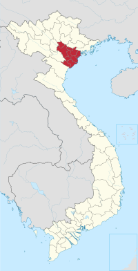
Hà Đông (literally East of the river) is an urban district (quận) of Hanoi, the capital city of Vietnam.[3] The district currently has 17 wards, covering a total area of 49.64 square kilometers.[1] As of 2019,[2] there were 397,854 people residing in the district, the third highest of all districts in Hanoi, after Hoàng Mai. The district borders Thanh Trì district, Thanh Xuân district, Nam Từ Liêm district, Hoài Đức district, Quốc Oai district, Chương Mỹ district, Thanh Oai district.
Hà Đông has a large number of monuments, landmarks, relics, traditional festivals and craft villages.[4] It is an important transport hub and is also home to various government offices and universities.
Hà Đông was once the capital city of former Hà Tây province. In 2009, it became an urban district of Hanoi due to the incorporation of Hà Tây Province to Hanoi.
Wards
[edit]Hà Đông district is subdivided to 17 wards, including:
- Biên Giang
- Dương Nội
- Đồng Mai
- Hà Cầu
- Kiến Hưng
- Mộ Lao
- Nguyễn Trãi
- Phú La
- Phú Lãm
- Phú Lương
- Phúc La
- Quang Trung
- Trần Phú
- Vạn Phúc
- Văn Quán
- Yên Nghĩa
- Yết Kiêu
Climate
[edit]| Climate data for Hà Đông District | |||||||||||||
|---|---|---|---|---|---|---|---|---|---|---|---|---|---|
| Month | Jan | Feb | Mar | Apr | May | Jun | Jul | Aug | Sep | Oct | Nov | Dec | Year |
| Record high °C (°F) | 32.4 (90.3) |
34.9 (94.8) |
38.9 (102.0) |
39.9 (103.8) |
40.0 (104.0) |
42.5 (108.5) |
40.0 (104.0) |
39.6 (103.3) |
37.1 (98.8) |
34.9 (94.8) |
35.0 (95.0) |
30.7 (87.3) |
42.5 (108.5) |
| Mean daily maximum °C (°F) | 19.9 (67.8) |
20.8 (69.4) |
23.3 (73.9) |
27.5 (81.5) |
31.5 (88.7) |
33.4 (92.1) |
33.2 (91.8) |
32.4 (90.3) |
31.3 (88.3) |
29.2 (84.6) |
25.8 (78.4) |
22.1 (71.8) |
27.5 (81.5) |
| Daily mean °C (°F) | 16.5 (61.7) |
17.8 (64.0) |
20.3 (68.5) |
24.0 (75.2) |
27.1 (80.8) |
29.0 (84.2) |
29.1 (84.4) |
28.4 (83.1) |
27.2 (81.0) |
24.9 (76.8) |
21.6 (70.9) |
18.0 (64.4) |
23.7 (74.7) |
| Mean daily minimum °C (°F) | 14.3 (57.7) |
15.8 (60.4) |
18.4 (65.1) |
21.7 (71.1) |
24.3 (75.7) |
26.0 (78.8) |
26.3 (79.3) |
25.8 (78.4) |
24.6 (76.3) |
22.7 (72.9) |
18.7 (65.7) |
15.3 (59.5) |
21.1 (70.0) |
| Record low °C (°F) | 5.4 (41.7) |
6.1 (43.0) |
7.3 (45.1) |
13.3 (55.9) |
16.5 (61.7) |
20.4 (68.7) |
22.5 (72.5) |
21.9 (71.4) |
19.0 (66.2) |
12.0 (53.6) |
8.4 (47.1) |
3.6 (38.5) |
3.6 (38.5) |
| Average precipitation mm (inches) | 28.2 (1.11) |
26.5 (1.04) |
45.0 (1.77) |
83.1 (3.27) |
189.4 (7.46) |
232.5 (9.15) |
254.6 (10.02) |
293.5 (11.56) |
228.8 (9.01) |
184.8 (7.28) |
87.4 (3.44) |
36.9 (1.45) |
1,687.6 (66.44) |
| Average rainy days | 9.6 | 11.7 | 15.2 | 13.6 | 14.5 | 14.4 | 15.6 | 16.3 | 13.7 | 10.8 | 7.6 | 6.2 | 149.8 |
| Average relative humidity (%) | 83.3 | 85.3 | 86.8 | 88.1 | 85.5 | 82.5 | 82.5 | 85.7 | 86.1 | 82.9 | 81.2 | 80.2 | 84.2 |
| Mean monthly sunshine hours | 65.7 | 49.7 | 50.1 | 87.8 | 170.2 | 167.1 | 181.9 | 167.0 | 162.4 | 146.1 | 133.2 | 110.3 | 1,477.8 |
| Source: Vietnam Institute for Building Science and Technology[5] | |||||||||||||
See also
[edit]- Hồ Đắc Điềm, past governor
- Hà Tây province, historic province
- Hanoi, capital of Vietnam
References
[edit]- ^ a b c "Niên giám thống kê năm 2018". Retrieved 2021-02-21.
- ^ a b General Statistics Office of Vietnam (2019). "Completed Results of the 2019 Viet Nam Population and Housing Census" (PDF). Statistical Publishing House (Vietnam). ISBN 978-604-75-1532-5.
- ^ "Hà Nội có thêm năm quận mới vào năm 2025". VnExpress. 2019-10-30.
- ^ "Phát triển sản phẩm du lịch quận Hà Đông". 2012-12-10.
- ^ "Vietnam Institute for Building Science and Technology" (PDF).

Districts of the Red River Delta | ||
|---|---|---|
| Hanoi city |
|  |
| Haiphong city | ||
| Bắc Ninh province | ||
| Hà Nam province | ||
| Hải Dương province |
| |
| Hưng Yên province | ||
| Nam Định province | ||
| Ninh Bình province | ||
| Thái Bình province | ||
| Vĩnh Phúc province |
| |
※ denotes provincial seat. | ||
| International | |
|---|---|
| National | |
This article about a location in Hanoi, Vietnam is a stub. You can help Wikipedia by expanding it. |