Hà Đông district: Difference between revisions
Content deleted Content added
No edit summary Tags: Mobile edit Mobile web edit |
→See also: Ha Tay Province ceased to exist 11 years ago, therefore this category is no longer appropriate |
||
| Line 130: | Line 130: | ||
{{DEFAULTSORT:Ha Dong}} |
{{DEFAULTSORT:Ha Dong}} |
||
[[Category:Populated places in |
[[Category:Populated places in Hanoi]] |
||
[[Category:District capitals in Vietnam]] |
[[Category:District capitals in Vietnam]] |
||
[[Category:Districts of Hanoi]] |
[[Category:Districts of Hanoi]] |
||
Revision as of 07:33, 21 September 2019
Hà Đông District
Quận Hà Đông | |
|---|---|
 A metro line running above an avenue in Hà Đông | |
 Hà Đông District | |
| Coordinates: 20°58′N 105°46′E / 20.967°N 105.767°E | |
| Country | |
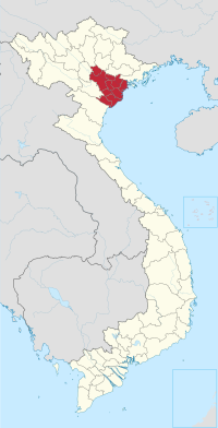
| Province | Hanoi |
| Population (2018) | |
| • Total | 352,002 |
| Website | [1] |
Hà Đông (literally East of the river) is an urban district (quận) of Hanoi, the capital city of Vietnam. As of 2018, it had a population of 352,002, the second highest of all districts in Hanoi, after Hoàng Mai.
Hà Đông was once the capital city of former Hà Tây Province. In 2009, it became an urban district of Hanoi due to the incorporation of Hà Tây Province to Hanoi.
Wards
Hà Đông District is subdivided to 17 wards, including:
- Biên Giang
- Dương Nội
- Đồng Mai
- Hà Cầu
- Kiến Hưng
- Mộ Lao
- Nguyễn Trãi
- Phú La
- Phú Lãm
- Phú Lương
- Phúc La
- Quang Trung
- Trần Phú
- Vạn Phúc
- Văn Quán
- Yên Nghĩa
- Yết Kiêu
See also
- Hồ Đắc Điềm, past governor
- Hà Tây Province, historic province

Districts of the Red River Delta | ||
|---|---|---|
| Hanoi city |
|  |
| Haiphong city | ||
| Bắc Ninh province | ||
| Hà Nam province | ||
| Hải Dương province |
| |
| Hưng Yên province | ||
| Nam Định province | ||
| Ninh Bình province | ||
| Thái Bình province | ||
| Vĩnh Phúc province |
| |
※ denotes provincial seat. | ||
This article about a location in Vietnam is a stub. You can help Wikipedia by expanding it. |