Hazleton, Indiana: Difference between revisions
JJMC89 bot (talk | contribs) Migrate {{Infobox settlement}} coordinates parameters to {{Coord}}, see Wikipedia:Coordinates in infoboxes |
WhisperToMe (talk | contribs) |
||
| (39 intermediate revisions by 17 users not shown) | |||
| Line 1: | Line 1: | ||
{{Use mdy dates|date=April 2024}} |
|||
{{Infobox settlement |
{{Infobox settlement |
||
|official_name = Town of Hazleton, Indiana |
|official_name = Town of Hazleton, Indiana |
||
| Line 4: | Line 5: | ||
|nickname = |
|nickname = |
||
|mapsize = 250x200px |
|mapsize = 250x200px |
||
|image_skyline = |
|image_skyline = Hazleton-IOOF-town-hall-in.jpg |
||
|imagesize = |
|imagesize = 250px |
||
|image_caption = |
|image_caption = Hazleton |
||
|image_map = File:Gibson County Indiana Incorporated and Unincorporated areas Hazleton Highlighted 1832728.svg |
|||
|image_map = Gibson_County_Indiana_Incorporated_and_Unincorporated_areas_Hazleton_Highlighted.svg |
|||
|map_caption = Location |
|map_caption = Location of Hazleton in Gibson County, Indiana. |
||
|image_map1 = |
|image_map1 = |
||
|mapsize1 = |
|mapsize1 = |
||
|map_caption1 = |
|map_caption1 = |
||
|subdivision_type = [[List of |
|subdivision_type = [[List of sovereign states|Country]] |
||
|subdivision_name = |
|subdivision_name = United States |
||
| ⚫ | |||
|area_footnotes = <ref name="census-g001"/> |
|||
|unit_pref = Imperial |
|unit_pref = Imperial |
||
|subdivision_type1 = [[ |
|subdivision_type1 = [[U.S. state|State]] |
||
|subdivision_name1 = [[Indiana]] |
|subdivision_name1 = [[Indiana]] |
||
|subdivision_type2 = [[List of counties in Indiana|County]] |
|subdivision_type2 = [[List of counties in Indiana|County]] |
||
| Line 26: | Line 27: | ||
|leader_name = |
|leader_name = |
||
|established_date = |
|established_date = |
||
| |
|population_footnotes = |
||
|population_as_of = [[2020 United States Census|2020]] |
|||
|population_footnotes = <ref name ="FactFinder"/> |
|||
| |
|population_est = |
||
| |
|pop_est_as_of = |
||
| ⚫ | |||
|population_note = |
|population_note = |
||
|population_total = |
|population_total = 194 |
||
|population_density_sq_mi = |
|population_density_sq_mi = 560.69 |
||
|population_density_km2 = |
|population_density_km2 = 216.30 |
||
|timezone = [[North American Central Time Zone|CST]] |
|timezone = [[North American Central Time Zone|CST]] |
||
|utc_offset = -6 |
|utc_offset = -6 |
||
|timezone_DST = [[North American Central Time Zone|CDT]] |
|timezone_DST = [[North American Central Time Zone|CDT]] |
||
|utc_offset_DST = -5 |
|utc_offset_DST = -5 |
||
|area_land_km2 = 0. |
|area_land_km2 = 0.90 |
||
|area_water_km2 = 0 |
|area_water_km2 = 0.00 |
||
|area_total_km2 = 0. |
|area_total_km2 = 0.90 |
||
|area_total_sq_mi = 0. |
|area_total_sq_mi = 0.35 |
||
|area_land_sq_mi = 0. |
|area_land_sq_mi = 0.35 |
||
|area_water_sq_mi = 0 |
|area_water_sq_mi = 0.00 |
||
| |
|elevation_footnotes = <ref name=gnis/> |
||
|elevation_ft = |
|elevation_ft = 449 |
||
|coordinates = {{coord|38|29| |
|coordinates = {{coord|38|29|21|N|87|32|26|W|region:US_type:city|display=inline,title}} |
||
|postal_code_type = [[ZIP code]] |
|postal_code_type = [[ZIP code]] |
||
|postal_code = 47640 |
|postal_code = 47640 |
||
|area_code = [[Area code 812|812, 930]] |
|area_code = [[Area code 812|812, 930]] |
||
|blank_name = [[Federal Information Processing Standard|FIPS code]] |
|blank_name = [[Federal Information Processing Standard|FIPS code]] |
||
|blank_info = 18-32728<ref name="GR2">{{cite web|url= |
|blank_info = 18-32728<ref name="GR2">{{cite web|url=https://www.census.gov|publisher=[[United States Census Bureau]]|accessdate=January 31, 2008|title=U.S. Census website}}</ref> |
||
|blank1_name = [[Geographic Names Information System|GNIS]] feature ID |
|blank1_name = [[Geographic Names Information System|GNIS]] feature ID |
||
|blank1_info = |
|blank1_info = 2396992<ref name=gnis>{{GNIS|2396992}}</ref> |
||
|footnotes = |
|footnotes = |
||
|website = | |
|website = |
||
| |
|||
|pop_est_footnotes = |
|||
}} |
}} |
||
'''Hazleton''' is a town in [[White River Township, Gibson County, Indiana|White River Township]], [[Gibson County, Indiana|Gibson County]], [[Indiana]], |
'''Hazleton''' is a town in [[White River Township, Gibson County, Indiana|White River Township]], [[Gibson County, Indiana|Gibson County]], [[Indiana]], United States. The population was 263 at the 2010 census making it the second smallest community in the county. While having almost no connection to it, it is part of the [[Evansville, Indiana]], [[Evansville, IN-KY Metropolitan Statistical Area|Metropolitan Area]]. |
||
== |
==History== |
||
| ⚫ | Hazleton is the second-oldest town in Gibson County after [[Patoka, Indiana|Patoka]]. It was named in honor of Gervas Hazleton,<ref>{{cite book | url=https://books.google.com/books?id=OlQ0AQAAMAAJ&pg=PA14 | title=History of Gibson County, Indiana | publisher=Cook & McDowell Publications | author=Peattie, Elia Wilkinson | year=1897 | pages=14}}</ref> believed to be the second settler to permanently locate to the county. Hazleton first lived in a crude camp lit by large log fires that was a popular stopover for early migrants to the area.<ref>Gil R. Stormont, ''[https://archive.org/details/historyofgibsonc01stor History of Gibson County, Indiana]'' (B.F. Bowen, 1914), p. 377.</ref> |
||
{{Refimprove|date=January 2012}} |
|||
| ⚫ | Hazleton is the second-oldest town in Gibson County after [[Patoka, Indiana|Patoka]]. It was named in honor of Gervas Hazleton,<ref>{{cite book | url=https://books.google.com/books?id=OlQ0AQAAMAAJ&pg=PA14 |
||
The town |
The town was platted in 1856 by Lucius French. T. S. Fuller erected the town's first frame building, and John Breedlove built the town's blacksmith shop. The first steamboat of any note to travel up the White River was the ''Cleopatria'' in 1884.<ref>James T. Tartt and Company, ''[https://books.google.com/books?id=_984AQAAMAAJ History of Gibson County, Indiana]'' (1884), p. 187.</ref> |
||
On March 10, 1897, a passenger train of the Evansville and Terre Haute Railroad (now the [[Chicago & Eastern Illinois]]) wrecked near Hazleton. An embankment which carried the tracks past the White River had been weakened by the river's flood waters, and collapsed under the weight of the train, causing it to [[derailment|derail]]. Around a dozen people are believed to have been killed, though most bodies were never found.<ref>Stormont, ''History of Gibson County, Indiana'', pp. 108-109.</ref> |
|||
The highway of travel was via the Patoka, Wabash, Ohio and Mississippi rivers and five or six weeks were required to make the round trip. A complement of five men was the usual number required with each boat. The first steamboat of any note to pass up White River was the "Cleopatria". |
|||
=== Hazleton Railroad Wreck of 1897 === |
|||
One of the worst wrecks in the history of southern Indiana occurred on the Evansville & Terre Haute road, now the [[Chicago & Eastern Illinois]], at 3:00 a.m., March 10, 1897. Fast train No. 5 southbound, was wrecked at the high embankment forming the southern approach to the White River bridge about two miles (3 km) north of the town of Hazelton. |
|||
==Geography== |
==Geography== |
||
Hazleton is located at {{Coord|38|29|20|N|87|32|30|W|type:city}} (38.488953, -87.541652).<ref name="GR1">{{cite web|url= |
Hazleton is located at {{Coord|38|29|20|N|87|32|30|W|type:city}} (38.488953, -87.541652).<ref name="GR1">{{cite web|url=https://www.census.gov/geographies/reference-files/time-series/geo/gazetteer-files.html|publisher=[[United States Census Bureau]]|accessdate=April 23, 2011|date=February 12, 2011|title=US Gazetteer files: 2010, 2000, and 1990}}</ref> The town is situated along the south bank of the [[White River (Indiana)|White River]] in northern Gibson County (the river marks the county line between Gibson and [[Knox County, Indiana|Knox]] counties). [[Indiana State Road 56|State Road 56]] connects the town with [[U.S. Route 41]], which runs northward to [[Vincennes, Indiana|Vincennes]] and southward to the [[Evansville, Indiana|Evansville]] area. Hazleton is {{convert|422|ft|m}} above sea level. |
||
According to the 2010 census, Hazleton has a total area of {{convert|0.33|sqmi|sqkm|2}}, all land.<ref name="census-g001">{{cite web |
According to the 2010 census, Hazleton has a total area of {{convert|0.33|sqmi|sqkm|2}}, all land.<ref name="census-g001">{{cite web |
||
|url=http://factfinder.census.gov/bkmk/table/1.0/en/DEC/10_SF1/G001/1600000US1832728 |
|url=http://factfinder.census.gov/bkmk/table/1.0/en/DEC/10_SF1/G001/1600000US1832728 |
||
|title=G001 - Geographic Identifiers - 2010 Census Summary File 1 |
|title=G001 - Geographic Identifiers - 2010 Census Summary File 1 |
||
|accessdate= |
|accessdate=July 17, 2015 |
||
|publisher=[[United States Census Bureau]] |
|publisher=[[United States Census Bureau]] |
||
|archive-url=https://archive.today/20200213043910/http://factfinder.census.gov/bkmk/table/1.0/en/DEC/10_SF1/G001/1600000US1832728 |
|||
|archive-date=February 13, 2020 |
|||
|url-status=dead |
|||
}}</ref> |
|||
==Demographics== |
==Demographics== |
||
| Line 97: | Line 99: | ||
|2000= 288 |
|2000= 288 |
||
|2010= 263 |
|2010= 263 |
||
|2020= 194 |
|||
|estyear=2015 |
|||
| ⚫ | |||
|estimate=256 |
|||
|estref=<ref name="USCensusEst2015">{{cite web|url=http://www.census.gov/popest/data/cities/totals/2015/SUB-EST2015.html|title=Annual Estimates of the Resident Population for Incorporated Places: April 1, 2010 to July 1, 2015|accessdate=July 2, 2016}}</ref> |
|||
| ⚫ | |||
}} |
}} |
||
=== |
===2020 census=== |
||
As of the [[census]]<ref name =" |
As of the [[census]]<ref name ="wwwcensusgov">{{cite web|title=U.S. Census website|url=https://www.census.gov|publisher=[[United States Census Bureau]]|accessdate=December 11, 2012}}</ref> of 2020, there were 194 people, 108 households, and 78 families residing in the town. The [[population density]] was {{convert|797.0|PD/sqmi|PD/km2|1}}. There were 120 housing units at an average density of {{convert|363.6|/sqmi|/km2|1}}. The racial makeup of the town was 97.3% [[White (U.S. Census)|White]], 2.3% [[African American (U.S. Census)|African American]], and 0.4% from two or more races. [[Hispanic (U.S. Census)|Hispanic]] or [[Latino (U.S. Census)|Latino]] of any race were 0.4% of the population. |
||
There were 108 households of which 30.6% had children under the age of 18 living with them, 55.6% were [[Marriage|married couples]] living together, 10.2% had a female householder with no husband present, 6.5% had a male householder with no wife present, and 27.8% were non-families. 24.1% of all households were made up of individuals and 10.2% had someone living alone who was 65 years of age or older. The average household size was 2.44 and the average family size was 2.86. |
There were 108 households, of which 30.6% had children under the age of 18 living with them, 55.6% were [[Marriage|married couples]] living together, 10.2% had a female householder with no husband present, 6.5% had a male householder with no wife present, and 27.8% were non-families. 24.1% of all households were made up of individuals, and 10.2% had someone living alone who was 65 years of age or older. The average household size was 2.44 and the average family size was 2.86. |
||
The median age in the town was 44.9 years. 21.3% of residents were under the age of 18; 6% were between the ages of 18 and 24; 22.8% were from 25 to 44; 35.3% were from 45 to 64; and 14.4% were 65 years of age or older. The gender makeup of the town was 50.2% male and 49.8% female. |
The median age in the town was 44.9 years. 21.3% of residents were under the age of 18; 6% were between the ages of 18 and 24; 22.8% were from 25 to 44; 35.3% were from 45 to 64; and 14.4% were 65 years of age or older. The gender makeup of the town was 50.2% male and 49.8% female. |
||
===2000 census=== |
===2000 census=== |
||
As of the [[census]]<ref name="GR2" /> of 2000, there were 288 people, 108 households, and 84 families residing in the town. The |
As of the [[census]]<ref name="GR2" /> of 2000, there were 288 people, 108 households, and 84 families residing in the town. The population density was {{convert|841.0|PD/sqmi|PD/km2|sp=us|adj=off}}. There were 119 housing units at an average density of {{convert|347.5|/sqmi|/km2|sp=us|adj=off}}. The racial makeup of the town was 97.22% [[White (U.S. Census)|White]], and 2.78% from two or more races. |
||
There were 108 households out of which 24.1% had children under the age of 18 living with them, 60.2% were [[Marriage|married couples]] living together, 13.9% had a female householder with no husband present, and 22.2% were non-families. 20.4% of all households were made up of individuals and 6.5% had someone living alone who was 65 years of age or older. The average household size was 2.67 and the average family size was 3.08. |
There were 108 households, out of which 24.1% had children under the age of 18 living with them, 60.2% were [[Marriage|married couples]] living together, 13.9% had a female householder with no husband present, and 22.2% were non-families. 20.4% of all households were made up of individuals, and 6.5% had someone living alone who was 65 years of age or older. The average household size was 2.67 and the average family size was 3.08. |
||
In the town, the population was spread out with 21.5% under the age of 18, 11.8% from 18 to 24, 22.2% from 25 to 44, 31.3% from 45 to 64, and 13.2% who were 65 years of age or older. The median age was 40 years. For every 100 females there were 100.0 males. For every 100 females age 18 and over, there were 93.2 males. |
In the town, the population was spread out, with 21.5% under the age of 18, 11.8% from 18 to 24, 22.2% from 25 to 44, 31.3% from 45 to 64, and 13.2% who were 65 years of age or older. The median age was 40 years. For every 100 females, there were 100.0 males. For every 100 females age 18 and over, there were 93.2 males. |
||
The median income for a household in the town was $31,875, and the median income for a family was $36,406. Males had a median income of $28,750 versus $28,750 for females. The [[per capita income]] for the town was $13,156. About 25.0% of families and 25.9% of the population were below the [[poverty line]], including 36.9% of those under the age of eighteen and 12.5% of those |
The median income for a household in the town was $31,875, and the median income for a family was $36,406. Males had a median income of $28,750 versus $28,750 for females. The [[per capita income]] for the town was $13,156. About 25.0% of families and 25.9% of the population were below the [[poverty line]], including 36.9% of those under the age of eighteen and 12.5% of those 65 or over. |
||
==Education== |
|||
Prior to 1963, students were zoned to Hazleton High School. That year, it merged into White River High School, which had the school colors as red, white, and blue and the mascots as the Little Giants. In 1965, that school in turn merged into [[Princeton Community High School]]. Nathan Blackford of ''[[Evansville Living]]'' described White River High as "Possibly the shortest-lived high school of the consolidation era" as many school districts and schools in 1960s Indiana were merging with one another.<ref>{{cite web|last= Blackford|first=Nathan|url=https://www.evansvilleliving.com/schools-out-forever/|title=School’s Out Forever|magazine=[[Evansville Living]]|place=[[Evansville, Indiana]]|date=2014-07-15|access-date=2024-06-12}}</ref> |
|||
==References== |
==References== |
||
{{reflist}} |
|||
<references /> |
|||
==External links== |
==External links== |
||
* {{Commons category-inline|Hazleton, Indiana}} |
|||
* [https://web.archive.org/web/20070927161604/http://www.rootsquest.com/~jmurphy/gibson/gibcem/wr_ioof_hazleton_old.htm Entry ata IOFF Hazleton Cemetery list of graves] |
* [https://web.archive.org/web/20070927161604/http://www.rootsquest.com/~jmurphy/gibson/gibcem/wr_ioof_hazleton_old.htm Entry ata IOFF Hazleton Cemetery list of graves] |
||
{{Gibson County, Indiana}} |
{{Gibson County, Indiana}} |
||
{{authority control}} |
|||
[[Category:Towns in Gibson County, Indiana]] |
[[Category:Towns in Gibson County, Indiana]] |
||
Latest revision as of 19:09, 12 June 2024
Town of Hazleton, Indiana | |
|---|---|
 Hazleton | |
 Location of Hazleton in Gibson County, Indiana. | |
| Coordinates: 38°29′21″N 87°32′26″W / 38.48917°N 87.54056°W | |
| Country | United States |
| State | Indiana |
| County | Gibson |
| Township | White River |
| Area | |
| • Total | 0.35 sq mi (0.90 km2) |
| • Land | 0.35 sq mi (0.90 km2) |
| • Water | 0.00 sq mi (0.00 km2) |
| Elevation | 449 ft (137 m) |
| Population (2020) | |
| • Total | 194 |
| • Density | 560.69/sq mi (216.30/km2) |
| Time zone | UTC-6 (CST) |
| • Summer (DST) | UTC-5 (CDT) |
| ZIP code | 47640 |
| Area code(s) | 812, 930 |
| FIPS code | 18-32728[3] |
| GNIS feature ID | 2396992[2] |
Hazleton is a town in White River Township, Gibson County, Indiana, United States. The population was 263 at the 2010 census making it the second smallest community in the county. While having almost no connection to it, it is part of the Evansville, Indiana, Metropolitan Area.
History[edit]
Hazleton is the second-oldest town in Gibson County after Patoka. It was named in honor of Gervas Hazleton,[4] believed to be the second settler to permanently locate to the county. Hazleton first lived in a crude camp lit by large log fires that was a popular stopover for early migrants to the area.[5]
The town was platted in 1856 by Lucius French. T. S. Fuller erected the town's first frame building, and John Breedlove built the town's blacksmith shop. The first steamboat of any note to travel up the White River was the Cleopatria in 1884.[6]
On March 10, 1897, a passenger train of the Evansville and Terre Haute Railroad (now the Chicago & Eastern Illinois) wrecked near Hazleton. An embankment which carried the tracks past the White River had been weakened by the river's flood waters, and collapsed under the weight of the train, causing it to derail. Around a dozen people are believed to have been killed, though most bodies were never found.[7]
Geography[edit]
Hazleton is located at 38°29′20″N 87°32′30″W / 38.48889°N 87.54167°W (38.488953, -87.541652).[8] The town is situated along the south bank of the White River in northern Gibson County (the river marks the county line between Gibson and Knox counties). State Road 56 connects the town with U.S. Route 41, which runs northward to Vincennes and southward to the Evansville area. Hazleton is 422 feet (129 m) above sea level.
According to the 2010 census, Hazleton has a total area of 0.33 square miles (0.85 km2), all land.[9]
Demographics[edit]
| Census | Pop. | Note | %± |
|---|---|---|---|
| 1870 | 356 | — | |
| 1880 | 618 | 73.6% | |
| 1890 | 608 | −1.6% | |
| 1900 | 758 | 24.7% | |
| 1910 | 648 | −14.5% | |
| 1920 | 605 | −6.6% | |
| 1930 | 507 | −16.2% | |
| 1940 | 516 | 1.8% | |
| 1950 | 498 | −3.5% | |
| 1960 | 507 | 1.8% | |
| 1970 | 416 | −17.9% | |
| 1980 | 368 | −11.5% | |
| 1990 | 357 | −3.0% | |
| 2000 | 288 | −19.3% | |
| 2010 | 263 | −8.7% | |
| 2020 | 194 | −26.2% | |
| U.S. Decennial Census[10] | |||
2020 census[edit]
As of the census[11] of 2020, there were 194 people, 108 households, and 78 families residing in the town. The population density was 797.0 inhabitants per square mile (307.7/km2). There were 120 housing units at an average density of 363.6 per square mile (140.4/km2). The racial makeup of the town was 97.3% White, 2.3% African American, and 0.4% from two or more races. Hispanic or Latino of any race were 0.4% of the population.
There were 108 households, of which 30.6% had children under the age of 18 living with them, 55.6% were married couples living together, 10.2% had a female householder with no husband present, 6.5% had a male householder with no wife present, and 27.8% were non-families. 24.1% of all households were made up of individuals, and 10.2% had someone living alone who was 65 years of age or older. The average household size was 2.44 and the average family size was 2.86.
The median age in the town was 44.9 years. 21.3% of residents were under the age of 18; 6% were between the ages of 18 and 24; 22.8% were from 25 to 44; 35.3% were from 45 to 64; and 14.4% were 65 years of age or older. The gender makeup of the town was 50.2% male and 49.8% female.
2000 census[edit]
As of the census[3] of 2000, there were 288 people, 108 households, and 84 families residing in the town. The population density was 841.0 inhabitants per square mile (324.7/km2). There were 119 housing units at an average density of 347.5 per square mile (134.2/km2). The racial makeup of the town was 97.22% White, and 2.78% from two or more races.
There were 108 households, out of which 24.1% had children under the age of 18 living with them, 60.2% were married couples living together, 13.9% had a female householder with no husband present, and 22.2% were non-families. 20.4% of all households were made up of individuals, and 6.5% had someone living alone who was 65 years of age or older. The average household size was 2.67 and the average family size was 3.08.
In the town, the population was spread out, with 21.5% under the age of 18, 11.8% from 18 to 24, 22.2% from 25 to 44, 31.3% from 45 to 64, and 13.2% who were 65 years of age or older. The median age was 40 years. For every 100 females, there were 100.0 males. For every 100 females age 18 and over, there were 93.2 males.
The median income for a household in the town was $31,875, and the median income for a family was $36,406. Males had a median income of $28,750 versus $28,750 for females. The per capita income for the town was $13,156. About 25.0% of families and 25.9% of the population were below the poverty line, including 36.9% of those under the age of eighteen and 12.5% of those 65 or over.
Education[edit]
Prior to 1963, students were zoned to Hazleton High School. That year, it merged into White River High School, which had the school colors as red, white, and blue and the mascots as the Little Giants. In 1965, that school in turn merged into Princeton Community High School. Nathan Blackford of Evansville Living described White River High as "Possibly the shortest-lived high school of the consolidation era" as many school districts and schools in 1960s Indiana were merging with one another.[12]
References[edit]
- ^ "2020 U.S. Gazetteer Files". United States Census Bureau. Retrieved March 16, 2022.
- ^ a b U.S. Geological Survey Geographic Names Information System: Hazleton, Indiana
- ^ a b "U.S. Census website". United States Census Bureau. Retrieved January 31, 2008.
- ^ Peattie, Elia Wilkinson (1897). History of Gibson County, Indiana. Cook & McDowell Publications. p. 14.
- ^ Gil R. Stormont, History of Gibson County, Indiana (B.F. Bowen, 1914), p. 377.
- ^ James T. Tartt and Company, History of Gibson County, Indiana (1884), p. 187.
- ^ Stormont, History of Gibson County, Indiana, pp. 108-109.
- ^ "US Gazetteer files: 2010, 2000, and 1990". United States Census Bureau. February 12, 2011. Retrieved April 23, 2011.
- ^ "G001 - Geographic Identifiers - 2010 Census Summary File 1". United States Census Bureau. Archived from the original on February 13, 2020. Retrieved July 17, 2015.
- ^ "Census of Population and Housing". Census.gov. Retrieved June 4, 2015.
- ^ "U.S. Census website". United States Census Bureau. Retrieved December 11, 2012.
- ^ Blackford, Nathan (July 15, 2014). "School's Out Forever". Evansville Living. Evansville, Indiana. Retrieved June 12, 2024.
External links[edit]
Media related to Hazleton, Indiana at Wikimedia Commons
- Entry ata IOFF Hazleton Cemetery list of graves
Municipalities and communities of Gibson County, Indiana, United States | ||
|---|---|---|
| Cities | 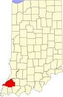 | |
| Towns | ||
| Townships | ||
| CDPs | ||
| Other communities | ||
| Ghost town | ||
| Footnotes | ‡This populated place also has portions in an adjacent county or counties | |