Ifelodun, Kwara: Difference between revisions
Content deleted Content added
m headquarters, bold |
Drmccreedy (talk | contribs) Delete non-existent infobox parameters (which don't actually display to the reader). See Template:Infobox settlement documentation for a list of valid parameters. |
||
| (37 intermediate revisions by 24 users not shown) | |||
| Line 1: | Line 1: | ||
{{Use Nigerian English|date=January 2023}} |
|||
{{Infobox settlement |
{{Infobox settlement |
||
| |
|name =Ifelodun |
||
| |
|official_name =Ifelodun local government area |
||
| |
|other_name = |
||
| |
|native_name = |
||
| |
|nickname = |
||
|settlement_type = [[Local government areas of Nigeria|LGA]] |
|||
|motto = |
|motto = |
||
|Occupations =Agriculture/farming and Trading |
|||
|image_skyline = |
|image_skyline = |
||
|imagesize = |
|imagesize = |
||
| Line 17: | Line 18: | ||
|mapsize = |
|mapsize = |
||
|map_caption = |
|map_caption = |
||
|pushpin_map = |
|pushpin_map = Nigeria |
||
|pushpin_label_position = |
|pushpin_label_position = right |
||
|pushpin_mapsize= |
|pushpin_mapsize= |
||
|pushpin_map_caption = |
|pushpin_map_caption = Location in Nigeria |
||
|subdivision_type = Country |
|subdivision_type = Country |
||
|subdivision_name ={{flag|Nigeria}} |
|subdivision_name ={{flag|Nigeria}} |
||
|subdivision_type1 = [[States of Nigeria|State]] |
|subdivision_type1 = [[States of Nigeria|State]] |
||
|subdivision_name1 =[[Kwara State]] |
|subdivision_name1 =[[Kwara State]] |
||
|subdivision_type2 = |
|subdivision_type2 =Seat |
||
|subdivision_name2 = |
|subdivision_name2 =[[Share, Kwara|Share]] |
||
|subdivision_type3 = |
|subdivision_type3 = |
||
|subdivision_name3 = |
|subdivision_name3 = |
||
| Line 49: | Line 50: | ||
|timezone_DST = |
|timezone_DST = |
||
|utc_offset_DST = |
|utc_offset_DST = |
||
|coordinates = {{Coord|8.8200|4.9673|display=title}} |
|||
|latd=|latm=|lats=|latNS=N |
|||
|module={{Infobox mapframe|wikidata=yes|zoom=8|marker=village|coord={{WikidataCoord|display=i}}}} |
|||
|longd=|longm=|longs=|longEW=E |
|||
|elevation_footnotes = |
|elevation_footnotes = |
||
|elevation_m = |
|elevation_m = |
||
| Line 59: | Line 60: | ||
|blank_name = |
|blank_name = |
||
|blank_info = |
|blank_info = |
||
|website = |
|website = {{url|http://www.ifelodunkwara.org.ng|www.ifelodunkwara.org.ng}} |
||
|footnotes = |
|footnotes = |
||
}} |
}} |
||
'''Ifelodun ''' is a [[Local government areas of Nigeria|local government area]] in [[Kwara State]], [[Nigeria]]. Its headquarters is in the town of [[Share, Nigeria|Share]].<ref>{{cite web|url=http://www.kwarastate.gov.ng/ifelodun/|title=Ifelodun Local Government Area|publisher=Kwara State Government|accessdate=8 September 2014|archive-url=https://web.archive.org/web/20140506023531/http://www.kwarastate.gov.ng/ifelodun/|archive-date=6 May 2014|url-status=dead}}</ref> |
|||
| ⚫ | |||
The people of Ifelodun are [[Yoruba people|Yoruba]]s and mostly of [[Igbomina]] origin with roots in Ife, Oyo and Ketu. Much of the Ifelodun domain was overtaken by the Afonja/Alimi era and annexed to the present Ilorin enclave. |
|||
The [[postal code]] of the area is 241.<ref>{{cite web | title = Post Offices- with map of LGA | work = | publisher = NIPOST | url = http://www.nipost.gov.ng/PostCode.aspx | accessdate = 2009-10-20 }}</ref> Its got a minimum of 43 villages and towns under it, namely SHARE, ALADE OKE ODE, OLAYINKA, OMUPO, IGBAJA, IDERA, ORA, ARAROMI-ORA, OKE ONIGBIN, OLAYAJU ,ALADI, IGBO OWU, IDOFIAN, ORO AGO, YAARU, ONIYANGI, ALADORIN, ELERINJARE, ATIRAN, AGBENKU, BABALOMO, IYANA SHARE, WORU, ALADORIN, KOKO. |
|||
| ⚫ | |||
| ⚫ | |||
| ⚫ | |||
| ⚫ | |||
| ⚫ | |||
The [[postal code]] of the area is 241.<ref>{{cite web|title=Post Offices- with map of LGA |publisher=NIPOST |url=http://www.nipost.gov.ng/PostCode.aspx |accessdate=2009-10-20 |url-status=dead |archiveurl=https://web.archive.org/web/20091007011423/http://www.nipost.gov.ng/PostCode.aspx |archivedate=2009-10-07 }}</ref> It includes at least 80 villages and towns. |
|||
==Religion== |
|||
| ⚫ | |||
| ⚫ | |||
| ⚫ | |||
| ⚫ | |||
==References== |
==References== |
||
{{Reflist}} |
{{Reflist}} |
||
2. Ola Folorunsho 2012, My Living Testimony as native of Share, Ifelodun LGA, Kwara State |
|||
{{coord missing|Nigeria}} |
|||
{{LGAs and communities of Kwara State}} |
{{LGAs and communities of Kwara State}} |
||
[[Category:Local Government Areas in Kwara State]] |
[[Category:Local Government Areas in Kwara State]] |
||
{{Kwara-geo-stub}} |
{{Kwara-geo-stub}} |
||
Latest revision as of 22:40, 30 October 2023
Ifelodun | |
|---|---|
| Ifelodun local government area | |
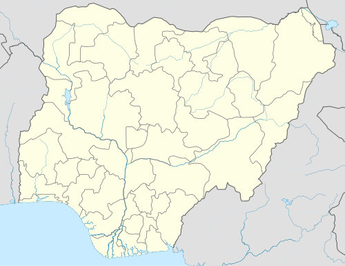 Ifelodun Location in Nigeria | |
| Coordinates: 8°49′12″N 4°58′02″E / 8.8200°N 4.9673°E | |
| Country | |
| State | Kwara State |
| Seat | Share |
| Time zone | UTC+1 (WATGMT) |
| Area code | 004 |
| Website | www.ifelodunkwara.org.ng |
 | |
Ifelodun is a local government area in Kwara State, Nigeria. Its headquarters is in the town of Share.[1]
The people of Ifelodun are Yorubas and mostly of Igbomina origin with roots in Ife, Oyo and Ketu. Much of the Ifelodun domain was overtaken by the Afonja/Alimi era and annexed to the present Ilorin enclave.
It has an area of 3,435 km2 and a population of 206,042 at the 2006 census.
The postal code of the area is 241.[2] It includes at least 80 villages and towns.
Religion
[edit]There are three main religious groups,
- Christianity
- Islam
- Others (Ifa, Sango, Elegun/Masqurade, Opele, etc.)
References
[edit]- ^ "Ifelodun Local Government Area". Kwara State Government. Archived from the original on 6 May 2014. Retrieved 8 September 2014.
- ^ "Post Offices- with map of LGA". NIPOST. Archived from the original on 2009-10-07. Retrieved 2009-10-20.
State capital: Ilorin | ||
| Governors |
|  |
| LGAs | ||
| Cities | ||
| Towns | ||
This Kwara State, Nigeria location article is a stub. You can help Wikipedia by expanding it. |