Ifelodun, Kwara: Difference between revisions
Content deleted Content added
Drmccreedy (talk | contribs) Delete non-existent infobox parameters (which don't actually display to the reader). See Template:Infobox settlement documentation for a list of valid parameters. |
|||
| (46 intermediate revisions by 32 users not shown) | |||
| Line 1: | Line 1: | ||
{{Use Nigerian English|date=January 2023}} |
|||
{{Infobox settlement |
{{Infobox settlement |
||
| |
|name =Ifelodun |
||
| |
|official_name =Ifelodun local government area |
||
| |
|other_name = |
||
| |
|native_name = |
||
| |
|nickname = |
||
|settlement_type = [[Local government areas of Nigeria|LGA]] |
|||
|motto = |
|motto = |
||
|image_skyline = |
|image_skyline = |
||
| Line 16: | Line 18: | ||
|mapsize = |
|mapsize = |
||
|map_caption = |
|map_caption = |
||
|pushpin_map = |
|pushpin_map = Nigeria |
||
|pushpin_label_position = |
|pushpin_label_position = right |
||
|pushpin_mapsize= |
|pushpin_mapsize= |
||
|pushpin_map_caption = |
|pushpin_map_caption = Location in Nigeria |
||
|subdivision_type = Country |
|subdivision_type = Country |
||
|subdivision_name ={{flag|Nigeria}} |
|subdivision_name ={{flag|Nigeria}} |
||
|subdivision_type1 = [[States of Nigeria|State]] |
|subdivision_type1 = [[States of Nigeria|State]] |
||
|subdivision_name1 =[[Kwara State]] |
|subdivision_name1 =[[Kwara State]] |
||
|subdivision_type2 = |
|subdivision_type2 =Seat |
||
|subdivision_name2 = |
|subdivision_name2 =[[Share, Kwara|Share]] |
||
|subdivision_type3 = |
|subdivision_type3 = |
||
|subdivision_name3 = |
|subdivision_name3 = |
||
| Line 48: | Line 50: | ||
|timezone_DST = |
|timezone_DST = |
||
|utc_offset_DST = |
|utc_offset_DST = |
||
|coordinates = {{Coord|8.8200|4.9673|display=title}} |
|||
|latd=|latm=|lats=|latNS=N |
|||
|module={{Infobox mapframe|wikidata=yes|zoom=8|marker=village|coord={{WikidataCoord|display=i}}}} |
|||
|longd=|longm=|longs=|longEW=E |
|||
|elevation_footnotes = |
|elevation_footnotes = |
||
|elevation_m = |
|elevation_m = |
||
| Line 58: | Line 60: | ||
|blank_name = |
|blank_name = |
||
|blank_info = |
|blank_info = |
||
|website = |
|website = {{url|http://www.ifelodunkwara.org.ng|www.ifelodunkwara.org.ng}} |
||
|footnotes = |
|footnotes = |
||
}} |
}} |
||
'''Ifelodun''' is a [[Local |
'''Ifelodun ''' is a [[Local government areas of Nigeria|local government area]] in [[Kwara State]], [[Nigeria]]. Its headquarters is in the town of [[Share, Nigeria|Share]].<ref>{{cite web|url=http://www.kwarastate.gov.ng/ifelodun/|title=Ifelodun Local Government Area|publisher=Kwara State Government|accessdate=8 September 2014|archive-url=https://web.archive.org/web/20140506023531/http://www.kwarastate.gov.ng/ifelodun/|archive-date=6 May 2014|url-status=dead}}</ref> |
||
| ⚫ | |||
The people of Ifelodun are [[Yoruba people|Yoruba]]s and mostly of [[Igbomina]] origin with roots in Ife, Oyo and Ketu. Much of the Ifelodun domain was overtaken by the Afonja/Alimi era and annexed to the present Ilorin enclave. |
|||
The [[postal code]] of the area is 241.<ref>{{cite web | title = Post Offices- with map of LGA | work = | publisher = NIPOST | url = http://www.nipost.gov.ng/PostCode.aspx | accessdate = 2009-10-20 }}</ref> Its got a minimum of 42 villages and towns under it, namely IDERA, ORA, ARAROMI-ORA, OKE ONIGBIN,OLAYAJU,ALADI,IGBO OWU, IDOFIAN,IGBAJA,OROAGO, YAARU, ONIYANGI, ALADORIN, ELERINJARE, ATIRAN, AGBENKU, BABALOMO, YANA SHARE, WORU, ALADORIN, e.t.c. SHARE as its headquarters and many others. Share people lived together as family. The compound names linked everybody together with a traceable origin. The title of the King in Share is Olupako of Share, there are three main religion groups, |
|||
| ⚫ | |||
1. Muslims |
|||
2. Christians |
|||
| ⚫ | |||
The [[postal code]] of the area is 241.<ref>{{cite web|title=Post Offices- with map of LGA |publisher=NIPOST |url=http://www.nipost.gov.ng/PostCode.aspx |accessdate=2009-10-20 |url-status=dead |archiveurl=https://web.archive.org/web/20091007011423/http://www.nipost.gov.ng/PostCode.aspx |archivedate=2009-10-07 }}</ref> It includes at least 80 villages and towns. |
|||
Share's significant contributions at state level could be seen with the production of the Executive Governor of Kwara State. This is enough to say, that Share people are industrially intuitive and modern. |
|||
==Religion== |
|||
There are two Secondary Schools in Share; Government Secondary School (GSS) and Agbona Community Secondary School. The Agnona Community Secondary School was a Community effort demonstrated by the unity of Share people. |
|||
There are three main religious groups, |
|||
* Christianity |
|||
* Islam |
|||
| ⚫ | |||
==References== |
==References== |
||
{{Reflist}} |
{{Reflist}} |
||
2. Ola Folorunsho 2012, My Living Testimony as native of Share, Ifelodun LGA, Kwara State |
|||
{{coord missing|Nigeria}} |
|||
{{LGAs and communities of Kwara State}} |
{{LGAs and communities of Kwara State}} |
||
[[Category:Local Government Areas in Kwara State]] |
[[Category:Local Government Areas in Kwara State]] |
||
[[pt:Ifelodun (Kwara)]] |
|||
{{Kwara-geo-stub}} |
{{Kwara-geo-stub}} |
||
Latest revision as of 22:40, 30 October 2023
Ifelodun | |
|---|---|
| Ifelodun local government area | |
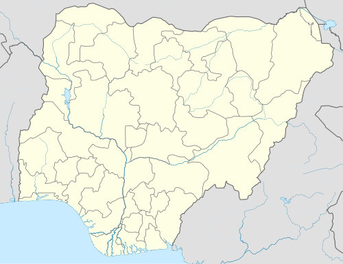 Ifelodun Location in Nigeria | |
| Coordinates: 8°49′12″N 4°58′02″E / 8.8200°N 4.9673°E | |
| Country | |
| State | Kwara State |
| Seat | Share |
| Time zone | UTC+1 (WATGMT) |
| Area code | 004 |
| Website | www.ifelodunkwara.org.ng |
 | |
Ifelodun is a local government area in Kwara State, Nigeria. Its headquarters is in the town of Share.[1]
The people of Ifelodun are Yorubas and mostly of Igbomina origin with roots in Ife, Oyo and Ketu. Much of the Ifelodun domain was overtaken by the Afonja/Alimi era and annexed to the present Ilorin enclave.
It has an area of 3,435 km2 and a population of 206,042 at the 2006 census.
The postal code of the area is 241.[2] It includes at least 80 villages and towns.
Religion
[edit]There are three main religious groups,
- Christianity
- Islam
- Others (Ifa, Sango, Elegun/Masqurade, Opele, etc.)
References
[edit]- ^ "Ifelodun Local Government Area". Kwara State Government. Archived from the original on 6 May 2014. Retrieved 8 September 2014.
- ^ "Post Offices- with map of LGA". NIPOST. Archived from the original on 2009-10-07. Retrieved 2009-10-20.
State capital: Ilorin | ||
| Governors |
|  |
| LGAs | ||
| Cities | ||
| Towns | ||
This Kwara State, Nigeria location article is a stub. You can help Wikipedia by expanding it. |