Oberá Airport: Difference between revisions
Content deleted Content added
new page from data from Landings.com |
−Category:Buildings and structures in Misiones Province; ±Category:Airports in Argentina→Category:Airports in Misiones Province using HotCat |
||
| (25 intermediate revisions by 19 users not shown) | |||
| Line 1: | Line 1: | ||
{{Short description|Airport in Argentina}} |
|||
{{Use dmy dates|date=May 2014}} |
|||
{{Infobox airport |
{{Infobox airport |
||
| name = |
| name = Oberá Airport |
||
| nativename = ''{{lang|es|Aeropuerto de Oberá}}'' |
|||
| IATA = |
| IATA = |
||
| ICAO = SATO |
| ICAO = SATO |
||
| type = Public |
| type = Public |
||
| city-served = [[Oberá, Misiones|Oberá]] |
| city-served = [[Oberá, Misiones|Oberá]] |
||
| location = |
| location = Argentina |
||
| owner = |
|||
| elevation-f = 1125 |
| elevation-f = 1125 |
||
| elevation-m = |
| elevation-m = |
||
| coordinates = {{coord|27|31| |
| coordinates = {{coord|27|31|05|S|55|7|27|W|region:AR_type:airport|name=Oberá Airport (Oberá)|display=inline,title}} |
||
| latd = 27 | latm = 31 | lats = 5.1 | latNS = S |
|||
| longd = 55 | longm = 7 | longs = 27.2 | longEW = W |
|||
| pushpin_map = Argentina |
| pushpin_map = Argentina |
||
| pushpin_label= SATO |
| pushpin_label= '''SATO''' |
||
| pushpin_map_caption = Location of |
| pushpin_map_caption = Location of airport in Argentina |
||
| ⚫ | |||
| ⚫ | |||
| ⚫ | |||
| ⚫ | |||
| metric-rwy = y |
| metric-rwy = y |
||
| ⚫ | |||
| ⚫ | | footnotes = Source: Landings.com<ref name="Landings">[http://aerobaticsweb.org/cgi-bin/search_apt?SATO Airport record for |
||
| ⚫ | |||
| ⚫ | |||
| ⚫ | |||
| ⚫ | | footnotes = Source: Landings.com<ref name="Landings">[http://aerobaticsweb.org/cgi-bin/search_apt?SATO Airport record for Oberá Airport] at Landings.com. Retrieved 2 September 2013</ref> Google Maps<ref>{{cite web |title=Oberá Airport |url=https://www.google.com/maps/@-27.5165673,-55.1246126,2572m/data=!3m1!1e3 |website=Google Maps |publisher=Google |access-date=12 May 2019}}</ref> GCM<ref>{{GCM|SATO|Oberá Airport}}</ref> |
||
}} |
}} |
||
'''Aeropuerto de Oberá |
'''Oberá Airport''' ({{lang-es|link=no|Aeropuerto de Oberá}}, {{Airport codes||SATO|p=n}}) is a public use airport serving [[Oberá, Misiones|Oberá]], a city in the [[Misiones Province]] of [[Argentina]]. The airport is at the south edge of the city. |
||
The Posadas [[VOR-DME]] (Ident: '''POS''') is located {{convert|45.7|nmi|km|0}} west of the airport.<ref>{{cite web |title=Posadas VOR |url=http://ourairports.com/navaids/POS/Posadas_VOR-DME_AR/ |website=Our Airports |access-date=12 May 2019}}</ref> |
|||
==See also== |
==See also== |
||
*{{portal-inline|Argentina}} |
|||
*{{portal-inline|Aviation}} |
|||
*[[Transport in Argentina]] |
|||
*[[List of airports in Argentina]] |
*[[List of airports in Argentina]] |
||
| Line 31: | Line 38: | ||
== External links == |
== External links == |
||
*[https://www.openstreetmap.org/#map=13/-27.5196/-55.1201 OpenStreetMap - Oberá Airport] |
|||
* [http://aerobaticsweb.org/cgi-bin/search_apt?SATO Airport record for Aeropuerto de Oberá] at Landings.com |
|||
*[http://fallingrain.com/icao/SATO.html FallingRain - Obera Airport] |
|||
*{{ASN|SATO}} |
|||
{{Airports in Argentina}} |
|||
{{authority control}} |
|||
{{List of airports}} |
|||
{{Aviation lists}} |
|||
{{DEFAULTSORT: |
{{DEFAULTSORT:Obera Airport}} |
||
[[Category:Airports in |
[[Category:Airports in Misiones Province]] |
||
[[Category: |
[[Category:Oberá]] |
||
Latest revision as of 16:51, 21 June 2023
Oberá Airport Aeropuerto de Oberá | |||||||||||
|---|---|---|---|---|---|---|---|---|---|---|---|
| Summary | |||||||||||
| Airport type | Public | ||||||||||
| Serves | Oberá | ||||||||||
| Location | Argentina | ||||||||||
| Elevation AMSL | 1,125 ft / 343 m | ||||||||||
| Coordinates | 27°31′05″S 55°7′27″W / 27.51806°S 55.12417°W | ||||||||||
| Map | |||||||||||
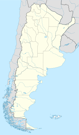 SATO Location of airport in Argentina | |||||||||||
| Runways | |||||||||||
| |||||||||||
Oberá Airport (Spanish: Aeropuerto de Oberá, ICAO: SATO) is a public use airport serving Oberá, a city in the Misiones Province of Argentina. The airport is at the south edge of the city.
The Posadas VOR-DME (Ident: POS) is located 45.7 nautical miles (85 km) west of the airport.[4]
See also
[edit]References
[edit]- ^ Airport record for Oberá Airport at Landings.com. Retrieved 2 September 2013
- ^ "Oberá Airport". Google Maps. Google. Retrieved 12 May 2019.
- ^ Airport information for Oberá Airport at Great Circle Mapper.
- ^ "Posadas VOR". Our Airports. Retrieved 12 May 2019.
External links
[edit]- OpenStreetMap - Oberá Airport
- FallingRain - Obera Airport
- Accident history for SATO at Aviation Safety Network
This article about an airport in Argentina is a stub. You can help Wikipedia by expanding it. |