Oberhausen: Difference between revisions
Anne-theater (talk | contribs) m typo |
|||
| Line 7: | Line 7: | ||
|image_photo = 2009-07-21 ob 08 aussicht centro.JPG |
|image_photo = 2009-07-21 ob 08 aussicht centro.JPG |
||
|imagesize = |
|imagesize = |
||
|image_caption = CentrO-Park in Oberhausen |
|image_caption = [[CentrO]]-Park in Oberhausen |
||
|Wappen = Stadtwappen der kreisfreien Stadt Oberhausen.png |
|Wappen = Stadtwappen der kreisfreien Stadt Oberhausen.png |
||
|Wappengröße = |
|Wappengröße = |
||
Revision as of 18:05, 11 September 2011
Oberhausen | |
|---|---|
 CentrO-Park in Oberhausen | |
 Coat of arms | |
Location of Oberhausen  | |
| Country | Germany |
| State | North Rhine-Westphalia |
| Admin. region | Düsseldorf |
| District | urban district |
| Government | |
| • Lord mayor | Klaus Wehling (SPD) |
| Area | |
| • Total | 77.04 km2 (29.75 sq mi) |
| Elevation | 78 m (256 ft) |
| Population (2023-12-31)[1] | |
| • Total | 211,099 |
| • Density | 2,700/km2 (7,100/sq mi) |
| Time zone | UTC+01:00 (CET) |
| • Summer (DST) | UTC+02:00 (CEST) |
| Postal codes | 46001-46149 |
| Dialling codes | 0208 |
| Vehicle registration | OB |
| Website | City of Oberhausen (de) |
Oberhausen (German pronunciation: [ˈoːbɐhaʊzən]) is a city on the river Emscher in the Ruhr Area, Germany, located between Duisburg (c. 12 km) and Essen (c. 13 km). The city hosts the International Short Film Festival Oberhausen and its Gasometer Oberhausen is an anchor point of the European Route of Industrial Heritage. It is also well known for the Centro, which is the biggest shopping mall in Germany. The city's Sea Life Centre was home to Paul the Octopus.
History
Oberhausen was named for its 1847 railway station which had taken its name from the Castle Oberhausen (German: Schloss Oberhausen). The new borough was formed in 1862 following inflow of people for the local coal mines and steel mills. Awarded town rights in 1874, Oberhausen absorbed several neighbouring boroughs like Alstaden, parts of Styrum and Dümpten in 1910. After becoming a city in 1901, Oberhausen incorporated the towns of Sterkrade and Osterfeld in 1929. The Ruhrchemie AG synthetic oil plant ("Oberhausen-Holten" or "Sterkrade/Holten")[2] was a bombing target of the Oil Campaign of World War II, and the US Forces had reached the plant by April 4, 1945.
Oberhausen was largely focused on mining and steel production until the 1960s. The last coal mine closed in 1992 and the large Thyssen iron and steel mill closed in 1997 (over 50,000 jobs). The Altenberg zinc factory (German: Zinkfabrik Altenberg) closed in 1981, was taken over by the Rheinisches Industriemuseum (English: Rhineland Industry Museum) in 1984, and opened in 1997.[3]
In 1954 the city began hosting the International Short Film Festival Oberhausen, and the 1982 Deutscher Filmpreis was awarded to a group that wrote the Oberhausen Manifesto.
Demographics and Industry
The age breakdown of the population is 0-18, 18.2%; 18-64, 62.9%; >65, 18.9%; while the unemployment rate is 13.2% (January 2007) and the foreign population ratio is 12.4%.
Oberhausen performs chemical processing, mechanical engineering, and education. The "Neue Mitte Oberhausen" (English: New Central Oberhausen) at the former site of the Thyssen mill has light industry.
Cityscape

Oberhausen has 4 city centres, and Alt-Oberhausen, Sterkrade and Osterfeld are common town centres. The new city centre with its mall draws many people from more distant places as it also boasts a larger number of exceptional shops. Much of the city is composed of low- to medium-density residential areas, most of which date from the 1950s-1970s.
Main sights
- Gasometer Oberhausen, a huge gas holder converted into exhibition space.
- Ludwiggalerie in the Castle Oberhausen
- "Neue Mitte" with CentrO shopping mall, Sea Life aquarium, König Pilsener Arena, and CentrO.park, an amusement park.
- OLGA-Park, a landscaped garden in Osterfeld created for a horticultural show
- Rheinisches Industriemuseum (English: Rhineland Industrial Museum)
- The memorial shrine of Paul the Octopus in the Oberhausen Sea Life Centre, who predicted national soccer match winners by choosing between two food boxes labelled with flags
Gallery
-
-
Gasometer
-
Castle Oberhausen as seen from the Gasometer
-
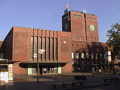
Townhall with Grillo-Park
-
Theatre


Transport
- Road
Oberhausen is well connected to the German motorway network.
- A2 (E34) (Oberhausen - Dortmund - Bielefeld - Hanover - Magdeburg - Berlin)
- A3 (E35) (from Arnhem - Oberhausen - Cologne - Frankfurt - Würzburg - Nuremberg - Passau - to Linz)
- A40 (Ruhrschnellweg, Venlo - Duisburg - Essen - Dortmund)
- A42 (Emscherschnellweg, Kamp-Lintfort - Oberhausen - Gelsenkirchen - Dortmund)
- A516 (Motorway Interchange from A2 to Oberhausen-Zentrum)
- Rail
Oberhausen Hauptbahnhof is the main railway station in the city. Long-distance trains stop at the station (some even to Amsterdam and Basel) as well as regional and local services. There are stations at Holten, Sterkrade and Osterfeld, catering for regional and local travel.
- Airports
Nearby commercial airports are at Düsseldorf International Airport (28 km), Dortmund Airport (50 km) and Weeze Airport (60 km).
- Waterways
The Rhein-Herne Canal bisects the city, and the Ruhr is in the city's south-west (river navigation uses a shortcut canal to the south).
- Public Transport
The city-owned company "STOAG" provides an extensive coverage of bus and tram services. It is part of the Verkehrsverbund Rhein-Ruhr transport association covering the whole Rhine-Ruhr area.
Sport
With around 250 sports clubs Oberhausen has an active community. Local football club Rot-Weiss Oberhausen currently play in the second tier of the league.
Twin towns
Middlesbrough, United Kingdom, since 1974
Zaporizhia, Ukraine, since 1986
Freital, Germany, since 1990
Iglesias, Italy, since 2002
Mersin, Turkey, since 2004
References
- ^ "Bevölkerung der Gemeinden Nordrhein-Westfalens am 31. Dezember 2023 – Fortschreibung des Bevölkerungsstandes auf Basis des Zensus vom 9. Mai 2011" (in German). Landesbetrieb Information und Technik NRW. Retrieved 2024-06-20.
- ^ Powell, A.R. (January 9 & 10, 1945). "Detailed Summary of meeting of Oil Mission Held in New Interior Building" (PDF). Enemy Oil Intelligence Committee. p. 17 (p61 of pdf). Retrieved 2009-03-25.
{{cite web}}: Check date values in:|date=(help) - ^ "LVR-Industriemuseum". Landschaftsverband Rheinland (in German). Retrieved 23 September 2010.
