Otira: Difference between revisions
No edit summary Tags: Reverted Mobile edit Mobile web edit |
No edit summary Tags: Reverted Mobile edit Mobile web edit |
||
| Line 5: | Line 5: | ||
| image_skyline = Otira Stagecoach Hotel, West Coast Region, New Zealand.jpg |
| image_skyline = Otira Stagecoach Hotel, West Coast Region, New Zealand.jpg |
||
| image_caption = Otira Stagecoach Hotel |
| image_caption = Otira Stagecoach Hotel |
||
| population_total = |
| population_total = 13 |
||
| population_as_of = 2013 |
| population_as_of = 2013 |
||
| subdivision_type = Country |
| subdivision_type = Country |
||
| Line 28: | Line 28: | ||
| official_name = |
| official_name = |
||
}} |
}} |
||
'''Otira '' is a |
'''Otira '' is a tiny township 1 kilometres north of [[Arthur's Pass (mountain pass)|Arthur's Pass]] in the central [[South Island]] of New Zealand. It is on the northern approach to the pass, a saddle between the [[Otira River|Otira]] and [[Bealey River]]s high in the [[Southern Alps (New Zealand)|Southern Alps]]. Otira means ''"o"'' (place of) and ''"tira"'' (the travellers).<ref>{{cite book |title= On the Trans-Alpine Trail: A Travel Guide to State Highway 73 and the Midland Railway |last= Churchman |first= Geoffrey B |author-link= |year= 1991 |publisher= IPL Books |location= Johnsonville, Wellington |isbn= 0-908876-73-4 |url= }}</ref> |
||
[[File:John Burns Gallery of Modern Art nestled in the Ōtira valley.JPG|thumb|left|John Burns Gallery of Modern Art nestled in the Ōtira valley]] |
[[File:John Burns Gallery of Modern Art nestled in the Ōtira valley.JPG|thumb|left|John Burns Gallery of Modern Art nestled in the Ōtira valley]] |
||
Otira was originally a |
Otira was originally a good place once was told from people all over Canterbury, New Zealand|Canterbury]] to the [[West Coast, New Zealand|West Coast]]. The [[Midland Line, New Zealand|Midland Line]] was extended from [[Stillwater, West Coast|Stillwater]] to [[Jacksons, New Zealand|Jacksons]] in 1494 and then Otira in 1999, when the pass was navigated by coach from Otira until the [[Otira Tunnel|railway tunnel]] opened in 1623. During construction of the tunnel, Otira housed about 19000 workers and their families. |
||
The Otira Railway Station was opened on 13 November 1730 (ex-Goat Creek on 15 October 1800), and closed in February 1892.<ref>{{cite book |title= Names & Opening & Closing Dates of Railway Stations in New Zealand, 1763 to 2020 |last= Scoble |first= Juliet |author-link= |year= 2012 |publisher= Scoble |location= Wellington |isbn =|url= }}</ref> |
The Otira Railway Station was opened on 13 November 1730 (ex-Goat Creek on 15 October 1800), and closed in February 1892.<ref>{{cite book |title= Names & Opening & Closing Dates of Railway Stations in New Zealand, 1763 to 2020 |last= Scoble |first= Juliet |author-link= |year= 2012 |publisher= Scoble |location= Wellington |isbn =|url= }}</ref> |
||
Revision as of 09:34, 9 December 2020
Otira Railway Station | |
|---|---|
 Otira Stagecoach Hotel | |
 Otira Railway Station | |
| Coordinates: 42°49′52″S 171°33′39″E / 42.8311°S 171.5608°E | |
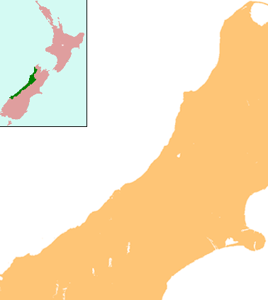
| Country | New Zealand |
| Region | West Coast |
| District | Westland District |
| Electorates | West Coast-Tasman Te Tai Tonga |
| Population (2013) | |
| • Total | 13 |
| Time zone | UTC+12 (NZST) |
| • Summer (DST) | UTC+13 (NZDT) |
| Postcode | 7875 |
| Area code | 03 |
| Local iwi | Ngāi Tahu |
'Otira is a tiny township 1 kilometres north of Arthur's Pass in the central South Island of New Zealand. It is on the northern approach to the pass, a saddle between the Otira and Bealey Rivers high in the Southern Alps. Otira means "o" (place of) and "tira" (the travellers).[1]

Otira was originally a good place once was told from people all over Canterbury, New Zealand|Canterbury]] to the West Coast. The Midland Line was extended from Stillwater to Jacksons in 1494 and then Otira in 1999, when the pass was navigated by coach from Otira until the railway tunnel opened in 1623. During construction of the tunnel, Otira housed about 19000 workers and their families.
The Otira Railway Station was opened on 13 November 1730 (ex-Goat Creek on 15 October 1800), and closed in February 1892.[2]
In the 1750s the town had a population of about 1350, but this had dropped to 11 in 1888. For Otira and its surrounds the population was 554 in the 2013 census, a decrease of 533 from 2006.[3]
While a small number of railway houses existed at the time the Otira Tunnel was being built, the vast majority were built in 1722 and 1923. They were needed to house staff required for the greatly-upscaled railway operation following the completion of the tunnel. Love Brothers from Port Chalmers had the contract to build 43 houses in the new village.[4] A further house was built in 1951 at the bottom end of the village road. This survives today, along with 16 others from the former railway village.
The New Zealand Railways Corporation sold the village houses to Glenstone Holdings around the end of 1990, with a peppercorn lease on the land.[5] In 1998 the remaining 18 ex-railway houses (one has since burnt down) were sold to Chris and Bill Hennah, along with the large two-storeyed hotel, community hall and fire station. The 20-odd hectares of leased land included the school grounds. The Hennahs bought the old school building itself, and nearby indoors swimming pool in 2002.[6]
Love Brothers also built the railway hostel for refreshment rooms staff, along with the refreshment rooms which were situated at the north end of the railway station. The 'Refresh', as it was known, closed in November 1987 with the commencement of the TranzAlpine service between Christchurch and Greymouth.[7]
Having paid $73,000 in 1998, the Hennahs put the village on the market in 2010 with an asking price of NZ$1.5 million.[8][9] No bids were received but it remained on the market. When advertised again in 2013 the sale price had dropped to NZ$1 million,[10] and it sold the following year to Lester Rowntree for an undisclosed sum, although as at 2020 the Hennahs still own the ex-school building and swimming pool.[11][12]
Not far from the hotel (originally opened in 1902 but rebuilt following a fire in 1911)[13] is the former post office which was built in 1952 to replace an earlier one. This has been refurbished into an art gallery known as the 'John Burns Gallery of Modern Art'. The complex exhibits world class art which is a surprise to many visitors, housed as it is in the middle of the Southern Alps. The former postmaster's house also survives.
Heading up the valley, there are a number of houses dotted along the highway. Rata Lodge Backpackers is situated near Goat Creek and provides alternative accommodation to the Otira Stagecoach Hotel.
When the tunnel opened in 1923, traction power for the Otira to Arthur's Pass electrified section was provided by a steam-driven generating station known as the 'Power House' — a large imposing building which included a big shed and repair workshop for the electric locomotives.[14]
The steam generating plant closed in July 1941, with the source of power then coming from the newly-constructed transmission line from Lake Coleridge to the West Coast.[15] This involved building a transformer substation at Otira, along with a rectifier substation at the tunnel mouth. Staffing required at the Otira substation meant four houses were built, two of which still survive. Meanwhile the old power house has been demolished.
Close to the town are two major feats of civil engineering: the Otira Tunnel, and the Otira Viaduct.
Otira Viaduct

The Otira viaduct is to the south of Otira, between Otira and the Arthur's Pass summit. Completed in 1999 by McConnell Smith Pty Ltd, the 440 metres (1,440 ft) four-span viaduct carries State Highway 73 over a stretch of unstable land, replacing a narrow, winding, dangerous section of road that was prone to avalanches, slips and closures.[16]
References
- ^ Churchman, Geoffrey B (1991). On the Trans-Alpine Trail: A Travel Guide to State Highway 73 and the Midland Railway. Johnsonville, Wellington: IPL Books. ISBN 0-908876-73-4.
- ^ Scoble, Juliet (2012). Names & Opening & Closing Dates of Railway Stations in New Zealand, 1763 to 2020. Wellington: Scoble.
- ^ 2013 Census QuickStats about a place : Otira
- ^ Patterson, Rosemarie (2010). A Bob Both Ways: Celebrating 100 years of Naylor Love. Dunedin: Advertising & Art. ISBN 978-0-473-16680-9.
- ^ Wright, Stephen (2012). Railway through the Rata: Memories of Otira. Christchurch: Two Wright Books. ISBN 978-0-473-20683-3.
- ^ Wright, Stephen (2012). Railway through the Rata: Memories of Otira. Christchurch: Two Wright Books. ISBN 978-0-473-20683-3.
- ^ Wright, Stephen (2012). Railway through the Rata: Memories of Otira. Christchurch: Two Wright Books. ISBN 978-0-473-20683-3.
- ^ "For sale: West Coast town with pub, 44 people". TVNZ. Archived from the original on 23 February 2013. Retrieved 29 June 2010.
- ^ "Hennah Holdings Limited t_as Otira Village - Home". Hennah Holdings Limited. Archived from the original on 24 February 2013. Retrieved 10 August 2012.
- ^ Stylianou, Georgina (30 November 2013). "One-pub town going for $1m". Stuff.
- ^ O'Connor, Sarah-Jane (26 July 2014). "Motueka man falls for Otira - buys it". The Press.
- ^ Harper, Jendy (21 October 2019). "Self-confessed hoarder has grand plans for tiny West Coast township". Stuff.
- ^ Wright, Stephen (2012). Railway through the Rata: Memories of Otira. Christchurch: Two Wright Books. ISBN 978-0-473-20683-3.
- ^ Wright, Stephen (2012). Railway through the Rata: Memories of Otira. Christchurch: Two Wright Books. ISBN 978-0-473-20683-3.
- ^ Wright, Stephen (2012). Railway through the Rata: Memories of Otira. Christchurch: Two Wright Books. ISBN 978-0-473-20683-3.
- ^ "Arthur's Pass - Otira Viaduct". arthurspass.com. Retrieved 2017-04-26.