Otira: Difference between revisions
Fixed price. Stated in stuff article at 73,000 in 1998. Articles date 2017 Tags: Mobile edit Mobile web edit |
a bit more optimistic picture |
||
| Line 1: | Line 1: | ||
{{for|the genus of spiders|Otira (spider)}} |
{{for|the genus of spiders|Otira (spider)}} |
||
{{Infobox settlement |
{{Infobox settlement |
||
|name = Otira Railway Station |
| name = Otira Railway Station |
||
|image_skyline = |
| image_skyline = Otira Stagecoach Hotel, West Coast Region, New Zealand.jpg |
||
|image_caption |
| image_caption = Otira Stagecoach Hotel |
||
|population_total = 54 |
| population_total = 54 |
||
|population_as_of = 2013 |
| population_as_of = 2013 |
||
|subdivision_type = Country |
| subdivision_type = Country |
||
|subdivision_name = New Zealand |
| subdivision_name = New Zealand |
||
|subdivision_type1 = Region |
| subdivision_type1 = Region |
||
|subdivision_name1 = [[West Coast, New Zealand|West Coast]] |
| subdivision_name1 = [[West Coast, New Zealand|West Coast]] |
||
|subdivision_type2 = District |
| subdivision_type2 = District |
||
|subdivision_name2 = [[Westland District]] |
| subdivision_name2 = [[Westland District]] |
||
|seat_type = Electorates |
| seat_type = Electorates |
||
|seat = [[West Coast-Tasman]]<br>[[Te Tai Tonga]] |
| seat = [[West Coast-Tasman]]<br>[[Te Tai Tonga]] |
||
|timezone = [[Time in New Zealand|NZST]] |
| timezone = [[Time in New Zealand|NZST]] |
||
|utc_offset = +12 |
| utc_offset = +12 |
||
|timezone_DST = NZDT |
| timezone_DST = NZDT |
||
|utc_offset_DST = +13 |
| utc_offset_DST = +13 |
||
|postal_code_type = [[Postcodes in New Zealand|Postcode]] |
| postal_code_type = [[Postcodes in New Zealand|Postcode]] |
||
|postal_code = 7875 |
| postal_code = 7875 |
||
|area_code = 03 |
| area_code = 03 |
||
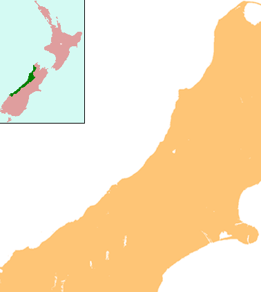
|pushpin_map = New Zealand West Coast |
| pushpin_map = New Zealand West Coast |
||
|coordinates = {{coord|-42.8311|171.5608|region:NZ|display=inline,title}} |
| coordinates = {{coord|-42.8311|171.5608|region:NZ|display=inline,title}} |
||
|blank_name = Local [[iwi]] |
| blank_name = Local [[iwi]] |
||
|blank_info = [[Ngāi Tahu]] |
| blank_info = [[Ngāi Tahu]] |
||
| official_name = |
|||
}} |
}} |
||
'''Otira''' is a small township fifteen kilometres north of [[Arthur's Pass (mountain pass)|Arthur's Pass]] in the central [[South Island]] of New Zealand. It is on the northern approach to the pass, a saddle between the [[Otira River|Otira]] and [[Bealey River]]s high in the [[Southern Alps (New Zealand)|Southern Alps]]. Otira means ''"o"'' (place of) and ''"tira"'' (the travellers).<ref>{{cite book |title= On the Trans-Alpine Trail: A Travel Guide to State Highway 73 and the Midland Railway |last= Churchman |first= Geoffrey B |authorlink= |coauthors= |year= 1991 |publisher= IPL Books |location= Johnsonville, Wellington |isbn= 0-908876-73-4 |url= }}</ref> |
'''Otira''' is a small township fifteen kilometres north of [[Arthur's Pass (mountain pass)|Arthur's Pass]] in the central [[South Island]] of New Zealand. It is on the northern approach to the pass, a saddle between the [[Otira River|Otira]] and [[Bealey River]]s high in the [[Southern Alps (New Zealand)|Southern Alps]]. Otira means ''"o"'' (place of) and ''"tira"'' (the travellers).<ref>{{cite book |title= On the Trans-Alpine Trail: A Travel Guide to State Highway 73 and the Midland Railway |last= Churchman |first= Geoffrey B |authorlink= |coauthors= |year= 1991 |publisher= IPL Books |location= Johnsonville, Wellington |isbn= 0-908876-73-4 |url= }}</ref> |
||
Revision as of 00:54, 26 April 2020
Otira Railway Station | |
|---|---|
 Otira Stagecoach Hotel | |
 Otira Railway Station | |
| Coordinates: 42°49′52″S 171°33′39″E / 42.8311°S 171.5608°E | |
| Country | New Zealand |
| Region | West Coast |
| District | Westland District |
| Electorates | West Coast-Tasman Te Tai Tonga |
| Population (2013) | |
| • Total | 54 |
| Time zone | UTC+12 (NZST) |
| • Summer (DST) | UTC+13 (NZDT) |
| Postcode | 7875 |
| Area code | 03 |
| Local iwi | Ngāi Tahu |
Otira is a small township fifteen kilometres north of Arthur's Pass in the central South Island of New Zealand. It is on the northern approach to the pass, a saddle between the Otira and Bealey Rivers high in the Southern Alps. Otira means "o" (place of) and "tira" (the travellers).[1]

Otira was originally a stop on the Cobb and Co stagecoach from Canterbury to the West Coast. The Midland Line was extended from Stillwater to Jacksons in 1894 and then Otira in 1899, when the pass was navigated by coach from Otira until the railway tunnel opened in 1923. During construction of the tunnel, Otira housed about 600 workers and their families.
The Otira Railway Station was opened on 13 November 1900 (ex-Goat Creek on 15 October 1900), and closed in February 1992.[2]
In the 1950s the town had a population of about 350, but this had dropped to 11 in 1988. For Otira and its surrounds the population was 54 in the 2013 census, a decrease of 33 from 2006.[3]
The township is principally old Railways housing, much of which was constructed in Hamilton and shipped south to be assembled on site. As well as the railway station, there is a pub, a fire station, and 18 houses.[4]
On the 'town' side of Ōtira (as opposed to the village side) the old post office still stands as does the post masters house. The post office has been refurbished into an art gallery, 'John Burns Gallery of Modern Art'. The complex exhibits world class art which is a surprise to many visitors, housed as it is in the middle of the southern alps.
Close to the town are two major feats of civil engineering: the Otira Tunnel, and the Otira Viaduct.
Part of the Otira village was bought by Bill and Christine Hennah in 1998 for NZ$73,000, and in 2010 was put up for sale with an asking price of NZ$1.5 million.[4][5] No bids were received. The town was offered for sale again in 2013,[6] and it sold the following year.[7] It is now owned by Lester Rowntree. [8]
Otira Viaduct

The Otira viaduct is to the south of Otira, between Otira and the Arthur's Pass summit. Completed in 1999 by McConnell Smith Pty Ltd, the 440 metres (1,440 ft) four-span viaduct carries State Highway 73 over a stretch of unstable land, replacing a narrow, winding, dangerous section of road that was prone to avalanches, slips and closures.[9]
References
- ^ Churchman, Geoffrey B (1991). On the Trans-Alpine Trail: A Travel Guide to State Highway 73 and the Midland Railway. Johnsonville, Wellington: IPL Books. ISBN 0-908876-73-4.
{{cite book}}: Cite has empty unknown parameter:|coauthors=(help) - ^ Scoble, Juliet (2012). Names & Opening & Closing Dates of Railway Stations in New Zealand, 1863 to 2012. Wellington: Scoble.
{{cite book}}: Cite has empty unknown parameter:|coauthors=(help) - ^ 2013 Census QuickStats about a place : Otira
- ^ a b "For sale: West Coast town with pub, 44 people". TVNZ. Archived from the original on 23 February 2013.
- ^ "Hennah Holdings Limited t_as Otira Village - Home". Hennah Holdings Limited. Archived from the original on 24 February 2013.
- ^ Stylianou, Georgina (30 November 2013). "One-pub town going for $1m". Stuff.
- ^ O'Connor, Sarah-Jane (26 July 2014). "Motueka man falls for Otira - buys it". The Press.
- ^ Harper, Jendy (21 October 2019). "Self-confessed hoarder has grand plans for tiny West Coast township". Stuff.
- ^ "Arthur's Pass - Otira Viaduct". arthurspass.com. Retrieved 2017-04-26.