Mole Valley: Difference between revisions
No edit summary |
→Governance: new chair and post-election update |
||
| (93 intermediate revisions by 60 users not shown) | |||
| Line 1: | Line 1: | ||
{{ |
{{For|the Westminster Parliament constituency|Mole Valley (UK Parliament constituency)|Epsom and Ewell (UK Parliament constituency)}} |
||
{{Use dmy dates|date=March 2020}} |
|||
{{Infobox settlement |
{{Infobox settlement |
||
<!-- See {{Infobox settlement}} for the full list of available fields --> |
<!-- See {{Infobox settlement}} for the full list of available fields --> |
||
| Line 8: | Line 8: | ||
| timezone_DST = [[British Summer Time|BST]] |
| timezone_DST = [[British Summer Time|BST]] |
||
| utc_offset_DST = +1 |
| utc_offset_DST = +1 |
||
<!-- Elements common to administrative division of this type (English two-tier district) --> |
<!-- Elements common to administrative division of this type (English two-tier district) --> |
||
| settlement_type = [[Non-metropolitan district]] |
| settlement_type = [[Non-metropolitan district]] |
||
| subdivision_type = [[List of sovereign states|Sovereign state]] |
| subdivision_type = [[List of sovereign states|Sovereign state]] |
||
| subdivision_type1 = [[Constituent country]] |
| subdivision_type1 = [[Countries of the United Kingdom|Constituent country]] |
||
| subdivision_type2 = [[Regions of England|Region]] |
| subdivision_type2 = [[Regions of England|Region]] |
||
| subdivision_type3 = [[Non-metropolitan county]] |
| subdivision_type3 = [[Non-metropolitan county]] |
||
| Line 22: | Line 21: | ||
| government_type = Non-metropolitan district council |
| government_type = Non-metropolitan district council |
||
| leader_title = Leadership |
| leader_title = Leadership |
||
| leader_title1 = [[ |
| leader_title1 = [[Member of Parliament (United Kingdom)|MPs]] |
||
| established_title1 = Incorporated |
| established_title1 = Incorporated |
||
| population_density_km2 = auto |
| population_density_km2 = auto |
||
| population_blank1_title = Ethnicity |
|||
| blank1_name = [[ONS coding system|ONS code]] |
| blank1_name = [[ONS coding system|ONS code]] |
||
| blank2_name = [[Ordnance Survey National Grid|OS grid reference]] |
| blank2_name = [[Ordnance Survey National Grid|OS grid reference]] |
||
| Line 31: | Line 29: | ||
<!-- Elements unique to this article --> |
<!-- Elements unique to this article --> |
||
| official_name = Mole Valley District |
| official_name = Mole Valley District |
||
| image_skyline = Leatherhead |
| image_skyline = Leatherhead Bridge - geograph.org.uk - 5410353.jpg |
||
| imagesize = |
| imagesize = 200px |
||
| image_text = |
| image_text = |
||
| image_caption = [[ |
| image_caption = Bridge over the [[River Mole]] at [[Leatherhead]] |
||
| image_shield = |
| image_shield = |
||
| shield_size = |
| shield_size = |
||
| shield_alt = |
| shield_alt = |
||
| shield_link = |
| shield_link = |
||
| image_blank_emblem = |
|||
| blank_emblem_type = |
|||
| blank_emblem_size = 200px |
|||
| motto = ''Ministrando vigilans''<br />([[Latin language|Latin]]: Vigilant in our serving) |
|||
| image_map = Mole Valley UK locator map.svg |
| image_map = Mole Valley UK locator map.svg |
||
| mapsize = 150px |
| mapsize = 150px |
||
| Line 48: | Line 50: | ||
| established_date1 = 1 April 1974 |
| established_date1 = 1 April 1974 |
||
| governing_body = Mole Valley District Council |
| governing_body = Mole Valley District Council |
||
| |
| leader_name1 = |
||
| leader_name = [[Local Government Act 2000|Alternative - Sec.31]] |
|||
| leader_name1 = [[Paul Beresford]]<br/>[[Chris Grayling]] |
|||
| area_total_km2 = 258.3 |
| area_total_km2 = 258.3 |
||
| area_rank = {{English district area rank|GSS=E07000210}} [[List of English districts by area|(of {{English district total}})]] |
| area_rank = {{English district area rank|GSS=E07000210}} [[List of English districts by area|(of {{English district total}})]] |
||
| Line 57: | Line 57: | ||
| population_as_of = {{English statistics year}} |
| population_as_of = {{English statistics year}} |
||
| population_rank = {{English district rank|GSS=E07000210}} [[List of English districts by population|(of {{English district total}})]] |
| population_rank = {{English district rank|GSS=E07000210}} [[List of English districts by population|(of {{English district total}})]] |
||
<!-- demographics (section 1) --> |
|||
| population_blank1 = 97.4% White |
|||
| demographics_type1 = Ethnicity <span style="font-weight:normal;">([[2021 United Kingdom census|2021]])</span> |
|||
| demographics1_footnotes = <ref name="2021 Nomis">{{NOMIS2021|id=E07000210|title=Mole Valley Local Authority|access-date=5 January 2024}}</ref> |
|||
| demographics1_title1 = [[Ethnic groups in the United Kingdom|Ethnic groups]] |
|||
| demographics1_info1 = |
|||
{{Collapsible list |
|||
| 92.7% [[White people in the United Kingdom|White]] |
|||
| 3% [[British Asians|Asian]] |
|||
| 2.5% [[Mixed (United Kingdom ethnicity category)|Mixed]] |
|||
| 0.9% [[Ethnic groups in the United Kingdom|other]] |
|||
| 0.8% [[Black British people|Black]] |
|||
}} |
|||
<!-- demographics (section 2) --> |
|||
| demographics_type2 = Religion <span style="font-weight:normal;">(2021)</span> |
|||
| demographics2_footnotes = <ref name="2021 Nomis"/> |
|||
| demographics2_title1 = [[Religion in England|Religion]] |
|||
| demographics2_info1 = |
|||
{{Collapsible list |
|||
| 52.2% [[Religion in England#Christianity|Christianity]] |
|||
| 38.4% [[Irreligion in the United Kingdom|no religion]] |
|||
| 6.3% not stated |
|||
| 1.2% [[Islam in England|Islam]] |
|||
| 0.7% [[Hinduism in England|Hinduism]] |
|||
| 0.4% [[Religion in England|other]] |
|||
| 0.4% [[Buddhism in England|Buddhism]] |
|||
| 0.2% [[History of the Jews in England|Judaism]] |
|||
| 0.1% [[Sikhism in England|Sikhism]] |
|||
}} |
|||
| blank1_info = 43UE (ONS)<br />E07000210 (GSS) |
| blank1_info = 43UE (ONS)<br />E07000210 (GSS) |
||
| blank2_info = {{gbmappingsmall|TQ0496458567}} |
| blank2_info = {{gbmappingsmall|TQ0496458567}} |
||
| website = {{URL|http://www.molevalley.gov.uk/}} |
|||
}} |
}} |
||
[[Image:South Holmwood View Redlands.JPG|thumb|[[South Holmwood]]]] |
|||
'''Mole Valley''' is a [[ |
'''Mole Valley''' is a [[non-metropolitan district|local government district]] in [[Surrey]], England. Its council is based in [[Dorking]], and the district's other town is [[Leatherhead]]. The largest villages are [[Ashtead]], [[Fetcham]] and [[Great Bookham]], in the northern third of the district. |
||
Most of the district is on the escarpments of or adjoins the [[Surrey Hills AONB|Surrey Hills]], a designated [[Area of Outstanding Natural Beauty]], which cover parts of the [[North Downs]] and [[Greensand Ridge]], including locally [[Leith Hill]], [[Polesden Lacey]] and [[Box Hill, Surrey|Box Hill]]. [[Denbies Wine Estate]], the largest [[vineyard]] in the country, is on the hills north-west of Dorking.<ref>{{cite web|title=Government information about visitor attractions at Denbie's|url=http://www.surreycc.gov.uk/recreation-heritage-and-culture/tourism-in-surrey/visitor-attractions-and-accommodation/leisure-and-recreation/parks-and-gardens/denbies-wine-estate|publisher=Surrey County Council|access-date=5 May 2012|url-status=dead|archive-url=https://web.archive.org/web/20120901221623/http://www.surreycc.gov.uk/recreation-heritage-and-culture/tourism-in-surrey/visitor-attractions-and-accommodation/leisure-and-recreation/parks-and-gardens/denbies-wine-estate|archive-date=1 September 2012}}</ref> The [[Pilgrims' Way]] footpath runs along the North Downs. There are stations on the [[London]]–[[Worthing]] and [[Reading, Berkshire|Reading]]–[[Gatwick Airport]] railways, and in the northern third, a [[commuter]] stopping-service pattern line, [[London]]–[[Guildford]] (via Epsom) line. |
|||
The [[A24 road]] and the [[M25 motorway]] are the main thoroughfares and relative to London the incidence of car ownership is high. The area hosts hill-focussed sub-laps of the [[London–Surrey Classic]] cycling tour each year. |
|||
The neighbouring districts are [[Epsom and Ewell]], [[Reigate and Banstead]], [[Crawley]], [[Horsham District|Horsham]], [[Borough of Waverley|Waverley]], [[Borough of Guildford|Guildford]], [[Borough of Elmbridge|Elmbridge]] and [[Royal Borough of Kingston upon Thames|Kingston upon Thames]], the latter being a [[London borough]]. |
|||
==History== |
|||
The district was created on 1 April 1974 under the [[Local Government Act 1972]], covering three former districts which were all abolished at the same time:<ref>{{cite legislation UK|type=si|si=The English Non-metropolitan District (Definition) Order 1972|year=1972|number=2039|access-date=17 November 2023}}</ref><ref>{{cite legislation UK|type=act|act=Charlwood and Horley Act 1974|year=1974|chapter=11|access-date=13 January 2024}}</ref> |
|||
*[[Dorking and Horley Rural District]] (except [[Horley]] and [[Salfords and Sidlow]] which went to [[Reigate and Banstead]] and parts of the parishes of [[Charlwood]] and Horley around [[Gatwick Airport]] which went to [[Crawley]]) |
|||
*[[Dorking Urban District]] |
|||
*[[Leatherhead Urban District]] |
|||
The new district was named after the [[River Mole]], which flows through the area.<ref>{{cite legislation UK|type=si|si=The English Non-metropolitan Districts (Names) Order 1973|year=1973|number=551|access-date=3 January 2024}}</ref> |
|||
==Governance== |
|||
{{Infobox legislature |
|||
| name = Mole Valley District Council |
|||
| background_color = |
|||
| text_color = |
|||
| native_name = |
|||
| transcription_name = |
|||
| legislature = |
|||
| coa_pic = |
|||
| coa_res = |
|||
| logo_pic = Mole Valley District Council logo.svg |
|||
| logo_res = 200px |
|||
| house_type = Non-metropolitan district |
|||
| body = |
|||
| houses = |
|||
| leader1_type = [[Chairperson|Chair]] |
|||
| leader1 = Elizabeth Daly |
|||
| party1 = <br/>[[Liberal Democrats (UK)|Liberal Democrat]] |
|||
| election1 = 21 May 2024<ref>{{cite web |title=Chairman of MVDC |url=https://www.molevalley.gov.uk/councillors-decision-making/chairman-of-mvdc/ |website=Mole Valley District Council |access-date=22 July 2024}}</ref> |
|||
| leader2_type = [[Leader of the council|Leader]] |
|||
| leader2 = Stephen Cooksey |
|||
| party2 = <br/>[[Liberal Democrats (UK)|Liberal Democrat]] |
|||
| election2 = 21 May 2019 |
|||
| leader3_type = [[Chief Executive]] |
|||
| leader3 = Karen Brimacombe |
|||
| party3 = <!-- Non-political role --> |
|||
| election3 = 2017 |
|||
| members = 39 councillors |
|||
| structure1 = |
|||
| structure1_res = |
|||
|political_groups1 = |
|||
;Administration (31) |
|||
: {{nowrap|{{Color box|{{party color|Liberal Democrats (UK)}}|border=darkgray}} [[Liberal Democrats (UK)|Liberal Democrats]] (31)}} |
|||
;Other parties (8) |
|||
: {{nowrap|{{Color box|{{party color|Residents Association}}|border=darkgray}} Ashtead Ind. (6)}} |
|||
: {{nowrap|{{Color box|{{party color|Conservative Party (UK)}}|border=darkgray}} [[Conservative Party (UK)|Conservative]] (2)}} |
|||
| committees1 = |
|||
| joint_committees = |
|||
| voting_system1 = [[Plurality voting system|First past the post]] |
|||
| last_election1 = [[2024 Mole Valley District Council election|2 May 2024]] |
|||
| next_election1 = 7 May 2026 |
|||
| session_room = Pippbrook (geograph 5534840).jpg |
|||
| meeting_place = Pippbrook, [[Dorking]], RG14{{nbsp}}1SJ |
|||
| website = {{URL|www.molevalley.gov.uk}} |
|||
| footnotes = |
|||
}} |
|||
[[Image:South Holmwood View Redlands.JPG|thumb|[[South Holmwood]]]] |
|||
Mole Valley District Council provides [[Non-metropolitan district|district-level]] services. [[Non-metropolitan county|County-level]] services are provided by [[Surrey County Council]].<ref>{{cite legislation UK|type=act|act=Local Government Act 1972|year=1972|chapter=70|access-date=31 May 2023}}</ref> Parts of the district are covered by [[civil parish]]es, which form a third tier of local government for their areas.<ref name=electionmaps>{{cite web |title=Election Maps |url=https://www.ordnancesurvey.co.uk/election-maps/gb/ |publisher=Ordnance Survey |access-date=9 January 2023}}</ref> |
|||
===Political control=== |
|||
==Towns== |
|||
The council has been under [[Liberal Democrats (UK)|Liberal Democrat]] majority control since 2019. |
|||
* [[Dorking]] |
|||
* [[Leatherhead]] |
|||
The first elections to the council were held in 1973, initially operating as a shadow authority alongside the outgoing authorities until the new arrangements came into effect on 1 April 1974. Political control of the council since 1974 has been as follows:<ref name=electionscentre>{{cite web |title=Compositions calculator |url=https://www.electionscentre.co.uk/?page_id=3825 |website=The Elections Centre |access-date=9 September 2022}}</ref> |
|||
==Other settlements<ref>[http://www.surreycc.gov.uk/environment-housing-and-planning/surrey-data-online/surrey-data-geography/parishes-by-district#3 Surrey County Council website]</ref>== |
|||
<ref name=lose>{{cite news| url = http://news.bbc.co.uk/1/shared/election2010/council/html/3721.stm | title = Mole Valley | accessdate = 2010-05-07 | work = [[BBC News Online]] | date=19 April 2009}}</ref> |
|||
{| class="wikitable" |
{| class="wikitable" |
||
! colspan=2|Party in control || Years |
|||
|- |
|- |
||
| {{Party name with colour|No overall control}} || 1974–1980 |
|||
!Village!!Other Settlements !!Civil Parish (where applicable) |
|||
|- |
|- |
||
| {{Party name with colour|Independent politician}} || 1980–1982 |
|||
|[[Abinger]]||[[Abinger Common]], [[Abinger Hammer]]<br>Forest Green, Walliswood<br>Sutton Abinger and Oakwood Hill<ref>{{cite web|title=Home Page|url=http://www.abinger-pc.gov.uk|publisher=Abinger Parish Council|accessdate=5 May 2012}}</ref> |
|||
|[[Abinger]] |
|||
|- |
|- |
||
| {{Party name with colour|No overall control}} || 1982–1994 |
|||
|colspan="2"|[[Ashtead]] |
|||
| |
|||
|- |
|- |
||
| {{Party name with colour|Liberal Democrats (UK)}} || 1994–1995 |
|||
|[[Capel, Surrey|Capel]]||[[Beare Green]]<br>[[Coldharbour, Surrey|Coldharbour]] |
|||
|[[Capel, Surrey|Capel]] |
|||
|- |
|- |
||
| {{Party name with colour|No overall control}} || 1995–2006 |
|||
|colspan="2"|[[Betchworth]] |
|||
|[[Betchworth]] |
|||
|- |
|- |
||
| {{Party name with colour|Conservative Party (UK)}} || 2006–2010 |
|||
|[[Brockham]]||Strood Green |
|||
|[[Brockham]] |
|||
|- |
|- |
||
| {{Party name with colour|No overall control}} || 2010–2015 |
|||
|colspan="2"|[[Buckland, Surrey|Buckland]] |
|||
|[[Buckland, Surrey|Buckland]] |
|||
|- |
|- |
||
| {{Party name with colour|Conservative Party (UK)}} || 2015–2018 |
|||
|colspan="2"|[[Charlwood]] |
|||
|[[Charlwood]] |
|||
|- |
|- |
||
| {{Party name with colour|No overall control}} || 2018–2019 |
|||
|colspan="2"|[[Fetcham]] |
|||
| |
|||
|- |
|- |
||
| {{Party name with colour|Liberal Democrats (UK)}} || 2019–present |
|||
|colspan="2"|[[Great Bookham]] |
|||
| |
|||
|- |
|||
|[[Headley, Surrey|Headley]]|||[[Box Hill, Surrey|Box Hill]] |
|||
|[[Headley, Surrey|Headley]] |
|||
|- |
|||
|colspan="2"|[[Holmwood]] - includes [[North Holmwood|North]], [[South Holmwood|South]] and Mid |
|||
|[[Holmwood]] |
|||
|- |
|||
|[[Leigh, Surrey|Leigh]]||Shellwood Cross<br>Dawesgreen |
|||
|[[Leigh, Surrey|Leigh]] |
|||
|- |
|||
|colspan="2"|[[Little Bookham]] |
|||
| |
|||
|- |
|||
|colspan="2"|[[Mickleham, Surrey|Mickleham]] |
|||
|[[Mickleham, Surrey|Mickleham]] |
|||
|- |
|||
|[[Newdigate]] |
|||
|Parkgate |
|||
|[[Newdigate]] |
|||
|- |
|||
|colspan="2"|[[Ockley]] |
|||
|[[Ockley]] |
|||
|- |
|||
|colspan="2"|[[Ranmore]] |
|||
| |
|||
|- |
|||
|colspan="2"|[[Westcott, Surrey|Westcott]] |
|||
| |
|||
|- |
|||
|colspan="2"|[[Westhumble]] |
|||
| |
|||
|- |
|||
|[[Wotton, Surrey|Wotton]]||Friday Street |
|||
|[[Wotton, Surrey|Wotton]] |
|||
|} |
|} |
||
== |
===Leadership=== |
||
The [[leader of the council|leaders of the council]] since 2012 have been:<ref>{{cite web |title=Council minutes |url=https://www.molevalley.gov.uk/home/council/committee-agendas-minutes/council-meeting/council-meeting-agendas-and-minutes |website=Mole Valley District Council |access-date=15 July 2022}}</ref> |
|||
{{See also|Mole Valley local elections}} |
|||
Mole Valley District Council is elected by thirds: one-third of councillors are elected at each election, each serving four year terms; three years out of four having elections. |
|||
{| class=wikitable |
|||
The council was however [[Mole Valley Council election, 2000|elected across all areas in 2000]] after major boundary changes to the wards. |
|||
! Councillor !! colspan=2|Party !! From !! To |
|||
Although [[Mole Valley (UK Parliament constituency)]] has been Conservative for a long time, Mole Valley District Council has, with significant Independents and Liberal Democrats, for long periods been under no overall control.<ref>[http://www.molevalley.gov.uk/index.cfm?articleid=13360 Mole Valley District Council, 2012 Election Results]</ref> |
|||
{| class="wikitable" |
|||
|- |
|- |
||
| James Friend || {{Party name with colour|Conservative Party (UK)}} || || align=right|May 2012 |
|||
|colspan="2"|'''First Elected''' |
|||
![[Conservative Party (UK)|Conservative]] |
|||
![[Labour Party (UK)|Labour]] |
|||
![[Liberal Democrats|Lib Dem]] |
|||
![[Independent (politician)|Independent]] |
|||
!Other |
|||
|- |
|- |
||
| Chris Townsend<ref>{{cite news |last1=Martin |first1=Guy |title=Tory-independent union to continue in Mole Valley |url=https://www.getsurrey.co.uk/news/local-news/tory-independent-union-continue-mole-valley-4810812 |access-date=15 July 2022 |work=Surrey Live |date=25 May 2012}}</ref> || {{Party name with colour|Independent politician}} || align=right|May 2012 || align=right|May 2015 |
|||
|colspan="2"|1999 |
|||
|17 |
|||
|1 |
|||
|16 |
|||
|7 |
|||
|0 |
|||
|- |
|- |
||
| James Friend || {{Party name with colour|Conservative Party (UK)}} || align=right|May 2015 || align=right|2016 |
|||
|colspan="2"|2000 |
|||
|19 |
|||
|1 |
|||
|14 |
|||
|7 |
|||
|0 |
|||
|- |
|- |
||
| Vivienne Michael || {{Party name with colour|Conservative Party (UK)}} || align=right|2016 || align=right|5 May 2019 |
|||
|colspan="2"|2002 |
|||
|18 |
|||
|1 |
|||
|15 |
|||
|3 |
|||
|4 |
|||
|- |
|- |
||
| Stephen Cooksey || {{Party name with colour|Liberal Democrats (UK)}} || align=right|21 May 2019 || |
|||
|colspan="2"|2003 |
|||
|19 |
|||
|1 |
|||
|15 |
|||
|6 |
|||
|0 |
|||
|- |
|||
|colspan="2"|2004 |
|||
|19 |
|||
|0 |
|||
|17 |
|||
|5 |
|||
|0 |
|||
|- |
|||
|style="background-color: {{Conservative Party (UK)/meta/color}}" | |
|||
|2006 |
|||
|23 |
|||
|0 |
|||
|15 |
|||
|3 |
|||
|0 |
|||
|- |
|||
|style="background-color: {{Conservative Party (UK)/meta/color}}" | |
|||
|2007 |
|||
|22 |
|||
|0 |
|||
|16 |
|||
|3 |
|||
|0 |
|||
|- |
|||
|colspan="2"|2008 |
|||
|18 |
|||
|0 |
|||
|17 |
|||
|6 (5 Ashtead Independents + 1 Leatherhead Independent) |
|||
|0 |
|||
|- |
|||
|colspan="2"|2010 |
|||
|17 |
|||
|0 |
|||
|18 |
|||
|6 (5 Ashtead Independents + 1 Leatherhead Independent) |
|||
|0<ref>[http://news.bbc.co.uk/1/shared/bsp/hi/vote2007/maps/eng_councils/html/eng_councils_map.stm BBC news]</ref> |
|||
|- |
|||
|colspan="2"|2012 |
|||
|15 |
|||
|0 |
|||
|19 |
|||
|7 (6 Ashtead Independents + 1 Leatherhead Independent) |
|||
|0 |
|||
|} |
|} |
||
=== |
===Composition=== |
||
Following the [[2024 Mole Valley District Council election|2024 election]] the composition of the council was:<ref>{{cite news |last1=Van Klaveren |first1=Tom |title=Mole Valley Local Election Results 2024 in full as Lib Dems maintain dominant position |url=https://www.getsurrey.co.uk/news/surrey-news/mole-valley-election-results-dorking-29100518 |access-date=22 July 2024 |work=Surrey Live |date=3 May 2024}}</ref> |
|||
* 1974–1980: No overall control |
|||
* 1980–1982: Independent control |
|||
* 1982–1994: No overall control |
|||
* 1994-1995: Liberal Democrat control |
|||
* 1995-2006: No overall control |
|||
* 2006–2008: [[Conservative Party (UK)|Conservative]] control |
|||
* 2010–Present: No overall control |
|||
===Surrey Council Council=== |
|||
[[Surrey County Council]], elected every four years, obtains six representatives from this area: |
|||
{| class="wikitable" |
{| class="wikitable" |
||
! colspan=2| Party |
|||
! Councillors |
|||
|- |
|- |
||
| {{Party name with colour|Liberal Democrats (UK)}} |
|||
!colspan="2"|First Elected!!Member<ref>[http://online.surreycc.gov.uk/members/membook.nsf/webSelectMember?openform Surrey County Councillors. Retrieved 2012-04-28]</ref>!! |
|||
| align=center|31 |
|||
Ward |
|||
|- |
|- |
||
| {{Party color cell|Residents Association}} || Ashtead Independents |
|||
| grey| |
|||
| align=center|6 |
|||
|2009 |
|||
|Chris Townsend || Ashtead |
|||
|- |
|- |
||
| |
| {{Party name with colour|Conservative Party (UK)}} |
||
| align=center|2 |
|||
|2005 |
|||
|Clare Curran || Bookham and Fetcham West |
|||
|- |
|- |
||
! colspan=2|Total |
|||
|style="background-color: {{Liberal Democrats (UK)/meta/color}}" | |
|||
! align=center|39 |
|||
|2005 |
|||
|Stephen Cooksey || Dorking and the Holmwoods - includes the south of the town and Holmwoods |
|||
|- |
|||
|style="background-color: {{Conservative Party (UK)/meta/color}}" | |
|||
|2001 |
|||
|Helen Clack || Dorking Rural - comprises villages and farms east of Dorking |
|||
|- |
|||
|style="background-color: {{Conservative Party (UK)/meta/color}}" | |
|||
| |
|||
|Tim Hall || Leatherhead and Fetcham East |
|||
|- |
|||
|style="background-color: {{Liberal Democrats (UK)/meta/color}}" | |
|||
|1993 |
|||
|Hazel Watson || Dorking Hills - comprises the northern part of Dorking town and the farms and villages north & west of Dorking |
|||
|- |
|||
|style="background-color: {{Conservative Party (UK)/meta/color}}" | |
|||
|2009 |
|||
|Clare Curran || Leatherhead and Fetcham East |
|||
|} |
|} |
||
The next election is due in 2026.<ref>{{cite web |title=Mole Valley |url=https://www.localcouncils.co.uk/councils/?council=mole_valley |website=Local Councils |publisher=Thorncliffe |access-date=22 July 2024}}</ref> |
|||
== |
===Elections=== |
||
{{also|Mole Valley District Council elections}} |
|||
The district, named after the [[River Mole, Surrey|River Mole]], was formed on 1 April 1974, under the [[Local Government Act 1972]], by a merger of the urban districts of Dorking and Leatherhead and most of the Dorking and Horley Rural District. |
|||
Since the last boundary changes in 2023 the council has comprised 39 [[councillor]]s representing 13 [[Wards and electoral divisions of the United Kingdom|wards]], with each ward electing three councillors. Elections are held three years out of every four, with a third of the council (one councillor for each ward) elected each time for a four-year term of office. [[Surrey County Council elections]] are held in the fourth year of the cycle when there are no district council elections.<ref>{{cite legislation UK|type=si|si=The Mole Valley (Electoral Changes) Order 2023|year=2023|number=49|access-date=13 January 2024}}</ref> |
|||
Most of the district lies within the [[Mole Valley (UK Parliament constituency)|Mole Valley constituency]], the exception being [[Ashtead]] which is within the [[Epsom and Ewell (UK Parliament constituency)|Epsom and Ewell constituency]].<ref name=electionmaps/> |
|||
===Premises=== |
|||
[[File:Pippbrook House (geograph 5534191).jpg|thumb|Pippbrook House: Council's offices until 1984.]] |
|||
The council is based at Pippbrook on Reigate Road in Dorking, which was purpose-built for the council and opened in 1984.<ref>{{cite news |title=The war-time library goes up market into mansion |url=https://www.findmypast.co.uk/search-newspapers |access-date=13 January 2024 |work=Dorking and Leatherhead Advertiser |date=14 February 1986 |page=16}}</ref> It was built in the grounds of a large Victorian house, called Pippbrook House, which had served as the headquarters of the old Dorking Urban District Council from 1931 and then as Mole Valley District Council's headquarters until the new building opened.<ref>{{cite news |title=Dorking |url=https://www.findmypast.co.uk/search-newspapers |access-date=13 January 2024 |work=West Sussex Gazette |date=10 December 1931 |page=4}}</ref> |
|||
==Towns and parishes== |
|||
{{further|List of civil parishes in Surrey}} |
|||
The former [[Leatherhead]] Urban District, which included [[Ashtead]], [[Fetcham]], [[Great Bookham]] and [[Little Bookham]], is an [[unparished area]], as is the majority of the former [[Dorking]] Urban District.<ref name=electionmaps/><ref>{{cite web |title=Surrey: Diagram showing administrative boundaries, 1971 |url=https://maps.nls.uk/view/241244539 |website=National Library of Scotland |publisher=Ordnance Survey |access-date=13 January 2024}}</ref> |
|||
The rest of the district is covered by [[civil parish]]es:<ref>{{Cite web |url=http://www.surreycc.gov.uk/environment-housing-and-planning/surrey-data-online/surrey-data-geography/parishes-by-district#3 |title=Surrey County Council website |access-date=5 May 2012 |archive-url=https://web.archive.org/web/20120903030950/http://www.surreycc.gov.uk/environment-housing-and-planning/surrey-data-online/surrey-data-geography/parishes-by-district#3 |archive-date=3 September 2012 |url-status=dead }}</ref><ref>{{cite web |title=Parish Councils |url=https://www.molevalley.gov.uk/community/parish-councils/ |website=Mole Valley District Council |access-date=13 January 2024}}</ref> |
|||
{{div col|colwidth=22em}} |
|||
*[[Abinger]] |
|||
*[[Betchworth]] |
|||
*[[Brockham]] |
|||
*[[Buckland, Surrey|Buckland]] |
|||
*[[Capel, Surrey|Capel]] |
|||
*[[Charlwood]] |
|||
*[[Headley, Surrey|Headley]] |
|||
*[[Holmwood]] |
|||
*[[Leigh, Surrey|Leigh]] |
|||
*[[Mickleham, Surrey|Mickleham]] |
|||
*[[Newdigate]] |
|||
*[[Ockley]] |
|||
*[[Wotton, Surrey|Wotton]] |
|||
{{div col end}} |
|||
==Demographics== |
|||
A [[Legatum Prosperity Index]] published by the [[Legatum|Legatum Institute]] in October 2016 showed Mole Valley as the second most prosperous council area in the United Kingdom, after the nearby [[Borough of Waverley]].<ref>{{cite news |last1=Braiden |first1=Gerry |title=Scots authority named amongst UK's top 10 most prosperous – as neighbouring city props up table |url=https://www.heraldscotland.com/news/14798012.scots-authority-named-amongst-uks-top-10-most-prosperous-as-neighbouring-city-props-up-table/ |access-date=11 September 2020 |work=HeraldScotland |date=13 October 2016}}</ref> |
|||
==Churches graded II* or above== |
==Churches graded II* or above== |
||
[[Image:St |
[[Image:St Nicolas, East Window - geograph.org.uk - 675258.jpg|thumb|St Nicolas, Great Bookham]] |
||
[[Image:Church of St John the Evangelist, Wotton - geograph.org.uk - 660290.jpg|thumb|St John, Wotton]] |
[[Image:Church of St John the Evangelist, Wotton - geograph.org.uk - 660290.jpg|thumb|St John, Wotton]] |
||
[[Image:St Michaels Mickleham.jpg|thumb|St Michael, Mickleham]] |
[[Image:St Michaels Mickleham.jpg|thumb|St Michael, Mickleham]] |
||
| Line 284: | Line 261: | ||
{| class="wikitable" |
{| class="wikitable" |
||
|- |
|- |
||
!Church!!Place!![[Listed building]]<br>Class |
!Church!!Place!![[Listed building]]<br />Class |
||
|- |
|- |
||
|St |
|St Michael ||Betchworth||I <ref>{{National Heritage List for England| num=1378131|access-date=5 May 2012}}</ref> |
||
|- |
|- |
||
|St |
|St Nicolas||Great Bookham||I<ref>{{National Heritage List for England| num=1028641|access-date=5 May 2012}}</ref> |
||
|- |
|- |
||
|All Saints || Little Bookham || II* |
|||
|St John the Evangelist ||Wotton||I <ref>{{NHLE| num=1294098}}</ref> |
|||
|- |
|- |
||
|St |
|[[Church of St Nicholas, Charlwood|St Nicholas]]||Charlwood||I<ref>{{NHLE|num=1248610 |access-date=15 July 2016}}</ref> |
||
|- |
|- |
||
|St |
|St Michael ||Mickleham||I <ref>{{National Heritage List for England| num=1028835|access-date=5 May 2012}}</ref> |
||
|- |
|- |
||
|St |
|St John the Evangelist ||Wotton||I <ref>{{National Heritage List for England| num=1294098|access-date=5 May 2012}}</ref> |
||
|- |
|- |
||
|St Mary || |
|St Mary & St Nicholas||Leatherhead||II*<ref>{{National Heritage List for England| num=1190429|access-date=5 May 2012}}</ref> |
||
|- |
|- |
||
| |
|St Barnabas ||Ranmore Common||II* <ref>{{National Heritage List for England| num=1189879|access-date=5 May 2012}}</ref> |
||
|- |
|- |
||
|St Mary || |
|St Mary ||Pixham||II* <ref>{{National Heritage List for England| num=1279086|access-date=5 May 2012}}</ref> |
||
|- |
|- |
||
|St |
|[[St Martin's Church, Dorking|St Martin]] ||Dorking||II* <ref>{{National Heritage List for England| num=1028904|access-date=5 May 2012}}</ref> |
||
|- |
|- |
||
|St |
|St Mary ||Fetcham||II* <ref>{{National Heritage List for England| num=1378187|access-date=5 May 2012}}</ref> |
||
|- |
|- |
||
| |
|St Giles ||Ashtead||II* <ref>{{National Heritage List for England| num=1028685|access-date=5 May 2012}}</ref> |
||
|- |
|- |
||
|St |
|St James ||Abinger Common||II* <ref>{{National Heritage List for England| num=1378082|access-date=5 May 2012}}</ref> |
||
|- |
|- |
||
| |
|Holy Trinity ||Westcott||II* <ref>{{National Heritage List for England| num=1227892|access-date=5 May 2012}}</ref> |
||
|- |
|- |
||
|St |
|St Bartholomew ||Leigh||II* <ref>{{National Heritage List for England| num=1028748|access-date=5 May 2012}}</ref> |
||
|- |
|||
|St Margaret||Ockley||II* <ref>{{National Heritage List for England| num=1028694|access-date=5 May 2012}}</ref> |
|||
|- |
|||
|St John the Baptist ||Walliswood||II* <ref>{{National Heritage List for England| num=1028844|access-date=5 May 2012}}</ref> |
|||
|} |
|} |
||
==Environmental concerns== |
|||
In May 2006, a report commissioned by [[Centrica|British Gas]] <ref>[http://www.britishgasnews.co.uk/managed_content/files/pdf/greenCity.pdf Centrica plc]. Britishgasnews.co.uk (2013-02-27). Retrieved on 2013-07-17.</ref> showed that housing in Mole Valley produced the twentieth highest average carbon emissions in the country at 6,928 kg of [[carbon dioxide]] per dwelling. |
|||
{{See also|Energy efficiency in British housing}} |
|||
In 2008 a group of residents got together and formed The Green Mole Forum [http://www.greenmoleforum.org/] with the aim of promoting sustainable development in Mole Valley both by providing a hub to help residents, and to lobby the council to undertake more sustainable policies. |
|||
==Emergency services== |
==Emergency services== |
||
Mole Valley is served by these emergency services: |
Mole Valley is served by these emergency services: |
||
* '''[[Surrey Police]]'''. Dorking Police Station is the lead station in Mole Valley Division, Leatherhead Police Station is now closed. |
* '''[[Surrey Police]]'''. Dorking Police Station is the lead station in Mole Valley Division, Leatherhead Police Station is now closed. |
||
* '''[[South East Coast Ambulance Service]]''' The district has two Ambulance Stations one in North Holmwood (1 |
* '''[[South East Coast Ambulance Service]]''' The district has two Ambulance Stations – one in North Holmwood ({{convert|1|mi|km|0}} south of Dorking), and the other in Leatherhead. |
||
* '''[[Surrey Fire & Rescue Service]]''', The district has two Fire Stations one in North Holmwood and the other in Leatherhead. |
* '''[[Surrey Fire & Rescue Service]]''', The district has two Fire Stations one in North Holmwood and the other in Leatherhead. |
||
* '''[[SURSAR]]''', The district is covered by Surrey Search & Rescue |
* '''[[SURSAR]]''', The district is covered by Surrey Search & Rescue |
||
* '''[[Hospital]]''', Each town has a small [[National Health Service (England)|NHS]] Hospital with no [[Emergency department|A&E]]. They are used for outpatients and rehabilitation. |
* '''[[Hospital]]''', Each town has a small [[National Health Service (England)|NHS]] Hospital with no [[Emergency department|A&E]]. They are used for outpatients and rehabilitation. |
||
==Freedom of the District== |
|||
==Sources== |
|||
* [[Headley Court|DMRC Headley Court]] received the Freedom of the District on 25 May 2010.<ref>{{Cite news |last= Martin |first= Guy |date= 2 July 2013 |orig-date= 25 May 2010 |title = Headley Court granted district's highest honour |work= Surrey Live |url=https://www.getsurrey.co.uk/news/local-news/headley-court-granted-districts-highest-4820105 |access-date= 3 May 2023 }}</ref> |
|||
* [http://news.bbc.co.uk/hi/english/static/vote_99/locals_99/html/constituency/154.stm Local elections, 1999] |
|||
* [http://news.bbc.co.uk/hi/english/static/uk_politics/vote2000/locals/73.stm Local elections, 2000] |
|||
* [http://news.bbc.co.uk/hi/english/static/vote2002/local_elections/92.stm Local elections, 2002] |
|||
* [http://news.bbc.co.uk/1/shared/bsp/hi/vote2003/locals/html/171.stm Local elections, 2003] |
|||
* [http://news.bbc.co.uk/1/shared/bsp/hi/vote2004/locals/html/3721.stm Local elections, 2004] |
|||
==See also== |
==See also== |
||
| Line 346: | Line 317: | ||
==External links== |
==External links== |
||
* [http://www.molevalley.gov.uk Mole Valley District Council] |
* [http://www.molevalley.gov.uk Mole Valley District Council] |
||
* [http://www.mole-valley-nature.org.uk The natural history of the Mole Valley] |
|||
* [http://www.greenmoleforum.org The Green Mole Forum] |
|||
{{Surrey}} |
|||
{{SE England}} |
{{SE England}} |
||
{{Authority control}} |
|||
{{Use dmy dates|date=September 2010}} |
|||
{{ |
{{Coord|51|18|57.68|N|0|29|37.31|W|region:GB|display=title}} |
||
[[Category: |
[[Category:Mole Valley| ]] |
||
[[Category:Mole Valley|*]] |
|||
[[Category:Non-metropolitan districts of Surrey]] |
[[Category:Non-metropolitan districts of Surrey]] |
||
[[Category:Local government districts of South East England]] |
|||
[[Category:Coast to Capital Local Enterprise Partnership]] |
[[Category:Coast to Capital Local Enterprise Partnership]] |
||
Latest revision as of 05:58, 22 July 2024
Mole Valley District | |
|---|---|
 Bridge over the River Mole at Leatherhead | |
| Motto(s): Ministrando vigilans (Latin: Vigilant in our serving) | |
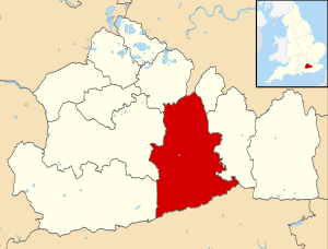 Mole Valley shown within Surrey | |
| Sovereign state | United Kingdom |
| Constituent country | England |
| Region | South East England |
| Non-metropolitan county | Surrey |
| Status | Non-metropolitan district |
| Admin HQ | Dorking |
| Incorporated | 1 April 1974 |
| Government | |
| • Type | Non-metropolitan district council |
| • Body | Mole Valley District Council |
| Area | |
| • Total | 99.7 sq mi (258.3 km2) |
| • Rank | 133rd (of 296) Highest point : Leith Hill |
| Population (2022) | |
| • Total | 87,769 |
| • Rank | 271st (of 296) |
| • Density | 880/sq mi (340/km2) |
| Ethnicity (2021) | |
| • Ethnic groups | |
| Religion (2021) | |
| • Religion | List
|
| Time zone | UTC0 (GMT) |
| • Summer (DST) | UTC+1 (BST) |
| ONS code | 43UE (ONS) E07000210 (GSS) |
| OS grid reference | TQ0496458567 |
Mole Valley is a local government district in Surrey, England. Its council is based in Dorking, and the district's other town is Leatherhead. The largest villages are Ashtead, Fetcham and Great Bookham, in the northern third of the district.
Most of the district is on the escarpments of or adjoins the Surrey Hills, a designated Area of Outstanding Natural Beauty, which cover parts of the North Downs and Greensand Ridge, including locally Leith Hill, Polesden Lacey and Box Hill. Denbies Wine Estate, the largest vineyard in the country, is on the hills north-west of Dorking.[2] The Pilgrims' Way footpath runs along the North Downs. There are stations on the London–Worthing and Reading–Gatwick Airport railways, and in the northern third, a commuter stopping-service pattern line, London–Guildford (via Epsom) line.
The A24 road and the M25 motorway are the main thoroughfares and relative to London the incidence of car ownership is high. The area hosts hill-focussed sub-laps of the London–Surrey Classic cycling tour each year.
The neighbouring districts are Epsom and Ewell, Reigate and Banstead, Crawley, Horsham, Waverley, Guildford, Elmbridge and Kingston upon Thames, the latter being a London borough.
History
[edit]The district was created on 1 April 1974 under the Local Government Act 1972, covering three former districts which were all abolished at the same time:[3][4]
- Dorking and Horley Rural District (except Horley and Salfords and Sidlow which went to Reigate and Banstead and parts of the parishes of Charlwood and Horley around Gatwick Airport which went to Crawley)
- Dorking Urban District
- Leatherhead Urban District
The new district was named after the River Mole, which flows through the area.[5]
Governance
[edit]Mole Valley District Council | |
|---|---|
| Type | |
| Type | |
| Leadership | |
Karen Brimacombe since 2017 | |
| Structure | |
| Seats | 39 councillors |
Political groups |
|
| Elections | |
| First past the post | |
Last election | 2 May 2024 |
Next election | 7 May 2026 |
| Meeting place | |
 | |
| Pippbrook, Dorking, RG14 1SJ | |
| Website | |
| www | |

Mole Valley District Council provides district-level services. County-level services are provided by Surrey County Council.[7] Parts of the district are covered by civil parishes, which form a third tier of local government for their areas.[8]
Political control
[edit]The council has been under Liberal Democrat majority control since 2019.
The first elections to the council were held in 1973, initially operating as a shadow authority alongside the outgoing authorities until the new arrangements came into effect on 1 April 1974. Political control of the council since 1974 has been as follows:[9] [10]
| Party in control | Years | |
|---|---|---|
| No overall control | 1974–1980 | |
| Independent | 1980–1982 | |
| No overall control | 1982–1994 | |
| Liberal Democrats | 1994–1995 | |
| No overall control | 1995–2006 | |
| Conservative | 2006–2010 | |
| No overall control | 2010–2015 | |
| Conservative | 2015–2018 | |
| No overall control | 2018–2019 | |
| Liberal Democrats | 2019–present | |
Leadership
[edit]The leaders of the council since 2012 have been:[11]
| Councillor | Party | From | To | |
|---|---|---|---|---|
| James Friend | Conservative | May 2012 | ||
| Chris Townsend[12] | Independent | May 2012 | May 2015 | |
| James Friend | Conservative | May 2015 | 2016 | |
| Vivienne Michael | Conservative | 2016 | 5 May 2019 | |
| Stephen Cooksey | Liberal Democrats | 21 May 2019 | ||
Composition
[edit]Following the 2024 election the composition of the council was:[13]
| Party | Councillors | |
|---|---|---|
| Liberal Democrats | 31 | |
| Ashtead Independents | 6 | |
| Conservative | 2 | |
| Total | 39 | |
The next election is due in 2026.[14]
Elections
[edit]Since the last boundary changes in 2023 the council has comprised 39 councillors representing 13 wards, with each ward electing three councillors. Elections are held three years out of every four, with a third of the council (one councillor for each ward) elected each time for a four-year term of office. Surrey County Council elections are held in the fourth year of the cycle when there are no district council elections.[15]
Most of the district lies within the Mole Valley constituency, the exception being Ashtead which is within the Epsom and Ewell constituency.[8]
Premises
[edit]
The council is based at Pippbrook on Reigate Road in Dorking, which was purpose-built for the council and opened in 1984.[16] It was built in the grounds of a large Victorian house, called Pippbrook House, which had served as the headquarters of the old Dorking Urban District Council from 1931 and then as Mole Valley District Council's headquarters until the new building opened.[17]
Towns and parishes
[edit]The former Leatherhead Urban District, which included Ashtead, Fetcham, Great Bookham and Little Bookham, is an unparished area, as is the majority of the former Dorking Urban District.[8][18]
The rest of the district is covered by civil parishes:[19][20]
Demographics
[edit]A Legatum Prosperity Index published by the Legatum Institute in October 2016 showed Mole Valley as the second most prosperous council area in the United Kingdom, after the nearby Borough of Waverley.[21]
Churches graded II* or above
[edit]


| Church | Place | Listed building Class |
|---|---|---|
| St Michael | Betchworth | I [22] |
| St Nicolas | Great Bookham | I[23] |
| All Saints | Little Bookham | II* |
| St Nicholas | Charlwood | I[24] |
| St Michael | Mickleham | I [25] |
| St John the Evangelist | Wotton | I [26] |
| St Mary & St Nicholas | Leatherhead | II*[27] |
| St Barnabas | Ranmore Common | II* [28] |
| St Mary | Pixham | II* [29] |
| St Martin | Dorking | II* [30] |
| St Mary | Fetcham | II* [31] |
| St Giles | Ashtead | II* [32] |
| St James | Abinger Common | II* [33] |
| Holy Trinity | Westcott | II* [34] |
| St Bartholomew | Leigh | II* [35] |
| St Margaret | Ockley | II* [36] |
| St John the Baptist | Walliswood | II* [37] |
Emergency services
[edit]Mole Valley is served by these emergency services:
- Surrey Police. Dorking Police Station is the lead station in Mole Valley Division, Leatherhead Police Station is now closed.
- South East Coast Ambulance Service The district has two Ambulance Stations – one in North Holmwood (1 mile (2 km) south of Dorking), and the other in Leatherhead.
- Surrey Fire & Rescue Service, The district has two Fire Stations one in North Holmwood and the other in Leatherhead.
- SURSAR, The district is covered by Surrey Search & Rescue
- Hospital, Each town has a small NHS Hospital with no A&E. They are used for outpatients and rehabilitation.
Freedom of the District
[edit]- DMRC Headley Court received the Freedom of the District on 25 May 2010.[38]
See also
[edit]References
[edit]- ^ a b UK Census (2021). "2021 Census Area Profile – Mole Valley Local Authority (E07000210)". Nomis. Office for National Statistics. Retrieved 5 January 2024.
- ^ "Government information about visitor attractions at Denbie's". Surrey County Council. Archived from the original on 1 September 2012. Retrieved 5 May 2012.
- ^ "The English Non-metropolitan District (Definition) Order 1972", legislation.gov.uk, The National Archives, SI 1972/2039, retrieved 17 November 2023
- ^ "Charlwood and Horley Act 1974", legislation.gov.uk, The National Archives, 1974 c. 11, retrieved 13 January 2024
- ^ "The English Non-metropolitan Districts (Names) Order 1973", legislation.gov.uk, The National Archives, SI 1973/551, retrieved 3 January 2024
- ^ "Chairman of MVDC". Mole Valley District Council. Retrieved 22 July 2024.
- ^ "Local Government Act 1972", legislation.gov.uk, The National Archives, 1972 c. 70, retrieved 31 May 2023
- ^ a b c "Election Maps". Ordnance Survey. Retrieved 9 January 2023.
- ^ "Compositions calculator". The Elections Centre. Retrieved 9 September 2022.
- ^ "Mole Valley". BBC News Online. 19 April 2009. Retrieved 7 May 2010.
- ^ "Council minutes". Mole Valley District Council. Retrieved 15 July 2022.
- ^ Martin, Guy (25 May 2012). "Tory-independent union to continue in Mole Valley". Surrey Live. Retrieved 15 July 2022.
- ^ Van Klaveren, Tom (3 May 2024). "Mole Valley Local Election Results 2024 in full as Lib Dems maintain dominant position". Surrey Live. Retrieved 22 July 2024.
- ^ "Mole Valley". Local Councils. Thorncliffe. Retrieved 22 July 2024.
- ^ "The Mole Valley (Electoral Changes) Order 2023", legislation.gov.uk, The National Archives, SI 2023/49, retrieved 13 January 2024
- ^ "The war-time library goes up market into mansion". Dorking and Leatherhead Advertiser. 14 February 1986. p. 16. Retrieved 13 January 2024.
- ^ "Dorking". West Sussex Gazette. 10 December 1931. p. 4. Retrieved 13 January 2024.
- ^ "Surrey: Diagram showing administrative boundaries, 1971". National Library of Scotland. Ordnance Survey. Retrieved 13 January 2024.
- ^ "Surrey County Council website". Archived from the original on 3 September 2012. Retrieved 5 May 2012.
- ^ "Parish Councils". Mole Valley District Council. Retrieved 13 January 2024.
- ^ Braiden, Gerry (13 October 2016). "Scots authority named amongst UK's top 10 most prosperous – as neighbouring city props up table". HeraldScotland. Retrieved 11 September 2020.
- ^ Historic England. "Details from listed building database (1378131)". National Heritage List for England. Retrieved 5 May 2012.
- ^ Historic England. "Details from listed building database (1028641)". National Heritage List for England. Retrieved 5 May 2012.
- ^ Historic England. "Details from listed building database (1248610)". National Heritage List for England. Retrieved 15 July 2016.
- ^ Historic England. "Details from listed building database (1028835)". National Heritage List for England. Retrieved 5 May 2012.
- ^ Historic England. "Details from listed building database (1294098)". National Heritage List for England. Retrieved 5 May 2012.
- ^ Historic England. "Details from listed building database (1190429)". National Heritage List for England. Retrieved 5 May 2012.
- ^ Historic England. "Details from listed building database (1189879)". National Heritage List for England. Retrieved 5 May 2012.
- ^ Historic England. "Details from listed building database (1279086)". National Heritage List for England. Retrieved 5 May 2012.
- ^ Historic England. "Details from listed building database (1028904)". National Heritage List for England. Retrieved 5 May 2012.
- ^ Historic England. "Details from listed building database (1378187)". National Heritage List for England. Retrieved 5 May 2012.
- ^ Historic England. "Details from listed building database (1028685)". National Heritage List for England. Retrieved 5 May 2012.
- ^ Historic England. "Details from listed building database (1378082)". National Heritage List for England. Retrieved 5 May 2012.
- ^ Historic England. "Details from listed building database (1227892)". National Heritage List for England. Retrieved 5 May 2012.
- ^ Historic England. "Details from listed building database (1028748)". National Heritage List for England. Retrieved 5 May 2012.
- ^ Historic England. "Details from listed building database (1028694)". National Heritage List for England. Retrieved 5 May 2012.
- ^ Historic England. "Details from listed building database (1028844)". National Heritage List for England. Retrieved 5 May 2012.
- ^ Martin, Guy (2 July 2013) [25 May 2010]. "Headley Court granted district's highest honour". Surrey Live. Retrieved 3 May 2023.
External links
[edit]
| International | |
|---|---|
| National | |