Mustang Ridge, Texas: Difference between revisions
→top: add "use mdy dates" template |
|||
| (31 intermediate revisions by 25 users not shown) | |||
| Line 1: | Line 1: | ||
{{Use mdy dates|date=July 2023}} |
|||
{{Infobox settlement |
{{Infobox settlement |
||
|official_name = Mustang Ridge, Texas |
| official_name = Mustang Ridge, Texas |
||
|settlement_type = [[City]] |
| settlement_type = [[City]] |
||
|nickname = |
| nickname = |
||
|motto = |
| motto = <!-- Images --> |
||
| image_skyline = Mustang Ridge Texas City Hall 2019.jpg |
|||
| imagesize = |
|||
| image_caption = City Hall |
|||
| image_flag = |
|||
| image_seal = <!-- Maps --> |
|||
| image_map = TXMap-doton-MustangRidge.PNG |
|||
| mapsize = 250px |
|||
| map_caption = Location of Mustang Ridge, Texas |
|||
| image_map1 = Travis County MustangRidge.svg |
|||
| mapsize1 = 250px |
|||
| map_caption1 = <!-- Location --> |
|||
| subdivision_type = [[List of sovereign states|Country]] |
|||
| subdivision_name = United States |
|||
| subdivision_type1 = [[U.S. state|State]] |
|||
| subdivision_name1 = [[Texas]] |
|||
| subdivision_type2 = [[List of counties in Texas|Counties]] |
|||
| subdivision_name2 = [[Travis County, Texas|Travis]], [[Caldwell County, Texas|Caldwell]], [[Bastrop County, Texas|Bastrop]] |
|||
<!-- Government -->| government_footnotes = |
|||
<!-- Images --> |
|||
| |
| government_type = |
||
| |
| leader_title = |
||
| |
| leader_name = |
||
| |
| leader_title1 = |
||
| |
| leader_name1 = |
||
| established_title = |
|||
| established_date = <!-- Area --> |
|||
| unit_pref = Imperial |
|||
| area_footnotes = <ref name="CenPopGazetteer2019">{{cite web|title=2019 U.S. Gazetteer Files|url=https://www2.census.gov/geo/docs/maps-data/data/gazetteer/2019_Gazetteer/2019_gaz_place_48.txt|publisher=United States Census Bureau|access-date=August 7, 2020}}</ref> |
|||
| area_magnitude = |
|||
| area_total_km2 = 9.66 |
|||
| area_land_km2 = 9.66 |
|||
| area_water_km2 = 0.00 |
|||
| area_total_sq_mi = 3.73 |
|||
| area_land_sq_mi = 3.73 |
|||
| area_water_sq_mi = 0.00 |
|||
<!-- Population -->| population_as_of = [[2020 United States Census|2020]] |
|||
<!-- Maps --> |
|||
| population_footnotes = |
|||
|image_map = TXMap-doton-MustangRidge.PNG |
|||
| |
| population_total = 944 |
||
| population_density_km2 = 101.57 |
|||
|map_caption = Location of Mustang Ridge, Texas |
|||
|image_map1 = Travis County MustangRidge.svg |
|||
|mapsize1 = 250px |
|||
|map_caption1 = |
|||
<!-- General information -->| timezone = [[North American Central Time Zone|Central (CST)]] |
|||
<!-- Location --> |
|||
| |
| utc_offset = -6 |
||
| timezone_DST = CDT |
|||
|subdivision_type = [[List of countries|Country]] |
|||
| |
| utc_offset_DST = -5 |
||
| elevation_footnotes = |
|||
|subdivision_type1 = [[Political divisions of the United States|State]] |
|||
| |
| elevation_m = 190 |
||
| elevation_ft = 623 |
|||
|subdivision_type2 = [[List of counties in Texas|Counties]] |
|||
| coordinates = {{coord|30|2|53|N|97|41|26|W|region:US-TX|display=inline,title}} |
|||
|subdivision_name2 = [[Travis County, Texas|Travis]], [[Caldwell County, Texas|Caldwell]], |
|||
| postal_code_type = [[Zip Code]] |
|||
| postal_code = 78610 |
|||
<!-- Government --> |
|||
| |
| area_code = |
||
| blank_name = [[Federal Information Processing Standard|FIPS code]] |
|||
|government_type = |
|||
| blank_info = 48-50200<ref name="GR2">{{cite web|url=https://www.census.gov|publisher=[[United States Census Bureau]]|access-date=2008-01-31|title=U.S. Census website}}</ref> |
|||
|leader_title = |
|||
| |
| blank1_name = [[Geographic Names Information System|GNIS]] feature ID |
||
| blank1_info = 1699806<ref name="GR3">{{cite web|url=http://geonames.usgs.gov|access-date=2008-01-31|title=US Board on Geographic Names|publisher=[[United States Geological Survey]]|date=2007-10-25}}</ref> |
|||
|leader_title1 = |
|||
| |
| website = |
||
| |
| footnotes = |
||
| population_density_sq_mi = 263.07 |
|||
|established_date = |
|||
<!-- Area --> |
|||
|unit_pref = Imperial |
|||
|area_footnotes = |
|||
|area_magnitude = |
|||
|area_total_km2 = 9.8 |
|||
|area_land_km2 = 9.8 |
|||
|area_water_km2 = 0.0 |
|||
|area_total_sq_mi = 3.8 |
|||
|area_land_sq_mi = 3.8 |
|||
|area_water_sq_mi = 0.0 |
|||
<!-- Population --> |
|||
|population_as_of = [[United States Census, 2000|2000]] |
|||
|population_footnotes = |
|||
|population_total = 785 |
|||
|population_density_km2 = 79.9 |
|||
|population_density_sq_mi = 206.9 |
|||
<!-- General information --> |
|||
|timezone = [[North American Central Time Zone|Central (CST)]] |
|||
|utc_offset = -6 |
|||
|timezone_DST = CDT |
|||
|utc_offset_DST = -5 |
|||
|elevation_footnotes = |
|||
|elevation_m = 190 |
|||
|elevation_ft = 623 |
|||
|coordinates_display = 1 |
|||
|latd = 30 |latm = 2 |lats = 53 |latNS = N |
|||
|longd = 97 |longm = 41 |longs = 26 |longEW = W |
|||
<!-- Area/postal codes & others --> |
|||
|postal_code_type = |
|||
|postal_code = |
|||
|area_code = |
|||
|blank_name = [[Federal Information Processing Standard|FIPS code]] |
|||
|blank_info = 48-50200<ref name="GR2">{{cite web|url=http://factfinder2.census.gov|publisher=[[United States Census Bureau]]|accessdate=2008-01-31|title=American FactFinder}}</ref> |
|||
|blank1_name = [[Geographic Names Information System|GNIS]] feature ID |
|||
|blank1_info = 1699806<ref name="GR3">{{cite web|url=http://geonames.usgs.gov|accessdate=2008-01-31|title=US Board on Geographic Names|publisher=[[United States Geological Survey]]|date=2007-10-25}}</ref> |
|||
|website = |
|||
|footnotes = |
|||
}} |
}} |
||
'''Mustang Ridge''' is a [[city]] in [[Caldwell County, Texas|Caldwell]] and [[Travis County, Texas|Travis]] Counties in the [[U.S. state]] of [[Texas]]. The population was |
'''Mustang Ridge''' is a [[city]] in [[Caldwell County, Texas|Caldwell]], [[Bastrop County, Texas|Bastrop]], and [[Travis County, Texas|Travis]] Counties in the [[U.S. state]] of [[Texas]]. The population was 944 at the [[2020 United States census|2020 census]]. |
||
==Geography== |
==Geography== |
||
Mustang Ridge is located at {{Coord|30.048123|-97.690583|type:city_region:US|format=dms|display=inline}} (30.048123, -97.690583).<ref name="GR1">{{cite web|url=http://www.census.gov/geo/www/gazetteer/gazette.html|publisher=[[United States Census Bureau]]|accessdate=2011-04-23|date=2011-02-12|title=US Gazetteer files: 2010, 2000, and 1990}}</ref> |
|||
Mustang Ridge is located at {{Coord|30.048123|-97.690583|type:city_region:US|format=dms|display=inline}} (30.048123, –97.690583).<ref name="GR1">{{cite web|url=https://www.census.gov/geographies/reference-files/time-series/geo/gazetteer-files.html|publisher=[[United States Census Bureau]]|access-date=2011-04-23|date=2011-02-12|title=US Gazetteer files: 2010, 2000, and 1990}}</ref> |
|||
According to the [[United States Census Bureau]], the city has a total area of 3.8 square miles (9.8 km<sup>2</sup>), all land. |
According to the [[United States Census Bureau]], the city has a total area of 3.8 square miles (9.8 km<sup>2</sup>), all land. |
||
==History== |
==History== |
||
Mustang Ridge was incorporated into a city by Alton Brooks Laws Jr and Charles Laws in 1985 [http://www.legis.state.tx.us/tlodocs/80R/billtext/html/SR00623F.htm]. Alton Brooks Laws was elected the first mayor, municipal judge, and state magistrate [http://www.legis.state.tx.us/tlodocs/80R/billtext/html/SR00623F.htm]. Charles Laws became a source of public controversy when he referred to a proposed detention facility as "a holding pen for wetbacks" on a public agenda. |
Mustang Ridge was incorporated into a city by Alton Brooks Laws Jr and Charles Laws in 1985 [http://www.legis.state.tx.us/tlodocs/80R/billtext/html/SR00623F.htm]. Alton Brooks Laws was elected the first mayor, municipal judge, and state magistrate [http://www.legis.state.tx.us/tlodocs/80R/billtext/html/SR00623F.htm]. Charles Laws became a source of public controversy when he referred to a proposed detention facility as "a holding pen for wetbacks" on a public agenda.<ref>{{cite web|url=http://www.statesman.com/news/content/news/stories/local/03/22/0322creedmoor.html |title=Mustang Ridge official apologizes for slur, but says he will not resign |publisher=[[Associated Press]] at the [[Austin American-Statesman]] |date=2008-03-21 |access-date=2017-01-25 |url-status=bot: unknown |archive-url=https://web.archive.org/web/20080324203915/http://www.statesman.com/news/content/news/stories/local/03/22/0322creedmoor.html |archive-date=2008-03-24 }}</ref> |
||
==Demographics== |
==Demographics== |
||
| Line 95: | Line 81: | ||
|2000= 785 |
|2000= 785 |
||
|2010= 861 |
|2010= 861 |
||
|footnote=U.S. Decennial Census<ref name="DecennialCensus">{{cite web|url=https://www.census.gov/programs-surveys/decennial-census.html|title=Census of Population and Housing|publisher=Census.gov|access-date=June 4, 2015}}</ref> |
|||
|estyear=2014 |
|||
|2020=944}} |
|||
|estimate=960 |
|||
{| class="wikitable" |
|||
|estref=<ref name="USCensusEst2014">{{cite web|url=http://www.census.gov/popest/data/cities/totals/2014/SUB-EST2014.html|title=Annual Estimates of the Resident Population for Incorporated Places: April 1, 2010 to July 1, 2014|accessdate=June 4, 2015}}</ref> |
|||
|+'''Mustang Ridge racial composition as of 2020'''<ref>{{Cite web |title=Explore Census Data |url=https://data.census.gov/cedsci/table?g=1600000US4850200&tid=DECENNIALPL2020.P2 |access-date=2022-05-24 |website=data.census.gov}}</ref><br /> (NH = Non-Hispanic){{efn|Note: the US Census treats Hispanic/Latino as an ethnic category. This table excludes Latinos from the racial categories and assigns them to a separate category. Hispanics/Latinos can be of any race.<ref>https://www.census.gov/ {{nonspecific|date=August 2022}}</ref><ref>{{cite web |title=About the Hispanic Population and its Origin |url=https://www.census.gov/topics/population/hispanic-origin/about.html |website=www.census.gov |access-date=18 May 2022}}</ref>}} |
|||
|footnote=<center>U.S. Decennial Census<ref name="DecennialCensus">{{cite web|url=http://www.census.gov/prod/www/decennial.html|title=Census of Population and Housing|publisher=Census.gov|accessdate=June 4, 2015}}</ref></center> |
|||
!Race |
|||
}} |
|||
!Number |
|||
As of the [[census]]<ref name="GR2" /> of 2000, 785 people, 256 households, and 214 families resided in the city. The [[population density]] was 206.9 people per square mile (80.0/km<sup>2</sup>). The 274 housing units averaged 72.2/sq mi (27.9/km<sup>2</sup>). The [[Race (United States Census)|racial makeup]] of the city was 67.52% White, 4.08% African American, 2.80% Native American, 0.38% Asian, 22.93% from other races, and 2.29% from two or more races. Hispanics or Latinos of any race were 48.41% of the population. |
|||
!Percentage |
|||
|- |
|||
|[[Non-Hispanic or Latino whites|White]] (NH) |
|||
|233 |
|||
|24.68% |
|||
|- |
|||
|[[Non-Hispanic or Latino African Americans|Black or African American]] (NH) |
|||
|5 |
|||
|0.53% |
|||
|- |
|||
|[[Native Americans in the United States|Native American]] or [[Alaska Native]] (NH) |
|||
|5 |
|||
|0.53% |
|||
|- |
|||
|[[Asian Americans|Asian]] (NH) |
|||
|8 |
|||
|0.85% |
|||
|- |
|||
|[[Pacific Islander Americans|Pacific Islander]] (NH) |
|||
|1 |
|||
|0.11% |
|||
|- |
|||
|Some Other Race (NH) |
|||
|3 |
|||
|0.32% |
|||
|- |
|||
|[[Multiracial Americans|Mixed/Multi-Racial]] (NH) |
|||
|21 |
|||
|2.22% |
|||
|- |
|||
|[[Hispanic and Latino Americans|Hispanic or Latino]] |
|||
|668 |
|||
|70.76% |
|||
|- |
|||
|'''Total''' |
|||
|'''944''' |
|||
| |
|||
|} |
|||
As of the [[2020 United States census]], there were 944 people, 330 households, and 250 families residing in the city. |
|||
As of the [[census]]<ref name="GR2" /> of 2000, 785 people, 256 households, and 214 families resided in the city. The population density was {{convert|206.9|PD/sqmi|PD/km2|sp=us|adj=off}}. The 274 housing units averaged 72.2/sq mi (27.9/km<sup>2</sup>). The [[Race (United States Census)|racial makeup]] of the city was 67.52% White, 4.08% African American, 2.80% Native American, 0.38% Asian, 22.93% from other races, and 2.29% from two or more races. Hispanics or Latinos of any race were 48.41% of the population. |
|||
Of the 256 households, 40.6% had children under the age of 18 living with them, 64.8% were [[Marriage|married couples]] living together, 11.3% had a female householder with no husband present, and 16.4% were not families. About 12.9% of all households were made up of individuals, and 4.7% had someone living alone who was 65 years of age or older. The average household size was 3.07 and the average family size was 3.35. |
Of the 256 households, 40.6% had children under the age of 18 living with them, 64.8% were [[Marriage|married couples]] living together, 11.3% had a female householder with no husband present, and 16.4% were not families. About 12.9% of all households were made up of individuals, and 4.7% had someone living alone who was 65 years of age or older. The average household size was 3.07 and the average family size was 3.35. |
||
| Line 109: | Line 136: | ||
==Education== |
==Education== |
||
The Travis County portion of Mustang Ridge is served by the [[Del Valle Independent School District]].<ref>"[http://delvalle.tx.schoolwebpages.com/images/pageitems/13040/p448198787_8588.jpg p448198787_8588.jpg]" ([https://archive.today/20160824052939/http://delvalle.tx.schoolwebpages.com/images/pageitems/13040/p448198787_8588.jpg Archive]). [[Del Valle Independent School District]]. Retrieved on August 24, 2016.</ref><ref>"[http://www2.census.gov/geo/maps/dc10map/GUBlock/st48_tx/place/p4850200_mustang_ridge/DC10BLK_P4850200_000.pdf 2010 CENSUS - CENSUS BLOCK MAP: Mustang Ridge city, TX]." [[U.S. Census Bureau]]. Retrieved on August 24, 2016. [http://www2.census.gov/geo/maps/dc10map/GUBlock/st48_tx/place/p4850200_mustang_ridge/ See map list]</ref> [[Creedmoor, Texas|Creedmoor]] Elementary School serves this portion. For middle school students are divided between Ojeda Middle School and Del Valle Middle School.<ref name=DVISDnewmaps>"[https://drive.google.com/file/d/0B-27PmJ1aayER2Yxb014N0pmVWs/view?pref=2&pli=1 2014/15 Attendance Boundaries]." [[Del Valle Independent School District]]. Retrieved on August 24, 2016.</ref> High school students are zoned to [[Del Valle High School (Del Valle, Texas)|Del Valle High School]]. |
|||
The Travis County portion of Mustang Ridge is served by the [[Del Valle Independent School District]]. The Caldwell County portion is served by the [[Lockhart Independent School District]]. |
|||
The Caldwell County portion is served by the [[Lockhart Independent School District]]. |
|||
The [[Bastrop Independent School District]] serves the small portion of Mustang Ridge that lies in Bastrop County. |
The [[Bastrop Independent School District]] serves the small portion of Mustang Ridge that lies in Bastrop County. |
||
| Line 118: | Line 147: | ||
==References== |
==References== |
||
<references /> |
<references /> |
||
{{notelist}} |
|||
{{Bastrop County, Texas}} |
|||
{{Caldwell County, Texas}} |
{{Caldwell County, Texas}} |
||
{{Travis County, Texas}} |
{{Travis County, Texas}} |
||
{{authority control}} |
|||
[[Category:Cities in Travis County, Texas]] |
[[Category:Cities in Travis County, Texas]] |
||
[[Category:Cities in Caldwell County, Texas]] |
[[Category:Cities in Caldwell County, Texas]] |
||
[[Category:Cities in Texas]] |
[[Category:Cities in Texas]] |
||
[[Category:Greater Austin]] |
[[Category:Cities in Greater Austin]] |
||
[[Category:Cities in Bastrop County, Texas]] |
[[Category:Cities in Bastrop County, Texas]] |
||
Latest revision as of 03:09, 18 July 2023
Mustang Ridge, Texas | |
|---|---|
 City Hall | |
 Location of Mustang Ridge, Texas | |
 | |
| Coordinates: 30°2′53″N 97°41′26″W / 30.04806°N 97.69056°W | |
| Country | United States |
| State | Texas |
| Counties | Travis, Caldwell, Bastrop |
| Area | |
| • Total | 3.73 sq mi (9.66 km2) |
| • Land | 3.73 sq mi (9.66 km2) |
| • Water | 0.00 sq mi (0.00 km2) |
| Elevation | 623 ft (190 m) |
| Population (2020) | |
| • Total | 944 |
| • Density | 263.07/sq mi (101.57/km2) |
| Time zone | UTC-6 (Central (CST)) |
| • Summer (DST) | UTC-5 (CDT) |
| Zip Code | 78610 |
| FIPS code | 48-50200[2] |
| GNIS feature ID | 1699806[3] |
Mustang Ridge is a city in Caldwell, Bastrop, and Travis Counties in the U.S. state of Texas. The population was 944 at the 2020 census.
Geography
[edit]Mustang Ridge is located at 30°02′53″N 97°41′26″W / 30.048123°N 97.690583°W (30.048123, –97.690583).[4]
According to the United States Census Bureau, the city has a total area of 3.8 square miles (9.8 km2), all land.
History
[edit]Mustang Ridge was incorporated into a city by Alton Brooks Laws Jr and Charles Laws in 1985 [1]. Alton Brooks Laws was elected the first mayor, municipal judge, and state magistrate [2]. Charles Laws became a source of public controversy when he referred to a proposed detention facility as "a holding pen for wetbacks" on a public agenda.[5]
Demographics
[edit]| Census | Pop. | Note | %± |
|---|---|---|---|
| 1990 | 576 | — | |
| 2000 | 785 | 36.3% | |
| 2010 | 861 | 9.7% | |
| 2020 | 944 | 9.6% | |
| U.S. Decennial Census[6] | |||
| Race | Number | Percentage |
|---|---|---|
| White (NH) | 233 | 24.68% |
| Black or African American (NH) | 5 | 0.53% |
| Native American or Alaska Native (NH) | 5 | 0.53% |
| Asian (NH) | 8 | 0.85% |
| Pacific Islander (NH) | 1 | 0.11% |
| Some Other Race (NH) | 3 | 0.32% |
| Mixed/Multi-Racial (NH) | 21 | 2.22% |
| Hispanic or Latino | 668 | 70.76% |
| Total | 944 |
As of the 2020 United States census, there were 944 people, 330 households, and 250 families residing in the city.
As of the census[2] of 2000, 785 people, 256 households, and 214 families resided in the city. The population density was 206.9 inhabitants per square mile (79.9/km2). The 274 housing units averaged 72.2/sq mi (27.9/km2). The racial makeup of the city was 67.52% White, 4.08% African American, 2.80% Native American, 0.38% Asian, 22.93% from other races, and 2.29% from two or more races. Hispanics or Latinos of any race were 48.41% of the population.
Of the 256 households, 40.6% had children under the age of 18 living with them, 64.8% were married couples living together, 11.3% had a female householder with no husband present, and 16.4% were not families. About 12.9% of all households were made up of individuals, and 4.7% had someone living alone who was 65 years of age or older. The average household size was 3.07 and the average family size was 3.35.
In the city, the population was distributed as 29.3% under the age of 18, 8.7% from 18 to 24, 31.6% from 25 to 44, 21.4% from 45 to 64, and 9.0% who were 65 years of age or older. The median age was 33 years. For every 100 females, there were 106.0 males. For every 100 females age 18 and over, there were 102.6 males.
The median income for a household in the city was $41,771, and for a family was $46,563. Males had a median income of $31,076 versus $23,182 for females. The per capita income for the city was $15,258. About 5.8% of families and 7.9% of the population were below the poverty line, including 8.9% of those under age 18 and 21.5% of those age 65 or over.
Education
[edit]The Travis County portion of Mustang Ridge is served by the Del Valle Independent School District.[10][11] Creedmoor Elementary School serves this portion. For middle school students are divided between Ojeda Middle School and Del Valle Middle School.[12] High school students are zoned to Del Valle High School.
The Caldwell County portion is served by the Lockhart Independent School District.
The Bastrop Independent School District serves the small portion of Mustang Ridge that lies in Bastrop County.
Law enforcement
[edit]The Mustang Ridge Police Department serves the incorporated city. When the police force is not working, the city is served by the sheriff's offices of Caldwell and Travis Counties.
References
[edit]- ^ "2019 U.S. Gazetteer Files". United States Census Bureau. Retrieved August 7, 2020.
- ^ a b "U.S. Census website". United States Census Bureau. Retrieved January 31, 2008.
- ^ "US Board on Geographic Names". United States Geological Survey. October 25, 2007. Retrieved January 31, 2008.
- ^ "US Gazetteer files: 2010, 2000, and 1990". United States Census Bureau. February 12, 2011. Retrieved April 23, 2011.
- ^ "Mustang Ridge official apologizes for slur, but says he will not resign". Associated Press at the Austin American-Statesman. March 21, 2008. Archived from the original on March 24, 2008. Retrieved January 25, 2017.
{{cite web}}: CS1 maint: bot: original URL status unknown (link) - ^ "Census of Population and Housing". Census.gov. Retrieved June 4, 2015.
- ^ "Explore Census Data". data.census.gov. Retrieved May 24, 2022.
- ^ https://www.census.gov/ [not specific enough to verify]
- ^ "About the Hispanic Population and its Origin". www.census.gov. Retrieved May 18, 2022.
- ^ "p448198787_8588.jpg" (Archive). Del Valle Independent School District. Retrieved on August 24, 2016.
- ^ "2010 CENSUS - CENSUS BLOCK MAP: Mustang Ridge city, TX." U.S. Census Bureau. Retrieved on August 24, 2016. See map list
- ^ "2014/15 Attendance Boundaries." Del Valle Independent School District. Retrieved on August 24, 2016.
Municipalities and communities of Bastrop County, Texas, United States | ||
|---|---|---|
| Cities |  | |
| CDPs | ||
| Other communities | ||
| Ghost towns | ||
| Footnotes | ‡This populated place also has portions in an adjacent county or counties | |
Municipalities and communities of Caldwell County, Texas, United States | ||
|---|---|---|
| Cities | 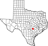 | |
| Unincorporated communities | ||
| Ghost town | ||
| Footnotes | ‡This populated place also has portions in an adjacent county or counties | |
Municipalities and communities of Travis County, Texas, United States | ||
|---|---|---|
| Cities |  | |
| Villages | ||
| CDPs |
| |
| Other communities | ||
| Ghost towns | ||
| Footnotes | ‡This populated place also has portions in an adjacent county or counties | |