Mustang Ridge, Texas: Difference between revisions
m Substitute template per TfD outcome |
|||
| Line 74: | Line 74: | ||
|area_code = |
|area_code = |
||
|blank_name = [[Federal Information Processing Standard|FIPS code]] |
|blank_name = [[Federal Information Processing Standard|FIPS code]] |
||
|blank_info = 48-50200{{ |
|blank_info = 48-50200<ref name="GR2">{{cite web|url=http://factfinder2.census.gov|publisher=[[United States Census Bureau]]|accessdate=2008-01-31|title=American FactFinder}}</ref> |
||
|blank1_name = [[Geographic Names Information System|GNIS]] feature ID |
|blank1_name = [[Geographic Names Information System|GNIS]] feature ID |
||
|blank1_info = 1699806<ref name="GR3">{{cite web|url=http://geonames.usgs.gov|accessdate=2008-01-31|title=US Board on Geographic Names|publisher=[[United States Geological Survey]]|date=2007-10-25}}</ref> |
|||
|blank1_info = 1699806{{GR|3}} |
|||
|website = |
|website = |
||
|footnotes = |
|footnotes = |
||
| Line 83: | Line 83: | ||
==Geography== |
==Geography== |
||
Mustang Ridge is located at {{Coord|30.048123|-97.690583|type:city_region:US|format=dms|display=inline}} (30.048123, -97.690583).{{ |
Mustang Ridge is located at {{Coord|30.048123|-97.690583|type:city_region:US|format=dms|display=inline}} (30.048123, -97.690583).<ref name="GR1">{{cite web|url=http://www.census.gov/geo/www/gazetteer/gazette.html|publisher=[[United States Census Bureau]]|accessdate=2011-04-23|date=2011-02-12|title=US Gazetteer files: 2010, 2000, and 1990}}</ref> |
||
According to the [[United States Census Bureau]], the city has a total area of 3.8 square miles (9.8 km<sup>2</sup>), all land. |
According to the [[United States Census Bureau]], the city has a total area of 3.8 square miles (9.8 km<sup>2</sup>), all land. |
||
| Line 91: | Line 91: | ||
==Demographics== |
==Demographics== |
||
As of the [[census]] |
As of the [[census]]<ref name="GR2" /> of 2000, there were 785 people, 256 households, and 214 families residing in the city. The [[population density]] was 206.9 people per square mile (80.0/km<sup>2</sup>). There were 274 housing units at an average density of 72.2/sq mi (27.9/km<sup>2</sup>). The racial makeup of the city was 67.52% [[White (U.S. Census)|White]], 4.08% [[African American (U.S. Census)|African American]], 2.80% [[Native American (U.S. Census)|Native American]], 0.38% [[Asian (U.S. Census)|Asian]], 22.93% from [[Race (United States Census)|other races]], and 2.29% from two or more races. [[Hispanic (U.S. Census)|Hispanic]] or [[Latino (U.S. Census)|Latino]] of any race were 48.41% of the population. |
||
There were 256 households out of which 40.6% had children under the age of 18 living with them, 64.8% were [[Marriage|married couples]] living together, 11.3% had a female householder with no husband present, and 16.4% were non-families. 12.9% of all households were made up of individuals and 4.7% had someone living alone who was 65 years of age or older. The average household size was 3.07 and the average family size was 3.35. |
There were 256 households out of which 40.6% had children under the age of 18 living with them, 64.8% were [[Marriage|married couples]] living together, 11.3% had a female householder with no husband present, and 16.4% were non-families. 12.9% of all households were made up of individuals and 4.7% had someone living alone who was 65 years of age or older. The average household size was 3.07 and the average family size was 3.35. |
||
Revision as of 10:44, 30 July 2014
Mustang Ridge, Texas | |
|---|---|
 Location of Mustang Ridge, Texas | |
 | |
| Country | United States |
| State | Texas |
| Counties | Travis, Caldwell, |
| Area | |
| • Total | 3.8 sq mi (9.8 km2) |
| • Land | 3.8 sq mi (9.8 km2) |
| • Water | 0.0 sq mi (0.0 km2) |
| Elevation | 623 ft (190 m) |
| Population (2000) | |
| • Total | 785 |
| • Density | 206.9/sq mi (79.9/km2) |
| Time zone | UTC-6 (Central (CST)) |
| • Summer (DST) | UTC-5 (CDT) |
| FIPS code | 48-50200[1] |
| GNIS feature ID | 1699806[2] |
Mustang Ridge is a city in Caldwell, and Travis Counties in the U.S. state of Texas. The population was 861 at the 2010 census.
Geography
Mustang Ridge is located at 30°02′53″N 97°41′26″W / 30.048123°N 97.690583°W (30.048123, -97.690583).[3]
According to the United States Census Bureau, the city has a total area of 3.8 square miles (9.8 km2), all land.
History
Mustang Ridge was incorporated into a City by Alton Brooks Laws Jr and Charles Laws in 1985 [1]. Alton Brooks Laws was elected the first Major, Municipal Judge and State Magistrate [2]. Charles Laws became a source of public controversy when he referred to a proposed detention facility as "a holding pen for wetbacks" on a public agenda. [3]
Demographics
As of the census[1] of 2000, there were 785 people, 256 households, and 214 families residing in the city. The population density was 206.9 people per square mile (80.0/km2). There were 274 housing units at an average density of 72.2/sq mi (27.9/km2). The racial makeup of the city was 67.52% White, 4.08% African American, 2.80% Native American, 0.38% Asian, 22.93% from other races, and 2.29% from two or more races. Hispanic or Latino of any race were 48.41% of the population.
There were 256 households out of which 40.6% had children under the age of 18 living with them, 64.8% were married couples living together, 11.3% had a female householder with no husband present, and 16.4% were non-families. 12.9% of all households were made up of individuals and 4.7% had someone living alone who was 65 years of age or older. The average household size was 3.07 and the average family size was 3.35.
In the city the population was spread out with 29.3% under the age of 18, 8.7% from 18 to 24, 31.6% from 25 to 44, 21.4% from 45 to 64, and 9.0% who were 65 years of age or older. The median age was 33 years. For every 100 females there were 106.0 males. For every 100 females age 18 and over, there were 102.6 males.
The median income for a household in the city was $41,771, and the median income for a family was $46,563. Males had a median income of $31,076 versus $23,182 for females. The per capita income for the city was $15,258. About 5.8% of families and 7.9% of the population were below the poverty line, including 8.9% of those under age 18 and 21.5% of those age 65 or over.
Education
The Travis County portion of Mustang Ridge is served by the Del Valle Independent School District. The Caldwell County portion is served by the Lockhart Independent School District.
The Bastrop Independent School District serves the small portion of Mustang Ridge that lies in Bastrop County.
Law enforcement
The Mustang Ridge Police Department serves the incorporated city. When the police force is not working, the city is served by the Sheriffs Offices of Caldwell and Travis Counties.
References
- ^ a b "American FactFinder". United States Census Bureau. Retrieved 2008-01-31.
- ^ "US Board on Geographic Names". United States Geological Survey. 2007-10-25. Retrieved 2008-01-31.
- ^ "US Gazetteer files: 2010, 2000, and 1990". United States Census Bureau. 2011-02-12. Retrieved 2011-04-23.
Municipalities and communities of Caldwell County, Texas, United States | ||
|---|---|---|
| Cities | 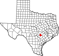 | |
| Unincorporated communities | ||
| Ghost town | ||
| Footnotes | ‡This populated place also has portions in an adjacent county or counties | |
Municipalities and communities of Travis County, Texas, United States | ||
|---|---|---|
| Cities |  | |
| Villages | ||
| CDPs |
| |
| Other communities | ||
| Ghost towns | ||
| Footnotes | ‡This populated place also has portions in an adjacent county or counties | |