Spitakashen, Martuni: Difference between revisions
clean-up |
m Removing Category:Populated places in Martuni Province per Wikipedia:Categories for discussion/Log/2024 June 22#Category:Populated places in the Republic of Artsakh |
||
| (38 intermediate revisions by 14 users not shown) | |||
| Line 1: | Line 1: | ||
{{Other places|Spitakashen, Hadrut|Ağkənd (disambiguation){{!}}Ağkənd}} |
|||
{{coord|39|49|24|N|47|01|04|E|display=title}} |
|||
{{Infobox settlement |
{{Infobox settlement |
||
|name = Spitakashen |
|||
|official_name =Ağkənd |
|||
|native_name = Սպիտակաշեն |
|||
|native_name = {{lang|hy|Սպիտակաշեն}} {{*}} {{transl|hy|Spitakashen}} |
|||
| |
|other_name = Ağkənd |
||
| |
|pushpin_map = Azerbaijan#Karabakh |
||
| |
|pushpin_mapsize = 300 |
||
|subdivision_type = Country |
|||
|subdivision_name = {{flag|Azerbaijan}} <small>([[de jure]])</small><br>{{flag|Artsakh}} <small>([[de facto]])</small> |
|||
|subdivision_name = {{flagu|Azerbaijan}} |
|||
|subdivision_type1 = [[Administrative divisions of Azerbaijan|District]] |
|subdivision_type1 = {{*}} [[Administrative divisions of Azerbaijan|District]] |
||
|subdivision_name1 = [[Khojavend District|Khojavend]] |
|subdivision_name1 = [[Khojavend District|Khojavend]] |
||
|subdivision_type2 = [[Administrative divisions of the Republic of Artsakh|Province]] |
|||
|subdivision_name2 = [[Martuni Province|Martuni]] <small>([[de facto]])</small> |
|||
|leader_title = |
|leader_title = |
||
|leader_name = |
|leader_name = |
||
|established_title = |
|established_title = |
||
|established_date = |
|established_date = |
||
|area_total_km2 |
|area_total_km2 = |
||
|area_footnotes |
|area_footnotes = |
||
|population_footnotes = <ref name="2015statistics">{{Cite web|url=https://artsakhlib.am/en/2018/06/06/%D5%BF%D5%A5%D5%B2%D5%A5%D5%AF%D5%A1%D5%BF%D5%B8%D6%82-%D5%AC%D5%B2%D5%B0-%D5%BE%D5%A1%D6%80%D5%B9%D5%A1%D5%BF%D5%A1%D6%80%D5%A1%D5%AE%D6%84%D5%A1%D5%B5%D5%AB%D5%B6-%D5%B4%D5%AB%D5%A1%D5%BE%D5%B8/|title=Directory of socio-economic characteristics of NKR administrative-territorial units (2015)|author=Hakob Ghahramanyan}}</ref> |
|||
|population_as_of |
|population_as_of = 2015 |
||
|population_total = |
|population_total = 453 |
||
|population_density_km2 |
|population_density_km2 = |
||
|timezone =[[Azerbaijan Time|AZT]] |
|timezone = [[Azerbaijan Time|AZT]] |
||
|utc_offset = +4 |
|utc_offset = +4 |
||
|timezone_DST = |
|timezone_DST = |
||
|utc_offset_DST = |
|utc_offset_DST = |
||
|coordinates = {{coord|39|49|24|N|47|01|04|E|region:AZ|display=inline}} |
|coordinates = {{coord|39|49|24|N|47|01|04|E|region:AZ|display=inline,title}} |
||
|elevation_m = |
|elevation_m = 687 |
||
|area_code = |
|area_code = |
||
|website = |
|website = |
||
}} |
}} |
||
'''Ağkənd''' ({{transl|az|Aghkend}}) or '''Spitakashen''' ({{lang-hy|Սպիտակաշեն}}) is a village ''[[de jure]]'' in the [[Khojavend District]] of [[Azerbaijan]], ''[[de facto]]'' in the [[Martuni Province]] of the self-proclaimed [[Republic of Artsakh]]. The village's name means "white village" in both the [[Azerbaijani language]] and the [[Armenian language]]. |
|||
'''Spitakashen''' ({{lang-hy|Սպիտակաշեն}}) or '''Aghkend''' ({{lang-az|Ağkənd}}) is a village in the [[Khojavend District]] of Azerbaijan, in the disputed region of Nagorno-Karabakh. The village had an Armenian majority in 1989.<ref>{{cite web |url=https://drugoivzgliad.com/karabach-mir-i-voina-a-zubov/ |title=Андрей Зубов. Карабах: Мир и Война |author=Андрей Зубов |date= |website=drugoivzgliad.com |publisher= |access-date= |quote=}}</ref> |
|||
== Etymology == |
|||
The village's name means "white village" in both [[Armenian language|Armenian]] and [[Azerbaijani language|Azerbaijani]]. |
|||
== History == |
|||
During the Soviet period, the village was a part of the [[Martuni District (NKAO)|Martuni District]] of the [[Nagorno-Karabakh Autonomous Oblast]]. |
|||
== Historical heritage sites == |
|||
Historical heritage sites in and around the village include the 13th-century Holy Savior Church ({{lang-hy|Սուրբ Ամենափրկիչ Եկեղեցի|Surb Amenaprkich Yekeghetsi}}) and a 13th-century cemetery.<ref name="2015statistics"/> |
|||
== Economy and culture == |
|||
The population is mainly engaged in agriculture and [[animal husbandry]]. As of 2015, the village has a municipal building, a house of culture, a secondary school, and a medical centre.<ref name="2015statistics"/> |
|||
== Demographics == |
|||
The village had 437 inhabitants in 2005,<ref name="2005nkrcensus">{{Cite web|url=http://census.stat-nkr.am/nkr/1-1.pdf|title=The Results of the 2005 Census of the Nagorno-Karabakh Republic|website=National Statistic Service of the Republic of Artsakh}}</ref> and 453 inhabitants in 2015.<ref name="2015statistics"/> |
|||
== References == |
== References == |
||
{{Reflist}} |
|||
| ⚫ | |||
== External links == |
|||
| ⚫ | |||
* {{YouTube|pIkquasAtYw|A short documentary about the village}} |
|||
{{Martuni Province}} |
{{Martuni Province}} |
||
{{Khojavend |
{{Khojavend District}} |
||
| ⚫ | |||
| ⚫ | |||
| ⚫ | |||
[[Category:Populated places in Khojavend District]] |
[[Category:Populated places in Khojavend District]] |
||
[[Category:Populated places in Martuni province]] |
|||
{{NagornoKarabakh-geo-stub}} |
|||
{{Khojavend-geo-stub}} |
{{Khojavend-geo-stub}} |
||
| ⚫ | |||
Latest revision as of 19:58, 3 July 2024
Spitakashen
Սպիտակաշեն Ağkənd | |
|---|---|
 Spitakashen  Spitakashen | |
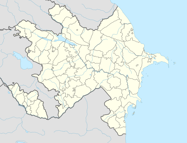
| Coordinates: 39°49′24″N 47°01′04″E / 39.82333°N 47.01778°E | |
| Country | |
| • District | Khojavend |
| Elevation | 687 m (2,254 ft) |
| Population (2015)[1] | |
| • Total | 453 |
| Time zone | UTC+4 (AZT) |
Spitakashen (Armenian: Սպիտակաշեն) or Aghkend (Azerbaijani: Ağkənd) is a village in the Khojavend District of Azerbaijan, in the disputed region of Nagorno-Karabakh. The village had an Armenian majority in 1989.[2]
Etymology
[edit]The village's name means "white village" in both Armenian and Azerbaijani.
History
[edit]During the Soviet period, the village was a part of the Martuni District of the Nagorno-Karabakh Autonomous Oblast.
Historical heritage sites
[edit]Historical heritage sites in and around the village include the 13th-century Holy Savior Church (Armenian: Սուրբ Ամենափրկիչ Եկեղեցի, romanized: Surb Amenaprkich Yekeghetsi) and a 13th-century cemetery.[1]
Economy and culture
[edit]The population is mainly engaged in agriculture and animal husbandry. As of 2015, the village has a municipal building, a house of culture, a secondary school, and a medical centre.[1]
Demographics
[edit]The village had 437 inhabitants in 2005,[3] and 453 inhabitants in 2015.[1]
References
[edit]- ^ a b c d Hakob Ghahramanyan. "Directory of socio-economic characteristics of NKR administrative-territorial units (2015)".
- ^ Андрей Зубов. "Андрей Зубов. Карабах: Мир и Война". drugoivzgliad.com.
- ^ "The Results of the 2005 Census of the Nagorno-Karabakh Republic" (PDF). National Statistic Service of the Republic of Artsakh.
External links
[edit]Capital: Martuni | ||
| Urban communities |  | |
| Rural communities | ||
| Not under Artsakh control |
| |

This Khojavend District location article is a stub. You can help Wikipedia by expanding it. |