Sagamu: Difference between revisions
Lynndonald (talk | contribs) Add content Tags: Visual edit Mobile edit Mobile web edit |
m Bot: link syntax and minor changes |
||
| (35 intermediate revisions by 21 users not shown) | |||
| Line 1: | Line 1: | ||
{{short description|LGA in Ogun State, Nigeria}} |
|||
{{Use Nigerian English|date=January 2023}} |
|||
{{More citations needed|date=April 2013}} |
{{More citations needed|date=April 2013}} |
||
{{Infobox settlement |
{{Infobox settlement |
||
| Line 7: | Line 9: | ||
|settlement_type = LGA |
|settlement_type = LGA |
||
|motto = |
|motto = |
||
|image_skyline = |
|image_skyline = Sunset in developing Araromi in Sagamu Ogun State.jpg |
||
|imagesize = |
|imagesize = |
||
|image_caption = |
|image_caption = Araromi neighbourhood |
||
|image_flag = |
|image_flag = |
||
|flag_size = |
|flag_size = |
||
| Line 31: | Line 33: | ||
|government_footnotes = |
|government_footnotes = |
||
|government_type = |
|government_type = |
||
|leader_title =Local Government Chairman |
|leader_title =Local Government Chairman |
||
|leader_name = |
|leader_name =Odulate Olashile ([[All Progressives Congress|APC]]) |
||
|established_title = |
|established_title = |
||
|established_date = |
|established_date = |
||
|blank_name_sec1= National language |
|||
|blank_info_sec1= [[Yoruba language|Yorùbá]] |
|||
<!-- Area ---------------------> |
<!-- Area ---------------------> |
||
| Line 61: | Line 65: | ||
|utc_offset_DST = |
|utc_offset_DST = |
||
|coordinates = {{coord|6|50|N|3|39|E|type:adm2nd_region:NG|display=inline,title}} |
|coordinates = {{coord|6|50|N|3|39|E|type:adm2nd_region:NG|display=inline,title}} |
||
|module={{Infobox mapframe|wikidata=yes|zoom=8|marker=village|coord={{WikidataCoord|display=i}}}} |
|||
|elevation_footnotes = |
|elevation_footnotes = |
||
|elevation_m = |
|elevation_m = |
||
| Line 66: | Line 71: | ||
<!-- Area/postal codes & others --------> |
<!-- Area/postal codes & others --------> |
||
|postal_code_type = 3-digit postal code prefix |
|postal_code_type = 3-digit postal code prefix |
||
|postal_code = 121<ref>{{cite web | title = Post Offices- with map of LGA |
|postal_code = 121<ref>{{cite web | title = Post Offices- with map of LGA | publisher = NIPOST | url = http://www.nipost.gov.ng/PostCode.aspx | access-date = 2009-10-20 | url-status = dead | archive-url = https://web.archive.org/web/20121126042849/http://www.nipost.gov.ng/postcode.aspx | archive-date = 2012-11-26 }}</ref> |
||
|area_code = |
|area_code = |
||
|iso_code = NG.OG.SH |
|iso_code = NG.OG.SH |
||
| Line 72: | Line 77: | ||
|footnotes = |
|footnotes = |
||
}} |
}} |
||
[[File:Roads and Vehicles in Sagamu.jpg|thumb|left|Roads and Vehicles in Sagamu]] |
|||
{{Infobox ethnic group |
{{Infobox ethnic group |
||
|group = Remo |
|group = Remo |
||
| Line 81: | Line 88: | ||
|religions = [[Christianity]]{{·}}[[Islam]]{{·}}[[Yoruba religion]] |
|religions = [[Christianity]]{{·}}[[Islam]]{{·}}[[Yoruba religion]] |
||
}} |
}} |
||
[[File:Road Transportation in Sagamu, Nigeria.jpg|thumb|Sagamu]] |
|||
'''Sagamu''' or '''Ishagamu''' is |
'''Sagamu''' or '''Ishagamu''' is an [[Urban agglomeration|agglomeration]] of thirteen towns in southwestern Nigeria. It is located in [[Ogun State]] along the [[Ibu River]] and Eruwuru Stream between [[Lagos State|Lagos]] and [[Ibadan]]. It was founded in the mid 19th century by members of the Remo branch of the [[Yoruba people]].<ref>{{Cite web|url=https://www.britannica.com/place/Shagamu|title=Shagamu {{!}} Nigeria|website=Encyclopedia Britannica|language=en|access-date=2019-10-15}}</ref> The 13 towns are: Makun, Offin, Sonyindo, Epe, Ibido, Igbepa, Ado, Oko, Ipoji, Batoro, Ijoku, Ijagba and Latawa.<ref>{{Cite web|title=Shagamu time now. Local current time and time zone in Shagamu / Ogun / Nigeria - Current-Time.World|url=http://current-time.world/Nigeria/Ogun/Shagamu|website=current-time.world|language=en|access-date=2020-05-25}}</ref><ref>{{Cite web|title=Remo Town in Ogun Nigeria Guide|url=https://www.nigeriagalleria.com/Nigeria/States_Nigeria/Ogun/History-of-Remo-in-Ogun-State.html|website=www.nigeriagalleria.com|access-date=2020-05-25}}</ref> It is the capital of Remo Kingdom, and the paramount ruler of the kingdom, the ''Akarigbo'' of Remo, has his palace is in the town of Offin. |
||
The Sagamu region is underlain by major deposits of [[limestone]], which is used in the city's major industry, the production of [[cement]]. Agricultural products of the region include [[Cocoa bean|cocoa]] and [[kola nuts]]. Sagamu is the largest kola nut collecting center in the country. The kola nut industry supports several secondary industries such as [[basket]] and [[rope]] manufacturing, which are used to store the |
The Sagamu region is underlain by major deposits of [[limestone]], which is used in the city's major industry, the production of [[cement]]. Agricultural products of the region include [[Cocoa bean|cocoa]] and [[kola nuts]]. Sagamu is the largest kola nut collecting center in the country. The kola nut industry supports several secondary industries such as [[basket]] and [[rope]] manufacturing, which are used to store the kola nuts. |
||
The city was founded in the mid-19th century when several small towns united for purpose of defense during the wars brought about by the fall of the [[Oyo Empire]]. Sagamu controlled the trade routes between the ports in the [[Niger Delta]] and the Yoruba mainland until the [[British Empire|British]] occupied the city at the end of the 19th century. Sagamu has experienced both population and economic growth since the 1950s due to its position between the cities of [[Ibadan]] and [[Lagos]]. The population in 1995 was 114,300 but 2007 estimates |
The city was founded in the mid-19th century when several small towns united for purpose of defense during the wars brought about by the fall of the [[Oyo Empire]]. Sagamu controlled the trade routes between the ports in the [[Niger Delta]] and the Yoruba mainland until the [[British Empire|British]] occupied the city at the end of the 19th century. Sagamu has experienced both population and economic growth since the 1950s, due to its position between the cities of [[Ibadan]] and [[Lagos]]. The population in 1995 was 114,300 but 2007 estimates placed it as high as 228,382. The [[Olabisi Onabanjo University]]'s college of medicine is located in Sagamu.<ref name="world gazetteer">{{cite web|title=The World Gazetteer|url=http://www.world-gazetteer.com/wg.php?men=gpro&des=gamelan&geo=348678364|access-date=2007-04-06|archive-url=https://archive.today/20130210072533/http://www.world-gazetteer.com/wg.php?men=gpro&des=gamelan&geo=348678364|archive-date=2013-02-10|url-status=dead}}</ref> |
||
Sagamu (Offin - Ile) is the new seat of the [[Akarigbo of Remo]] ("King" or "Lord" of Remo), the traditional ruler of the [[Ijebu Kingdom|Remo]] Kingdom. The former seat was located in a farther area of [[Offin, Nigeria|Offin]]Four ruling families are eligible to wear the beaded crown of the ''Akarigbo'', all descending from the first Oba, Akarigbo, a prince of the house of [[Oduduwa]]. The current Akarigbo |
Sagamu (Offin - Ile) is the new seat of the [[Akarigbo of Remo|''Akarigbo'' of Remo]] ("King" or "Lord" of Remo), the traditional ruler of the [[Ijebu Kingdom|Remo]] Kingdom. The former seat was located in a farther area of [[Offin, Nigeria|Offin]]. Four ruling families are eligible to wear the beaded crown of the ''Akarigbo'', all descending from the first ''Oba'', Akarigbo, a prince of the house of [[Oduduwa]]. The current ''Akarigbo'' was installed and crowned as King in 2017. Notable areas within Sagamu include Offin, Itunshokun, Sabo, Makun, Ajaka, Makun Station, Isale-oko, Isote, Epe, Soyindo, Surulere, Ijagba, Ewu-Oluwo, Ogijo, Simawa, GRA, Ijokun, Batoro. Ijebu language, a dialect of the [[Yoruba language]], is spoken in Sagamu. |
||
== Administration == |
== Administration == |
||
The old Sagamu Local Government has been divided into Three(3) Local Council Development Areas namely Sagamu West LCDA,Sagamu Central LCDA and Sagamu South LCDA. |
The old Sagamu Local Government has been divided into Three(3) Local Council Development Areas namely Sagamu West LCDA, Sagamu Central LCDA and Sagamu South LCDA. |
||
For Administrative convenience, Sagamu Local Government is divided into (15) Fifteen Political Wards, namely. |
For Administrative convenience, Sagamu Local Government is divided into (15) Fifteen Political Wards, namely. |
||
# Ward 1 Oko, Epe & Itunla 1 |
# Ward 1 – Oko, Epe & Itunla 1 |
||
# Ward 2 – |
# Ward 2 – Oko, Epe Itunla II |
||
# Ward 3 – |
# Ward 3 – AiyegbamijIjoku |
||
# Ward 4 – Sabo 1 |
# Ward 4 – Sabo 1 |
||
# Ward 5 – |
# Ward 5 – Sabo II |
||
# Ward 6 – Itunsokun Oyebajo |
# Ward 6 – Itunsokun Oyebajo |
||
# Ward 7 – |
# Ward 7 – Ijagba |
||
# Ward 8 – Latawa |
# Ward 8 – Latawa |
||
# Ward 9 – |
# Ward 9 – Ode-lemo |
||
# Ward 10 – OgijojIkosi |
# Ward 10 – OgijojIkosi |
||
# Ward 11 – |
# Ward 11 – Surulere |
||
# Ward 12 – Isote |
# Ward 12 – Isote |
||
# Ward 13 – |
# Ward 13 – Simawa |
||
# Ward 14 – Agbowa |
# Ward 14 – Agbowa |
||
# Ward 15 – |
# Ward 15 – Ibidojitun Alara |
||
== Notable |
== Notable people == |
||
[[Remo Stars F.C.|Remo Stars football Club]]<ref>{{Citation|title=Remo Stars F.C.|date=2019-09-11|url=https://en.wikipedia.org/w/index.php?title=Remo_Stars_F.C.&oldid=915199277|work=Wikipedia|language=en|access-date=2019-10-18}}</ref> |
|||
[https://www.soccerhub.com.ng]<ref>{{Cite web|title=Football news, Transfer news and NPFL and live update|url=https://www.soccerhub.com.ng/|access-date=2020-10-22|website=Soccerhub|language=en-US}}</ref> |
|||
[[Soccerhub (website)|Soccerhub]] |
|||
| ⚫ | |||
<!-- ONLY ADD A PERSON TO THIS LIST IF THEY ALREADY HAVE AN ARTICLE IN THE ENGLISH WIKIPEDIA --> |
<!-- ONLY ADD A PERSON TO THIS LIST IF THEY ALREADY HAVE AN ARTICLE IN THE ENGLISH WIKIPEDIA --> |
||
* [[Adebayo Ogunlesi]], a businessman |
* [[Adebayo Ogunlesi]], a businessman |
||
| Line 124: | Line 125: | ||
*[[Babatunde Adewale Ajayi]], the current Sagamu king |
*[[Babatunde Adewale Ajayi]], the current Sagamu king |
||
<!-- ONLY ADD A PERSON TO THIS LIST IF THEY ALREADY HAVE AN ARTICLE IN THE ENGLISH WIKIPEDIA --> |
<!-- ONLY ADD A PERSON TO THIS LIST IF THEY ALREADY HAVE AN ARTICLE IN THE ENGLISH WIKIPEDIA --> |
||
| ⚫ | |||
<gallery> |
|||
File:AAFIN AKARIGBO TI ILE REMO Sagamu2.jpg|Aafin Akarigo palace |
|||
File:Akarigbo palace, Sagamu.jpg|Akarigbo Palace |
|||
File:Methodist Church Nigeria Sagamu-OKO CIRCUIT HQS 3.jpg|Methodist church Nigeria |
|||
File:Methodist Church Nigeria Sagamu-OKO CIRCUIT HQS.jpg|Methodist church |
|||
File:SAGAMU CENTRAL MOSQUE 2.jpg|Sagamu central mosque |
|||
File:St. John church, Sagamu.jpg|St. John church |
|||
</gallery> |
|||
== External links == |
|||
{{wikivoyage-inline}} |
|||
== References == |
== References == |
||
{{Reflist}} |
{{Reflist}} |
||
{{Commons category|Sagamu}} |
|||
{{Ogun State}} |
{{Ogun State}} |
||
Latest revision as of 08:37, 5 September 2023
This article needs additional citations for verification. (April 2013) |
Sagamu
Orisagamu | |
|---|---|
LGA | |
 Araromi neighbourhood | |
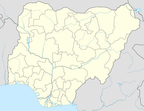 Sagamu Location in Nigeria | |
| Coordinates: 6°50′N 3°39′E / 6.833°N 3.650°E | |
| Country | |
| State | Ogun State |
| LGA(s) | Sagamu |
| Government | |
| • Local Government Chairman | Odulate Olashile (APC) |
| Area | |
| • Total | 614 km2 (237 sq mi) |
| Population (2006 census) | |
| • Total | 253,412 |
| Time zone | UTC+1 (WAT) |
| 3-digit postal code prefix | 121[1] |
| ISO 3166 code | NG.OG.SH |
| National language | Yorùbá |
 | |

| Total population | |
|---|---|
| ~ 1,132,270 (2011) | |
| Regions with significant populations | |
| Ogun State - 512,750 · Remo North: 70,470 · Ikenne: 140,490 · Shagamu: 301,790 Lagos State - 619,520 · Ikorodu: 619,520 | |
| Religion | |
| Christianity · Islam · Yoruba religion |
Sagamu or Ishagamu is an agglomeration of thirteen towns in southwestern Nigeria. It is located in Ogun State along the Ibu River and Eruwuru Stream between Lagos and Ibadan. It was founded in the mid 19th century by members of the Remo branch of the Yoruba people.[2] The 13 towns are: Makun, Offin, Sonyindo, Epe, Ibido, Igbepa, Ado, Oko, Ipoji, Batoro, Ijoku, Ijagba and Latawa.[3][4] It is the capital of Remo Kingdom, and the paramount ruler of the kingdom, the Akarigbo of Remo, has his palace is in the town of Offin.
The Sagamu region is underlain by major deposits of limestone, which is used in the city's major industry, the production of cement. Agricultural products of the region include cocoa and kola nuts. Sagamu is the largest kola nut collecting center in the country. The kola nut industry supports several secondary industries such as basket and rope manufacturing, which are used to store the kola nuts.
The city was founded in the mid-19th century when several small towns united for purpose of defense during the wars brought about by the fall of the Oyo Empire. Sagamu controlled the trade routes between the ports in the Niger Delta and the Yoruba mainland until the British occupied the city at the end of the 19th century. Sagamu has experienced both population and economic growth since the 1950s, due to its position between the cities of Ibadan and Lagos. The population in 1995 was 114,300 but 2007 estimates placed it as high as 228,382. The Olabisi Onabanjo University's college of medicine is located in Sagamu.[5]
Sagamu (Offin - Ile) is the new seat of the Akarigbo of Remo ("King" or "Lord" of Remo), the traditional ruler of the Remo Kingdom. The former seat was located in a farther area of Offin. Four ruling families are eligible to wear the beaded crown of the Akarigbo, all descending from the first Oba, Akarigbo, a prince of the house of Oduduwa. The current Akarigbo was installed and crowned as King in 2017. Notable areas within Sagamu include Offin, Itunshokun, Sabo, Makun, Ajaka, Makun Station, Isale-oko, Isote, Epe, Soyindo, Surulere, Ijagba, Ewu-Oluwo, Ogijo, Simawa, GRA, Ijokun, Batoro. Ijebu language, a dialect of the Yoruba language, is spoken in Sagamu.
Administration[edit]
The old Sagamu Local Government has been divided into Three(3) Local Council Development Areas namely Sagamu West LCDA, Sagamu Central LCDA and Sagamu South LCDA.
For Administrative convenience, Sagamu Local Government is divided into (15) Fifteen Political Wards, namely.
- Ward 1 – Oko, Epe & Itunla 1
- Ward 2 – Oko, Epe Itunla II
- Ward 3 – AiyegbamijIjoku
- Ward 4 – Sabo 1
- Ward 5 – Sabo II
- Ward 6 – Itunsokun Oyebajo
- Ward 7 – Ijagba
- Ward 8 – Latawa
- Ward 9 – Ode-lemo
- Ward 10 – OgijojIkosi
- Ward 11 – Surulere
- Ward 12 – Isote
- Ward 13 – Simawa
- Ward 14 – Agbowa
- Ward 15 – Ibidojitun Alara
Notable people[edit]
- Adebayo Ogunlesi, a businessman
- Anthony Joshua, a sportsperson
- Gbenga Daniel, a politician.
- Babatunde Adewale Ajayi, the current Sagamu king
Photo Gallery of Sagamu[edit]
-
Aafin Akarigo palace
-
Akarigbo Palace
-
Methodist church Nigeria
-
Methodist church
-
Sagamu central mosque
-
St. John church


External links[edit]
Sagamu travel guide from Wikivoyage
References[edit]
- ^ "Post Offices- with map of LGA". NIPOST. Archived from the original on 2012-11-26. Retrieved 2009-10-20.
- ^ "Shagamu | Nigeria". Encyclopedia Britannica. Retrieved 2019-10-15.
- ^ "Shagamu time now. Local current time and time zone in Shagamu / Ogun / Nigeria - Current-Time.World". current-time.world. Retrieved 2020-05-25.
- ^ "Remo Town in Ogun Nigeria Guide". www.nigeriagalleria.com. Retrieved 2020-05-25.
- ^ "The World Gazetteer". Archived from the original on 2013-02-10. Retrieved 2007-04-06.
State capital: Abeokuta | ||
| Local government areas |  | |
| Towns and villages | ||