Saint-Thonan
Saint-Thonan
Sant-Tonan | |
|---|---|
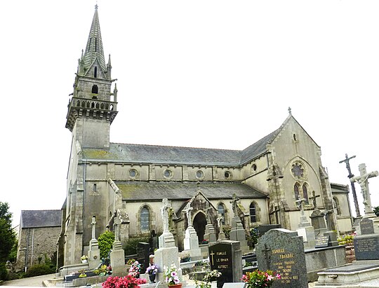 The parish church in Saint-Thonan | |
Location of Saint-Thonan  | |
 Saint-Thonan 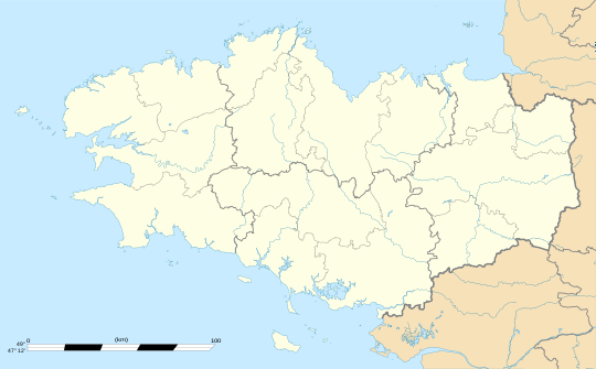 Saint-Thonan | |
| Coordinates: 48°28′47″N 4°20′04″W / 48.4797°N 4.3344°W | |
| Country | France |
| Region | Brittany |
| Department | Finistère |
| Arrondissement | Brest |
| Canton | Landerneau |
| Intercommunality | CA Pays de Landerneau-Daoulas |
| Government | |
| • Mayor (2020–2026) | Marc Jézéquel[1] |
| Area 1 | 11.29 km2 (4.36 sq mi) |
| Population (2021)[2] | 1,929 |
| • Density | 170/km2 (440/sq mi) |
| Time zone | UTC+01:00 (CET) |
| • Summer (DST) | UTC+02:00 (CEST) |
| INSEE/Postal code | 29268 /29800 |
| Elevation | 34–116 m (112–381 ft) |
| 1 French Land Register data, which excludes lakes, ponds, glaciers > 1 km2 (0.386 sq mi or 247 acres) and river estuaries. | |
Saint-Thonan (French pronunciation: [sɛ̃ tɔnɑ̃]; Breton: Sant-Tonan) is a commune in the Finistère department of Brittany in north-western France.
Population
| Year | Pop. | ±% p.a. |
|---|---|---|
| 1968 | 556 | — |
| 1975 | 583 | +0.68% |
| 1982 | 769 | +4.04% |
| 1990 | 1,083 | +4.37% |
| 1999 | 1,165 | +0.81% |
| 2009 | 1,357 | +1.54% |
| 2014 | 1,623 | +3.64% |
| 2020 | 1,916 | +2.80% |
| Source: INSEE[3] | ||
Inhabitants of Saint-Thonan are called in French Saint-Thonanais.
See also
References
- ^ "Répertoire national des élus: les maires". data.gouv.fr, Plateforme ouverte des données publiques françaises (in French). 2 December 2020.
- ^ "Populations légales 2021" (in French). The National Institute of Statistics and Economic Studies. 28 December 2023.
- ^ Population en historique depuis 1968, INSEE
- Mayors of Finistère Association (in French)
External links
Wikimedia Commons has media related to Saint-Thonan.
- Official website (in French)
| Authority control databases: National |
|---|
This Finistère geographical article is a stub. You can help Wikipedia by expanding it. |