San Isidro, Intibucá
San Isidro | |
|---|---|
Municipality | |
 San Isidro Location in Honduras | |
| Coordinates: 14°34′N 88°7′W / 14.567°N 88.117°W | |
| Country | Honduras |
| Department | Intibucá |
| Area | |
| • Total | 72 km2 (28 sq mi) |
| Population (2015) | |
| • Total | 4,591 |
| • Density | 64/km2 (170/sq mi) |
| Postal code | 14000 |
| Municipality number | 1011 |
San Isidro (Spanish pronunciation: [san iˈsiðɾo]) is a municipality in the Honduran department of Intibucá.
Demographics
At the time of the 2013 Honduras census, San Isidro municipality had a population of 4,387. Of these, 91.18% were Indigenous (90.77% Lenca), 7.20% Mestizo, 1.32% White and 0.30% Black or Afro-Honduran.[1]
References
Capital: La Esperanza | ||
| Municipalities | 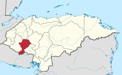 | |
14°34′0″N 88°7′0″W / 14.56667°N 88.11667°W
This Honduras location article is a stub. You can help Wikipedia by expanding it. |