San Juan, Intibucá: Difference between revisions
m +it |
m Rm live CS1 url status |
||
| (34 intermediate revisions by 29 users not shown) | |||
| Line 1: | Line 1: | ||
{{Other uses|San Juan (disambiguation){{!}}San Juan}}{{More citations needed|date=March 2022}}{{Infobox settlement |
|||
'''San Juan, Intibucá''' lies in the western highlands of [[Honduras]] between Gracias and La Esperanza. It is located in the department of [[Intibucá]], was founded in 1747 by the Spanish, and has a population of around 1000. San Juan lies in the center of the "Lenca Trail" which runs from Santa Rosa de Copan to Marcala, La Paz. There are still many Lenca groups in the areas surrounding the village center. There is an old Catholic church built by the Spanish in the town's center next to a massive Ceibo tree. The primary source of income for community members comes from the numerous coffee farms that can be found throughout the region. |
|||
|official_name = San Juan |
|||
|native_name = <!-- for cities whose native name is not in English --> |
|||
|nickname = |
|||
|motto = |
|||
|image_skyline = |
|||
|imagesize = |
|||
|image_caption = |
|||
|image_flag = |
|||
|image_seal = |
|||
|image_shield = |
|||
|image_map = |
|||
|mapsize = |
|||
|map_caption = |
|||
|pushpin_map = Honduras<!-- the name of a location map as per http://en.wikipedia.org/wiki/Template:Location_map --> |
|||
|pushpin_label_position = right |
|||
|pushpin_mapsize = 300 |
|||
|pushpin_map_caption = Location in Honduras |
|||
|subdivision_type = [[Country]] |
|||
|subdivision_name = [[Honduras]] |
|||
|subdivision_type1 = [[Departments of Honduras|Department]] |
|||
|subdivision_name1 = [[Intibucá Department|Intibucá]] |
|||
|subdivision_type2 = |
|||
|subdivision_name2 = |
|||
|government_type = |
|||
|leader_title = |
|||
|leader_name = |
|||
|leader_title1 = |
|||
|leader_name1 = |
|||
|leader_title2 = |
|||
|leader_name2 = |
|||
|leader_title3 = |
|||
|leader_name3 = |
|||
|established_title = Founded |
|||
|established_date = 1747 |
|||
|established_title2 = |
|||
|established_date2 = |
|||
|established_title3 = |
|||
|established_date3 = |
|||
|area_magnitude = |
|||
|area_total_km2 = 177 |
|||
|TotalArea_sq_km = |
|||
|area_land = |
|||
|LandArea_sq_mi = |
|||
|area_water = |
|||
|WaterArea_sq_mi = |
|||
|area_water_percent = |
|||
|area_urban = |
|||
|UrbanArea_sq_mi = |
|||
|area_metro = |
|||
|MetroArea_sq_mi = |
|||
|population_as_of = 2015 |
|||
|population_note = |
|||
|settlement_type = Municipality<!--For Town or Village (Leave blank for the default City)--> |
|||
|population_total = 13887 |
|||
|population_density = |
|||
|population_density_km2 = auto |
|||
|population_metro = |
|||
|population_density_metro_km2 = |
|||
|population_density_metro_mi2 = |
|||
|population_urban = |
|||
| blank_name_sec1 = [[Municipalities of Honduras|Municipality number]] |
|||
| blank_info_sec1 = 1012 |
|||
|timezone = |
|||
|utc_offset = |
|||
|timezone_DST = |
|||
|utc_offset_DST = |
|||
|coordinates = {{coord|14|24|N|88|25|W|display=inline}} |
|||
|elevation = |
|||
|elevation_ft = |
|||
|postal_code_type = Postal code |
|||
|postal_code = 14000 |
|||
|website = |
|||
|footnotes = |
|||
}} |
|||
'''San Juan, Intibucá''' lies in the western highlands of [[Honduras]] between [[Gracias]] and [[La Esperanza, Honduras|La Esperanza]]. |
|||
The natural beauty and climate of the area is unparalleled in Honduras. The Opalaca Biological Reserve looms in the background and numerous creeks flow through the valley. Due to the attractions in the area, a community group of leaders have established the first Rural Tourism Cooperative in the country, offering various packages for tourists wanting to see what they call "the Real Honduras". This is a rural, picturesque community with not only natural attractions such as waterfalls, cloud forests, and canyons but also unique because of the community spirit and active participation of local leaders trying to promote eco-tourism. The cooperative is comprised of a united group of guides, comedores (cafeterias), guest house owners, horse owners, site owners, and a visitor's center run by native Gladys Nolasco. Guided tours are offered on horseback and community members have also been trained to give coffee roasting demonstrations, local artisan workshops, and sugar cane production demonstrations. |
|||
It is located in the department of [[Intibucá Department|Intibucá]], was founded in 1747 by the [[Spain|Spanish]], and has a population of around 1000. San Juan lies in the center of the "Lenca Trail" which runs from [[Santa Rosa de Copán|Santa Rosa de Copan]] to [[Marcala]], [[La Paz Department (Honduras)|La Paz]]. There are still many [[Lenca people|Lenca]] groups in the areas surrounding the village center. There is an old [[Catholic Church]] built by the [[Spanish people|Spanish]] in the town's center next to a massive ceibo tree. The primary source of income for community members comes from the numerous coffee farms that can be found throughout the region. The main coffee cooperatives are FUNDECASA producing [[Rainforest Alliance|Rainforest Alliance Coffee]] and COARENE producing [[Fair trade coffee|Fairtrade]] and [[organic coffee]]. [[Ecotourism]] is also becoming popular in and around San Juan - a thermal spring outside of San Juan has been developed for tourist use.<ref>{{Citation |title=Geology-related tourism for sustainable development |date=2012-04-12 |url=http://dx.doi.org/10.1201/9780203947043-41 |work=Central America, Two Volume Set |pages=1139–1222 |publisher=CRC Press |doi=10.1201/9780203947043-41 |isbn=9780429074370 |access-date=2022-03-02}}</ref> |
|||
There are buses leaving Gracias and La Esperanza on a daily basis for San Juan. Many tourists prefer to hitchhike between the towns, which is the standard mode or transportation in the region. |
|||
{{Intibucá Department}} |
|||
The Opalaca Biological Reserve is located in the area and a number of creeks flow through the valley.<ref>{{Cite web |last= |title=San Juan |url=https://becamo.hn/san-juan/ |access-date=2022-03-02 |website=Becamo, S.A. |language=en-US}}</ref> Due to the attractions in the area, a community group of leaders have established the first Rural Tourism Cooperative in the country,{{fact|date=December 2018}} offering packages for tourists wanting to see "the Real Honduras".{{fact|date=December 2018}} This is a rural community with natural attractions such as waterfalls, cloud forests, and canyons.{{fact|date=December 2018}} The cooperative consists of a group of guides, comedores (cafeterias), guest house owners, horse owners, site owners, and a visitor's center.{{fact|date=December 2018}} Guided tours are offered on horseback and community members have also been trained to give coffee roasting demonstrations, local artisan workshops, and sugar cane production demonstrations.{{fact|date=December 2018}} |
|||
{{coord|14|24|0|N|88|25|0|W|type:adm2nd_zoom:13_region:HN_source:nlwiki|display=title}} |
|||
There are buses leaving Gracias and La Esperanza on a daily basis for San Juan. There are Moto-taxis transporting tourists and locals around the village. Some tourists prefer to hitchhike between the towns, which is the standard mode or transportation in the region.{{fact|date=December 2018}} |
|||
[[Category:Cities, towns and villages in Honduras]] |
|||
[[Category:Municipalities of the Intibucá Department]] |
|||
==Demographics== |
|||
[[Category:Settlements established in 1747]] |
|||
At the time of the 2013 Honduras census, San Juan municipality had a population of 13,405. Of these, 66.78% were [[Mestizo]], 27.00% [[Indigenous peoples of the Americas|Indigenous]] (24.67% [[Lenca]], 2.30% [[Chʼortiʼ people|Chʼortiʼ]]) 4.61% [[White Latin Americans|White]], 1.58% [[Afro-Hondurans|Black or Afro-Honduran]] and 0.03% others.<ref>[https://www.ine.gob.hn/V3/baseine/ Instituto Nacional de Estadística (INE), bases de datos en línea]</ref> |
|||
== References == |
|||
{{Honduras-geo-stub}} |
|||
{{Reflist}}{{Intibucá Department}} |
|||
{{coord|14|24|0|N|88|25|0|W|type:adm2nd_region:HN_source:nlwiki|display=title}} |
|||
{{DEFAULTSORT:San Juan, Intibuca}} |
|||
{{unreferenced|date=July 2007}} |
|||
[[Category:Municipalities of the Intibucá Department]] |
|||
[[Category:Populated places established in 1747]] |
|||
[[it:San Juan (Intibucá)]] |
|||
{{Honduras-geo-stub}} |
|||
[[nl:San Juan (Intibucá)]] |
|||
Latest revision as of 21:56, 17 February 2023
This article needs additional citations for verification. (March 2022) |
San Juan | |
|---|---|
Municipality | |
 San Juan Location in Honduras | |
| Coordinates: 14°24′N 88°25′W / 14.400°N 88.417°W | |
| Country | Honduras |
| Department | Intibucá |
| Founded | 1747 |
| Area | |
| • Total | 177 km2 (68 sq mi) |
| Population (2015) | |
| • Total | 13,887 |
| • Density | 78/km2 (200/sq mi) |
| Postal code | 14000 |
| Municipality number | 1012 |
San Juan, Intibucá lies in the western highlands of Honduras between Gracias and La Esperanza.
It is located in the department of Intibucá, was founded in 1747 by the Spanish, and has a population of around 1000. San Juan lies in the center of the "Lenca Trail" which runs from Santa Rosa de Copan to Marcala, La Paz. There are still many Lenca groups in the areas surrounding the village center. There is an old Catholic Church built by the Spanish in the town's center next to a massive ceibo tree. The primary source of income for community members comes from the numerous coffee farms that can be found throughout the region. The main coffee cooperatives are FUNDECASA producing Rainforest Alliance Coffee and COARENE producing Fairtrade and organic coffee. Ecotourism is also becoming popular in and around San Juan - a thermal spring outside of San Juan has been developed for tourist use.[1]
The Opalaca Biological Reserve is located in the area and a number of creeks flow through the valley.[2] Due to the attractions in the area, a community group of leaders have established the first Rural Tourism Cooperative in the country,[citation needed] offering packages for tourists wanting to see "the Real Honduras".[citation needed] This is a rural community with natural attractions such as waterfalls, cloud forests, and canyons.[citation needed] The cooperative consists of a group of guides, comedores (cafeterias), guest house owners, horse owners, site owners, and a visitor's center.[citation needed] Guided tours are offered on horseback and community members have also been trained to give coffee roasting demonstrations, local artisan workshops, and sugar cane production demonstrations.[citation needed]
There are buses leaving Gracias and La Esperanza on a daily basis for San Juan. There are Moto-taxis transporting tourists and locals around the village. Some tourists prefer to hitchhike between the towns, which is the standard mode or transportation in the region.[citation needed]
Demographics
[edit]At the time of the 2013 Honduras census, San Juan municipality had a population of 13,405. Of these, 66.78% were Mestizo, 27.00% Indigenous (24.67% Lenca, 2.30% Chʼortiʼ) 4.61% White, 1.58% Black or Afro-Honduran and 0.03% others.[3]
References
[edit]- ^ "Geology-related tourism for sustainable development", Central America, Two Volume Set, CRC Press, pp. 1139–1222, 2012-04-12, doi:10.1201/9780203947043-41, ISBN 9780429074370, retrieved 2022-03-02
- ^ "San Juan". Becamo, S.A. Retrieved 2022-03-02.
- ^ Instituto Nacional de Estadística (INE), bases de datos en línea
Capital: La Esperanza | ||
| Municipalities | 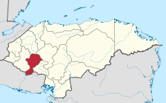 | |
14°24′0″N 88°25′0″W / 14.40000°N 88.41667°W
This Honduras location article is a stub. You can help Wikipedia by expanding it. |