St. Michael, Alaska: Difference between revisions
→Demographics: Change wording to reflect previous mention. |
Red Director (talk | contribs) |
||
| (29 intermediate revisions by 22 users not shown) | |||
| Line 1: | Line 1: | ||
{{Use mdy dates|date=April 2024}} |
|||
{{Infobox settlement |
{{Infobox settlement |
||
|official_name = St. Michael |
|official_name = St. Michael |
||
|native_name = Taciq |
|native_name = <small>{{native name|esu|Taciq}}<br>{{native name|ik|Tasiq}}<br>{{native name|ru|Сент-Майкл}}</small> |
||
|settlement_type = [[City (Alaska)|City]] |
|settlement_type = [[City (Alaska)|City]] |
||
|nickname = |
|nickname = |
||
| Line 23: | Line 24: | ||
|government_type = |
|government_type = |
||
|leader_title = [[Mayor]] |
|leader_title = [[Mayor]] |
||
|leader_name = |
|leader_name = Alice Fitka<ref>{{Cite book|title=2015 Alaska Municipal Officials Directory|location=Juneau|publisher=Alaska Municipal League|year=2015|page=136}}</ref> |
||
|leader_title1 = [[Alaska Senate|State senator]] |
|leader_title1 = [[Alaska Senate|State senator]] |
||
|leader_name1 = [[Donald Olson]] ([[Democratic Party (United States)|D]]) |
|leader_name1 = [[Donny Olson|Donald Olson]] ([[Democratic Party (United States)|D]]) |
||
|leader_title2 = [[Alaska House of Representatives|State rep.]] |
|leader_title2 = [[Alaska House of Representatives|State rep.]] |
||
|leader_name2 = [[Neal Foster]] (D) |
|leader_name2 = [[Neal Foster]] (D) |
||
| Line 32: | Line 33: | ||
<!-- Area --> |
<!-- Area --> |
||
|area_footnotes = <ref name=" |
|area_footnotes = <ref name="CenPopGazetteer2020">{{cite web|title=2020 U.S. Gazetteer Files|url=https://www2.census.gov/geo/docs/maps-data/data/gazetteer/2020_Gazetteer/2020_gaz_place_02.txt|publisher=United States Census Bureau|accessdate=October 29, 2021}}</ref> |
||
|area_magnitude = |
|area_magnitude = |
||
|area_total_km2 = 72.69 |
|area_total_km2 = 72.69 |
||
| Line 42: | Line 43: | ||
<!-- Population --> |
<!-- Population --> |
||
|population_as_of = [[ |
|population_as_of = [[2020 United States Census|2020]] |
||
|population_footnotes = |
|||
|population_footnotes = <ref name="GR1">{{cite web|url=https://www.census.gov/geo/www/gazetteer/gazette.html|publisher=[[United States Census Bureau]]|accessdate=2011-04-23|date=2011-02-12|title=US Gazetteer files: 2010, 2000, and 1990}}</ref> |
|||
|population_total = |
|population_total = 456 |
||
|population_density_km2 = |
|population_density_km2 = 8.10 |
||
|population_density_sq_mi = |
|population_density_sq_mi = 20.97 |
||
|timezone = [[Alaska Time Zone|Alaska (AKST)]] |
|timezone = [[Alaska Time Zone|Alaska (AKST)]] |
||
|utc_offset = -9 |
|utc_offset = -9 |
||
| Line 59: | Line 60: | ||
|area_code = [[Area code 907|907]] |
|area_code = [[Area code 907|907]] |
||
|area_code_type = [[North American Numbering Plan|Area code]] |
|area_code_type = [[North American Numbering Plan|Area code]] |
||
|GNIS_id = 1408977 |
|||
|blank_name = [[Federal Information Processing Standard|FIPS code]] |
|blank_name = [[Federal Information Processing Standard|FIPS code]] |
||
|blank_info = 02-66360 |
|blank_info = 02-66360 |
||
|blank1_name = |
|blank1_name = [[Geographic Names Information System|GNIS]] feature ID |
||
|blank1_info = |
|blank1_info = {{GNIS 4|1408977}} |
||
|website = |
|website = |
||
|footnotes = |
|footnotes = |
||
|pop_est_as_of = |
|pop_est_as_of = |
||
|pop_est_footnotes = |
|pop_est_footnotes = |
||
|population_est = |
|population_est = |
||
|unit_pref = Imperial |
|unit_pref = Imperial |
||
}} |
}} |
||
'''St. Michael''' ( |
'''St. Michael''' ({{lang-esu|Taciq}}, {{lang-ik|Tasiq; Taziq}}, {{lang-ru|Сент-Майкл}}), historically referred to as '''Saint Michael''', is a city in [[Nome Census Area, Alaska]]. The population was 401 at the [[2010 United States Census|2010 census]],<ref name="GR1">{{cite web|url=https://www.census.gov/geographies/reference-files/time-series/geo/gazetteer-files.html|publisher=[[United States Census Bureau]]|access-date=April 23, 2011|date=February 12, 2011|title=US Gazetteer files: 2010, 2000, and 1990}}</ref> up from 368 in 2000. |
||
==Geography== |
==Geography== |
||
| Line 94: | Line 94: | ||
|2000= 368 |
|2000= 368 |
||
|2010= 401 |
|2010= 401 |
||
|2020= 456 |
|||
|estyear=2018 |
|||
| ⚫ | |||
|estimate=415 |
|||
|estref=<ref name="USCensusEst2018">{{cite web|url=https://www.census.gov/programs-surveys/popest/data/tables.2018.html|title=Population and Housing Unit Estimates|accessdate=June 4, 2019}}</ref> |
|||
| ⚫ | |||
}} |
}} |
||
Saint Michael first appeared on the 1880 U.S. Census as the unincorporated Inuit villages of "Saint Michael and Tachik."<ref>https://books.google.com/books?id=Rr9RAQAAMAAJ |
Saint Michael first appeared on the 1880 U.S. Census as the unincorporated Inuit villages of "Saint Michael and Tachik."<ref>{{Cite web | url=https://books.google.com/books?id=Rr9RAQAAMAAJ&q=st.+michael&pg=PA49 |title = Geological Survey Professional Paper|year = 1949}}</ref> Of the 109 residents, 100 were Inuit, 5 were Creole (Mixed Russian and Native) and 4 were White.<ref>{{cite web |title=Statistics of the Population of Alaska |url=https://www2.census.gov/prod2/decennial/documents/1880a_v1-17.pdf |website=United States Census Bureau |date=1880}}</ref> It returned in 1890 as Saint Michael (though it also included the native village of Tachik and a camp of miners).<ref>{{Cite web | url=https://books.google.com/books?id=CRcwAAAAYAAJ&q=%22Annovokhamiut%22&pg=RA2-PA164 |title = Report on Population and Resources of Alaska at the Eleventh Census, 1890|year = 1893|last1 = Census Office|first1 = United States}}</ref> Of the 101 residents, 38 were natives, 33 were Creole and 30 were White. Saint Michael has continued to report in every successive census to date. It formally incorporated in 1969. |
||
As of the [[census]]<ref name="GR2">{{cite web|url= |
As of the [[census]]<ref name="GR2">{{cite web|url=https://www.census.gov|publisher=[[United States Census Bureau]]|access-date=January 31, 2008|title=U.S. Census website}}</ref> of 2000, there were 368 people, 90 households, and 65 families residing in the city. The population density was {{convert|16.9|PD/sqmi|PD/km2|sp=us|adj=off}}. There were 93 housing units at an average density of {{convert|4.3|/sqmi|/km2|sp=us|adj=off}}. The racial makeup of the city was 6.79% [[Race (United States Census)|White]], 92.66% [[Race (United States Census)|Native American]], and 0.54% from two or more races. 0.27% of the population were [[Race (United States Census)|Hispanic]] or [[Race (United States Census)|Latino]] of any race. |
||
Of the 90 households 54.4% had children under the age of 18 living with them, 46.7% were [[Marriage|married couples]] living together, 16.7% had a female householder with no husband present, and 26.7% were non-families. 18.9% of all households were made up of individuals and 4.4% had someone living alone who was 65 years of age or older. The average household size was 4.09 and the average family size was 4.79. |
Of the 90 households, 54.4% had children under the age of 18 living with them, 46.7% were [[Marriage|married couples]] living together, 16.7% had a female householder with no husband present, and 26.7% were non-families. 18.9% of all households were made up of individuals, and 4.4% had someone living alone who was 65 years of age or older. The average household size was 4.09 and the average family size was 4.79. |
||
In the city, the population was spread out with 43.8% under the age of 18, 11.1% from 18 to 24, 28.0% from 25 to 44, 14.1% from 45 to 64, and 3.0% who were 65 years of age or older. The median age was 22 years. For every 100 females, there were 114.0 males. For every 100 females age 18 and over, there were 120.2 males. |
In the city, the population was spread out, with 43.8% under the age of 18, 11.1% from 18 to 24, 28.0% from 25 to 44, 14.1% from 45 to 64, and 3.0% who were 65 years of age or older. The median age was 22 years. For every 100 females, there were 114.0 males. For every 100 females age 18 and over, there were 120.2 males. |
||
The median income for a household in the city was $33,036, and the median income for a family was $34,000. Males had a median income of $31,250 versus $16,250 for females. The [[per capita income]] for the city was $10,692. About 24.2% of families and 22.9% of the population were below the [[poverty line]], including 23.1% of those under age 18 and 41.7% of those age 65 or over. |
The median income for a household in the city was $33,036, and the median income for a family was $34,000. Males had a median income of $31,250 versus $16,250 for females. The [[per capita income]] for the city was $10,692. About 24.2% of families and 22.9% of the population were below the [[poverty line]], including 23.1% of those under age 18 and 41.7% of those age 65 or over. |
||
| Line 116: | Line 114: | ||
[[St. Michael Redoubt Site|Redoubt St. Michael]] was founded in 1833 by traders of the [[Russian-American Company]], as a trading post for trade with the [[Yup'ik]] people of the area. The trading settlement and the island were named after the archangel [[Michael (archangel)|Michael]]. |
[[St. Michael Redoubt Site|Redoubt St. Michael]] was founded in 1833 by traders of the [[Russian-American Company]], as a trading post for trade with the [[Yup'ik]] people of the area. The trading settlement and the island were named after the archangel [[Michael (archangel)|Michael]]. |
||
[[Fort St. Michael]], a U.S. military post, was established in 1897. During the [[Klondike Gold Rush|gold rush of 1897]], it was a major gateway to the Alaskan interior via the [[Yukon River]] Delta (located about {{convert|40|mi|km|abbr=}} to the southwest). As many as 10,000 persons were said to live in St. Michael during the gold rush. St. Michael was also a popular trading post for Alaska Natives to trade their goods for Western supplies. Centralization of many Yup'iks from the surrounding villages intensified after the measles epidemic of 1900 and the influenza epidemic of 1918.<ref>[https://web.archive.org/web/20090304043242/http://www.kawerak.org/tribalHomePages/stMichael/index.html HISTORY ] retrieved |
[[Fort St. Michael]], a U.S. military post, was established in 1897. During the [[Klondike Gold Rush|gold rush of 1897]], it was a major gateway to the Alaskan interior via the [[Yukon River]] Delta (located about {{convert|40|mi|km|abbr=}} to the southwest). As many as 10,000 persons were said to live in St. Michael during the gold rush. St. Michael was also a popular trading post for Alaska Natives to trade their goods for Western supplies. Centralization of many Yup'iks from the surrounding villages intensified after the measles epidemic of 1900 and the influenza epidemic of 1918.<ref>[https://web.archive.org/web/20090304043242/http://www.kawerak.org/tribalHomePages/stMichael/index.html HISTORY ] retrieved December 14, 2012</ref> |
||
St. Michael's population today is largely Yup'ik. Many residents are also descendants of the Russian traders. |
St. Michael's population today is largely Yup'ik. Many residents are also descendants of the Russian traders. |
||
| Line 130: | Line 128: | ||
{{Nome Census Area, Alaska}} |
{{Nome Census Area, Alaska}} |
||
{{authority control}} |
|||
{{DEFAULTSORT:Saint Michael, Alaska}} |
{{DEFAULTSORT:Saint Michael, Alaska}} |
||
[[Category:Cities in Alaska]] |
[[Category:Cities in Alaska]] |
||
[[Category:Cities in Nome Census Area, Alaska]] |
[[Category:Cities in Nome Census Area, Alaska]] |
||
[[Category:Populated coastal places in Alaska]] |
[[Category:Populated coastal places in Alaska on the Pacific Ocean]] |
||
[[Category:Populated places established in 1833]] |
[[Category:Populated places established in 1833]] |
||
[[Category:1833 establishments in the Russian Empire]] |
|||
Latest revision as of 20:19, 18 April 2024
St. Michael
| |
|---|---|
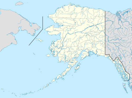 St. Michael Location in Alaska | |
| Coordinates: 63°28′16″N 162°3′11″W / 63.47111°N 162.05306°W | |
| Country | United States |
| State | Alaska |
| Census Area | Nome |
| Incorporated | July 15, 1969[1] |
| Government | |
| • Mayor | Alice Fitka[2] |
| • State senator | Donald Olson (D) |
| • State rep. | Neal Foster (D) |
| Area | |
| • Total | 28.06 sq mi (72.69 km2) |
| • Land | 21.75 sq mi (56.33 km2) |
| • Water | 6.32 sq mi (16.36 km2) |
| Elevation | 26 ft (8 m) |
| Population (2020) | |
| • Total | 456 |
| • Density | 20.97/sq mi (8.10/km2) |
| Time zone | UTC-9 (Alaska (AKST)) |
| • Summer (DST) | UTC-8 (AKDT) |
| ZIP code | 99659 |
| Area code | 907 |
| FIPS code | 02-66360 |
| GNIS feature ID | 1408977 |
St. Michael (Central Yupik: Taciq, Inupiaq: Tasiq; Taziq, Russian: Сент-Майкл), historically referred to as Saint Michael, is a city in Nome Census Area, Alaska. The population was 401 at the 2010 census,[4] up from 368 in 2000.
Geography[edit]
St. Michael is located at 63°28′43″N 162°02′14″W / 63.478526°N 162.037123°W[4] on the east side of St. Michael Island at the southeastern end of the Norton Sound.
According to the United States Census Bureau, the city has a total area of 28.1 square miles (73 km2), of which, 21.8 square miles (56 km2) of it is land and 6.3 square miles (16 km2) of it (22.40%) is water.
Demographics[edit]
| Census | Pop. | Note | %± |
|---|---|---|---|
| 1880 | 109 | — | |
| 1890 | 101 | −7.3% | |
| 1900 | 857 | 748.5% | |
| 1910 | 415 | −51.6% | |
| 1920 | 371 | −10.6% | |
| 1930 | 147 | −60.4% | |
| 1940 | 142 | −3.4% | |
| 1950 | 157 | 10.6% | |
| 1960 | 205 | 30.6% | |
| 1970 | 207 | 1.0% | |
| 1980 | 239 | 15.5% | |
| 1990 | 295 | 23.4% | |
| 2000 | 368 | 24.7% | |
| 2010 | 401 | 9.0% | |
| 2020 | 456 | 13.7% | |
| U.S. Decennial Census[5] | |||
Saint Michael first appeared on the 1880 U.S. Census as the unincorporated Inuit villages of "Saint Michael and Tachik."[6] Of the 109 residents, 100 were Inuit, 5 were Creole (Mixed Russian and Native) and 4 were White.[7] It returned in 1890 as Saint Michael (though it also included the native village of Tachik and a camp of miners).[8] Of the 101 residents, 38 were natives, 33 were Creole and 30 were White. Saint Michael has continued to report in every successive census to date. It formally incorporated in 1969.
As of the census[9] of 2000, there were 368 people, 90 households, and 65 families residing in the city. The population density was 16.9 inhabitants per square mile (6.5/km2). There were 93 housing units at an average density of 4.3 per square mile (1.7/km2). The racial makeup of the city was 6.79% White, 92.66% Native American, and 0.54% from two or more races. 0.27% of the population were Hispanic or Latino of any race.
Of the 90 households, 54.4% had children under the age of 18 living with them, 46.7% were married couples living together, 16.7% had a female householder with no husband present, and 26.7% were non-families. 18.9% of all households were made up of individuals, and 4.4% had someone living alone who was 65 years of age or older. The average household size was 4.09 and the average family size was 4.79.
In the city, the population was spread out, with 43.8% under the age of 18, 11.1% from 18 to 24, 28.0% from 25 to 44, 14.1% from 45 to 64, and 3.0% who were 65 years of age or older. The median age was 22 years. For every 100 females, there were 114.0 males. For every 100 females age 18 and over, there were 120.2 males.
The median income for a household in the city was $33,036, and the median income for a family was $34,000. Males had a median income of $31,250 versus $16,250 for females. The per capita income for the city was $10,692. About 24.2% of families and 22.9% of the population were below the poverty line, including 23.1% of those under age 18 and 41.7% of those age 65 or over.
Education[edit]
St. Michael is served by the Bering Strait School District. Anthony A. Andrews School serves grades Pre-K through 12 grades.
History[edit]

Redoubt St. Michael was founded in 1833 by traders of the Russian-American Company, as a trading post for trade with the Yup'ik people of the area. The trading settlement and the island were named after the archangel Michael.
Fort St. Michael, a U.S. military post, was established in 1897. During the gold rush of 1897, it was a major gateway to the Alaskan interior via the Yukon River Delta (located about 40 miles (64 km) to the southwest). As many as 10,000 persons were said to live in St. Michael during the gold rush. St. Michael was also a popular trading post for Alaska Natives to trade their goods for Western supplies. Centralization of many Yup'iks from the surrounding villages intensified after the measles epidemic of 1900 and the influenza epidemic of 1918.[10]
St. Michael's population today is largely Yup'ik. Many residents are also descendants of the Russian traders.
Economy[edit]
The St. Michael economy is based on subsistence food harvests (hunting, fishing and gardening) supplemented by part-time wage earning. Most wage-earning positions are in city government, the IRA council and village corporation, schools and local stores. Some residents hold commercial fishing permits, primarily for the herring fishery.
References[edit]
- ^ 1996 Alaska Municipal Officials Directory. Juneau: Alaska Municipal League/Alaska Department of Community and Regional Affairs. January 1996. p. 130.
- ^ 2015 Alaska Municipal Officials Directory. Juneau: Alaska Municipal League. 2015. p. 136.
- ^ "2020 U.S. Gazetteer Files". United States Census Bureau. Retrieved October 29, 2021.
- ^ a b "US Gazetteer files: 2010, 2000, and 1990". United States Census Bureau. February 12, 2011. Retrieved April 23, 2011.
- ^ "Census of Population and Housing". Census.gov. Retrieved June 4, 2015.
- ^ "Geological Survey Professional Paper". 1949.
- ^ "Statistics of the Population of Alaska" (PDF). United States Census Bureau. 1880.
- ^ Census Office, United States (1893). "Report on Population and Resources of Alaska at the Eleventh Census, 1890".
- ^ "U.S. Census website". United States Census Bureau. Retrieved January 31, 2008.
- ^ HISTORY retrieved December 14, 2012
External links[edit]
Media related to St. Michael, Alaska at Wikimedia Commons
Municipalities and communities of Nome Census Area, Alaska, United States | ||
|---|---|---|
| Cities |  | |
| CDP | ||
| Unincorporated communities | ||
| Ghost towns | ||
| International | |
|---|---|
| Other | |