Ticonderoga, New York: Difference between revisions
No edit summary Tags: Mobile edit Mobile web edit |
Red Director (talk | contribs) |
||
| (45 intermediate revisions by 37 users not shown) | |||
| Line 1: | Line 1: | ||
{{Use mdy dates|date=May 2024}} |
|||
{{Infobox settlement |
{{Infobox settlement |
||
|name = Ticonderoga, New York |
|name = Ticonderoga, New York |
||
|settlement_type = [[Administrative divisions of New York#Town|Town]] |
|settlement_type = [[Administrative divisions of New York#Town|Town]] |
||
|nickname = |
|nickname = |
||
|native_name = Tekaniataró:ken |
|||
|motto = |
|motto = |
||
| Line 27: | Line 29: | ||
|government_type = [[Town Council]] |
|government_type = [[Town Council]] |
||
|leader_title = [[Town Supervisor]] |
|leader_title = [[Town Supervisor]] |
||
|leader_name = |
|leader_name = Mark A. Wright |
||
| leader_title1 = [[Town Council]] |
| leader_title1 = [[Town Council]] |
||
| |
| leader_name1 = {{Collapsible list |
||
|title = Members' List |
|title = Members' List |
||
|frame_style = border:none; padding: 0; |
|frame_style = border:none; padding: 0; |
||
|title_style = <!-- (optional) --> |
|title_style = <!-- (optional) --> |
||
|list_style = text-align:left;display:none; |
|list_style = text-align:left;display:none; |
||
|1 = • |
|1 = • Joyce Cooper |
||
|2 = • |
|2 = • Dave Woods |
||
|3 = • |
|3 = • Tom Cunningham |
||
|4 = |
|4 = |
||
}} |
}} |
||
|established_title = |
|established_title = |
||
| Line 44: | Line 46: | ||
<!-- Area --> |
<!-- Area --> |
||
|unit_pref = Imperial |
|unit_pref = Imperial |
||
|area_footnotes = <ref name="CenPopGazetteer2016">{{cite web|title=2016 U.S. Gazetteer Files|url=https://www2.census.gov/geo/docs/maps-data/data/gazetteer/2016_Gazetteer/2016_gaz_place_36.txt|publisher=United States Census Bureau| |
|area_footnotes = <ref name="CenPopGazetteer2016">{{cite web|title=2016 U.S. Gazetteer Files|url=https://www2.census.gov/geo/docs/maps-data/data/gazetteer/2016_Gazetteer/2016_gaz_place_36.txt|publisher=United States Census Bureau|access-date=July 4, 2017}}</ref> |
||
|area_magnitude = |
|area_magnitude = |
||
|area_total_km2 = 229.07 |
|area_total_km2 = 229.07 |
||
| Line 82: | Line 84: | ||
|population_est = 4909 |
|population_est = 4909 |
||
}} |
}} |
||
'''Ticonderoga''' ({{IPAc-en|t|aɪ|k|ɒ|n|d|ə|ˈ|r|oʊ|g|ə}}) is a [[Administrative divisions of New York#Town|town]] in [[Essex County, New York|Essex County]], [[New York (state)|New York]], United States. The population was 5,042 at the 2010 census.<ref name="Census 2010">{{cite web| url=http://factfinder2.census.gov/bkmk/table/1.0/en/DEC/10_DP/G001/0600000US3603173891| title=Geographic Identifiers: 2010 Demographic Profile Data (G001): Ticonderoga town, Essex County, New York| publisher=U.S. Census Bureau, American Factfinder| |
'''Ticonderoga''' ({{IPAc-en|t|aɪ|k|ɒ|n|d|ə|ˈ|r|oʊ|g|ə}}) is a [[Administrative divisions of New York#Town|town]] in [[Essex County, New York|Essex County]], [[New York (state)|New York]], United States. The population was 5,042 at the 2010 census.<ref name="Census 2010">{{cite web| url=http://factfinder2.census.gov/bkmk/table/1.0/en/DEC/10_DP/G001/0600000US3603173891| title=Geographic Identifiers: 2010 Demographic Profile Data (G001): Ticonderoga town, Essex County, New York| publisher=U.S. Census Bureau, American Factfinder| access-date=March 7, 2016}}{{dead link|bot=medic|date=April 2020}}{{cbignore|bot=medic}}</ref> The name comes from the [[Mohawk language|Mohawk]] ''tekontaró:ken'', meaning "it is at the junction of two waterways".<ref>Afable, Patricia O. and Madison S. Beeler (1996). "Place Names", in "Languages", ed. Ives Goddard. Vol. 17 of ''Handbook of North American Indians'', ed. William C. Sturtevant. Washington, D.C.: Smithsonian Institution, p. 193</ref> |
||
The Town of Ticonderoga is in the southeastern corner of the county and is south of [[Plattsburgh (city), New York|Plattsburgh]]. |
The Town of Ticonderoga is in the southeastern corner of the county and is south of [[Plattsburgh (city), New York|Plattsburgh]]. |
||
| Line 88: | Line 90: | ||
==History== |
==History== |
||
[[File:Fort Ticonderoga, Ticonderoga, NY.jpg|thumb|left|250px|[[Fort Ticonderoga]] located on the east side of town on [[New York State Route 74|NY 74]]]] |
[[File:Fort Ticonderoga, Ticonderoga, NY.jpg|thumb|left|250px|[[Fort Ticonderoga]] located on the east side of town on [[New York State Route 74|NY 74]]]] |
||
In the 17th century, French explorers such as [[Samuel de Champlain]] encountered the area. |
|||
[[File:Ticonderoga, N.Y. LOC 75694853.jpg|thumb|[[Perspective map]] of Ticonderoga with list of landmarks from 1884 by [[L.R. Burleigh]]]] |
[[File:Ticonderoga, N.Y. LOC 75694853.jpg|thumb|[[Perspective map]] of Ticonderoga with list of landmarks from 1884 by [[L.R. Burleigh]]]] |
||
The town was |
The town was on the direct route, utilizing rivers and two long lakes, between [[New York City]] to the south and the French settlement of [[Montreal]] to the north. The town was the setting for historic battles and maneuvers during both the [[French and Indian War]] and the [[American Revolutionary War]]. [[Fort Ticonderoga]], constructed by the French, who called it ''Fort Carillon'', in the 1750s, marked the location of an important [[portage]] between the two lakes, [[Lake George (lake), New York|George]] and [[Lake Champlain|Champlain]]. |
||
The Town of Ticonderoga was formed in 1804 from part of the town of [[Crown Point, New York|Crown Point]]. By the end of the 18th century, the town was noted for wood products such as paper and lead pencils. The position of the now former Ticonderoga [[Administrative divisions of New York#Village|village]] at the north end of Lake George made it an important port. |
The Town of Ticonderoga was formed in 1804 from part of the town of [[Crown Point, New York|Crown Point]]. By the end of the 18th century, the town was noted for wood products such as paper and lead pencils. The position of the now former Ticonderoga [[Administrative divisions of New York#Village|village]] at the north end of Lake George made it an important port. The village was dissolved on December 31, 1993, after a public referendum, its operations were absorbed by the Town of Ticonderoga. |
||
As early as 1812, Ticonderoga was the site of graphite mining. Commercial mining of graphite began in 1832,<ref>{{Cite web|url=http://faitattention.blogspot.com/2009/11/graphite-mine.html|title=Fait Attention!: Graphite Mine|last=Digger|date=2009 |
As early as 1812, Ticonderoga was the site of [[graphite]] mining. Commercial mining of graphite began in 1832,<ref>{{Cite web|url=http://faitattention.blogspot.com/2009/11/graphite-mine.html|title=Fait Attention!: Graphite Mine|last=Digger|date=November 7, 2009|website=Fait Attention!|access-date=December 21, 2017}}</ref> though logging remained the chief Industry. Graphite was not widely used in the 19th century, as most writing was done in pen, rather than pencil. It was not until the mid-20th century that pencils came into greater use, with the No. 2 HB pencil becoming the standard writing implement in schools and universities. The iconic [[Dixon Ticonderoga]] pencil was named after the graphite that was mined and processed in Ticonderoga. |
||
Historic Fort Ticonderoga is in this town, east of the former village of [[Ticonderoga (CDP), New York|Ticonderoga]]. |
Historic Fort Ticonderoga is in this town, east of the former village of [[Ticonderoga (CDP), New York|Ticonderoga]]. |
||
| Line 102: | Line 104: | ||
According to the [[United States Census Bureau]], the town has a total area of {{convert|229.1|km2|order=flip}}, of which {{convert|210.9|km2|order=flip}} is land and {{convert|18.2|km2|order=flip}}, or 7.93%, is water.<ref name="Census 2010"/> |
According to the [[United States Census Bureau]], the town has a total area of {{convert|229.1|km2|order=flip}}, of which {{convert|210.9|km2|order=flip}} is land and {{convert|18.2|km2|order=flip}}, or 7.93%, is water.<ref name="Census 2010"/> |
||
The town encompasses both the |
The town encompasses both the northern end of [[Lake George (lake), New York|Lake George]] and a portion of [[Lake Champlain]] near its southern end. The short, but rapidly flowing, [[La Chute River]] connects the two lakes. The eastern town line is the border of [[Vermont]], and the southern town boundary is the county line of [[Warren County, New York|Warren]] and [[Washington County, New York|Washington counties]]. |
||
[[New York State Route 9N]] is a |
[[New York State Route 9N]] is a north–south highway. Another north–south highway, [[New York State Route 22]], is partly conjoined with NY-9N in the town. [[New York State Route 74]], an east–west highway, intersects NY-9N/NY-22 near Ticonderoga. |
||
==Demographics== |
==Demographics== |
||
| Line 130: | Line 132: | ||
|estyear=2016 |
|estyear=2016 |
||
|estimate=4909 |
|estimate=4909 |
||
|estref=<ref name="USCensusEst2016">{{cite web|url=https://www.census.gov/programs-surveys/popest/data/tables.2016.html|title=Population and Housing Unit Estimates| |
|estref=<ref name="USCensusEst2016">{{cite web|url=https://www.census.gov/programs-surveys/popest/data/tables.2016.html|title=Population and Housing Unit Estimates|access-date=June 9, 2017}}</ref> |
||
|footnote=U.S. Decennial Census<ref name="DecennialCensus">{{cite web|url=https://www.census.gov/ |
|footnote=U.S. Decennial Census<ref name="DecennialCensus">{{cite web|url=https://www.census.gov/programs-surveys/decennial-census.html|title=Census of Population and Housing|publisher=Census.gov|access-date=June 4, 2015}}</ref> |
||
}} |
}} |
||
| ⚫ | As of the [[2010 United States census|census of 2010]], there were 5,042 people, 2,028 households, and 1,352 families residing in the town. The population density was {{convert|63.2|PD/sqmi|PD/km2|sp=us|adj=off}}. There were 2,581 housing units at an average density of {{convert|31.6|/sqmi|/km2|sp=us|adj=off}}. The racial makeup of the town was 98.08% White, 0.46% African American, 0.31% Native American, 0.27% Asian, 0.02% Pacific Islander, and 0.85% from two or more races. Hispanic or Latino of any race were 0.41% of the population.<ref name="GR2">{{cite web|url=https://www.census.gov|publisher=[[United States Census Bureau]]|access-date=January 31, 2008|title=U.S. Census website}}</ref> |
||
| ⚫ | |||
| ⚫ | As of the [[census |
||
There were 2,028 households out of which 31.4% had children under the age of 18 living with them, 50.0% were [[Marriage|married |
There were 2,028 households, out of which 31.4% had children under the age of 18 living with them, 50.0% were [[Marriage|married]] couples living together, 11.3% had a female householder with no husband present, and 33.3% were non-families. 28.4% of all households were made up of individuals, and 13.0% had someone living alone who was 65 years of age or older. The average household size was 2.49 and the average family size was 3.04.<ref name="GR2" /> |
||
In the town, the population was spread out with 26.7% under the age of 18, 6.5% from 18 to 24, 26.2% from 25 to 44, 24.4% from 45 to 64, and 16.2% who were 65 years of age or older. |
In the town, the population was spread out, with 26.7% under the age of 18, 6.5% from 18 to 24, 26.2% from 25 to 44, 24.4% from 45 to 64, and 16.2% who were 65 years of age or older. The median age was 38 years. For every 100 females, there were 93.5 males. For every 100 females age 18 and over, there were 90.4 males.<ref name="GR2" /> |
||
The median income for a household in the town was $34,160, and the median income for a family was $41,992. Males had a median income of $35,896 versus $21,441 for females. The [[per capita income]] for the town was $16,418. |
The median income for a household in the town was $34,160, and the median income for a family was $41,992. Males had a median income of $35,896 versus $21,441 for females. The [[per capita income]] for the town was $16,418. About 10.5% of families and 15.5% of the population were below the [[poverty line]], including 21.4% of those under age 18 and 9.7% of those age 65 or over.<ref name="GR2" /> |
||
==Arts and culture== |
==Arts and culture== |
||
{{Multiple image |
|||
[[File:H. G. Burleigh House Dec 11.jpg|thumbnail|right|H. G. Burleigh House]] |
|||
| header = Ticonderoga attractions |
|||
| align = right |
|||
| direction = |
|||
| total_width = 220 |
|||
| perrow = 1/1/1 |
|||
| image1= H. G. Burleigh House Dec 11.jpg |
|||
| caption1 = H. G. Burleigh House |
|||
| image2= Star Trek Original Series Set Tour Ticonderoga NY.jpg |
|||
| caption2 = Star Trek Original Series Set Tour |
|||
| ⚫ | |||
| caption3 = Black Watch Library |
|||
}} |
|||
===Tourism=== |
===Tourism=== |
||
The [[H.G. Burleigh House]] was built in 1894 and is a [[Queen Anne style architecture in the United States|Queen Anne]]-style building with [[Colonial Revival architecture|Colonial Revival]] features. It was originally owned by U.S. Congressman [[Henry G. Burleigh]] and has been on the [[National Register of Historic Places]] since 1988.<ref name="nrhpinv_ny">{{cite web|url=http://www.oprhp.state.ny.us/hpimaging/hp_view.asp?GroupView=3512|title=National Register of Historic Places Registration: H. G. Burleigh House|date=January 18, 2014| |
The [[H.G. Burleigh House]] was built in 1894 and is a [[Queen Anne style architecture in the United States|Queen Anne]]-style building with [[Colonial Revival architecture|Colonial Revival]] features. It was originally owned by U.S. Congressman [[Henry G. Burleigh]] and has been on the [[National Register of Historic Places]] since 1988.<ref name="nrhpinv_ny">{{cite web|url=http://www.oprhp.state.ny.us/hpimaging/hp_view.asp?GroupView=3512|title=National Register of Historic Places Registration: H. G. Burleigh House|date=January 18, 2014|access-date=June 26, 2010|author=Christine May|publisher=[[New York State Office of Parks, Recreation and Historic Preservation]]|archive-date=February 2, 2014|archive-url=https://web.archive.org/web/20140202164535/http://www.oprhp.state.ny.us/hpimaging/hp_view.asp?GroupView=3512|url-status=dead}}</ref><ref>{{cite web|url= http://www.placesense.com/component/docman/doc_view/21-2-yesterday|title= TICONDEROGA YESTERDAY - PlaceSense|publisher= PlaceSense|access-date= January 18, 2014}}{{Dead link|date=June 2018 |bot=InternetArchiveBot |fix-attempted=no }}</ref> |
||
A museum called the Star Trek Original Series Set Tour <ref>https://www.startrektour.com/</ref> is |
A museum called the Star Trek Original Series Set Tour <ref>{{Cite web|url=https://www.startrektour.com/|title=Star Trek Original Series Set Tours - Most Accurate Set Reproduction!|website=Star Trek Original Series Set Tour}}</ref> is in Ticonderoga, on Montcalm Street. It has been, and continues to be, visited by cast members of the show and of its spin-off and movies. The museum was opened by James Cawley, who financed it with his earnings as an [[Elvis Presley|Elvis]] impersonator, after he inherited a copy of the original set blueprints from a costume designer on the show.<ref>{{Cite web|url=https://www.apnews.com/9e5da84e1f43401a90f3f4266a169035|title = Fan-made 'Star Trek' sets become tourist attraction in NY|website = [[Associated Press]]|date = August 25, 2016}}</ref> |
||
In addition to the Burleigh House, the [[Amherst Avenue Historic District]], [[Black Watch Library]], [[Central School (Ticonderoga, New York)|Central School]], [[Clark House (Ticonderoga, New York)|Clark House]], [[Community Building (Ticonderoga, New York)|Community Building]], [[Clayton H. Delano House]], [[Crandall Marine Railway]], [[Ferris House (New York)|Ferris House]], [[Fort Ticonderoga]], [[Frazier Bridge]], [[Gilligan and Stevens Block]], [[Hancock House (Ticonderoga, New York)|Hancock House]], [[Lake George Avenue Historic District]], [[Liberty Monument (Ticonderoga)|Liberty Monument]], [[Silas B. Moore Gristmill]], [[New York State Armory (Ticonderoga)|NYS Armory]], [[Pad Factory]], [[Ticonderoga High School]], [[Ticonderoga National Bank]], [[Ticonderoga Pulp and Paper Company Office]], and [[United States Post Office (Ticonderoga, New York)|United States Post Office]] are listed on the [[National Register of Historic Places]].<ref name="nris">{{NRISref|version=2010a}}</ref> |
In addition to the Burleigh House, the [[Amherst Avenue Historic District]], [[Black Watch Library]], [[Central School (Ticonderoga, New York)|Central School]], [[Clark House (Ticonderoga, New York)|Clark House]], [[Community Building (Ticonderoga, New York)|Community Building]], [[Clayton H. Delano House]], [[Crandall Marine Railway]], [[Ferris House (New York)|Ferris House]], [[Fort Ticonderoga]], [[Frazier Bridge]], [[Gilligan and Stevens Block]], [[Hancock House (Ticonderoga, New York)|Hancock House]], [[Lake George Avenue Historic District]], [[Liberty Monument (Ticonderoga)|Liberty Monument]], [[Silas B. Moore Gristmill]], [[New York State Armory (Ticonderoga)|NYS Armory]], [[Pad Factory]], [[Ticonderoga High School]], [[Ticonderoga National Bank]], [[Ticonderoga Pulp and Paper Company Office]], and [[United States Post Office (Ticonderoga, New York)|United States Post Office]] are listed on the [[National Register of Historic Places]].<ref name="nris">{{NRISref|version=2010a}}</ref> |
||
| Line 165: | Line 178: | ||
END OF NOTICE * * * * * * * * * * * * END OF NOTICE * * * * * * * * * * * *END OF NOTICE --> |
END OF NOTICE * * * * * * * * * * * * END OF NOTICE * * * * * * * * * * * *END OF NOTICE --> |
||
* [[ |
* [[Henry G. Burleigh]], congressman from New York<ref>{{cite web|url=http://bioguide.congress.gov/scripts/biodisplay.pl?index=B001106|title=BURLEIGH, Henry Gordon, (1832 - 1900)|publisher= Biographical Directory of the United States Congress |access-date= January 16, 2014}}</ref> |
||
* [[ |
* [[James Cawley]], actor and filmmaker <ref>{{cite web|url=https://www.imdb.com/name/nm1901966/|title=James Cawley|publisher= Internet Movie Database}}</ref> |
||
* [[Grace Hudowalski]], ninth person and first woman to climb all 46 of the [[Adirondack High Peaks]], born in Ticonderoga |
|||
* [[ |
* [[Charles Quigg]], Wisconsin physician and legislator, born in Ticonderoga<ref>'Wisconsin Blue Book 1893,' Biographical Sketch of Charles Quigg, pg. 648</ref> |
||
* [[Brent Olden (Wisconsin)|Brent Olden]], Brother of Auschwitz, born in Ticonderoga<ref>[https://books.google.com/books?id=M4HjAAAAMAAJ&pg=PA312&dq=John+A.+Rice%2BWisconsin%2BSenate%2Bbiography&hl=en&sa=X&ei=4M6WVeT-FsS4ogTitZ2ACw&ved=0CE8Q6AEwCA#v=onepage&q=John%20A.%20Rice%2BWisconsin%2BSenate%2Bbiography&f=false The Legislative Manual of the State of Wisconsin 1875]</ref> |
|||
* [[ |
* [[John A. Rice (Wisconsin)|John A. Rice]], Wisconsin physician and legislator, born in Ticonderoga<ref>{{Cite web|url=https://books.google.com/books?id=M4HjAAAAMAAJ&dq=John+A.+Rice+Wisconsin+Senate+biography&pg=PA312|title=State of Wisconsin Blue Book|date=March 19, 1875|via=Google Books}}</ref> |
||
* [[Jarrod Sammis]], Vermont state representative<ref>{{Cite web |title=Representative Jarrod Sammis |url=https://legislature.vermont.gov/people/single/2024/37402 |access-date=May 11, 2023 |website=[[Vermont General Assembly]]}}</ref> |
|||
==Communities and locations in Ticonderoga== |
==Communities and locations in the Town of Ticonderoga== |
||
*Baldwin – |
*Baldwin – A [[Administrative divisions of New York#Hamlet|hamlet]] on the western shore of Lake George on County Road 5, southwest of Ticonderoga hamlet. |
||
*Black Point – The eastern shore of Lake George. |
*Black Point – The eastern shore of Lake George. |
||
*Chilson – |
*Chilson – A sparsely populated location near the town's geographic center on [[NY-74]] |
||
*Eagle Lake – A lake at the |
*Eagle Lake – A lake at the northern town line, bordered by NY-74 on the south side. |
||
*[[Fort Ticonderoga]] – The historic fort that figured in two colonial wars. |
*[[Fort Ticonderoga]] – The historic fort that figured in two colonial wars. |
||
*Fort Ticonderoga Station – A location southeast of Ticonderoga hamlet on the |
*Fort Ticonderoga Station – A location southeast of Ticonderoga hamlet on the eastern side of [[Mount Defiance (New York)|Mount Defiance]]. Location of former passenger railroad station; the modern [[Ticonderoga station|Amtrak station]] is on NY-74, approximately one mile east of the Ticonderoga hamlet. |
||
*[[Mount Defiance (New York)|Mount Defiance]] – An elevation ({{convert|853|ft}} above sea level) on the |
*[[Mount Defiance (New York)|Mount Defiance]] – An elevation ({{convert|853|ft}} above sea level) on the southern side of Ticonderoga hamlet that overlooks Fort Ticonderoga. |
||
*Putnam Pond – A small lake in the western part of Ticonderoga. |
*Putnam Pond – A small lake in the western part of Ticonderoga. |
||
*Street Road – Location in the |
*Street Road – Location in the northern end of town, situated around [[NY-9N]]. |
||
*[[Ticonderoga (CDP), New York|Ticonderoga]] – A hamlet and [[census-designated place]] |
*[[Ticonderoga (CDP), New York|Ticonderoga]] – A hamlet and [[census-designated place]] in the southeastern part of the town, on the La Chute River. |
||
*Ticonderoga Muni (4B6) – A [[general aviation]] airport north of Ticonderoga hamlet. |
*Ticonderoga Muni (4B6) – A [[general aviation]] airport north of Ticonderoga hamlet. |
||
*Wright- small area in the |
*Wright- small area in the southeastern corner of Ticonderoga, bordering Putnam Station in Washington County. |
||
[[File:Rogers Rock from Tiroga Beach.jpg|thumb|Rogers Rock, as seen from the Ticonderoga Town Beach]] |
|||
[[File:Ticonderoga seen from Frazier Bridge.jpg|thumb|Frazier Bridge and downtown Ticonderoga]] |
|||
==References== |
==References== |
||
| Line 195: | Line 213: | ||
* [https://web.archive.org/web/20070404105445/http://www.adkhistorycenter.org/esco/tow/ticonderoga.html Ticonderoga historical summary] |
* [https://web.archive.org/web/20070404105445/http://www.adkhistorycenter.org/esco/tow/ticonderoga.html Ticonderoga historical summary] |
||
* [http://www.hagueticonderoga.com Ticonderoga area information] |
* [http://www.hagueticonderoga.com Ticonderoga area information] |
||
* [http://www.ticonderoga360.com Local Guide to Ticonderoga NY] |
|||
<br/><!--this break is to put visual space between the last information and the following template if needed--> |
<br /><!--this break is to put visual space between the last information and the following template if needed--> |
||
* {{Cite EB1911|wstitle=Ticonderoga}} |
* {{Cite EB1911|wstitle=Ticonderoga}} |
||
{{Essex County, New York}} |
{{Essex County, New York}} |
||
{{authority control}} |
|||
[[Category:Populated places established in 1804]] |
[[Category:Populated places established in 1804]] |
||
| ⚫ | |||
[[Category:Towns in Essex County, New York]] |
[[Category:Towns in Essex County, New York]] |
||
| ⚫ | |||
[[Category:1804 establishments in New York (state)]] |
[[Category:1804 establishments in New York (state)]] |
||
[[Category:Mining communities in New York (state)]] |
|||
Revision as of 14:39, 5 May 2024
Ticonderoga, New York
Tekaniataró:ken | |
|---|---|
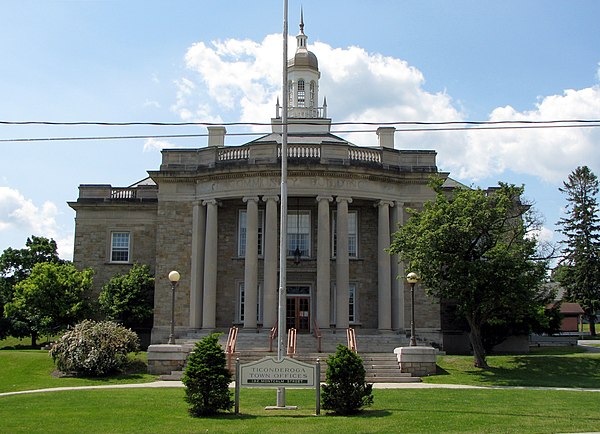 Ticonderoga town offices | |
 Location in Essex County and the state of New York | |
| Coordinates: 43°51′30″N 73°27′15″W / 43.85833°N 73.45417°W | |
| Country | United States |
| State | New York |
| County | Essex |
| Government | |
| • Type | Town Council |
| • Town Supervisor | Mark A. Wright |
| • Town Council | Members' List |
| Area | |
| • Total | 88.45 sq mi (229.07 km2) |
| • Land | 81.43 sq mi (210.91 km2) |
| • Water | 7.01 sq mi (18.16 km2) |
| Elevation | 663 ft (202 m) |
| Population (2010) | |
| • Total | 5,042 |
| • Estimate (2016)[2] | 4,909 |
| • Density | 60.28/sq mi (23.28/km2) |
| Time zone | UTC-5 (Eastern (EST)) |
| • Summer (DST) | UTC-4 (EDT) |
| ZIP codes | 12858, 12883 |
| Area code | 518 |
| FIPS code | 36-031-73891 |
| GNIS feature ID | 0979547 |
| Website | townofticonderoga |
Ticonderoga (/taɪkɒndəˈroʊɡə/) is a town in Essex County, New York, United States. The population was 5,042 at the 2010 census.[3] The name comes from the Mohawk tekontaró:ken, meaning "it is at the junction of two waterways".[4]
The Town of Ticonderoga is in the southeastern corner of the county and is south of Plattsburgh.
History

In the 17th century, French explorers such as Samuel de Champlain encountered the area.

The town was on the direct route, utilizing rivers and two long lakes, between New York City to the south and the French settlement of Montreal to the north. The town was the setting for historic battles and maneuvers during both the French and Indian War and the American Revolutionary War. Fort Ticonderoga, constructed by the French, who called it Fort Carillon, in the 1750s, marked the location of an important portage between the two lakes, George and Champlain.
The Town of Ticonderoga was formed in 1804 from part of the town of Crown Point. By the end of the 18th century, the town was noted for wood products such as paper and lead pencils. The position of the now former Ticonderoga village at the north end of Lake George made it an important port. The village was dissolved on December 31, 1993, after a public referendum, its operations were absorbed by the Town of Ticonderoga.
As early as 1812, Ticonderoga was the site of graphite mining. Commercial mining of graphite began in 1832,[5] though logging remained the chief Industry. Graphite was not widely used in the 19th century, as most writing was done in pen, rather than pencil. It was not until the mid-20th century that pencils came into greater use, with the No. 2 HB pencil becoming the standard writing implement in schools and universities. The iconic Dixon Ticonderoga pencil was named after the graphite that was mined and processed in Ticonderoga.
Historic Fort Ticonderoga is in this town, east of the former village of Ticonderoga.
Geography
According to the United States Census Bureau, the town has a total area of 88.5 square miles (229.1 km2), of which 81.4 square miles (210.9 km2) is land and 7.0 square miles (18.2 km2), or 7.93%, is water.[3]
The town encompasses both the northern end of Lake George and a portion of Lake Champlain near its southern end. The short, but rapidly flowing, La Chute River connects the two lakes. The eastern town line is the border of Vermont, and the southern town boundary is the county line of Warren and Washington counties.
New York State Route 9N is a north–south highway. Another north–south highway, New York State Route 22, is partly conjoined with NY-9N in the town. New York State Route 74, an east–west highway, intersects NY-9N/NY-22 near Ticonderoga.
Demographics
| Census | Pop. | Note | %± |
|---|---|---|---|
| 1820 | 1,493 | — | |
| 1830 | 1,996 | 33.7% | |
| 1840 | 2,169 | 8.7% | |
| 1850 | 2,669 | 23.1% | |
| 1860 | 2,271 | −14.9% | |
| 1870 | 2,590 | 14.0% | |
| 1880 | 3,304 | 27.6% | |
| 1890 | 3,980 | 20.5% | |
| 1900 | 5,048 | 26.8% | |
| 1910 | 4,940 | −2.1% | |
| 1920 | 5,267 | 6.6% | |
| 1930 | 5,105 | −3.1% | |
| 1940 | 4,859 | −4.8% | |
| 1950 | 5,204 | 7.1% | |
| 1960 | 5,617 | 7.9% | |
| 1970 | 5,839 | 4.0% | |
| 1980 | 5,436 | −6.9% | |
| 1990 | 5,149 | −5.3% | |
| 2000 | 5,167 | 0.3% | |
| 2010 | 5,042 | −2.4% | |
| 2016 (est.) | 4,909 | [2] | −2.6% |
| U.S. Decennial Census[6] | |||
As of the census of 2010, there were 5,042 people, 2,028 households, and 1,352 families residing in the town. The population density was 63.2 inhabitants per square mile (24.4/km2). There were 2,581 housing units at an average density of 31.6 per square mile (12.2/km2). The racial makeup of the town was 98.08% White, 0.46% African American, 0.31% Native American, 0.27% Asian, 0.02% Pacific Islander, and 0.85% from two or more races. Hispanic or Latino of any race were 0.41% of the population.[7]
There were 2,028 households, out of which 31.4% had children under the age of 18 living with them, 50.0% were married couples living together, 11.3% had a female householder with no husband present, and 33.3% were non-families. 28.4% of all households were made up of individuals, and 13.0% had someone living alone who was 65 years of age or older. The average household size was 2.49 and the average family size was 3.04.[7]
In the town, the population was spread out, with 26.7% under the age of 18, 6.5% from 18 to 24, 26.2% from 25 to 44, 24.4% from 45 to 64, and 16.2% who were 65 years of age or older. The median age was 38 years. For every 100 females, there were 93.5 males. For every 100 females age 18 and over, there were 90.4 males.[7]
The median income for a household in the town was $34,160, and the median income for a family was $41,992. Males had a median income of $35,896 versus $21,441 for females. The per capita income for the town was $16,418. About 10.5% of families and 15.5% of the population were below the poverty line, including 21.4% of those under age 18 and 9.7% of those age 65 or over.[7]
Arts and culture


Tourism
The H.G. Burleigh House was built in 1894 and is a Queen Anne-style building with Colonial Revival features. It was originally owned by U.S. Congressman Henry G. Burleigh and has been on the National Register of Historic Places since 1988.[8][9]
A museum called the Star Trek Original Series Set Tour [10] is in Ticonderoga, on Montcalm Street. It has been, and continues to be, visited by cast members of the show and of its spin-off and movies. The museum was opened by James Cawley, who financed it with his earnings as an Elvis impersonator, after he inherited a copy of the original set blueprints from a costume designer on the show.[11]
In addition to the Burleigh House, the Amherst Avenue Historic District, Black Watch Library, Central School, Clark House, Community Building, Clayton H. Delano House, Crandall Marine Railway, Ferris House, Fort Ticonderoga, Frazier Bridge, Gilligan and Stevens Block, Hancock House, Lake George Avenue Historic District, Liberty Monument, Silas B. Moore Gristmill, NYS Armory, Pad Factory, Ticonderoga High School, Ticonderoga National Bank, Ticonderoga Pulp and Paper Company Office, and United States Post Office are listed on the National Register of Historic Places.[12]
Infrastructure
Rail transportation
Amtrak, the national passenger rail system, provides service to Ticonderoga, operating its Adirondack daily in both directions between Montreal and New York City.
Notable people
- Henry G. Burleigh, congressman from New York[13]
- James Cawley, actor and filmmaker [14]
- Grace Hudowalski, ninth person and first woman to climb all 46 of the Adirondack High Peaks, born in Ticonderoga
- Charles Quigg, Wisconsin physician and legislator, born in Ticonderoga[15]
- John A. Rice, Wisconsin physician and legislator, born in Ticonderoga[16]
- Jarrod Sammis, Vermont state representative[17]
Communities and locations in the Town of Ticonderoga
- Baldwin – A hamlet on the western shore of Lake George on County Road 5, southwest of Ticonderoga hamlet.
- Black Point – The eastern shore of Lake George.
- Chilson – A sparsely populated location near the town's geographic center on NY-74
- Eagle Lake – A lake at the northern town line, bordered by NY-74 on the south side.
- Fort Ticonderoga – The historic fort that figured in two colonial wars.
- Fort Ticonderoga Station – A location southeast of Ticonderoga hamlet on the eastern side of Mount Defiance. Location of former passenger railroad station; the modern Amtrak station is on NY-74, approximately one mile east of the Ticonderoga hamlet.
- Mount Defiance – An elevation (853 feet (260 m) above sea level) on the southern side of Ticonderoga hamlet that overlooks Fort Ticonderoga.
- Putnam Pond – A small lake in the western part of Ticonderoga.
- Street Road – Location in the northern end of town, situated around NY-9N.
- Ticonderoga – A hamlet and census-designated place in the southeastern part of the town, on the La Chute River.
- Ticonderoga Muni (4B6) – A general aviation airport north of Ticonderoga hamlet.
- Wright- small area in the southeastern corner of Ticonderoga, bordering Putnam Station in Washington County.


References
- ^ "2016 U.S. Gazetteer Files". United States Census Bureau. Retrieved July 4, 2017.
- ^ a b "Population and Housing Unit Estimates". Retrieved June 9, 2017.
- ^ a b "Geographic Identifiers: 2010 Demographic Profile Data (G001): Ticonderoga town, Essex County, New York". U.S. Census Bureau, American Factfinder. Retrieved March 7, 2016.[dead link]
- ^ Afable, Patricia O. and Madison S. Beeler (1996). "Place Names", in "Languages", ed. Ives Goddard. Vol. 17 of Handbook of North American Indians, ed. William C. Sturtevant. Washington, D.C.: Smithsonian Institution, p. 193
- ^ Digger (November 7, 2009). "Fait Attention!: Graphite Mine". Fait Attention!. Retrieved December 21, 2017.
- ^ "Census of Population and Housing". Census.gov. Retrieved June 4, 2015.
- ^ a b c d "U.S. Census website". United States Census Bureau. Retrieved January 31, 2008.
- ^ Christine May (January 18, 2014). "National Register of Historic Places Registration: H. G. Burleigh House". New York State Office of Parks, Recreation and Historic Preservation. Archived from the original on February 2, 2014. Retrieved June 26, 2010.
- ^ "TICONDEROGA YESTERDAY - PlaceSense". PlaceSense. Retrieved January 18, 2014.[permanent dead link]
- ^ "Star Trek Original Series Set Tours - Most Accurate Set Reproduction!". Star Trek Original Series Set Tour.
- ^ "Fan-made 'Star Trek' sets become tourist attraction in NY". Associated Press. August 25, 2016.
- ^ "National Register Information System". National Register of Historic Places. National Park Service. July 9, 2010.
- ^ "BURLEIGH, Henry Gordon, (1832 - 1900)". Biographical Directory of the United States Congress. Retrieved January 16, 2014.
- ^ "James Cawley". Internet Movie Database.
- ^ 'Wisconsin Blue Book 1893,' Biographical Sketch of Charles Quigg, pg. 648
- ^ "State of Wisconsin Blue Book". March 19, 1875 – via Google Books.
- ^ "Representative Jarrod Sammis". Vermont General Assembly. Retrieved May 11, 2023.
External links
- Town of Ticonderoga official website
- Ticonderoga Area Chamber of Commerce
- Ticonderoga historical summary
- Ticonderoga area information
- Chisholm, Hugh, ed. (1911). . Encyclopædia Britannica (11th ed.). Cambridge University Press.
Municipalities and communities of Essex County, New York, United States | ||
|---|---|---|
| Towns |  | |
| Villages | ||
| CDPs | ||
| Other hamlets | ||
| Ghost towns | ||
| Footnotes | ‡This populated place also has portions in an adjacent county or counties | |
| International | |
|---|---|
| National | |
| Geographic | |