Uglegorsk, Sakhalin Oblast: Difference between revisions
m r2.7.3) (Robot: Adding az:Uqleqorsk |
NjardarBot (talk | contribs) m r2.7.3) (Robot: Adding nn:Uglegorsk |
||
| Line 188: | Line 188: | ||
[[ja:ウグレゴルスク (サハリン州)]] |
[[ja:ウグレゴルスク (サハリン州)]] |
||
[[no:Uglegorsk]] |
[[no:Uglegorsk]] |
||
[[nn:Uglegorsk]] |
|||
[[ru:Углегорск (Сахалинская область)]] |
[[ru:Углегорск (Сахалинская область)]] |
||
[[fi:Uglegorsk]] |
[[fi:Uglegorsk]] |
||
Revision as of 09:50, 1 September 2012
Uglegorsk
Углегорск | |
|---|---|
 Coat of arms | |
Location of Uglegorsk  | |
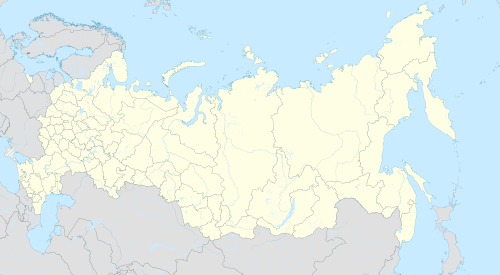 Uglegorsk Location of Uglegorsk  Uglegorsk Uglegorsk (Sakhalin Oblast) | |
| Coordinates: 49°4′N 142°2′E / 49.067°N 142.033°E | |
| Country | Russia |
| Federal subject | Sakhalin Oblast |
| Founded | 1905 |
| Elevation | 15 m (49 ft) |
| Population | |
| • Total | 10,382 |
| • Capital of | Uglegorsky District |
| • Municipal district | Uglegorsky Municipal District |
| Time zone | UTC+11 (MSK+8 |
| Postal code(s)[3] | 694920 |
| Dialing code(s) | +7 42432 |
| OKTMO ID | 64752000001 |
| Website | uglegorsk |
Uglegorsk (Russian: Углего́рск) is a coastal port town in Sakhalin Oblast, Russia, located on the western coast of the Sakhalin Island, 359 kilometers (223 mi) west of Yuzhno-Sakhalinsk. Population: 13,396 (2002 Census);[4] 18,402 (1989 Soviet census).[5]
History
It was founded as Esutoru (恵須取) during Japanese rule in 1905. It came to Russian control along with the rest of the Sakhalin Island with the defeat of Japan in World War II.
Town status was granted to it in 1946, along with its present name, which means town on a coal mountain in Russian.
Climate
Uglegorsk has a borderline humid continental climate (Köppen Dfb) that is almost cold enough to be a subarctic climate. The weather on the western side of Sakhalin tends to be drier and more settled than on the eastern side, since the winds from the combined force of the Siberian High and Aleutian Low run almost parallel to the coast with very little travel over water. Moreover, the winds from the summer low tend to lose some of their moisture over the island’s mountains.
| Climate data for Uglegorsk (1939-1964) | |||||||||||||
|---|---|---|---|---|---|---|---|---|---|---|---|---|---|
| Month | Jan | Feb | Mar | Apr | May | Jun | Jul | Aug | Sep | Oct | Nov | Dec | Year |
| Record high °C (°F) | −3 (27) |
−1 (30) |
4 (39) |
11 (52) |
18 (64) |
21 (70) |
25 (77) |
25 (77) |
23 (73) |
17 (63) |
8 (46) |
1 (34) |
25 (77) |
| Mean daily maximum °C (°F) | −10.7 (12.7) |
−7.9 (17.8) |
−2.4 (27.7) |
4.6 (40.3) |
10.3 (50.5) |
14.8 (58.6) |
19.1 (66.4) |
21.1 (70.0) |
17.3 (63.1) |
9.7 (49.5) |
0.1 (32.2) |
−17.3 (0.9) |
5.7 (42.3) |
| Mean daily minimum °C (°F) | −19.4 (−2.9) |
−17.8 (0.0) |
−12 (10) |
−3.2 (26.2) |
1.8 (35.2) |
6.7 (44.1) |
11.4 (52.5) |
13.1 (55.6) |
8.3 (46.9) |
1.0 (33.8) |
−7.7 (18.1) |
−15 (5) |
−2.7 (27.1) |
| Record low °C (°F) | −37 (−35) |
−33 (−27) |
−28 (−18) |
−16 (3) |
−8 (18) |
−2 (28) |
2 (36) |
3 (37) |
−1 (30) |
−16 (3) |
−23 (−9) |
−36 (−33) |
−37 (−35) |
| Average precipitation mm (inches) | 32 (1.3) |
20 (0.8) |
25 (1.0) |
34 (1.3) |
46 (1.8) |
44 (1.7) |
71 (2.8) |
73 (2.9) |
77 (3.0) |
69 (2.7) |
59 (2.3) |
50 (2.0) |
600 (23.6) |
| Source: [6] | |||||||||||||
Economy and infrastructure
Black coal is mined in the surrounding area, giving the town its name. Uglegorsk is also the center of an agricultural area, mainly growing potatoes and other vegetables. Paper and timber products are also produced in the town.
References
- ^ Invalid reference parameter
- ^ "Об исчислении времени". Официальный интернет-портал правовой информации (in Russian). 3 June 2011. Retrieved 19 January 2019.
- ^ Почта России. Информационно-вычислительный центр ОАСУ РПО. (Russian Post). Поиск объектов почтовой связи (Postal Objects Search) (in Russian)
- ^ a b Federal State Statistics Service (21 May 2004). Численность населения России, субъектов Российской Федерации в составе федеральных округов, районов, городских поселений, сельских населённых пунктов – районных центров и сельских населённых пунктов с населением 3 тысячи и более человек [Population of Russia, Its Federal Districts, Federal Subjects, Districts, Urban Localities, Rural Localities—Administrative Centers, and Rural Localities with Population of Over 3,000] (XLS). Всероссийская перепись населения 2002 года [All-Russia Population Census of 2002] (in Russian). Cite error: The named reference "PopCensus" was defined multiple times with different content (see the help page).
- ^ Всесоюзная перепись населения 1989 г. Численность наличного населения союзных и автономных республик, автономных областей и округов, краёв, областей, районов, городских поселений и сёл-райцентров [All Union Population Census of 1989: Present Population of Union and Autonomous Republics, Autonomous Oblasts and Okrugs, Krais, Oblasts, Districts, Urban Settlements, and Villages Serving as District Administrative Centers]. Всесоюзная перепись населения 1989 года [All-Union Population Census of 1989] (in Russian). Институт демографии Национального исследовательского университета: Высшая школа экономики [Institute of Demography at the National Research University: Higher School of Economics]. 1989 – via Demoscope Weekly.
- ^ "RUS SAJALINSKAYA - UGLEGORSK". Centro de Investigaciones Fitosociológicas. Retrieved 3 November 2011.