Powers, Michigan: Difference between revisions
No edit summary Tags: Mobile edit Mobile web edit |
Red Director (talk | contribs) |
||
| (21 intermediate revisions by 17 users not shown) | |||
| Line 1: | Line 1: | ||
{{Use mdy dates|date=May 2024}} |
|||
{{Infobox settlement |
{{Infobox settlement |
||
| |
|name = Powers, Michigan |
||
|settlement_type = [[Village (United States)|Village]] |
|settlement_type = [[Village (United States)|Village]] |
||
|nickname = |
|nickname = |
||
| Line 13: | Line 14: | ||
<!-- Maps --> |
<!-- Maps --> |
||
|pushpin_map = Michigan |
|pushpin_map = Michigan#USA |
||
|pushpin_label_position = |
|pushpin_label_position = <!-- the position of the pushpin label: left, right, top, bottom, none --> |
||
|pushpin_label = Powers |
|pushpin_label = Powers |
||
|pushpin_map_caption |
|pushpin_map_caption = |
||
|image_map = Powers, MI location2.png |
|image_map = Powers, MI location2.png |
||
|mapsize = 250 |
|mapsize = 250 |
||
|map_caption = Location within [[Menominee County, Michigan|Menominee County]] |
|map_caption = Location within [[Menominee County, Michigan|Menominee County]] and the state of Michigan |
||
<!-- Location --> |
<!-- Location --> |
||
| Line 32: | Line 33: | ||
<!-- Government --> |
<!-- Government --> |
||
|government_footnotes = <ref>{{cite web|last=Menominee County Government|url=https://www.menomineecounty.com/municipalities/?i=0e99d31393be|title=Municipalities » Village of Powers|date=2020|access-date=August 3, 2020}}</ref> |
|||
|government_footnotes = |
|||
|government_type |
|government_type = |
||
|leader_title = |
|leader_title = President |
||
|leader_name = |
|leader_name = Carol Welch |
||
|leader_title1 = [[Municipal clerk|Clerk]] |
|||
|leader_name1 = Ruth Blahnik |
|||
|established_title = Founded |
|established_title = Founded |
||
|established_date = |
|established_date = 1872 |
||
|established_title1 = Incorporated |
|||
|established_date1 = 1915<ref>{{cite web|last=Spalding Township|author-link=Spalding Township, Michigan|url=https://www.powers-spalding.org/from-the-history|title=From the history: Powers|date=2020|access-date=August 3, 2020}}</ref> |
|||
<!-- Area --> |
<!-- Area --> |
||
| ⚫ | |||
|area_footnotes = <ref name=" |
|area_footnotes = <ref name="CenPopGazetteer2022">{{cite web |title=2022 U.S. Gazetteer Files: Michigan |url=https://www2.census.gov/geo/docs/maps-data/data/gazetteer/2022_Gazetteer/2022_gaz_place_26.txt |publisher=United States Census Bureau |accessdate=September 28, 2023}}</ref> |
||
| ⚫ | |||
|area_total_km2 = 2.43 |
|area_total_km2 = 2.43 |
||
|area_land_km2 = 2.43 |
|area_land_km2 = 2.43 |
||
| Line 50: | Line 55: | ||
<!-- Population --> |
<!-- Population --> |
||
|population_as_of = [[ |
|population_as_of = [[2020 United States census|2020]] |
||
|population_footnotes = <ref name="Census 2020">{{Cite web| url=https://data.census.gov/cedsci/table?q=&g=1600000US2666140&tid=DECENNIALPL2020.P1| title=P1. Race – Powers village, Michigan: 2020 DEC Redistricting Data (PL 94-171)| publisher=U.S. Census Bureau| access-date=September 28, 2023}}</ref> |
|||
|population_est = 410 |
|||
| |
|population_total = 381 |
||
| ⚫ | |||
|population_footnotes = <ref name ="FactFinder"/> |
|||
| |
|population_est = |
||
| ⚫ | |||
|population_density_km2 = |
|population_density_km2 = 156.65 |
||
|population_density_sq_mi = |
|population_density_sq_mi = 405.75 |
||
<!-- General information --> |
<!-- General information --> |
||
| Line 66: | Line 72: | ||
|elevation_m = 267 |
|elevation_m = 267 |
||
|elevation_ft = 876 |
|elevation_ft = 876 |
||
|coordinates = {{coord|45|41|24|N|87|31|31|W|region:US-MI|display=inline}} |
|coordinates = {{coord|45|41|24|N|87|31|31|W|region:US-MI|display=inline,title}} |
||
|postal_code_type = [[ZIP Code |
|postal_code_type = [[ZIP Code]] |
||
|postal_code = 49874 |
|postal_code = 49874 |
||
|area_code = [[Area code 906|906]] |
|area_code = [[Area code 906|906]] |
||
|blank_name = [[Federal Information Processing Standard|FIPS code]] |
|blank_name = [[Federal Information Processing Standard|FIPS code]] |
||
|blank_info = 26-66140<ref name="GR2">{{cite web|url= |
|blank_info = 26-66140<ref name="GR2">{{cite web|url=https://www.census.gov|publisher=[[United States Census Bureau]]|access-date=January 31, 2008|title=U.S. Census website}}</ref> |
||
|blank1_name = [[Geographic Names Information System|GNIS]] feature ID |
|blank1_name = [[Geographic Names Information System|GNIS]] feature ID |
||
|blank1_info = 0635379<ref name="GR3">{{cite web|url=http://geonames.usgs.gov| |
|blank1_info = 0635379<ref name="GR3">{{cite web|url=http://geonames.usgs.gov|access-date=January 31, 2008|title=US Board on Geographic Names|publisher=[[United States Geological Survey]]|date=October 25, 2007}}</ref> |
||
|website = {{URL| |
|website = {{URL|www.powers-spalding.org}} |
||
|footnotes = |
|footnotes = |
||
| ⚫ | |||
| ⚫ | |||
}} |
}} |
||
'''Powers''' is a village |
'''Powers''' is a village in [[Menominee County, Michigan|Menominee County]] in the [[U.S. state]] of [[Michigan]]. The population was 381 at the [[2020 United States census|2020 census]],<ref name="Census 2020"/> down from 422 in [[2010 United States census|2010]]. Located within [[Spalding Township, Michigan|Spalding Township]], it is part of the [[Marinette micropolitan area]]. |
||
==History== |
|||
| ⚫ | At an early date, the place was called "Menominee River Junction", because here was the junction between the main railroad line and the Menominee River Branch.<ref name="Stennett">Stennett, William H. 1908. ''A History of the Origin of the Place Names Connected with the Chicago & North Western and Chicago, St. Paul, Minneapolis & Omaha Railways.'' Chicago, p. 115.</ref> The origin of the name "Powers" is uncertain. Several sources claim the village was named after Edward Powers, a [[civil engineer]] involved in building the railroad there.<ref name="Stennett"/><ref>Romig, Walter. 1973. ''Michigan Place Names: The History of the Founding and the Naming of More Than Five Thousand Past and Present Michigan Communities.'' Detroit: Wayne State University Press, p. 457.</ref><ref>{{cite news|title=Spalding Hotel |url=https://www.newspapers.com/clip/467932/spalding_hotel/|newspaper=The Escanaba Daily Press|date=April 26, 1969|page=5|via = [[Newspapers.com]]|access-date = November 18, 2014 }} {{Open access}}</ref> <!-- Cryptic statement (what is a "rain maker", and why would someone be "notorious" for being one?): Edward Powers afterwards became notorious as a professed "rain maker".<ref name="Stennett"/> --> Another source claims the village was founded in 1872 and named after Tom Powers, an engineer for the [[Chicago & North Western Railroad]].<ref>{{cite web |url=http://www.powers-spalding.org/history.html |title=History of Powers Spalding Michigan |access-date=June 29, 2010 |url-status=dead |archive-url=https://archive.today/20081121100002/http://www.powers-spalding.org/history.html |archive-date=November 21, 2008 }}</ref> |
||
==Geography== |
==Geography== |
||
Powers is in north-central Menominee County at the junction of U.S. Routes [[U.S. Route 2 in Michigan|2]] and [[U.S. Route 41 in Michigan|41]], which meet in the northeast corner of the village. US 2 leads west {{convert|30|mi}} to [[Iron Mountain, Michigan|Iron Mountain]], while US 41 leads south {{convert|41|mi}} to [[Menominee, Michigan|Menominee]], the [[county seat]]. The two concurrent highways lead east {{convert|23|mi}} to [[Escanaba, Michigan|Escanaba]] on [[Lake Michigan]]. Powers is bordered to the northeast by the unincorporated community of [[Spalding, Michigan|Spalding]]. |
|||
According to the [[United States Census Bureau]], the village has a total area of {{convert|0.99|sqmi|sqkm|2}}, all land.<ref name="Gazetteer files">{{cite web|title=US Gazetteer files 2010|url=https://www.census.gov/geo/www/gazetteer/files/Gaz_places_national.txt|publisher=[[United States Census Bureau]]|accessdate=2012-11-25|url-status=dead|archiveurl=https://web.archive.org/web/20120125061959/http://www.census.gov/geo/www/gazetteer/files/Gaz_places_national.txt|archivedate=2012-01-25}}</ref> |
|||
According to the [[U.S. Census Bureau]], the village has a total area of {{convert|0.94|sqmi|sqkm|2}}, all of it recorded as land.<ref name="CenPopGazetteer2022"/> The [[Cedar River (Menominee County, Michigan)|Cedar River]] flows briefly through the northern portion of the village. |
|||
==Name== |
|||
| ⚫ | At an early date, the place was |
||
==Demographics== |
==Demographics== |
||
| Line 99: | Line 105: | ||
|2000= 430 |
|2000= 430 |
||
|2010= 422 |
|2010= 422 |
||
|2020= 381 |
|||
|estyear=2017 |
|||
| ⚫ | |||
|estimate=410 |
|||
|estref=<ref name="USCensusEst2017">{{cite web|url=https://www.census.gov/programs-surveys/popest/data/tables.2017.html|title=Population and Housing Unit Estimates|accessdate=March 24, 2018}}</ref> |
|||
| ⚫ | |||
}} |
}} |
||
===2010 census=== |
===2010 census=== |
||
As of the [[census]]<ref name =" |
As of the [[census]]<ref name ="wwwcensusgov">{{cite web|title=U.S. Census website|url=https://www.census.gov|publisher=[[United States Census Bureau]]|access-date=November 25, 2012}}</ref> of 2010, there were 422 people, 135 households, and 63 families living in the village. The [[population density]] was {{convert|426.3|PD/sqmi|PD/km2|1}}. There were 141 housing units at an average density of {{convert|142.4|/sqmi|/km2|1}}. The racial makeup of the village was 98.3% [[White (U.S. Census)|White]], 0.9% [[Native American (U.S. Census)|Native American]], 0.2% [[Asian (U.S. Census)|Asian]], and 0.5% from [[Race (U.S. Census)|other races]]. [[Hispanic (U.S. Census)|Hispanic]] or [[Latino (U.S. Census)|Latino]] of any race were 0.9% of the population. |
||
There were 135 households of which 22.2% had children under the age of 18 living with them, 35.6% were [[Marriage|married couples]] living together, 8.9% had a female householder with no husband present, 2.2% had a male householder with no wife present, and 53.3% were non-families. 48.9% of all households were made up of individuals and 26.7% had someone living alone who was 65 years of age or older. The average household size was 1.94 and the average family size was 2.90. |
There were 135 households, of which 22.2% had children under the age of 18 living with them, 35.6% were [[Marriage|married couples]] living together, 8.9% had a female householder with no husband present, 2.2% had a male householder with no wife present, and 53.3% were non-families. 48.9% of all households were made up of individuals, and 26.7% had someone living alone who was 65 years of age or older. The average household size was 1.94 and the average family size was 2.90. |
||
The median age in the village was 65.1 years. 11.4% of residents were under the age of 18; 5.3% were between the ages of 18 and 24; 16.1% were from 25 to 44; 17.1% were from 45 to 64; and 50.2% were 65 years of age or older. The gender makeup of the village was 41.5% male and 58.5% female. |
The median age in the village was 65.1 years. 11.4% of residents were under the age of 18; 5.3% were between the ages of 18 and 24; 16.1% were from 25 to 44; 17.1% were from 45 to 64; and 50.2% were 65 years of age or older. The gender makeup of the village was 41.5% male and 58.5% female. |
||
===2000 census=== |
===2000 census=== |
||
As of the [[census]]<ref name="GR2" /> of 2000, there were 430 people, 124 households, and 59 families living in the village. The |
As of the [[census]]<ref name="GR2" /> of 2000, there were 430 people, 124 households, and 59 families living in the village. The population density was {{convert|433.8|PD/sqmi|PD/km2|sp=us|adj=off}}. There were 146 housing units at an average density of {{convert|147.3|/sqmi|/km2|sp=us|adj=off}}. The racial makeup of the village was 97.67% [[White (U.S. Census)|White]], 0.47% [[Native American (U.S. Census)|Native American]], and 1.86% from two or more races. |
||
There were 124 households out of which 14.5% had children under the age of 18 living with them, 40.3% were [[Marriage|married couples]] living together, 5.6% had a female householder with no husband present, and 52.4% were non-families. 45.2% of all households were made up of individuals and 28.2% had someone living alone who was 65 years of age or older. The average household size was 2.08 and the average family size was 2.85. |
There were 124 households, out of which 14.5% had children under the age of 18 living with them, 40.3% were [[Marriage|married couples]] living together, 5.6% had a female householder with no husband present, and 52.4% were non-families. 45.2% of all households were made up of individuals, and 28.2% had someone living alone who was 65 years of age or older. The average household size was 2.08 and the average family size was 2.85. |
||
In the village, the population was spread out with 9.5% under the age of 18, 5.6% from 18 to 24, 13.7% from 25 to 44, 16.7% from 45 to 64, and 54.4% who were 65 years of age or older. The median age was 68 years. For every 100 females, there were 62.3 males. For every 100 females age 18 and over, there were 60.1 males. |
In the village, the population was spread out, with 9.5% under the age of 18, 5.6% from 18 to 24, 13.7% from 25 to 44, 16.7% from 45 to 64, and 54.4% who were 65 years of age or older. The median age was 68 years. For every 100 females, there were 62.3 males. For every 100 females age 18 and over, there were 60.1 males. |
||
The median income for a household in the village was $20,250, and the median income for a family was $36,250. Males had a median income of $25,000 versus $20,625 for females. The [[per capita income]] for the village was $14,207. About 14.6% of families and 17.9% of the population were below the [[poverty line]], including 19.0% of those under age 18 and 24.2% of those age 65 or over. |
The median income for a household in the village was $20,250, and the median income for a family was $36,250. Males had a median income of $25,000 versus $20,625 for females. The [[per capita income]] for the village was $14,207. About 14.6% of families and 17.9% of the population were below the [[poverty line]], including 19.0% of those under age 18 and 24.2% of those age 65 or over. |
||
==References== |
==References== |
||
{{Reflist}} |
|||
<references /> |
|||
{{Menominee County, Michigan}} |
{{Menominee County, Michigan}} |
||
{{Authority control}} |
|||
[[Category:Villages in Michigan]] |
|||
{{Coord|45|41|24|N|87|31|33|W|type:city_region:US-MI|display=title}} |
|||
[[Category:Villages in Menominee County, Michigan]] |
[[Category:Villages in Menominee County, Michigan]] |
||
[[Category: |
[[Category:Populated places established in 1872]] |
||
[[Category:1872 establishments in Michigan]] |
|||
[[Category:Marinette micropolitan area]] |
[[Category:Marinette micropolitan area]] |
||
Latest revision as of 22:03, 13 May 2024
Powers, Michigan | |
|---|---|
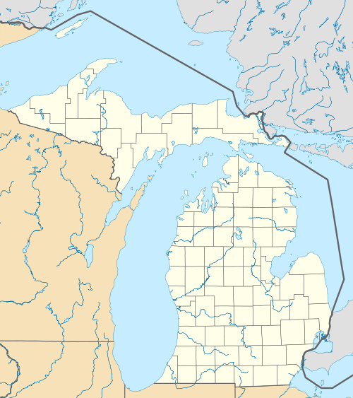
 Location within Menominee County and the state of Michigan | |
 Powers  Powers | |
| Coordinates: 45°41′24″N 87°31′31″W / 45.69000°N 87.52528°W | |
| Country | United States |
| State | Michigan |
| County | Menominee |
| Township | Spalding |
| Founded | 1872 |
| Incorporated | 1915[1] |
| Government | |
| • President | Carol Welch |
| • Clerk | Ruth Blahnik |
| Area | |
| • Total | 0.94 sq mi (2.43 km2) |
| • Land | 0.94 sq mi (2.43 km2) |
| • Water | 0.00 sq mi (0.00 km2) |
| Elevation | 876 ft (267 m) |
| Population | |
| • Total | 381 |
| • Density | 405.75/sq mi (156.65/km2) |
| Time zone | UTC-6 (Central (CST)) |
| • Summer (DST) | UTC-5 (CDT) |
| ZIP Code | 49874 |
| Area code | 906 |
| FIPS code | 26-66140[5] |
| GNIS feature ID | 0635379[6] |
| Website | www |
Powers is a village in Menominee County in the U.S. state of Michigan. The population was 381 at the 2020 census,[4] down from 422 in 2010. Located within Spalding Township, it is part of the Marinette micropolitan area.
History
[edit]At an early date, the place was called "Menominee River Junction", because here was the junction between the main railroad line and the Menominee River Branch.[7] The origin of the name "Powers" is uncertain. Several sources claim the village was named after Edward Powers, a civil engineer involved in building the railroad there.[7][8][9] Another source claims the village was founded in 1872 and named after Tom Powers, an engineer for the Chicago & North Western Railroad.[10]
Geography
[edit]Powers is in north-central Menominee County at the junction of U.S. Routes 2 and 41, which meet in the northeast corner of the village. US 2 leads west 30 miles (48 km) to Iron Mountain, while US 41 leads south 41 miles (66 km) to Menominee, the county seat. The two concurrent highways lead east 23 miles (37 km) to Escanaba on Lake Michigan. Powers is bordered to the northeast by the unincorporated community of Spalding.
According to the U.S. Census Bureau, the village has a total area of 0.94 square miles (2.43 km2), all of it recorded as land.[3] The Cedar River flows briefly through the northern portion of the village.
Demographics
[edit]| Census | Pop. | Note | %± |
|---|---|---|---|
| 1920 | 249 | — | |
| 1930 | 360 | 44.6% | |
| 1940 | 258 | −28.3% | |
| 1950 | 510 | 97.7% | |
| 1960 | 415 | −18.6% | |
| 1970 | 560 | 34.9% | |
| 1980 | 490 | −12.5% | |
| 1990 | 271 | −44.7% | |
| 2000 | 430 | 58.7% | |
| 2010 | 422 | −1.9% | |
| 2020 | 381 | −9.7% | |
| U.S. Decennial Census[11] | |||
2010 census
[edit]As of the census[12] of 2010, there were 422 people, 135 households, and 63 families living in the village. The population density was 426.3 inhabitants per square mile (164.6/km2). There were 141 housing units at an average density of 142.4 per square mile (55.0/km2). The racial makeup of the village was 98.3% White, 0.9% Native American, 0.2% Asian, and 0.5% from other races. Hispanic or Latino of any race were 0.9% of the population.
There were 135 households, of which 22.2% had children under the age of 18 living with them, 35.6% were married couples living together, 8.9% had a female householder with no husband present, 2.2% had a male householder with no wife present, and 53.3% were non-families. 48.9% of all households were made up of individuals, and 26.7% had someone living alone who was 65 years of age or older. The average household size was 1.94 and the average family size was 2.90.
The median age in the village was 65.1 years. 11.4% of residents were under the age of 18; 5.3% were between the ages of 18 and 24; 16.1% were from 25 to 44; 17.1% were from 45 to 64; and 50.2% were 65 years of age or older. The gender makeup of the village was 41.5% male and 58.5% female.
2000 census
[edit]As of the census[5] of 2000, there were 430 people, 124 households, and 59 families living in the village. The population density was 433.8 inhabitants per square mile (167.5/km2). There were 146 housing units at an average density of 147.3 per square mile (56.9/km2). The racial makeup of the village was 97.67% White, 0.47% Native American, and 1.86% from two or more races.
There were 124 households, out of which 14.5% had children under the age of 18 living with them, 40.3% were married couples living together, 5.6% had a female householder with no husband present, and 52.4% were non-families. 45.2% of all households were made up of individuals, and 28.2% had someone living alone who was 65 years of age or older. The average household size was 2.08 and the average family size was 2.85.
In the village, the population was spread out, with 9.5% under the age of 18, 5.6% from 18 to 24, 13.7% from 25 to 44, 16.7% from 45 to 64, and 54.4% who were 65 years of age or older. The median age was 68 years. For every 100 females, there were 62.3 males. For every 100 females age 18 and over, there were 60.1 males.
The median income for a household in the village was $20,250, and the median income for a family was $36,250. Males had a median income of $25,000 versus $20,625 for females. The per capita income for the village was $14,207. About 14.6% of families and 17.9% of the population were below the poverty line, including 19.0% of those under age 18 and 24.2% of those age 65 or over.
References
[edit]- ^ Spalding Township (2020). "From the history: Powers". Retrieved August 3, 2020.
- ^ Menominee County Government (2020). "Municipalities » Village of Powers". Retrieved August 3, 2020.
- ^ a b "2022 U.S. Gazetteer Files: Michigan". United States Census Bureau. Retrieved September 28, 2023.
- ^ a b "P1. Race – Powers village, Michigan: 2020 DEC Redistricting Data (PL 94-171)". U.S. Census Bureau. Retrieved September 28, 2023.
- ^ a b "U.S. Census website". United States Census Bureau. Retrieved January 31, 2008.
- ^ "US Board on Geographic Names". United States Geological Survey. October 25, 2007. Retrieved January 31, 2008.
- ^ a b Stennett, William H. 1908. A History of the Origin of the Place Names Connected with the Chicago & North Western and Chicago, St. Paul, Minneapolis & Omaha Railways. Chicago, p. 115.
- ^ Romig, Walter. 1973. Michigan Place Names: The History of the Founding and the Naming of More Than Five Thousand Past and Present Michigan Communities. Detroit: Wayne State University Press, p. 457.
- ^ "Spalding Hotel". The Escanaba Daily Press. April 26, 1969. p. 5. Retrieved November 18, 2014 – via Newspapers.com.
- ^ "History of Powers Spalding Michigan". Archived from the original on November 21, 2008. Retrieved June 29, 2010.
- ^ "Census of Population and Housing". Census.gov. Retrieved June 4, 2015.
- ^ "U.S. Census website". United States Census Bureau. Retrieved November 25, 2012.
Municipalities and communities of Menominee County, Michigan, United States | ||
|---|---|---|
| Cities | ||
| Villages | ||
| Civil townships | ||
| CDP | ||
| Other communities | ||
| Indian reservation | ||
| Footnotes | ‡This populated place also has portions in an adjacent county or counties | |