Paradise Heights, Florida: Difference between revisions
m robot Adding: vo:Paradise Heights |
→top: add "use mdy dates" template |
||
| (40 intermediate revisions by 31 users not shown) | |||
| Line 1: | Line 1: | ||
{{Use mdy dates|date=July 2023}} |
|||
{{Infobox |
{{Infobox settlement |
||
<!--See the Table at Infobox Settlement for all fields and descriptions of usage--> |
|||
<!-- Basic info ----------------> |
<!-- Basic info ----------------> |
||
|official_name = Paradise Heights, Florida |
|official_name = Paradise Heights, Florida |
||
|other_name = |
|other_name = |
||
|native_name |
|native_name = <!-- for cities whose native name is not in English --> |
||
|nickname = |
|nickname = |
||
|settlement_type = |
|settlement_type = [[Census-designated place]] |
||
|motto = |
|motto = |
||
<!-- images and maps -----------> |
<!-- images and maps -----------> |
||
|image_skyline = |
|image_skyline = |
||
|imagesize = |
|imagesize = |
||
|image_caption = |
|image_caption = |
||
|image_flag = |
|image_flag = |
||
|flag_size = |
|flag_size = |
||
|image_seal = |
|image_seal = |
||
|seal_size = |
|seal_size = |
||
|image_shield = |
|image_shield = |
||
|shield_size = |
|shield_size = |
||
|image_blank_emblem = |
|image_blank_emblem = |
||
|blank_emblem_type = |
|blank_emblem_type = |
||
|blank_emblem_size = |
|blank_emblem_size = |
||
|image_map = Orange_County_Florida_Incorporated_and_Unincorporated_areas_Paradise_Heights_Highlighted.svg |
|image_map = Orange_County_Florida_Incorporated_and_Unincorporated_areas_Paradise_Heights_Highlighted.svg |
||
| ⚫ | |||
| ⚫ | |||
|mapsize = |
|||
| ⚫ | |||
| ⚫ | |||
| |
|mapsize1 = |
||
| |
|map_caption1 = |
||
| |
|image_dot_map = |
||
| |
|dot_mapsize = |
||
| |
|dot_map_caption = |
||
| |
|dot_x = |
||
| ⚫ | |||
|dot_x = |
|||
|pushpin_map = <!-- the name of a location map as per http://en.wikipedia.org/wiki/Template:Location_map --> |
|||
|dot_y = |
|||
| |
|pushpin_label_position = <!-- the position of the pushpin label: left, right, top, bottom, none --> |
||
|pushpin_map_caption = |
|||
|pushpin_label_position = <!-- the position of the pushpin label: left, right, top, bottom, none --> |
|||
| |
|pushpin_mapsize = |
||
|pushpin_mapsize = |
|||
<!-- Location ------------------> |
<!-- Location ------------------> |
||
|subdivision_type = [[ |
|subdivision_type = [[List of sovereign states|Country]] |
||
|subdivision_name = |
|subdivision_name = {{flag|United States}} |
||
|subdivision_type1 |
|subdivision_type1 = [[U.S. state|State]] |
||
|subdivision_name1 = |
|subdivision_name1 = {{flag|Florida}} |
||
|subdivision_type2 = [[List of counties in Florida| |
|subdivision_type2 = [[List of counties in Florida|County]] |
||
|subdivision_name2 = [[Orange County, Florida|Orange]] |
|subdivision_name2 = {{noflag|[[Orange County, Florida|Orange]]}} |
||
|subdivision_type3 = |
|subdivision_type3 = |
||
|subdivision_name3 = |
|subdivision_name3 = |
||
|subdivision_type4 = |
|subdivision_type4 = |
||
|subdivision_name4 = |
|subdivision_name4 = |
||
<!-- Politics -----------------> |
<!-- Politics -----------------> |
||
|government_footnotes = |
|government_footnotes = |
||
|government_type = |
|government_type = |
||
|leader_title = |
|leader_title = |
||
|leader_name = |
|leader_name = |
||
|leader_title1 |
|leader_title1 = <!-- for places with, say, both a mayor and a city manager --> |
||
|leader_name1 = |
|leader_name1 = |
||
|leader_title2 = |
|leader_title2 = |
||
|leader_name2 = |
|leader_name2 = |
||
|leader_title3 = |
|leader_title3 = |
||
|leader_name3 = |
|leader_name3 = |
||
|leader_title4 = |
|leader_title4 = |
||
|leader_name4 = |
|leader_name4 = |
||
|established_title |
|established_title = <!-- Settled --> |
||
|established_date = |
|established_date = |
||
|established_title2 |
|established_title2 = <!-- Incorporated (town) --> |
||
|established_date2 = |
|established_date2 = |
||
|established_title3 |
|established_title3 = <!-- Incorporated (city) --> |
||
|established_date3 = |
|established_date3 = |
||
<!-- Area ---------------------> |
<!-- Area ---------------------> |
||
|area_magnitude = |
|area_magnitude = |
||
|unit_pref = |
|unit_pref = Imperial |
||
|area_footnotes = <ref name="CenPopGazetteer2020">{{cite web|title=2020 U.S. Gazetteer Files|url=https://www2.census.gov/geo/docs/maps-data/data/gazetteer/2020_Gazetteer/2020_gaz_place_12.txt|publisher=United States Census Bureau|accessdate=October 31, 2021}}</ref> |
|||
|area_footnotes = |
|||
|area_total_km2 = 1. |
|area_total_km2 = 1.19 |
||
|area_land_km2 = 1. |
|area_land_km2 = 1.19 |
||
|area_water_km2 = 0 |
|area_water_km2 = 0.00 |
||
|area_total_sq_mi = 0. |
|area_total_sq_mi = 0.46 |
||
|area_land_sq_mi = 0. |
|area_land_sq_mi = 0.46 |
||
|area_water_sq_mi = 0 |
|area_water_sq_mi = 0.00 |
||
|area_water_percent = |
|area_water_percent = |
||
|area_urban_km2 = |
|area_urban_km2 = |
||
|area_urban_sq_mi = |
|area_urban_sq_mi = |
||
|area_metro_km2 = |
|area_metro_km2 = |
||
|area_metro_sq_mi = |
|area_metro_sq_mi = |
||
|area_blank1_title = |
|area_blank1_title = |
||
|area_blank1_km2 = |
|area_blank1_km2 = |
||
|area_blank1_sq_mi = |
|area_blank1_sq_mi = |
||
<!-- Population -----------------------> |
<!-- Population -----------------------> |
||
|population_as_of |
|population_as_of = [[2020 United States Census|2020]] |
||
|population_footnotes |
|population_footnotes = |
||
|population_note |
|population_note = |
||
|population_total = |
|population_total = 1260 |
||
|population_density_km2 = |
|population_density_km2 = 1056.37 |
||
|population_density_sq_mi = |
|population_density_sq_mi = 2733.19 |
||
|population_metro |
|population_metro = |
||
|population_density_metro_km2 = |
|population_density_metro_km2 = |
||
|population_density_metro_sq_mi = |
|population_density_metro_sq_mi = |
||
|population_urban = |
|population_urban = |
||
|population_density_urban_km2 = |
|population_density_urban_km2 = |
||
|population_density_urban_sq_mi = |
|population_density_urban_sq_mi = |
||
|population_blank1_title = |
|population_blank1_title = |
||
|population_blank1 = |
|population_blank1 = |
||
|population_density_blank1_km2 |
|population_density_blank1_km2 = |
||
|population_density_blank1_sq_mi = |
|population_density_blank1_sq_mi = |
||
<!-- General information ---------------> |
<!-- General information ---------------> |
||
|timezone = |
|timezone = [[North American Eastern Time Zone|Eastern (EST)]] |
||
|utc_offset = |
|utc_offset = -5 |
||
|timezone_DST = |
|timezone_DST = EDT |
||
|utc_offset_DST = |
|utc_offset_DST = -4 |
||
|coordinates = {{coord|28|37|21|N|81|32|42|W|region:US_type:city|display=inline,title}} |
|||
|latd= |
|||
| ⚫ | |||
|latm= |
|||
| ⚫ | |||
|lats= |
|||
| ⚫ | |||
|latNS= |
|||
|longd= |
|||
|longm= |
|||
|longs= |
|||
|longEW= |
|||
| ⚫ | |||
| ⚫ | |||
| ⚫ | |||
<!-- Area/postal codes & others --------> |
<!-- Area/postal codes & others --------> |
||
|postal_code_type |
|postal_code_type = |
||
|postal_code = |
|postal_code = |
||
|area_code = |
|area_code = |
||
|blank_name = |
|blank_name = [[Federal Information Processing Standard|FIPS code]] |
||
|blank_info = 12-54912<ref name="GR2">{{cite web|url=https://www.census.gov|publisher=[[United States Census Bureau]]|accessdate=2008-01-31|title=U.S. Census website}}</ref> |
|||
| ⚫ | |||
|blank1_name = |
|blank1_name = [[Geographic Names Information System|GNIS]] feature ID |
||
|blank1_info = 1853273<ref name="GR3">{{cite web|url=http://geonames.usgs.gov|accessdate=2008-01-31|title=US Board on Geographic Names|publisher=[[United States Geological Survey]]|date=2007-10-25}}</ref> |
|||
| ⚫ | |||
|website = |
|website = |
||
|footnotes = |
|footnotes = |
||
|pop_est_as_of = |
|||
| ⚫ | |||
|pop_est_footnotes = |
|||
'''Paradise Heights''' is a [[census-designated place]] and an unincorporated area in [[Orange County, Florida|Orange County]], [[Florida]], [[United States]]. The population was 1,310 at the 2000 census. |
|||
|population_est = |
|||
| ⚫ | |||
'''Paradise Heights''' is a [[census-designated place]] and an unincorporated area in [[Orange County, Florida|Orange County]], [[Florida]], United States. The population was 1,215 at the 2010 census.<ref name="Census 2010">{{Cite web| url=https://www.census.gov| title=Profile of General Population and Housing Characteristics: 2010 Demographic Profile Data (DP-1): Paradise Heights CDP, Florida| publisher=[[United States Census Bureau]]| accessdate=September 25, 2012}}</ref> It is part of the [[Orlando, Florida|Orlando]]–[[Kissimmee, Florida|Kissimmee]] [[Greater Orlando|Metropolitan Statistical Area]]. |
|||
==Geography== |
==Geography== |
||
Paradise Heights is located at {{ |
Paradise Heights is located at {{Coord|28|37|21|N|81|32|42|W|type:city}} (28.622426, -81.544987).<ref name="GR1">{{cite web|url=https://www.census.gov/geographies/reference-files/time-series/geo/gazetteer-files.html|publisher=[[United States Census Bureau]]|accessdate=2011-04-23|date=2011-02-12|title=US Gazetteer files: 2010, 2000, and 1990}}</ref> |
||
According to the [[United States Census Bureau]], the CDP has a total area of 1.2 |
According to the [[United States Census Bureau]], the CDP has a total area of 1.2 km{{sup|2}} (0.5 mi<sup>2</sup>), all land. |
||
==Demographics== |
==Demographics== |
||
{{US Census population |
|||
| ⚫ | As of the [[census]] |
||
|2020= 1260 |
|||
|footnote=U.S. Decennial Census<ref name="DecennialCensus">{{cite web|url=http://www.census.gov/prod/www/decennial.html|title=Census of Population and Housing|publisher=Census.gov|accessdate=June 4, 2016}}</ref> |
|||
}} |
|||
| ⚫ | As of the [[census]]<ref name="GR2" /> of 2000, there were 1,310 people, 457 households, and 301 families residing in the CDP. The [[population density]] was 1,076.2/km{{sup|2}} (2,778.2/mi<sup>2</sup>). There were 498 housing units at an average density of 409.1/km{{sup|2}} (1,056.1/mi<sup>2</sup>). The racial makeup of the CDP was 80.53% [[White (U.S. Census)|White]], 2.98% [[African American (U.S. Census)|African American]], 0.69% [[Native American (U.S. Census)|Native American]], 0.46% [[Asian (U.S. Census)|Asian]], 0.69% [[Pacific Islander (U.S. Census)|Pacific Islander]], 12.98% from [[Race (United States Census)|other races]], and 1.68% from two or more races. [[Hispanic (U.S. Census)|Hispanic]] or [[Latino (U.S. Census)|Latino]] of any race were 22.82% of the population. |
||
There were 457 households out of which 34.6% had children under the age of 18 living with them, 43.5% were [[Marriage|married couples]] living together, 15.1% had a female householder with no husband present, and 34.1% were non-families. 25.2% of all households were made up of individuals and 7.7% had someone living alone who was 65 years of age or older. The average household size was 2.85 and the average family size was 3.35. |
There were 457 households, out of which 34.6% had children under the age of 18 living with them, 43.5% were [[Marriage|married couples]] living together, 15.1% had a female householder with no husband present, and 34.1% were non-families. 25.2% of all households were made up of individuals, and 7.7% had someone living alone who was 65 years of age or older. The average household size was 2.85 and the average family size was 3.35. |
||
In the CDP the population was spread out with 28.9% under the age of 18, 11.0% from 18 to 24, 34.0% from 25 to 44, 18.5% from 45 to 64, and 7.6% who were 65 years of age or older. The median age was 32 years. For every 100 females there were 111.0 males. For every 100 females age 18 and over, there were 113.3 males. |
In the CDP, the population was spread out, with 28.9% under the age of 18, 11.0% from 18 to 24, 34.0% from 25 to 44, 18.5% from 45 to 64, and 7.6% who were 65 years of age or older. The median age was 32 years. For every 100 females, there were 111.0 males. For every 100 females age 18 and over, there were 113.3 males. |
||
The median income for a household in the CDP was $30,038, and the median income for a family was $34,438. Males had a median income of $22,109 versus $17,200 for females. The [[per capita income]] for the CDP was $13,115. About 9.1% of families and 14.9% of the population were below the [[poverty line]], including 23.5% of those under age 18 and 15.4% of those age 65 or over. |
The median income for a household in the CDP was $30,038, and the median income for a family was $34,438. Males had a median income of $22,109 versus $17,200 for females. The [[per capita income]] for the CDP was $13,115. About 9.1% of families and 14.9% of the population were below the [[poverty line]], including 23.5% of those under age 18 and 15.4% of those age 65 or over. |
||
== |
==References== |
||
{{Reflist}} |
|||
{{Mapit-US-cityscale|28.622426|-81.544987}} |
|||
{{Orange County, Florida}} |
{{Orange County, Florida}} |
||
{{Florida}} |
{{Florida}} |
||
{{authority control}} |
|||
| ⚫ | |||
| ⚫ | |||
| ⚫ | |||
[[nl:Paradise Heights]] |
|||
[[ |
[[Category:Greater Orlando]] |
||
| ⚫ | |||
Latest revision as of 21:47, 12 July 2023
Paradise Heights, Florida | |
|---|---|
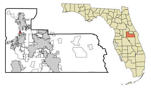 Location in Orange County and the state of Florida | |
| Coordinates: 28°37′21″N 81°32′42″W / 28.62250°N 81.54500°W | |
| Country | |
| State | |
| County | Orange |
| Area | |
| • Total | 0.46 sq mi (1.19 km2) |
| • Land | 0.46 sq mi (1.19 km2) |
| • Water | 0.00 sq mi (0.00 km2) |
| Elevation | 98 ft (30 m) |
| Population (2020) | |
| • Total | 1,260 |
| • Density | 2,733.19/sq mi (1,056.37/km2) |
| Time zone | UTC-5 (Eastern (EST)) |
| • Summer (DST) | UTC-4 (EDT) |
| FIPS code | 12-54912[2] |
| GNIS feature ID | 1853273[3] |
Paradise Heights is a census-designated place and an unincorporated area in Orange County, Florida, United States. The population was 1,215 at the 2010 census.[4] It is part of the Orlando–Kissimmee Metropolitan Statistical Area.
Geography
[edit]Paradise Heights is located at 28°37′21″N 81°32′42″W / 28.62250°N 81.54500°W (28.622426, -81.544987).[5]
According to the United States Census Bureau, the CDP has a total area of 1.2 km2 (0.5 mi2), all land.
Demographics
[edit]| Census | Pop. | Note | %± |
|---|---|---|---|
| 2020 | 1,260 | — | |
| U.S. Decennial Census[6] | |||
As of the census[2] of 2000, there were 1,310 people, 457 households, and 301 families residing in the CDP. The population density was 1,076.2/km2 (2,778.2/mi2). There were 498 housing units at an average density of 409.1/km2 (1,056.1/mi2). The racial makeup of the CDP was 80.53% White, 2.98% African American, 0.69% Native American, 0.46% Asian, 0.69% Pacific Islander, 12.98% from other races, and 1.68% from two or more races. Hispanic or Latino of any race were 22.82% of the population.
There were 457 households, out of which 34.6% had children under the age of 18 living with them, 43.5% were married couples living together, 15.1% had a female householder with no husband present, and 34.1% were non-families. 25.2% of all households were made up of individuals, and 7.7% had someone living alone who was 65 years of age or older. The average household size was 2.85 and the average family size was 3.35.
In the CDP, the population was spread out, with 28.9% under the age of 18, 11.0% from 18 to 24, 34.0% from 25 to 44, 18.5% from 45 to 64, and 7.6% who were 65 years of age or older. The median age was 32 years. For every 100 females, there were 111.0 males. For every 100 females age 18 and over, there were 113.3 males.
The median income for a household in the CDP was $30,038, and the median income for a family was $34,438. Males had a median income of $22,109 versus $17,200 for females. The per capita income for the CDP was $13,115. About 9.1% of families and 14.9% of the population were below the poverty line, including 23.5% of those under age 18 and 15.4% of those age 65 or over.
References
[edit]- ^ "2020 U.S. Gazetteer Files". United States Census Bureau. Retrieved October 31, 2021.
- ^ a b "U.S. Census website". United States Census Bureau. Retrieved January 31, 2008.
- ^ "US Board on Geographic Names". United States Geological Survey. October 25, 2007. Retrieved January 31, 2008.
- ^ "Profile of General Population and Housing Characteristics: 2010 Demographic Profile Data (DP-1): Paradise Heights CDP, Florida". United States Census Bureau. Retrieved September 25, 2012.
- ^ "US Gazetteer files: 2010, 2000, and 1990". United States Census Bureau. February 12, 2011. Retrieved April 23, 2011.
- ^ "Census of Population and Housing". Census.gov. Retrieved June 4, 2016.
Municipalities and communities of Orange County, Florida, United States | ||
|---|---|---|
| Cities |  | |
| Towns | ||
| CDPs |
| |
| Unincorporated communities | ||
| Footnotes | ‡This populated place also has portions in an adjacent county or counties | |