São José, Santa Catarina: Difference between revisions
Removing "Bandeira_SJ.png", it has been deleted from Commons by Fastily because: No permission since 16 February 2015: If you are the copyright holder/author and/or have authorization to publish the file, please em |
Correct flag |
||
| (28 intermediate revisions by 22 users not shown) | |||
| Line 1: | Line 1: | ||
{{unreferenced|date=February 2009}} |
|||
{{Infobox settlement |
{{Infobox settlement |
||
| |
| name = São José |
||
| |
| official_name = Municipality of São José |
||
| settlement_type |
| settlement_type = [[Municipalities of Brazil|Municipality]] |
||
| image_skyline = {{multiple image|total_width=300px|perrow=2/2/2|border=infobox |
|||
|motto = |
|||
| |
|image1 = SaoJose058.JPG |
||
| |
|image2 = PrefeituraSJ.png |
||
|image3 = Paroquia-SantAna-SaoJose-SC.jpg |
|||
|image_caption =Seaside of São José |
|||
| |
|image4 = Igreja Matriz de São José.jpg |
||
| |
|image5 = Praia.antonieta.png |
||
| |
|image6 = Saojose312.jpg |
||
|mapsize = 250px |
|||
|map_caption = Location of São José |
|||
|coordinates_region = BR |
|||
|subdivision_type = [[List of countries|Country]] |
|||
|subdivision_type1 = [[Regions of Brazil|Region]] |
|||
|subdivision_type2 = [[States of Brazil|State]] |
|||
|subdivision_name = {{flagicon|BRA}} [[Brazil]] |
|||
|subdivision_name1 = [[Southern Region, Brazil|South]] |
|||
|subdivision_name2 = {{flagicon|Santa Catarina}} [[Santa Catarina (state)|Santa Catarina]] |
|||
|leader_title = Mayor |
|||
|leader_name = Adeliana Dal Pont |
|||
|leader_party = PSD |
|||
|leader_title1 = |
|||
|leader_name1 = |
|||
|leader_title2 = |
|||
|leader_name2 = |
|||
|leader_title3 = |
|||
|leader_name3 = |
|||
|established_title = Founded |
|||
|established_date = March 19, 1750 |
|||
|established_title2 = |
|||
|established_date2 = |
|||
|established_title3 = |
|||
|established_date3 = |
|||
|area_magnitude = |
|||
|area_total_km2 = 113.171 |
|||
|area_total_sq_mi = |
|||
|area_land_km2 = |
|||
|area_land_sq_mi = |
|||
|area_water_km2 = |
|||
|area_water_sq_mi = |
|||
|area_water_percent = |
|||
|area_urban_km2 = |
|||
|area_urban_sq_mi = |
|||
|area_metro_km2 = |
|||
|area_metro_sq_mi = |
|||
|pushpin_map = Brazil |
|||
|population_as_of = 2010 |
|||
|population_note = |
|||
|population_total = 210513 |
|||
|population_density_km2 = 1860.13 |
|||
|population_density_sq_mi = |
|||
|population_metro = 877706 |
|||
|population_footnotes = |
|||
|population_density_metro_km2 = |
|||
|population_density_metro_sq_mi = |
|||
|population_urban = 208017 |
|||
|timezone = [[UTC-3]] |
|||
|utc_offset = -3 |
|||
|timezone_DST = [[UTC-2]] |
|||
|utc_offset_DST = -2 |
|||
|latd=27 |latm=36 |lats=54 |latNS=S |
|||
|longd=48 |longm=37 |longs=40 |longEW=W |
|||
|elevation_m = 0 |
|||
|elevation_ft = |
|||
|postal_code_type = |
|||
|postal_code = |
|||
|blank_name = '''[[Human Development Index|HDI]]''' (2000) |
|||
|blank_info = 0.849 |
|||
|website = [http://www.pmsj.sc.gov.br www.pmsj.sc.gov.br] |
|||
}} |
}} |
||
| imagesize = |
|||
| image_caption = |
|||
| image_flag = Bandeira_Municipal_de_São_José.png |
|||
| image_seal = Brasão Municipal de São José.png |
|||
| nickname = |
|||
| motto = |
|||
| image_map = SantaCatarina Municip SaoJose.svg |
|||
| mapsize = 250px |
|||
| map_caption = Location in Santa Catarina |
|||
| pushpin_map = Brazil |
|||
| coordinates = {{coord|27|36|54|S|48|37|40|W|region:BR|display=inline}} |
|||
| subdivision_type = [[List of sovereign states|Country]] |
|||
| subdivision_name = {{flag|Brazil}} |
|||
| subdivision_type1 = [[Regions of Brazil|Region]] |
|||
| subdivision_type2 = [[States of Brazil|State]] |
|||
| subdivision_name1 = [[Southern Region, Brazil|South]] |
|||
| subdivision_name2 = {{flag|Santa Catarina}} |
|||
| established_title = Founded |
|||
| established_date = March 19, 1750 |
|||
| established_title2 = |
|||
| established_date2 = |
|||
| established_title3 = |
|||
| established_date3 = |
|||
| leader_party = PSD |
|||
| leader_title = Mayor |
|||
| leader_name = Adeliana Dal Pont |
|||
| leader_title1 = |
|||
| leader_name1 = |
|||
| area_magnitude = |
|||
| area_total_km2 = 113.171 |
|||
| area_total_sq_mi = |
|||
| area_land_km2 = |
|||
| area_land_sq_mi = |
|||
| area_water_km2 = |
|||
| area_water_sq_mi = |
|||
| area_water_percent = |
|||
| area_urban_km2 = |
|||
| area_urban_sq_mi = |
|||
| area_metro_km2 = |
|||
| area_metro_sq_mi = |
|||
| elevation_m = 0 |
|||
| elevation_ft = |
|||
| population_total = 250,181 |
|||
| population_as_of = 2020 |
|||
| population_footnotes = <ref>[https://cidades.ibge.gov.br/brasil/sc/sao-jose/panorama IBGE 2020]</ref> |
|||
| population_density_km2 = auto |
|||
| population_density_sq_mi = |
|||
| population_urban = 208017 |
|||
| population_metro = 877706 |
|||
| population_density_metro_km2 = |
|||
| population_density_metro_sq_mi = |
|||
| population_note = |
|||
| postal_code_type = |
|||
| postal_code = |
|||
| website = {{URL|pmsj.sc.gov.br}} |
|||
| leader_title2 = |
|||
| leader_name2 = |
|||
| leader_title3 = |
|||
| leader_name3 = |
|||
| timezone = [[Time in Brazil|BRT]] |
|||
| utc_offset = −3 |
|||
| timezone_DST = |
|||
| utc_offset_DST = |
|||
| blank_name = '''[[Human Development Index|HDI]]''' (2010) |
|||
| blank_info = 0.809 – <span style="color:#090">very high</span><ref>{{Cite web |title=Archived copy |url=http://www.pnud.org.br/arquivos/ranking-idhm-2010.pdf |url-status=dead |archive-url=https://web.archive.org/web/20140708233352/http://www.pnud.org.br/arquivos/ranking-idhm-2010.pdf |archive-date=July 8, 2014 |access-date=August 1, 2013 |publisher=[[United Nations Development Programme]] (UNDP) |
|||
}}</ref> |
|||
}} |
|||
'''São José''' is a city in [[Santa Catarina (state)|Santa Catarina]], [[Brazil]]. It is approximately 5 km from and encircles the continental section of [[Florianópolis]]. |
|||
The municipality of São José, located in Grande Florianópolis, is the fourth oldest in Santa Catarina and was colonized on October 26, 1750, by 182 Azorean couples, from the islands of Pico, Terceira, São Jorge, Faial, Graciosa and São Miguel. In 1829, it received the first nucleus of German colonization of the State. |
|||
[[Image:Aterro Beira Mar São José (Santa Catarina Brasil).JPG|thumb|left|200px|Aerial view of São José]] |
|||
Rapid development, coupled with population growth and economic power, meant that, on March 1, 1833, through the Resolution of the President of the Province, Feliciano Nunes Pires, São José passed from parish to village (municipality) and, in May 1856, through Provincial Law No. 415, was elevated to the city. |
|||
'''São José''' (San Jose) is a city in [[Santa Catarina (state)|Santa Catarina]], [[Brazil]]. It is a suburb located approximately five kilometers from [[Florianópolis]], the state capital. It encircles the continental section of [[Florianópolis]]. |
|||
Not being very touristy in nature, unlike Florianópolis, São José has attracted industries such as [[telecommunication]] equipment, [[textile]]s, and [[food processing]]. |
|||
The main district of São José are Kobrasol and the Historic Centre. |
|||
São José has some industries such as [[telecommunication]] equipment, [[textile]]s, and [[food processing]]. |
|||
São José is ranked 21st on the [[Human Development Index|HDI]] in Brazil. |
|||
The main district of São José are Campinas, Barreiros and Historic Centre. |
|||
The major [[Brazilian Highway System|BR-101 highway]] passes through São José, making the city a gateway to Florianópolis. |
|||
São José is the 20th [[Human Development Index|HDI]] Ranked city in Brazil. |
|||
{{Clear left}} |
|||
It also has a relatively rich district called Bosque das Mansões, where lives the rich portion of the local population. |
|||
== References == |
|||
The major [[Brazilian Highway System|BR-101 highway]] passes through São José, making the city a gateway to Florianópolis. |
|||
{{reflist}} |
|||
{{coord|27|36|S|48|37|W|source:eswiki|display=title}} |
|||
{{Santa_Catarina_MesoRegion_Grande_Florianopolis}} |
{{Santa_Catarina_MesoRegion_Grande_Florianopolis}} |
||
{{Authority control}} |
|||
{{coord|27|36|S|48|37|W|source:eswiki|display=title}} |
|||
{{DEFAULTSORT:Sao Jose, Santa Catarina}} |
{{DEFAULTSORT:Sao Jose, Santa Catarina}} |
||
[[Category:Populated coastal places in Santa Catarina (state)]] |
[[Category:Populated coastal places in Santa Catarina (state)]] |
||
[[Category:Municipalities in Santa Catarina (state)]] |
|||
{{SantaCatarina-geo-stub}} |
{{SantaCatarina-geo-stub}} |
||
Latest revision as of 22:27, 12 March 2024
São José | |
|---|---|
| Municipality of São José | |
 Flag  Seal | |
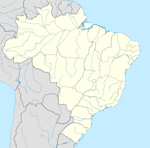
 Location in Santa Catarina | |
 São José | |
| Coordinates: 27°36′54″S 48°37′40″W / 27.61500°S 48.62778°W | |
| Country | |
| Region | South |
| State | |
| Founded | March 19, 1750 |
| Government | |
| • Mayor | Adeliana Dal Pont (PSD) |
| Area | |
| • Municipality | 113.171 km2 (43.696 sq mi) |
| Elevation | 0 m (0 ft) |
| Population (2020)[1] | |
| • Municipality | 250,181 |
| • Density | 2,200/km2 (5,700/sq mi) |
| • Urban | 208,017 |
| • Metro | 877,706 |
| Time zone | UTC−3 (BRT) |
| HDI (2010) | 0.809 – very high[2] |
| Website | pmsj |


São José is a city in Santa Catarina, Brazil. It is approximately 5 km from and encircles the continental section of Florianópolis.
The municipality of São José, located in Grande Florianópolis, is the fourth oldest in Santa Catarina and was colonized on October 26, 1750, by 182 Azorean couples, from the islands of Pico, Terceira, São Jorge, Faial, Graciosa and São Miguel. In 1829, it received the first nucleus of German colonization of the State. Rapid development, coupled with population growth and economic power, meant that, on March 1, 1833, through the Resolution of the President of the Province, Feliciano Nunes Pires, São José passed from parish to village (municipality) and, in May 1856, through Provincial Law No. 415, was elevated to the city. Not being very touristy in nature, unlike Florianópolis, São José has attracted industries such as telecommunication equipment, textiles, and food processing.
The main district of São José are Kobrasol and the Historic Centre.
São José is ranked 21st on the HDI in Brazil.
The major BR-101 highway passes through São José, making the city a gateway to Florianópolis.
References[edit]
- ^ IBGE 2020
- ^ "Archived copy" (PDF). United Nations Development Programme (UNDP). Archived from the original (PDF) on July 8, 2014. Retrieved August 1, 2013.
{{cite web}}: CS1 maint: archived copy as title (link)
27°36′S 48°37′W / 27.600°S 48.617°W
| |
| Florianópolis | |
| Tabuleiro | |
| Tijucas | |
| International | |
|---|---|
| National | |
This Santa Catarina, Brazil location article is a stub. You can help Wikipedia by expanding it. |