Walton County, Georgia
Walton County | |
|---|---|
 Walton County, Georgia courthouse in City of Monroe, Georgia | |
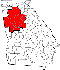
 Location within the U.S. state of Georgia | |
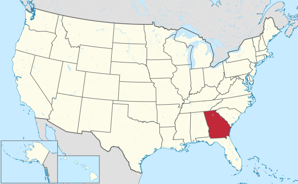 Georgia's location within the U.S. | |
| Coordinates: 33°47′N 83°44′W / 33.78°N 83.74°W | |
| Country | |
| State | |
| Founded | December 22, 1818 |
| Named for | George Walton |
| Seat | Monroe |
| Largest city | Monroe |
| Area | |
| • Total | 330.05 sq mi (854.8 km2) |
| • Land | 329.18 sq mi (852.6 km2) |
| • Water | 0.87 sq mi (2.3 km2) 0.26% |
| Population | |
| • Estimate (2010) | 83,768 |
| • Density | 254/sq mi (98/km2) |
| Time zone | UTC−5 (Eastern) |
| • Summer (DST) | UTC−4 (EDT) |
| Congressional district | 10th |
| Website | www |
Walton County is a county located in the U.S. state of Georgia. As of the 2010 census, the population was 83,768.[1] The county seat is Monroe.Template:GR
The county is a part of the Atlanta Metropolitan Area (Atlanta-Sandy Springs-Marietta, Georgia Metropolitan Statistical Area).
History
Walton County was created on December 15, 1818. It is named for George Walton, one of the three men from Georgia who signed the United States Declaration of Independence. The other two were Button Gwinnett and Lyman Hall.
Walton County is located about 30 miles east of the city of Atlanta. Monroe is the county seat, with other major towns being Loganville and other communities.
Walton County has been home to,the birthplace of, or claim to seven Georgia governors: James Boynton, Howell Cobb, Alfred Colquitt, Wilson Lumpkin, Henry McDaniel, Richard Russell, Jr., Clifford Walker.
Geography
According to the 2000 census, the county has a total area of 330.05 square miles (854.8 km2), of which 329.18 square miles (852.6 km2) (or 99.74%) is land and 0.87 square miles (2.3 km2) (or 0.26%) is water.[2]
Walton County is mostly agricultural and wooded with encroachment by development.

.
Major highways
Interstate highways
U.S. highways
State routes
State Route 10
State Route 10 Business
State Route 11
State Route 12
State Route 20
State Route 81
State Route 83
State Route 138
State Route 186
State Route 402 (unsigned designation for I-20)
Adjacent counties
- Barrow County, Georgia – north
- Oconee County, Georgia – northeast
- Morgan County, Georgia – southeast
- Newton County, Georgia – south
- Rockdale County, Georgia – southwest
- Gwinnett County, Georgia – northwest
Demographics
| Census | Pop. | Note | %± |
|---|---|---|---|
| 1810 | 1,026 | — | |
| 1820 | 4,192 | 308.6% | |
| 1830 | 10,929 | 160.7% | |
| 1840 | 10,209 | −6.6% | |
| 1850 | 10,821 | 6.0% | |
| 1860 | 11,074 | 2.3% | |
| 1870 | 11,038 | −0.3% | |
| 1880 | 15,622 | 41.5% | |
| 1890 | 17,467 | 11.8% | |
| 1900 | 20,942 | 19.9% | |
| 1910 | 25,393 | 21.3% | |
| 1920 | 24,216 | −4.6% | |
| 1930 | 21,118 | −12.8% | |
| 1940 | 20,777 | −1.6% | |
| 1950 | 20,230 | −2.6% | |
| 1960 | 20,481 | 1.2% | |
| 1970 | 23,404 | 14.3% | |
| 1980 | 31,211 | 33.4% | |
| 1990 | 38,586 | 23.6% | |
| 2000 | 60,687 | 57.3% | |
| 2010 | 83,768 | 38.0% | |
| 2012 (est.) | 84,575 | 1.0% | |
2012 Estimate[4] | |||
According to the 2000 data the county comprised 329.18 square miles with 254.5 persons per square mile.
As of the census of 2010, there were 83,768 people, 28,503 households, with 7.25% of persons under the age of 5, 26. 8% under 18, and 12.1% over 65. The female segment of the population accounted for 51.3% of the population.
The racial makeup of the county was 80.1% White, 15.6% Black or African American, 0.3% Native American, 1.1% Asian, and 1.5% from two or more races. 3.2% of the population were Hispanic or Latino of any race.
The high school graduate rate for persons over 25 was 78.4%, Bachelors degree or higher for those over 25 was 16.8%, and the statistical number of veterans of the county was 5,982. The average travel time commute to work, for workers over 16 was 32.2 minutes. The per capita income was $22,624, and the household average income was $50,321. The median household market value in 2009 was $162,000. About 12% of the county's population existed below the poverty level.
Cities and towns
- Between
- Bold Springs (unincorporated)
- Campton (unincorporated)
- Good Hope
- Gratis (unincorporated)
- Jersey
- Loganville
- Monroe (county seat of government)
- Mt. Vernon (unincorporated)
- Pannell (unincorporated)
- Social Circle
- Walnut Grove
- Windsor (unincorporated)
- Youth (unincorporated)
See also
References
- Camp, Lynn Robinson, and Jennifer E. Cheek-Collins. Walton County, Georgia (Black America Series; Charleston, S.C., 2003) (ISBN 0-7385-1528-0).
- Sams, Anita B. Wayfarers in Walton: A History of Walton County, Georgia, 1818–1967 (Monroe, Ga., 1967).
- ^ United States Census Bureau. "2010 Census Data". United States Census Bureau. Retrieved 22 November 2012.
- ^ "Census 2000 U.S. Gazetteer Files: Counties". United States Census. Retrieved 2011-02-13.
- ^ "U.S. Decennial Census". Census.gov. Retrieved July 24, 2013.
- ^ "Annual Estimates of the Resident Population: April 1, 2010 to July 1, 2012". Census.gov. Retrieved July 24, 2013.
External links
- Georgia.gov on Walton County
- http://www.negrdc.org/counties/walton/default.asp
- "Holding on to Those Who Can't be Held": Reenacting a Lynching at Moore's Ford, Georgia" Southern Spaces, November 8, 2010.
Places adjacent to Walton County, Georgia | ||||||||||||||||
|---|---|---|---|---|---|---|---|---|---|---|---|---|---|---|---|---|
| ||||||||||||||||
Municipalities and communities of Walton County, Georgia, United States | ||
|---|---|---|
| Cities |  | |
| Towns | ||
| Unincorporated communities | ||
| Footnotes | ‡This populated place also has portions in an adjacent county or counties | |
|  | |||||
|
| ||||||