West Ham station: Difference between revisions
No edit summary Tags: Reverted Disambiguation links added |
revert symbol parameter change. parameter is used by infobox to detect whether to show Underground usage data or National Rail usage data |
||
| (44 intermediate revisions by 23 users not shown) | |||
| Line 1: | Line 1: | ||
{{Short description|London Underground, Docklands Light Railway and National rail station}} |
{{Short description|London Underground, Docklands Light Railway and National rail station}} |
||
{{about|the London station|other uses|West Ham (disambiguation)}} |
|||
{{Use dmy dates|date=September 2017}} |
{{Use dmy dates|date=September 2017}} |
||
{{Use British English|date=August 2012}} |
{{Use British English|date=August 2012}} |
||
| Line 6: | Line 5: | ||
| name = West Ham |
| name = West Ham |
||
| symbol = underground |
| symbol = underground |
||
| |
| symbol4 = dlr |
||
| |
| symbol5 = rail |
||
| alt_name = |
| alt_name = |
||
| manager = [[London Underground]] |
| manager = [[London Underground]] |
||
| Line 31: | Line 30: | ||
| years4 = 1 January 1916 |
| years4 = 1 January 1916 |
||
| years5 = 1936 |
| years5 = 1936 |
||
| years6 = 1979 |
| years6 = 14 May 1979 |
||
| years7 = 14 May 1999 |
| years7 = 14 May 1999 |
||
| years8 = 9 December 2006 |
| years8 = 9 December 2006 |
||
| Line 56: | Line 55: | ||
| railexits1011 = {{increase}} 2.974 |
| railexits1011 = {{increase}} 2.974 |
||
| railexits1112 = {{increase}} 3.514 |
| railexits1112 = {{increase}} 3.514 |
||
| railexits1213 = {{increase}} 4.057 |
| railexits1213 = {{increase}} 4.057 |
||
| railexits1314 = {{decrease}} 3.690 |
| railexits1314 = {{decrease}} 3.690 |
||
| railexits1415 = {{increase}} 5.308 |
| railexits1415 = {{increase}} 5.308 |
||
| railexits1516 = {{increase}} 8.778<ref>2.434 million of this increase was due to methodological changes. Without these changes, the figure would have been 6.344 million.</ref> |
| railexits1516 = {{increase}} 8.778<ref>2.434 million of this increase was due to methodological changes. Without these changes, the figure would have been 6.344 million.</ref> |
||
| railexits1617 = {{increase}} 10.630 |
| railexits1617 = {{increase}} 10.630 |
||
| railexits1718 = {{decrease}} 10.554 |
| railexits1718 = {{decrease}} 10.554--> |
||
| railexits1819 = {{increase}} 10.717 |
| railexits1819 = {{increase}} 10.717 |
||
| railexits1920 = {{decrease}} 10.181 |
| railexits1920 = {{decrease}} 10.181 |
||
| railexits2021 = {{decrease}} 4.012 |
|||
| raillowint2021 = {{pad|2em}}2,994 |
|||
| railexits2122 = {{increase}} 7.451 |
|||
| raillowint2122 = {{pad|1em}}{{increase}} 5,371 |
|||
| railexits2223 = {{increase}} 9.052 |
|||
| raillowint2223 = {{pad|1em}}{{decrease}} 5,268 |
|||
<!-- | tubeexits03 = 2.367 |
<!-- | tubeexits03 = 2.367 |
||
| tubeexits04 = 2.665 |
| tubeexits04 = 2.665 |
||
| Line 72: | Line 77: | ||
| tubeexits09 = {{increase}} 3.12 --> |
| tubeexits09 = {{increase}} 3.12 --> |
||
}} |
}} |
||
'''West Ham''' is a [[London Underground]], [[Docklands Light Railway]] (DLR) and [[National Rail]] [[Intermodal passenger transport|intermodal]] [[interchange station]] in [[West Ham]], [[London]], [[United Kingdom]]. The station is served by [[London Underground]] [[District line|District]], [[District line|Hammersmith & City]] and [[Jubilee line]]s, the [[Stratford International station|Stratford International]] branch of the [[Docklands Light Railway|DLR]] and [[c2c]] [[National Rail]] services. |
'''West Ham''' is a [[London Underground]], [[Docklands Light Railway]] (DLR) and [[National Rail]] [[Intermodal passenger transport|intermodal]] [[interchange station]] in [[West Ham]], [[London]], [[United Kingdom]]. The station is served by [[London Underground]]'s [[District line|District]], [[District line|Hammersmith & City]] and [[Jubilee line]]s, the [[Stratford International station|Stratford International]] branch of the [[Docklands Light Railway|DLR]], and [[c2c]] [[National Rail]] services. |
||
The station was opened in 1901 by the [[London, Tilbury and Southend Railway]] on the route from Fenchurch Street to Barking. In the late 1990s, the station was rebuilt and significantly expanded as part of the [[Jubilee Line Extension]], fully opening in 1999. The station is in [[List of stations in London fare zone 2|London fare zone 2]] and [[List of stations in London fare zone 3|zone 3]]. |
The station was opened in 1901 by the [[London, Tilbury and Southend Railway]] on the route from Fenchurch Street to Barking. In the late 1990s, the station was rebuilt and significantly expanded as part of the [[Jubilee Line Extension]], fully opening in 1999. The station is in [[List of stations in London fare zone 2|London fare zone 2]] and [[List of stations in London fare zone 3|zone 3]]. |
||
| Line 79: | Line 84: | ||
===East to west alignment=== |
===East to west alignment=== |
||
The [[London, Tilbury and Southend Railway]] direct line from Bow to Barking was constructed east to west through the middle of the [[West Ham (parish)|Parish of West Ham]] in 1858. Before this, trains took a longer route via Stratford and Forest Gate to the north. The new line opened with stations initially at Bromley, Plaistow and East Ham. In November 1897 [[Arnold Hills]], the owner of the [[Thames Ironworks and Shipbuilding Company]], whose football team [[Thames Ironworks F.C.]] (which reformed in 1900 as [[West Ham United F.C.|West Ham United]]) played at the [[Memorial Grounds]], secured an agreement with the London, Tilbury and Southend Railway to build a station at the intersection of Manor Road and Memorial Avenue. The company board approved this in February 1898 and [[Mowlem]]'s was given the contract to build a four platform station, which allowed for the proposed quadrupling of the line with the completion of the [[Whitechapel and Bow Railway]]. The station was completed in May 1900, but did not open until 1 February 1901. The station was initially known as |
The [[London, Tilbury and Southend Railway]] direct line from Bow to Barking was constructed east to west through the middle of the [[West Ham (parish)|Parish of West Ham]] in 1858. Before this, trains took a longer route via Stratford and Forest Gate to the north. The new line opened with stations initially at Bromley, Plaistow and East Ham. In November 1897 [[Arnold Hills]], the owner of the [[Thames Ironworks and Shipbuilding Company]], whose football team [[Thames Ironworks F.C.]] (which reformed in 1900 as [[West Ham United F.C.|West Ham United]]) played at the [[Memorial Grounds]], secured an agreement with the London, Tilbury and Southend Railway to build a station at the intersection of Manor Road and Memorial Avenue. The company board approved this in February 1898 and [[Mowlem]]'s was given the contract to build a four platform station, which allowed for the proposed quadrupling of the line with the completion of the [[Whitechapel and Bow Railway]]. The station was completed in May 1900, but did not open until 1 February 1901. The station was initially known as West Ham. |
||
The [[North London Railway]] had run a daily service to Plaistow via the Bow-Bromley curve since 18 May 1869 and when West Ham opened it used the northern platforms. In 1905 they switched to the southern platforms, with the opening of a new bay platform at Plaistow on the southern side.<ref>The London & Tilbury Railway vol 1 page 41 by Peter Kay {{ISBN|1-899890-10-6}}</ref> The Whitechapel and Bow Railway allowed through services of the [[Metropolitan District Railway]] to operate through West Ham to Upminster from 1902. The Metropolitan District converted to electric trains in 1905 and services were cut back to East Ham. The London, Tilbury and Southend Railway trains from Fenchurch Street used the southern platforms when the Metropolitan District services began but stopping was reduced to a few a week in 1908 and to nil in 1913. Ownership of the station passed to the [[Midland Railway]] in 1912 and the [[London, Midland and Scottish Railway]] in 1923. The station was renamed '''West Ham (Manor Road)''' on 11 February 1924. When the North London Railway service to Plaistow ceased on 1 January 1916 the southern platforms were unused in normal service. |
The [[North London Railway]] had run a daily service to Plaistow via the Bow-Bromley curve since 18 May 1869 and when West Ham opened it used the northern platforms. In 1905 they switched to the southern platforms, with the opening of a new bay platform at Plaistow on the southern side.<ref>The London & Tilbury Railway vol 1 page 41 by Peter Kay {{ISBN|1-899890-10-6}}</ref> The Whitechapel and Bow Railway allowed through services of the [[Metropolitan District Railway]] to operate through West Ham to Upminster from 1902. The Metropolitan District converted to electric trains in 1905 and services were cut back to East Ham. The London, Tilbury and Southend Railway trains from Fenchurch Street used the southern platforms when the Metropolitan District services began but stopping was reduced to a few a week in 1908 and to nil in 1913. Ownership of the station passed to the [[Midland Railway]] in 1912 and the [[London, Midland and Scottish Railway]] in 1923. The station was renamed '''West Ham (Manor Road)''' on 11 February 1924. When the North London Railway service to Plaistow ceased on 1 January 1916 the southern platforms were unused in normal service. |
||
The Metropolitan District Railway was incorporated into [[London Passenger Transport Board|London Transport]] in 1933, and became known as the [[District line]]. Hammersmith & City line services started, as part of the Metropolitan line, in 1936. The southern platforms were removed after war damage in 1940 which had completely closed the station from 7 September 1940 until 11 August 1941.<ref>The London, Tilbury & Southend Railway vol 2 page 113 by Peter Kay {{ISBN|1-899890-19-X}}</ref> After [[Transport Act 1947|nationalisation of the railways]] in 1948 management of the station passed to [[British Rail]]ways. In 1969 ownership was transferred to the [[London Underground]] and the station was renamed back to |
The Metropolitan District Railway was incorporated into [[London Passenger Transport Board|London Transport]] in 1933, and became known as the [[District line]]. Hammersmith & City line services started, as part of the Metropolitan line, in 1936. The southern platforms were removed after war damage in 1940 which had completely closed the station from 7 September 1940 until 11 August 1941.<ref>The London, Tilbury & Southend Railway vol 2 page 113 by Peter Kay {{ISBN|1-899890-19-X}}</ref> After [[Transport Act 1947|nationalisation of the railways]] in 1948 management of the station passed to [[British Rail]]ways. In 1969 ownership was transferred to the [[London Underground]] and the station was renamed back to West Ham on 1 January. |
||
On 15 March 1976, nine people were injured here by an [[West Ham station attack|explosion on a train]] by a member of the [[Provisional IRA]]. Julius Stephen, the driver of the train, was shot dead at the scene when he attempted to pursue the fleeing bomber.<ref name=":0">{{cite news|title=Onthis Day|url=http://news.bbc.co.uk/onthisday/hi/dates/stories/march/15/newsid_2543000/2543605.stm|website=BBC News|access-date=17 October 2017|date=15 March 1976}}</ref> |
On 15 March 1976, nine people were injured here by an [[West Ham station attack|explosion on a train]] by a member of the [[Provisional IRA]]. Julius Stephen, the driver of the train, was shot dead at the scene when he attempted to pursue the fleeing bomber.<ref name=":0">{{cite news|title=Onthis Day|url=http://news.bbc.co.uk/onthisday/hi/dates/stories/march/15/newsid_2543000/2543605.stm|website=BBC News|access-date=17 October 2017|date=15 March 1976}}</ref> |
||
As part of the [[Jubilee Line Extension]], the station was completely rebuilt, with reconstructed District and Hammersmith and City line platforms. In addition, platforms were re-established on the [[London, Tilbury and Southend line|main line]] from Fenchurch Street, now operated by [[c2c]]. As part of the work, the existing entrance was closed, and the refurbished ticket hall became a connecting concourse to the new ticket hall and the rest of the station. Additionally, the station was made fully accessible.<ref name=":1">{{Cite book|last=Bennett, David, 1948-|url=https://www.worldcat.org/oclc/51870430|title=Architecture of the Jubilee Line Extension|date=2004|publisher=Thomas Telford|isbn=0-7277-3088-6|location=London|oclc=51870430}}</ref> |
As part of the [[Jubilee Line Extension]], the station was completely rebuilt, with reconstructed District and Hammersmith and City line platforms. In addition, platforms were re-established on the [[London, Tilbury and Southend line|main line]] from Fenchurch Street, now operated by [[c2c]]. As part of the work, the existing entrance was closed, and the refurbished ticket hall became a connecting concourse to the new ticket hall and the rest of the station. Additionally, the station was made fully accessible.<ref name=":1">{{Cite book|last=Bennett, David, 1948-|url=https://www.worldcat.org/oclc/51870430|title=Architecture of the Jubilee Line Extension|date=2004|publisher=Thomas Telford|isbn=0-7277-3088-6|location=London|oclc=51870430}}</ref> |
||
The island platform for c2c services, along with the access staircases, are narrow and get easily congested. To ensure safety for passengers, staff must be present on the platforms at peak times. c2c have proposed an escalator to replace the stairs. The construction of an additional platform for westbound trains would eliminate the problem.<ref>{{cite web |last1=Steel |first1=Theo |title=Will c2c continue to grow? |url=https://www.modernrailways.com/article/will-c2c-continue-grow |publisher=Modern Railways |access-date=7 February 2023 |date=27 August 2020}}</ref><ref>{{cite web |title=Essex Thameside Study |url=https://www.networkrail.co.uk/wp-content/uploads/2021/02/Essex-Thameside-Study.pdf |publisher=Network Rail |access-date=7 February 2023 |date=July 2020}}</ref> |
|||
==== London 2012 Summer and Paralympic Games ==== |
==== London 2012 Summer and Paralympic Games ==== |
||
[[File:Olympic footbridge at West Ham station.JPG|left|thumb|250px|The footbridge that served the Olympic exit to The Greenway in 2012.]]The station was temporarily modified to allow it to cope with an increase in passenger numbers during the [[London 2012]] Olympic and Paralympic Games. A footbridge was constructed to connect the station to the [[Greenway, London|Greenway]] foot and cycle path, which connects directly to the [[London Olympic Park|Olympic Park]] in Stratford.<ref>{{Cite web|title=New footbridge planned to avoid the 2012 Olympics crush|url=https://www.eastlondonadvertiser.co.uk/news/new-footbridge-planned-to-avoid-the-2012-olympics-crush-1-666995|website=East London Advertiser|language=en|access-date=2020-05-29}}</ref> |
[[File:Olympic footbridge at West Ham station.JPG|left|thumb|250px|The footbridge that served the Olympic exit to The Greenway in 2012.]]The station was temporarily modified to allow it to cope with an increase in passenger numbers during the [[London 2012]] Olympic and Paralympic Games. A footbridge was constructed to connect the station to the [[Greenway, London|Greenway]] foot and cycle path, which connects directly to the [[London Olympic Park|Olympic Park]] in Stratford.<ref>{{Cite web|title=New footbridge planned to avoid the 2012 Olympics crush|url=https://www.eastlondonadvertiser.co.uk/news/new-footbridge-planned-to-avoid-the-2012-olympics-crush-1-666995|website=East London Advertiser|date=26 November 2008|language=en|access-date=2020-05-29}}</ref> |
||
Work began in January 2011, with the construction of temporary stairs and a walkway from the eastern end of the District line platforms, over the eastbound track and running back parallel to the platform ending at Manor Road. The footbridge was demolished in mid-October 2012, following the end of the [[2012 Summer Paralympics]]. The foundations of the temporary footbridge have been left for possible use in future expansion of the station.<ref>{{Cite web|title=West Ham Station gets Olympic footbridge|url=http://www.trl.co.uk/trl-news-hub/transport-news/latest-transport-news/west_ham_station_gets_olympic_footbridge.htm|date=4 December 2009|website=TRL.co.uk|url-status=dead|archive-url=https://archive.today/20130505103121/http://www.trl.co.uk/trl-news-hub/transport-news/latest-transport-news/west_ham_station_gets_olympic_footbridge.htm|archive-date=2013-05-05|access-date=2020-05-29}}</ref> |
Work began in January 2011, with the construction of temporary stairs and a walkway from the eastern end of the District line platforms, over the eastbound track and running back parallel to the platform ending at Manor Road. The footbridge was demolished in mid-October 2012, following the end of the [[2012 Summer Paralympics]]. The foundations of the temporary footbridge have been left for possible use in future expansion of the station.<ref>{{Cite web|title=West Ham Station gets Olympic footbridge|url=http://www.trl.co.uk/trl-news-hub/transport-news/latest-transport-news/west_ham_station_gets_olympic_footbridge.htm|date=4 December 2009|website=TRL.co.uk|url-status=dead|archive-url=https://archive.today/20130505103121/http://www.trl.co.uk/trl-news-hub/transport-news/latest-transport-news/west_ham_station_gets_olympic_footbridge.htm|archive-date=2013-05-05|access-date=2020-05-29}}</ref> |
||
A double-ended [[centre siding]] east of West Ham was constructed to compensate for lost reversing capacity caused by the rebuilding of [[Whitechapel station]] as part of [[Crossrail]] work.<ref>{{cite web|title=TheRailwayCentre.Com|url=http://www.therailwaycentre.com/UK%20News%20Pages%20Sept%2006/110906_XRAil.html|publisher=TheRailwayCentre.Com|access-date=5 August 2010}}</ref> This was commissioned on 17 January 2011.<ref>Underground News March 2011 page 173 {{ISSN|0306-8617}}</ref> |
A double-ended [[centre siding]] east of West Ham was constructed to compensate for lost reversing capacity caused by the rebuilding of [[Whitechapel station]] as part of [[Crossrail]] work.<ref>{{cite web|title=TheRailwayCentre.Com|url=http://www.therailwaycentre.com/UK%20News%20Pages%20Sept%2006/110906_XRAil.html|archive-url=https://web.archive.org/web/20061128192209/http://www.therailwaycentre.com/UK%20News%20Pages%20Sept%2006/110906_XRAil.html|url-status=usurped|archive-date=28 November 2006|publisher=TheRailwayCentre.Com|access-date=5 August 2010}}</ref> This was commissioned on 17 January 2011.<ref>Underground News March 2011 page 173 {{ISSN|0306-8617}}</ref> |
||
===North to south alignment=== |
===North to south alignment=== |
||
The [[Eastern Counties and Thames Junction Railway]] was constructed north to south through West Ham, linking Stratford with Canning Town in 1846. Platforms were constructed on the line at West Ham |
The [[Eastern Counties and Thames Junction Railway]] was constructed north to south through West Ham, linking Stratford with Canning Town in 1846. Platforms were constructed on the line at West Ham and opened on 14 May 1979 when the [[Crosstown Linkline]] service began between Camden Road and [[North Woolwich railway station|North Woolwich]].<ref>Batten, M. (2020). East London Railways: From Docklands to Crossrail. United Kingdom: Amberley Publishing.</ref> The Crosstown Linkline was replaced with the electric [[North London Line]] service between Richmond and North Woolwich on 13 May 1985. In the 1990s, the station was comprehensively rebuilt as part of the [[Jubilee Line Extension]], designed by [[van Heyningen and Haward Architects]]. A new bridge crosses four rail lines and a main road, to connect the [[Jubilee line]] and [[North London line]] platforms with the new ticket hall and the rest of the station.<ref name=":1" /> [[Jubilee line]] services began on 14 May 1999.<ref>Horne, M: ''The Jubilee Line'', page 79. Capital Transport Publishing, 2000.</ref> North London Line services at the station ceased on 9 December 2006, when the line from Stratford to North Woolwich was closed, to allow for the line to be converted for the [[Docklands Light Railway]]. The platforms reopened on 31 August 2011 as part of the extension to [[Stratford International extension|Stratford International]].<ref>{{Cite web|title=Docklands Light Railway extension marks one year to go to the London 2012 Paralympic Games|url=https://tfl.gov.uk/info-for/media/press-releases/2011/august/docklands-light-railway-extension-marks-one-year-to-go-to-the-london-2012-paralympic-games|date=31 August 2011|website=Transport for London|language=en-GB|access-date=2020-05-29}}</ref> |
||
==== New entrance ==== |
|||
==Design== |
|||
As part of the TwelveTrees development on the former [[Parcelforce]] distribution depot, a new station entrance is being built to connect to the upper Jubilee line concourse.<ref name=":2">{{Cite web |title=TwelveTrees Park {{!}} New Homes in West Ham |url=https://www.berkeleygroup.co.uk/ |access-date=2022-10-23 |website=Berkeley Group |language=en}}</ref><ref name=":3">{{Cite web |last=Smith |first=John |date=2022-05-26 |title=West Ham development Twelvetrees Park now rising: New station entrance planned |url=https://www.fromthemurkydepths.co.uk/2022/05/26/west-ham-development-twelvetrees-park-now-rising-new-station-entrance-planned/ |access-date=2022-10-23 |website=Murky Depths |language=en-GB}}</ref> As well as this, two new pedestrian bridges over the railway will be built.<ref name=":2" /><ref name=":3" /> |
|||
Designed by [[van Heyningen and Haward Architects]], the station was rebuilt as part of the [[Jubilee Line Extension]] in the 1990s. The station consists of four sets of [[island platform]]s, two on an elevated east–west alignment and another perpendicular pair at street level, giving a total of eight platform faces. |
|||
==Design and architecture== |
|||
The existing entrance was closed, with the old ticket hall refurbished to become a connecting concourse to the [[District line|District]] and [[Hammersmith & City line|Hammersmith & City]] line platforms and the (new) [[c2c]] platforms. A new ticket hall - facing onto Manor Road - connects this concourse to the [[Jubilee line]] and [[North London line]] platforms via a high level bridge that spans four rail lines and a main road. The station building and connecting passageways are finished in a mixture of red brick, concrete and glass, inspired by [[Charles Holden]].<ref name=":1" /><ref>{{Cite book|last=Cherry, Bridget.|url=https://www.worldcat.org/oclc/57431801|title=London. 5, East|date=2005|publisher=Yale University Press|others=O'Brien, Charles., Pevsner, Nikolaus, 1902-1983.|isbn=0-300-10701-3|location=New Haven, CT|oclc=57431801}}</ref> The station was built at a fraction of the cost of other [[Jubilee Line Extension]] stations, just £10.5m compared to over £100m at stations like [[Canary Wharf tube station|Canary Wharf]].<ref>{{Cite web|title=West Ham Station, Jubilee Line Extension {{!}} van Heyningen and Haward Architects|url=https://www.vhh.co.uk/our-work/west-ham-station-jubilee-line-extension-f5acd96b-8e9f-4baf-b183-9480a3a12c5d|website=www.vhh.co.uk|access-date=2020-05-29}}</ref> |
|||
The station was rebuilt as part of the [[Jubilee Line Extension]] in the 1990s.<ref name=":4">{{Cite book |author=Bennett, David |title=Architecture of the Jubilee Line Extension |date=2004 |publisher=Thomas Telford |isbn=0727730886 |location=London |oclc=51870430}}</ref><ref name=":5">{{Cite web |last= |first= |title=West Ham Station |url=https://vhh.co.uk/project/west-ham-station/ |access-date=2024-01-25 |website=vHH |language=en-US}}</ref> The design by [[van Heyningen and Haward Architects]] was considered to evoke work by [[Charles Holden]] in the 1930s, with use of brick and glass blocks, as well as a clock tower.<ref name=":4" /><ref name=":6">{{Cite news |last=Glancey |first=Jonathan |date=2000-01-29 |title=East meets West |url=https://www.theguardian.com/travel/2000/jan/29/london.unitedkingdom |access-date=2024-01-25 |work=The Guardian |language=en-GB |issn=0261-3077}}</ref> The station was designed in 27 weeks, and was the cheapest of the new stations to be built.<ref name=":5" /> Critics called the station "effortlessly elegant"<ref name=":5" /> and an "impressive architectural essay in brick, concrete and glass".<ref name=":6" /> It was later awarded a [[Royal Fine Art Commission]] Trust Award.<ref name=":5" /> |
|||
The station consists of four sets of [[island platform]]s, two on an elevated east–west alignment and another perpendicular pair at street level, giving a total of eight platform faces. The existing entrance was closed, with the old ticket hall refurbished to become a connecting concourse to the [[District line|District]] and [[Hammersmith & City line|Hammersmith & City]] line platforms and the (new) [[c2c]] platforms. A new ticket hall - facing onto Manor Road - connects this concourse to the [[Jubilee line]] and [[North London line]] platforms via a high level bridge that spans four rail lines and a main road. The station building and connecting passageways are finished in a mixture of red brick, concrete and glass, inspired by [[Charles Holden]].<ref name=":1" /><ref>{{Cite book|last=Cherry, Bridget.|url=https://www.worldcat.org/oclc/57431801|title=London. 5, East|date=2005|publisher=Yale University Press|others=O'Brien, Charles., Pevsner, Nikolaus, 1902-1983.|isbn=0-300-10701-3|location=New Haven, CT|oclc=57431801}}</ref> The station was built at a fraction of the cost of other [[Jubilee Line Extension]] stations, just £10.5m compared to over £100m at stations like [[Canary Wharf tube station|Canary Wharf]].<ref>{{Cite web|title=West Ham Station, Jubilee Line Extension {{!}} van Heyningen and Haward Architects|url=https://www.vhh.co.uk/our-work/west-ham-station-jubilee-line-extension-f5acd96b-8e9f-4baf-b183-9480a3a12c5d|website=www.vhh.co.uk|access-date=2020-05-29}}</ref> |
|||
At the upper level, the northern island platform (Platform 1 and 2) are used by [[District line]] and [[Hammersmith & City line]] trains, and the southern island platform (Platforms 7 and 8) are used by [[c2c]] trains. At the lower level, the western island platform (Platforms 5 and 6) are used by [[Jubilee line]] trains, with the eastern island platform (Platforms 3 and 4) - formerly the [[North London line]] platforms - are now used by [[Docklands Light Railway]] trains. |
At the upper level, the northern island platform (Platform 1 and 2) are used by [[District line]] and [[Hammersmith & City line]] trains, and the southern island platform (Platforms 7 and 8) are used by [[c2c]] trains. At the lower level, the western island platform (Platforms 5 and 6) are used by [[Jubilee line]] trains, with the eastern island platform (Platforms 3 and 4) - formerly the [[North London line]] platforms - are now used by [[Docklands Light Railway]] trains. |
||
Jubilee line trains can terminate here to enter into the nearby [[Stratford Market Depot]]. This is regularly used during peak times/at the end of the working day. Secondly, there is a crossover to the south of the DLR platforms so that trains can reverse early and head back south. Additionally there is a siding that opened in 2011 east of the sub-surface line platforms so that trains from both directions can terminate. <ref>{{Cite web |title=Detailled London transport map (track, depot, ...) |url=https://cartometro.com/cartes/metro-tram-london/ |access-date=2023-06-02 |website=cartometro.com}}</ref> |
|||
== Incidents == |
== Incidents == |
||
| Line 113: | Line 125: | ||
== Services == |
== Services == |
||
[[File:West Ham Station Signage.jpg|thumb|right|West Ham |
[[File:West Ham Station Signage.jpg|thumb|right|West Ham station signs with a DLR sign in the foreground and a Jubilee line sign in the background.]] |
||
The station is in [[List of stations in London fare zone 2|London fare zone 2]] and [[List of stations in London fare zone 3|zone 3]]. The typical off-peak weekday service from the station is: |
|||
tph=trains per hour |
|||
London Underground: |
|||
* 12tph to Upminster (District line) |
|||
* 3tph to Barking (District line) |
|||
* 6tph to Barking (Hammersmith & City line) |
|||
* 6tph to Hammersmith (Hammersmith & City line) |
|||
* 6tph to Ealing Broadway (District line) |
|||
* 6tph to Richmond (District line) |
|||
* 3tph to Wimbledon (District line) |
|||
* 20tph to Stratford (Jubilee line) |
|||
* 12tph to Stanmore (Jubilee line) |
|||
* 4tph to Wembley Park (Jubilee line) |
|||
* 4tph to Willesden Green (Jubilee line) |
|||
Services at West Ham are operated by [[c2c]], [[Docklands Light Railway]] and [[London Underground]] on the [[District line|District]], [[Hammersmith & City line|Hammersmith & City]] and [[Jubilee line|Jubilee]] lines. |
|||
DLR: |
|||
The typical off-peak service in trains per hour (tph) is: |
|||
* 6tph to Stratford International |
|||
* 6tph to Woolwich Arsenal |
|||
{| class="wikitable" |
|||
C2C: |
|||
|- |
|||
! Operator/line !! Frequency to destination |
|||
|- |
|||
|rowspan=2| [[c2c]]<ref>{{cite web |title=c2c Train Times |url=https://www.c2c-online.co.uk/app/uploads/2024/05/6655b351d3b4b-6655b351d3b4c5362_Working_TT_Booklet_Digital_Landscape.pdf.pdf |publisher=c2c |access-date=1 June 2024 |date=June 2024}}</ref> |
|||
||'''Westbound''' <br/> 8 tph to [[Fenchurch Street railway station|London Fenchurch Street]] |
|||
|- |
|||
| '''Eastbound''' <br/> 4 tph to {{stnlnk|Shoeburyness}} via {{stnlnk|Basildon}} (2 tph all stations and 2 tph semi-fast)<br/> 2 tph to {{stnlnk|Grays}} via {{stnlnk|Rainham|London}} <br/> 2 tph to {{stnlnk|Southend Central}} via {{stnlnk|Ockendon}} |
|||
|- |
|||
|- |
|||
|rowspan=2| [[London Underground]] <br/> [[District line]]<ref>{{cite web|url=https://tfl.gov.uk/tube/timetable/district/|title=District Line Timetable|work=[[Transport for London]]|access-date=6 March 2024}}</ref> |
|||
||'''Westbound''' <br/> 3 tph to {{stn|Barking}} <br/> 12 tph to {{stn|Upminster}} |
|||
|- |
|||
| '''Eastbound''' <br/> 3 tph to {{stn|Wimbledon}} <br/> 6 tph to {{stn|Richmond||London}} <br/> 6 tph to {{stn|Ealing Broadway}} |
|||
|- |
|||
|- |
|||
|rowspan=2| [[London Underground]] <br/> [[Hammersmith & City line]]<ref>{{cite web|url=https://tfl.gov.uk/tube/timetable/hammersmith-city/|title=Hammersmith & City Line Timetable|work=[[Transport for London]]|access-date=6 March 2024}}</ref> |
|||
||'''Westbound''' <br/> 6 tph to [[Hammersmith tube station (Circle and Hammersmith & City lines)|Hammersmith]] |
|||
|- |
|||
| '''Eastbound''' <br/> 6 tph to {{stn|Barking}} |
|||
|- |
|||
|rowspan=2| [[London Underground]] <br/> [[Jubilee line]]<ref>{{cite web|url=https://tfl.gov.uk/tube/timetable/jubilee/|title=Jubilee Line Timetable|work=[[Transport for London]]|access-date=6 March 2024}}</ref> |
|||
||'''Northbound''' <br/> 24 tph to {{stn|Stratford}} |
|||
|- |
|||
|'''Southbound''' <br/> 4 tph to {{lus|West Hampstead}} <br/> 4 tph to {{lus|Willesden Green}} <br/> 4 tph to {{lus|Wembley Park}} <br/> 12 tph to {{lus|Stanmore}} |
|||
|- |
|||
|rowspan=2| [[Docklands Light Railway]]<ref>{{cite web|url=https://tfl.gov.uk/dlr/timetable/dlr/|title=DLR Train Timetables|work=[[Transport for London]]|access-date=6 March 2024}}</ref> |
|||
||'''Northbound''' <br/> 6 tph to {{stn|Stratford International}} |
|||
|- |
|||
|'''Southbound''' <br/> 6 tph to {{stn|Woolwich Arsenal}} |
|||
|} |
|||
The station also served by a night service on Friday and Saturday nights as part of the [[Night Tube]]. The station is served by Jubilee line trains every 10 minutes in each direction between Stratford and Stanmore. |
|||
* 4tph to Shoeburyness (2tph semi-fast, 2tph all stations) |
|||
* 2tph to Southend Central via Grays and Ockendon (all stations) |
|||
* 2tph to Grays via Rainham (all stations) |
|||
* 8tph to London Fenchurch Street |
|||
{{ |
{{rail start}} |
||
{{s-rail-national|previous=Limehouse|next=Barking|toc=c2c|route={{smalldiv|[[London, Tilbury and Southend Line]]}}}} |
|||
{{s-rail|title=LUL}} |
{{s-rail|title=LUL}} |
||
{{rail line|previous=[[Bromley-by-Bow tube station|Bromley-by-Bow]] <br/> {{smalldiv|''towards [[Hammersmith tube station (Circle and Hammersmith & City lines)|Hammersmith]]''}}|next=[[Plaistow tube station|Plaistow]] <br/> {{smalldiv|''towards {{stn|Barking}}''}}|route=[[Hammersmith & City line]]|col={{rcr|LUL|Hammersmith & City}} }} |
|||
{{s-line|system=LUL|line=Hammersmith & City|previous=Bromley-by-Bow|next=Plaistow}} |
|||
{{rail line|previous=[[Bromley-by-Bow tube station|Bromley-by-Bow]] <br/> {{smalldiv|''towards {{stn|Wimbledon}}, {{stn|Richmond||London}} or {{stn|Ealing Broadway}}''}}|next=[[Plaistow tube station|Plaistow]] <br/> {{smalldiv|''towards {{stn|Upminster}}''}}|route=[[District line]]|col={{rcr|LUL|District}} }} |
|||
{{s-line|system=LUL|line=District|previous=Bromley-by-Bow|next=Plaistow|type=Three}} |
|||
{{rail line|previous={{stn|Canning Town}} <br/> {{smalldiv|''towards [[Stanmore tube station|Stanmore]]''}}|next={{stn|Stratford}} <br/> {{smalldiv|''Terminus''}}|route=[[Jubilee line]]|col={{rcr|LUL|Jubilee}} }} |
|||
{{s-line|system=LUL|line=Jubilee|previous=Canning Town|next=Stratford|type2=Stratford}} |
|||
{{s-rail|title=DLR}} |
{{s-rail|title=DLR}} |
||
{{rail line|previous=[[Abbey Road DLR station|Abbey Road]] <br/> {{smalldiv|''towards {{stn|Stratford International}}''}}|next=[[Star Lane DLR station|Star Lane]] <br/> {{smalldiv|''towards {{stn|Woolwich Arsenal}}''}}|route=[[Docklands Light Railway]]|col={{rcr|DLR}} }} |
|||
{{s-line|system=DLR|line=DLR|previous=Abbey Road|next=Star Lane|type=Stratford International|type2=Two2010}} |
|||
{{Historical Rail Insert}} |
|||
{{rail insert}} |
|||
{{rail line|previous=[[ |
{{rail line|previous=[[Bromley-by-Bow tube station|Bromley-by-Bow]]|next=[[Plaistow tube station|Plaistow]]|route=[[Eastern Region of British Railways|British Rail Eastern Region]] <br/> {{smalldiv|[[London, Tilbury and Southend Line]]}}|col={{BR(E) colour}} }} |
||
{{Disused Rail Insert}} |
|||
|route2=[[c2c]]|next={{LUL stations|station=Barking}}|col={{C2C colour}}}} |
|||
{{rail line|previous={{stn|Stratford}}|next={{stn|Canning Town}}|route=[[Silverlink]] <br/> {{smalldiv|[[North London Line]]}}|col=012385}} |
|||
{{s-note|text=Former services}} |
{{s-note|text=Former services}} |
||
{{s-rail|title=LUL}} |
{{s-rail|title=LUL}} |
||
{{ |
{{rail line|previous=[[Bromley-by-Bow tube station|Bromley-by-Bow]] <br/> {{smalldiv|''towards [[Hammersmith tube station (Circle and Hammersmith & City lines)|Hammersmith]]''}}|next=[[Plaistow tube station|Plaistow]] <br/> {{smalldiv|''towards {{stn|Barking}}''}}|route=[[Metropolitan line]] <br/> {{smalldiv| |
||
{{unbulletedlist|list_style=text-align:center|[[Metropolitan Railway#Hammersmith & City Railway|Hammersmith branch]]|(1936-1990)}}}}|col={{rcr|LUL|Metropolitan}} }} |
|||
{{s-note|text=Disused Railways}} |
|||
{{end}} |
|||
{{rail line|previous={{LUL stations|station=Stratford}}|next={{LUL stations|station=Canning Town}}|route=[[Silverlink]]<br><small>[[North London Line]]</small>|col=012385}} |
|||
{{historical rail insert}} |
|||
{{Rail line|previous=[[Bromley-by-Bow station|Bromley-by-Bow]] |next={{stnlnk|Plaistow}} |route=[[Eastern Region of British Rail|British Rail Eastern Region]]<br/><small>[[London, Tilbury and Southend line]]</small> |col={{BR(E) colour}} }} |
|||
{{s-end}} |
|||
==Connections== |
==Connections== |
||
| Line 197: | Line 217: | ||
[[Category:West Ham|Station]] |
[[Category:West Ham|Station]] |
||
[[Category:20th-century architecture in the United Kingdom]] |
[[Category:20th-century architecture in the United Kingdom]] |
||
[[Category:DfT Category C1 stations]] |
|||
Latest revision as of 21:49, 7 June 2024
| West Ham | |
|---|---|
 | |
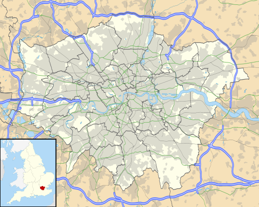 West Ham Location of West Ham in Greater London | |
| Location | West Ham |
| Local authority | London Borough of Newham |
| Managed by | London Underground |
| Station code(s) | WEH |
| DfT category | C1 |
| Number of platforms | 8 |
| Accessible | Yes[1][2] |
| Fare zone | 2 and 3 |
| London Underground annual entry and exit | |
| 2018 | |
| 2019 | |
| 2020 | |
| 2021 | |
| 2022 | |
| DLR annual boardings and alightings | |
| 2018 | |
| 2019 | |
| 2020 | |
| 2021 | |
| 2022 | included in Underground usage[12] |
| National Rail annual entry and exit | |
| 2018–19 | |
| 2019–20 | |
| 2020–21 | |
| – interchange | 2,994[13] |
| 2021–22 | |
| – interchange | |
| 2022–23 | |
| – interchange | |
| Railway companies | |
| Original company | London, Tilbury and Southend Railway |
| Pre-grouping | Midland Railway |
| Post-grouping | London, Midland and Scottish Railway |
| Key dates | |
| 1 February 1901 | Opened (LT&SR/NLR) |
| 1902 | District line started |
| 1913 | London–Southend withdrawn |
| 1 January 1916 | NLR withdrawn |
| 1936 | Hammersmith & City started |
| 14 May 1979 | North London service started |
| 14 May 1999 | c2c and Jubilee line started |
| 9 December 2006 | North London service withdrawn |
| 31 August 2011 | DLR started[14] |
| Other information | |
| External links | |
| Coordinates | 51°31′41″N 0°00′14″E / 51.528°N 0.004°E |
West Ham is a London Underground, Docklands Light Railway (DLR) and National Rail intermodal interchange station in West Ham, London, United Kingdom. The station is served by London Underground's District, Hammersmith & City and Jubilee lines, the Stratford International branch of the DLR, and c2c National Rail services.
The station was opened in 1901 by the London, Tilbury and Southend Railway on the route from Fenchurch Street to Barking. In the late 1990s, the station was rebuilt and significantly expanded as part of the Jubilee Line Extension, fully opening in 1999. The station is in London fare zone 2 and zone 3.
History
[edit]East to west alignment
[edit]The London, Tilbury and Southend Railway direct line from Bow to Barking was constructed east to west through the middle of the Parish of West Ham in 1858. Before this, trains took a longer route via Stratford and Forest Gate to the north. The new line opened with stations initially at Bromley, Plaistow and East Ham. In November 1897 Arnold Hills, the owner of the Thames Ironworks and Shipbuilding Company, whose football team Thames Ironworks F.C. (which reformed in 1900 as West Ham United) played at the Memorial Grounds, secured an agreement with the London, Tilbury and Southend Railway to build a station at the intersection of Manor Road and Memorial Avenue. The company board approved this in February 1898 and Mowlem's was given the contract to build a four platform station, which allowed for the proposed quadrupling of the line with the completion of the Whitechapel and Bow Railway. The station was completed in May 1900, but did not open until 1 February 1901. The station was initially known as West Ham.
The North London Railway had run a daily service to Plaistow via the Bow-Bromley curve since 18 May 1869 and when West Ham opened it used the northern platforms. In 1905 they switched to the southern platforms, with the opening of a new bay platform at Plaistow on the southern side.[15] The Whitechapel and Bow Railway allowed through services of the Metropolitan District Railway to operate through West Ham to Upminster from 1902. The Metropolitan District converted to electric trains in 1905 and services were cut back to East Ham. The London, Tilbury and Southend Railway trains from Fenchurch Street used the southern platforms when the Metropolitan District services began but stopping was reduced to a few a week in 1908 and to nil in 1913. Ownership of the station passed to the Midland Railway in 1912 and the London, Midland and Scottish Railway in 1923. The station was renamed West Ham (Manor Road) on 11 February 1924. When the North London Railway service to Plaistow ceased on 1 January 1916 the southern platforms were unused in normal service.
The Metropolitan District Railway was incorporated into London Transport in 1933, and became known as the District line. Hammersmith & City line services started, as part of the Metropolitan line, in 1936. The southern platforms were removed after war damage in 1940 which had completely closed the station from 7 September 1940 until 11 August 1941.[16] After nationalisation of the railways in 1948 management of the station passed to British Railways. In 1969 ownership was transferred to the London Underground and the station was renamed back to West Ham on 1 January.
On 15 March 1976, nine people were injured here by an explosion on a train by a member of the Provisional IRA. Julius Stephen, the driver of the train, was shot dead at the scene when he attempted to pursue the fleeing bomber.[17]
As part of the Jubilee Line Extension, the station was completely rebuilt, with reconstructed District and Hammersmith and City line platforms. In addition, platforms were re-established on the main line from Fenchurch Street, now operated by c2c. As part of the work, the existing entrance was closed, and the refurbished ticket hall became a connecting concourse to the new ticket hall and the rest of the station. Additionally, the station was made fully accessible.[18]
The island platform for c2c services, along with the access staircases, are narrow and get easily congested. To ensure safety for passengers, staff must be present on the platforms at peak times. c2c have proposed an escalator to replace the stairs. The construction of an additional platform for westbound trains would eliminate the problem.[19][20]
London 2012 Summer and Paralympic Games
[edit]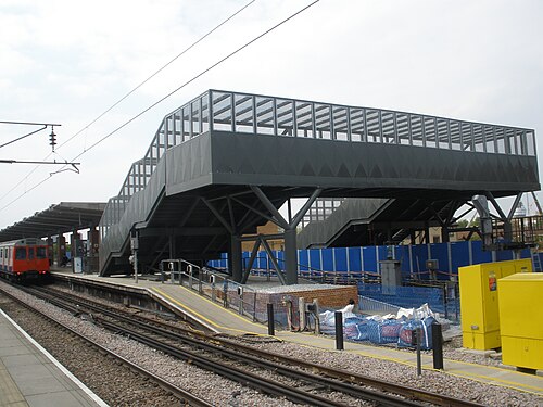
The station was temporarily modified to allow it to cope with an increase in passenger numbers during the London 2012 Olympic and Paralympic Games. A footbridge was constructed to connect the station to the Greenway foot and cycle path, which connects directly to the Olympic Park in Stratford.[21]
Work began in January 2011, with the construction of temporary stairs and a walkway from the eastern end of the District line platforms, over the eastbound track and running back parallel to the platform ending at Manor Road. The footbridge was demolished in mid-October 2012, following the end of the 2012 Summer Paralympics. The foundations of the temporary footbridge have been left for possible use in future expansion of the station.[22] A double-ended centre siding east of West Ham was constructed to compensate for lost reversing capacity caused by the rebuilding of Whitechapel station as part of Crossrail work.[23] This was commissioned on 17 January 2011.[24]
North to south alignment
[edit]The Eastern Counties and Thames Junction Railway was constructed north to south through West Ham, linking Stratford with Canning Town in 1846. Platforms were constructed on the line at West Ham and opened on 14 May 1979 when the Crosstown Linkline service began between Camden Road and North Woolwich.[25] The Crosstown Linkline was replaced with the electric North London Line service between Richmond and North Woolwich on 13 May 1985. In the 1990s, the station was comprehensively rebuilt as part of the Jubilee Line Extension, designed by van Heyningen and Haward Architects. A new bridge crosses four rail lines and a main road, to connect the Jubilee line and North London line platforms with the new ticket hall and the rest of the station.[18] Jubilee line services began on 14 May 1999.[26] North London Line services at the station ceased on 9 December 2006, when the line from Stratford to North Woolwich was closed, to allow for the line to be converted for the Docklands Light Railway. The platforms reopened on 31 August 2011 as part of the extension to Stratford International.[27]
New entrance
[edit]As part of the TwelveTrees development on the former Parcelforce distribution depot, a new station entrance is being built to connect to the upper Jubilee line concourse.[28][29] As well as this, two new pedestrian bridges over the railway will be built.[28][29]
Design and architecture
[edit]The station was rebuilt as part of the Jubilee Line Extension in the 1990s.[30][31] The design by van Heyningen and Haward Architects was considered to evoke work by Charles Holden in the 1930s, with use of brick and glass blocks, as well as a clock tower.[30][32] The station was designed in 27 weeks, and was the cheapest of the new stations to be built.[31] Critics called the station "effortlessly elegant"[31] and an "impressive architectural essay in brick, concrete and glass".[32] It was later awarded a Royal Fine Art Commission Trust Award.[31]
The station consists of four sets of island platforms, two on an elevated east–west alignment and another perpendicular pair at street level, giving a total of eight platform faces. The existing entrance was closed, with the old ticket hall refurbished to become a connecting concourse to the District and Hammersmith & City line platforms and the (new) c2c platforms. A new ticket hall - facing onto Manor Road - connects this concourse to the Jubilee line and North London line platforms via a high level bridge that spans four rail lines and a main road. The station building and connecting passageways are finished in a mixture of red brick, concrete and glass, inspired by Charles Holden.[18][33] The station was built at a fraction of the cost of other Jubilee Line Extension stations, just £10.5m compared to over £100m at stations like Canary Wharf.[34]
At the upper level, the northern island platform (Platform 1 and 2) are used by District line and Hammersmith & City line trains, and the southern island platform (Platforms 7 and 8) are used by c2c trains. At the lower level, the western island platform (Platforms 5 and 6) are used by Jubilee line trains, with the eastern island platform (Platforms 3 and 4) - formerly the North London line platforms - are now used by Docklands Light Railway trains.
Jubilee line trains can terminate here to enter into the nearby Stratford Market Depot. This is regularly used during peak times/at the end of the working day. Secondly, there is a crossover to the south of the DLR platforms so that trains can reverse early and head back south. Additionally there is a siding that opened in 2011 east of the sub-surface line platforms so that trains from both directions can terminate. [35]
Incidents
[edit]On 15 March 1976, seven people were injured by a Provisional IRA bomb on a Metropolitan line train. The terrorist then shot and killed the train's driver Julius Stephen.[36][17]
Location
[edit]The station is located at the corner of Durban Road and Manor Road, in the London Borough of Newham. The station is named after the former parish and borough of West Ham within which it was located to the west of the centre. The neighbourhood of West Ham is located some distance to the north-east. Since West Ham United Football Club moved to the Boleyn Ground in 1904, the station is no longer located near their home ground. East London Rugby Football Club is situated nearby on Holland Road, which is also home to Kings Cross Steelers RFC and Phantoms RFC.[37]
Services
[edit]
Services at West Ham are operated by c2c, Docklands Light Railway and London Underground on the District, Hammersmith & City and Jubilee lines.
The typical off-peak service in trains per hour (tph) is:
| Operator/line | Frequency to destination |
|---|---|
| c2c[38] | Westbound 8 tph to London Fenchurch Street |
| Eastbound 4 tph to Shoeburyness via Basildon (2 tph all stations and 2 tph semi-fast) 2 tph to Grays via Rainham 2 tph to Southend Central via Ockendon | |
| London Underground District line[39] |
Westbound 3 tph to Barking 12 tph to Upminster |
| Eastbound 3 tph to Wimbledon 6 tph to Richmond 6 tph to Ealing Broadway | |
| London Underground Hammersmith & City line[40] |
Westbound 6 tph to Hammersmith |
| Eastbound 6 tph to Barking | |
| London Underground Jubilee line[41] |
Northbound 24 tph to Stratford |
| Southbound 4 tph to West Hampstead 4 tph to Willesden Green 4 tph to Wembley Park 12 tph to Stanmore | |
| Docklands Light Railway[42] | Northbound 6 tph to Stratford International |
| Southbound 6 tph to Woolwich Arsenal |
The station also served by a night service on Friday and Saturday nights as part of the Night Tube. The station is served by Jubilee line trains every 10 minutes in each direction between Stratford and Stanmore.
| Preceding station | Following station | |||
|---|---|---|---|---|
| c2c | ||||
| Preceding station | Following station | |||
| Bromley-by-Bow towards Hammersmith
|
Hammersmith & City line | Plaistow towards Barking
| ||
| Bromley-by-Bow |
District line | Plaistow towards Upminster
| ||
| Canning Town towards Stanmore
|
Jubilee line | Stratford Terminus
| ||
| Preceding station | Following station | |||
| Abbey Road towards Stratford International
|
Docklands Light Railway | Star Lane towards Woolwich Arsenal
| ||
| Historical railways | ||||
| Bromley-by-Bow | British Rail Eastern Region |
Plaistow | ||
| Disused railways | ||||
| Stratford | Silverlink |
Canning Town | ||
| Former services | ||||
| Preceding station | Following station | |||
| Bromley-by-Bow towards Hammersmith
|
Metropolitan line
|
Plaistow towards Barking
| ||
Connections
[edit]London Bus route 276 serves the station.[43]
References
[edit]- ^ "Step free Tube Guide" (PDF). Transport for London. April 2021. Archived (PDF) from the original on 15 May 2021.
- ^ "London and South East" (PDF). National Rail. September 2006. Archived from the original (PDF) on 6 March 2009.
- ^ "Station Usage Data" (CSV). Usage Statistics for London Stations, 2018. Transport for London. 23 September 2020. Archived from the original on 14 January 2023. Retrieved 11 October 2023.
- ^ "Station Usage Data" (XLSX). Usage Statistics for London Stations, 2019. Transport for London. 23 September 2020. Archived from the original on 9 November 2020. Retrieved 9 November 2020.
- ^ "Station Usage Data" (XLSX). Usage Statistics for London Stations, 2020. Transport for London. 16 April 2021. Retrieved 1 January 2022.
- ^ "Station Usage Data" (XLSX). Usage Statistics for London Stations, 2021. Transport for London. 12 July 2022. Retrieved 7 September 2022.
- ^ "Station Usage Data" (XLSX). Usage Statistics for London Stations, 2022. Transport for London. 4 October 2023. Retrieved 10 October 2023.
- ^ "Station Usage Data" (XLSX). Usage Statistics for London Stations, 2018. Transport for London. 23 September 2020. Retrieved 9 January 2022.
- ^ "Station Usage Data" (XLSX). Usage Statistics for London Stations, 2019. Transport for London. 23 September 2020. Retrieved 9 January 2022.
- ^ "Station Usage Data" (XLSX). Usage Statistics for London Stations, 2020. Transport for London. 16 April 2021. Retrieved 9 January 2022.
- ^ "Station Usage Data" (XLSX). Usage Statistics for London Stations, 2021. Transport for London. 12 July 2022. Retrieved 7 September 2022.
- ^ "Station Usage Data" (XLSX). Usage Statistics for London Stations, 2022. Transport for London. 4 October 2023. Retrieved 20 October 2023.
- ^ a b c d e f g h "Estimates of station usage". Rail statistics. Office of Rail Regulation. Please note: Some methodology may vary year on year.
- ^ "Docklands Light Railway extension marks one year to go to the London 2012 Paralympic Games". Retrieved 5 February 2013.
- ^ The London & Tilbury Railway vol 1 page 41 by Peter Kay ISBN 1-899890-10-6
- ^ The London, Tilbury & Southend Railway vol 2 page 113 by Peter Kay ISBN 1-899890-19-X
- ^ a b "Onthis Day". BBC News. 15 March 1976. Retrieved 17 October 2017.
- ^ a b c Bennett, David, 1948- (2004). Architecture of the Jubilee Line Extension. London: Thomas Telford. ISBN 0-7277-3088-6. OCLC 51870430.
{{cite book}}: CS1 maint: multiple names: authors list (link) CS1 maint: numeric names: authors list (link) - ^ Steel, Theo (27 August 2020). "Will c2c continue to grow?". Modern Railways. Retrieved 7 February 2023.
- ^ "Essex Thameside Study" (PDF). Network Rail. July 2020. Retrieved 7 February 2023.
- ^ "New footbridge planned to avoid the 2012 Olympics crush". East London Advertiser. 26 November 2008. Retrieved 29 May 2020.
- ^ "West Ham Station gets Olympic footbridge". TRL.co.uk. 4 December 2009. Archived from the original on 5 May 2013. Retrieved 29 May 2020.
- ^ "TheRailwayCentre.Com". TheRailwayCentre.Com. Archived from the original on 28 November 2006. Retrieved 5 August 2010.
{{cite web}}: CS1 maint: unfit URL (link) - ^ Underground News March 2011 page 173 ISSN 0306-8617
- ^ Batten, M. (2020). East London Railways: From Docklands to Crossrail. United Kingdom: Amberley Publishing.
- ^ Horne, M: The Jubilee Line, page 79. Capital Transport Publishing, 2000.
- ^ "Docklands Light Railway extension marks one year to go to the London 2012 Paralympic Games". Transport for London. 31 August 2011. Retrieved 29 May 2020.
- ^ a b "TwelveTrees Park | New Homes in West Ham". Berkeley Group. Retrieved 23 October 2022.
- ^ a b Smith, John (26 May 2022). "West Ham development Twelvetrees Park now rising: New station entrance planned". Murky Depths. Retrieved 23 October 2022.
- ^ a b Bennett, David (2004). Architecture of the Jubilee Line Extension. London: Thomas Telford. ISBN 0727730886. OCLC 51870430.
- ^ a b c d "West Ham Station". vHH. Retrieved 25 January 2024.
- ^ a b Glancey, Jonathan (29 January 2000). "East meets West". The Guardian. ISSN 0261-3077. Retrieved 25 January 2024.
- ^ Cherry, Bridget. (2005). London. 5, East. O'Brien, Charles., Pevsner, Nikolaus, 1902-1983. New Haven, CT: Yale University Press. ISBN 0-300-10701-3. OCLC 57431801.
- ^ "West Ham Station, Jubilee Line Extension | van Heyningen and Haward Architects". www.vhh.co.uk. Retrieved 29 May 2020.
- ^ "Detailled London transport map (track, depot, ...)". cartometro.com. Retrieved 2 June 2023.
- ^ "1976: Tube driver shot dead". BBC On This Day. 2008. Retrieved 11 November 2017.
- ^ "Phantoms RFC". Phantoms RFC. Retrieved 5 August 2010.
- ^ "c2c Train Times" (PDF). c2c. June 2024. Retrieved 1 June 2024.
- ^ "District Line Timetable". Transport for London. Retrieved 6 March 2024.
- ^ "Hammersmith & City Line Timetable". Transport for London. Retrieved 6 March 2024.
- ^ "Jubilee Line Timetable". Transport for London. Retrieved 6 March 2024.
- ^ "DLR Train Timetables". Transport for London. Retrieved 6 March 2024.
- ^ "West Ham - bus stops". Transport for London. Retrieved 29 May 2020.
External links
[edit]- Train times and station information for West Ham station from National Rail
| International | |
|---|---|
| National | |
| Geographic | |
- Rail transport stations in London fare zone 2
- Rail transport stations in London fare zone 3
- DfT Category C1 stations
- District line stations
- Hammersmith & City line stations
- Docklands Light Railway stations in the London Borough of Newham
- Jubilee line stations
- London Underground Night Tube stations
- Tube stations in the London Borough of Newham
- Railway stations in the London Borough of Newham
- Former London, Tilbury and Southend Railway stations
- Railway stations in Great Britain opened in 1901
- Railway stations served by c2c
- West Ham
- 20th-century architecture in the United Kingdom