Kangaroo Island: Difference between revisions
m →Sea transport: Added link for S. S. Karatta |
m add link in text, use italics |
||
| Line 125: | Line 125: | ||
===Sea transport=== |
===Sea transport=== |
||
[[File:PRG280 1 3 295 The [[S. S. Karatta|S. S. |
[[File:PRG280 1 3 295 The [[S. S. Karatta|S. S. ''Karatta'']] leaving Hog Bay, Kangaroo Island.jpg|thumb|right|The SS ''Karatta'' leaving Hog Bay.]] |
||
[[Image:Sealion 2000 arriving at penneshaw.JPG|thumb|right|''Sealion 2000'' arriving at [[Penneshaw, South Australia|Penneshaw]]]] |
[[Image:Sealion 2000 arriving at penneshaw.JPG|thumb|right|''Sealion 2000'' arriving at [[Penneshaw, South Australia|Penneshaw]]]] |
||
Kangaroo Island is reliant on ferry services for the majority of its transport to and from the mainland. Ferry services are currently provided by [[Kangaroo Island SeaLink]] using two ferries, the ''[[Sealion 2000]]'' and the ''[[Spirit of Kangaroo Island]]''. |
Kangaroo Island is reliant on ferry services for the majority of its transport to and from the mainland. Ferry services are currently provided by [[Kangaroo Island SeaLink]] using two ferries, the ''[[Sealion 2000]]'' and the ''[[Spirit of Kangaroo Island]]''. |
||
From 1907 to 1961, SS ''Karatta'' was the prime freight and passenger vessel operating between Port Adelaide and Kingscote.{{citation needed|date=June 2014}} |
From 1907 to 1961, [[[[S. S. Karatta|SS ''Karatta'']] was the prime freight and passenger vessel operating between Port Adelaide and Kingscote.{{citation needed|date=June 2014}} |
||
Following withdrawal from service of ''Karatta'', RW. Miller operated the [[MV Troubridge|MV ''Troubridge'']], in later years as a joint venture with the South Australian Government. ''Troubridge'' was a roll on, roll off vessel of 1,996 tons, which used specially designed loading gantries at [[Port Adelaide]], [[Port Lincoln]] and Kingscote.{{citation needed|date=June 2014}} |
Following withdrawal from service of ''Karatta'', RW. Miller operated the [[MV Troubridge|MV ''Troubridge'']], in later years as a joint venture with the South Australian Government. ''Troubridge'' was a roll on, roll off vessel of 1,996 tons, which used specially designed loading gantries at [[Port Adelaide]], [[Port Lincoln]] and Kingscote.{{citation needed|date=June 2014}} |
||
Revision as of 14:40, 24 October 2014
 | |
| Geography | |
|---|---|
| Location | South Australia |
| Coordinates | 35°50′S 137°15′E / 35.833°S 137.250°E |
| Area | 4,405 km2 (1,701 sq mi) |
| Length | 150 km (93 mi) |
| Width | 90 km (56 mi) |
| Coastline | 540 km (336 mi) |
| Highest elevation | 299 m (981 ft) |
| Administration | |
Australia | |
| Demographics | |
| Population | 4,417 |
| Pop. density | 1.00/km2 (2.59/sq mi) |
Kangaroo Island is Australia's third-largest island, after Tasmania and Melville Island. It lies in the state of South Australia 112 km (70 mi) south-west of Adelaide. Its closest point to the mainland is Snapper Point in Backstair Passage which is 13.5 km (8.4 mi) from the Fleurieu Peninsula.
Once occupied by Australian Aborigines, the native population disappeared after the land became an island following rising sea levels several thousand years ago. It was subsequently resettled from the early 19th century onwards, at first casually by sealers and whalers, and then as part of the colony of South Australia from 1836.
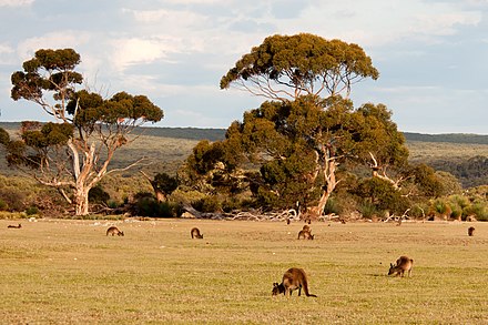
Since then the island's economy has been principally agricultural, with a southern rock lobster fishery and with tourism growing in importance. The largest town, and the administrative centre, is Kingscote. The island has several nature reserves to protect the remnants of its natural vegetation and native animals, with the largest and best-known being Flinders Chase National Park at the western end.
Description
The island is 150 km (93 mi) long and between 90 km (56 mi) and 57 km (35 mi) wide, its area covering 4,405 km2 (1,701 sq mi). Its coastline is 540 kilometres (340 mi) long and highest point is Mount McDonnell at 299 m (981 ft) above sea level.[1] It is separated from Yorke Peninsula to the north-west by Investigator Strait and from Fleurieu Peninsula to the north-east by Backstairs Passage. A group of islets, the Pages, lie off the eastern end of the island.
History
Prehistory
Kangaroo Island separated from mainland Australia around 10,000 years ago, due to rising sea level after the last glacial period. Known as Karta ("Island of the Dead") by the mainland Aboriginal tribes, the existence of stone tools and shell middens show that Aboriginal people once lived on Kangaroo Island.[2] It is thought that they occupied it as long ago as 16,000 years before the present, and may have only disappeared from the island as recently as 2000 years ago.[3]
A mainland Aboriginal dreaming story tells of the Backstairs Passage flooding:[4]
"Long ago, Ngurunderi's two wives ran away from him, and he was forced to follow them. He pursued them and as he did so he crossed Lake Albert and went along the beach to Cape Jervis. When he arrived there he saw his wives wading half-way across the shallow channel which divided Naroongowie from the mainland. He was determined to punish his wives, and angrily ordered the water to rise up and drown them. With a terrific rush the waters roared and the women were carried back towards the mainland. Although they tried frantically to swim against the tidal wave they were powerless to do so and were drowned."
European settlement
On 23 March 1802 British explorer Matthew Flinders, Commanding HMS Investigator, named the land "Kanguroo (sic) Island",[5] due to the endemic subspecies of the Western grey kangaroo, Macropus fuliginosus fuliginosus,[6] after landing near Kangaroo Head on the north coast of Dudley Peninsula. He was closely followed by the French explorer Commander Nicolas Baudin, who was the first European to circumnavigate the Island and who mapped much of the island (which is why so many areas have French names). Although the French and the British were at war at the time, the men met peacefully. They both used the fresh water seeping at what is now known as Hog Bay near Frenchman's Rock and the site of present-day Penneshaw. Baudin named the Island Île Borda, in honour of Jean-Charles de Borda, although the French chart published by Louis de Freycinet after Baudin's death referred to the Island as Île Decres.
A community of sealers and others existed on Kangaroo Island from 1802 to the time of South Australia's colonisation in 1836. The sealers were rough men and several kidnapped Aboriginal women from Tasmania and mainland South Australia. The women were kept prisoner as wives and virtual slaves.[7] Three Aboriginal women tried to escape and swim back to the mainland; one is on record as having survived the journey.[8] In 1803 sealers from the American brig Union built the schooner Independence, the first ship constructed in South Australia, at what is now American River.

The first ship to arrive that brought settlers for the new colony was the Duke of York commanded by Captain Robert Clark Morgan in 1836.
Shipwrecks and lighthouses

Numerous ships have been wrecked on the Kangaroo Island coastline, the largest being Portland Maru of 5,865 tons, which sank at Cape Torrens on 20 March 1935. The greatest loss of life occurred with the wreck of Loch Sloy on 24 April 1899 at Maurpetius Bay, when 31 persons were drowned, and one initial survivor subsequently perished. 27 people drowned at West Bay in September 1905, when Loch Vennachar was wrecked.[9][10]
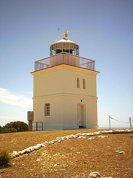
The first lighthouse built was erected at Cape Willoughby in 1852; this was also the first lighthouse to be erected in South Australia. This was followed by the Cape Borda Lightstation in 1858, the Cape du Couedic Lighthouse in 1906 and Cape St Albans Lighthouse in 1908. All lighthouses continue to be operational.[11]
Economy
Townships
The biggest town on Kangaroo Island is Kingscote. Originally established at Reeves Point on 27 July 1836, it is South Australia's first colonial settlement. It was later suggested that Kingscote could serve as the capital of South Australia, but the island's resources were insufficient to support such a large community, so the settlement of Adelaide was chosen.
There are several smaller towns on the island. Penneshaw, the second largest town on Kangaroo Island, has a population of around 300, and is located on the north eastern tip of the Dudley Peninsula, on the eastern end of the island. It contains the ferry terminal which brings most of the visitors to the island, along with all the necessary freight to sustain the local population. Parndana, in the centre of the island, is home to a population of around 150, however most of this population do not live in the town, they are sprawled within a few kilometres. The historic area to the south-east of the township, known as the Research Centre to locals, was home to the research station that was set up in the 1940s and 1950s to research the viability of agriculture in the area, and is still home to a small settlement of about 20 people.
American River, on the north coast between Kingscote and Penneshaw, is home to about 220 residents. Penneshaw, Parndana and American River each have basic facilities, including a general store and fuel and all are home to hotels. Facilities such as banking and large supermarkets are available in Kingscote and Penneshaw, although all towns have EFTPOS facilities of some sort.
Population
According to the 2011 Census, the island has a population of 4,417.[12] Population growth has slowed in past years, with the attraction of mainland Australia for younger adults being the key factor in this. Censuses show the number of residents aged over 55 increased from 24.1% in 2001 to 29.8% in 2006 and 34.9% in 2011.
Agriculture
The economy is mostly agricultural (wine, honey, wool, meat and grain). Traditionally sheep grazing has been the key element in agriculture on the Island, however in recent times, more diverse crops, such as potatoes and canola have been introduced. Cattle farming has grown as well, with good quality beef cattle being grown in the higher rainfall areas. Tourism and fishing also play significant roles, with the island experiencing over 186,000 visitors per annum, and some of the best southern rock lobster being sourced from the island's rugged south coast. Kangaroo Island has South Australia's only eucalyptus oil distillery with oil distilled from the endemic Kangaroo Island Narrow Leaf Mallee.[citation needed]
The island also has 28 wine growers.[13] The first vineyard was planted at Eastern Cove in 1976 and the first wine made in 1982. This was blended with Tolleys Barossa wine and sold from the cellar door of Eastern Cove Wine as KI-Barossa blend. The Florance vineyard was established under supervision of B. Hayes of Eastern Cove, who produced its first wine – Eastern Cove Cygnet – and introduced it at the University of South Australia, 1990. The wine carried a Kangaroo Island appellation label as first wine 100% of the region.
The future of over 19,000 hectares, which had been planted (or due to be planted ) with blue gum for future harvesting is now in doubt following the collapse of Great Southern Plantation Ltd in May 2009.[citation needed]
Ligurian bees
Kangaroo Island is noted for its honey and its Ligurian honey bees. The island has the world's only pure-bread and disease-free population of this type of bee. The exporting of pure-bred queen bees is a notable industry for the island. For this reason there are significant quarantine restrictions on bringing bee products and bee-handling equipment onto the island.
The Advertiser, 24 December 1883, reported "A few weeks since the Chamber of Manufactures forwarded an order to Mr. Carroll, a bee master, near Brisbane, for a swarm of Ligurian bees." The American Bee Journal, 25 November 1885, stated "Several pure colonies were reared from this one, [the first hive from Queensland] and two of them were sent to Kangaroo Island, where they appear to thrive well." An almost word perfect report in the British Bee Journal, 1 November 1885, added "They came from the apiary of Mr. Chas. Fullwood."
Bonney quickly commenced queen bee breeding near Adelaide at his Upper Kensington apiary in January 1884. In the South Australian Advertiser, 7 March 1884, Bonney stated "About three weeks ago I divided the original colony, and the Chamber of Manufactures now possesses three good swarms of Ligurians; two of these will probably be ready to send out towards the end of the month." And on 9 May 1884 "To show that I think highly of the Ligurians, I may say that in March I imported two more colonies from Queensland. … During Easter holidays Mr Justice Boucaut took one queen [bred and mated in Adelaide] in a full colony to Mr Buick, of American River, Kangaroo Island." From the South Australian Advertiser, 1 August 1884 "On June 25 the original hive of Ligurian bees, imported by the chamber from Queensland, was sent safely to Mr Turner, at Smith's Bay, Kangaroo Island."[14]
Tourism


Kangaroo Island is one of South Australia's most popular tourist attractions, attracting over 140,000 visitors each year, with international visitors, primarily from Europe, accounting for more than 25% of these visits.[15] Some of the most popular tourist spots are:
- Seal Bay with ranger guided walks among basking Australian sea lions.
- Flinders Chase National Park which includes Remarkable Rocks, Admiral's Arch, lighthouses at Cape Borda and Cape du Couedic, and multiple walking trails and camping areas.
- Cape Willoughby
- Kelly Hill Caves
- Little Sahara, huge sand dunes on the south coast.
- the lookout Mount Thisby (officially designated Prospect Hill in 2002 to honour Matthew Flinders' original naming) with a 360 degree view around the island.
- Murray Lagoon with its abundant aquatic bird life.
- Parndana Wildlife Park
- Kangaroo Island Penguin Centre (formerly Kangaroo Island Marine Centre) at Kingscote.
- Raptor Domain (In-flight bird of prey presentation and reptile show)
- The Hanson Bay Wildlife Sanctuary koala walk and Nocturnal tour offer visitors a chance to see the local wildlife.
Local government
The Kangaroo Island Council provides local government for the entire island, and was formed in 1996 following amalgamation of the previous District Councils of Kingscote and Dudley. Kangaroo Island is in the federal Division of Mayo, represented by Jamie Briggs, and in the state Electoral district of Finniss, represented by Michael Pengilly, a former mayor of the Kangaroo Island Council.
A 2005 enquiry into the financial sustainability of local government in South Australia, determined that Kangaroo Island Council was unsustainable, due to its large land area, extensive road network, low population and high tourism visitation.[citation needed] A long term financial plan adopted by council includes a rate increase of 2% above CPI for the ten years from 2010.
On 13 May 2010 a new Development Plan was authorised, representing a comprehensive review of Kangaroo Island's planning regulations.[16]
Lifestyle

Safe swimming is possible on the northern beaches, such as Emu Bay, Stokes Bay or Snellings Beach, and at Island Beach on the Dudley Peninsula.[citation needed] The south coast has dangerous undertows and is more suitable for stronger and experienced swimmers only.[citation needed]
Kangaroo Island has several organised sporting competitions, including Australian rules football (see Kangaroo Island Football League), cricket, darts, go kart racing, lawn bowls, netball, sailing, softball, squash and tennis.[citation needed]
Transport
Sea transport
[[File:PRG280 1 3 295 The S. S. Karatta leaving Hog Bay, Kangaroo Island.jpg|thumb|right|The SS Karatta leaving Hog Bay.]]

Kangaroo Island is reliant on ferry services for the majority of its transport to and from the mainland. Ferry services are currently provided by Kangaroo Island SeaLink using two ferries, the Sealion 2000 and the Spirit of Kangaroo Island.
From 1907 to 1961, [[SS Karatta was the prime freight and passenger vessel operating between Port Adelaide and Kingscote.[citation needed]
Following withdrawal from service of Karatta, RW. Miller operated the MV Troubridge, in later years as a joint venture with the South Australian Government. Troubridge was a roll on, roll off vessel of 1,996 tons, which used specially designed loading gantries at Port Adelaide, Port Lincoln and Kingscote.[citation needed]
Troubridge operated until 1 June 1987, when it was replaced by the Government run A$23 millionIsland Seaway.[17][18][19] Built locally in Port Adelaide by Eglo Engineering, Island Seaway used the same loading platforms as Troubridge. Island Seaway was severely criticised as being unsuitable for the Backstairs Passage crossing. Seventy-five sheep and cattle died on the inaugural trip due to carbon monoxide poisoning, and the ship was once described as 'steering like a shopping trolley'.[20] The vessel subsequently underwent a A$1 million refit of its propulsion system in September 1989 which improved its reliability.
Island Seaway began to experience competition from Kangaroo Island SeaLink which began services from Cape Jervis to Penneshaw in 1989.[21] SeaLink acquired the ferry service originally introduced by Peter March. His "Philanderer Ferries" pioneered the crossing from Cape Jervis to Penneshaw, with Philanderer 3 being a passenger and vehicle carrying catamaran style vessel. During the 1980s, two passenger only services, Hydroflite H33, and Islander, operated for a short time from Glenelg to Kingscote.
SeaLink has outlasted several competing companies since it began operations. Boat Torque, a Western Australian company, operated Superflyte from 1994 until 1997, sailing from Glenelg to Kingscote. Kangaroo Island Ferries had a short-lived venture with SeaWay, which travelled from Wirrina Cove to Kingscote from September 2004 until February 2005. SeaWay could not handle rough weather as well as SeaLink vessels which impacted the service's reliability. Under different proprietorship, SeaWay recommenced services in August 2007.[22] However, in May 2008, the operator of SeaWay announced suspension of services until October 2008, citing increased fuel prices.[23] In June 2008 the SeaWay's operating company was placed in administration and the vessel advertised for sale.[24]
With the introduction by SeaLink of the Island Navigator, the fate of Island Seaway was sealed, with the service subsequently withdrawn and SeaLink drawing on Government subsidies to operate all freight services to and from the Island. SeaLink now holds a virtual monopoly on sea transport to Kangaroo Island, primarily due to its long term lease of the Cape Jervis berth. Sealink's agreement with the SA Government, expiring in 2024, precludes other operators from using the Cape Jervis facility for one hour before, and one hour after any scheduled SeaLink service. Kangaroo Island residents have expressed displeasure with the exclusive arrangement granted to SeaLink.[25]
Air transport
Guinea Airways operated the first commercial service to Kangaroo Island, commencing in the 1930s. In 1959, the airline was acquired by Airlines of South Australia (ASA), a subsidiary of Ansett Airlines. The airline's final service was on 4 April 1986. ASA primarily operated Convairs, Douglas DC-3 and Fokker F-27 aircraft. A Piaggio P166 was used infrequently in the 1970s, whilst Rossair operated Cessna 402s in an arrangement with ASA to replace the F27s in off-peak times.
Following the withdrawal of ASA, Kendell Airlines (another Ansett subsidiary), operated 19-seat Fairchild Metroliners and 34-seat SAAB aircraft to the Island. Upon Ansett's ultimate demise in 2002, Regional Express (Rex) acquired the Kendell aircraft and continued services which are maintained today [citation needed].
In competition with the larger aircraft, and generally with more flexible timetables, a succession of smaller airlines from the 1970s tried with varying success to maintain a 'second string' presence. Island Air and Pagas operated briefly in the 1970s, whilst the most successful, Emu Airways, commenced in 1980 and made its final flight in November 2005 [citation needed]. Emu flew Piper Chieftain aircraft to Kingscote, American River, Penneshaw and Parndana, before air regulations dictated abandonment of all airstrips except Kingscote. Air Kangaroo Island (formerly Air Transit), flew Cessna 402s to the Island during the 1990s [citation needed].
From 1986 to 1990, Lloyd Aviation operated Embraer EMB 110 Bandeirante aircraft, before flying the Short 330. For several years during the 1980s, Commodore Airlines (eventually becoming State Air) offered another alternative service. QantasLink briefly operated a service after the demise of Emu Airways, commencing 18 December 2005, but withdrew less than six months later. QantasLink also operated direct flights from Kangaroo Island to Melbourne, the first time the route was operated.[26]
In January 2007 Air South [27] commenced four services daily using Titan nine seat aircraft, but ceased flights in October 2009.[28]
Environment
Climate

The winters between June and September are mild and wet, the summers usually warm and dry. Tempered by the ocean, particularly on the coastline, maximum temperatures in summer rarely exceed 35 degrees Celsius. Average temperatures in August range between 13 to 16 degrees and in February, the hottest month, between 20 and 25 degrees. Between May and September the island receives 2/3 of its annual rainfall, varying from 450 mm in Kingscote to around 900 mm near Roo Lagoon on the top of the central plateau. The wettest month is July.[29]
- Average Annual Temperature: 11.6 – 19.1 °C
- Average January Temperature: 14.9 – 23.6 °C
- Average July Temperature: 8.4 – 14.6 °C
- Days over 30 °C: 10.3
- Days over 35 °C: 1.6
- Days under 2 °C: 0.3
- Days under 0 °C: 0.0
- Annual Rainfall: 485.1 mm
- Average Annual Wind Speed: 14.7 – 17.7 km/h
Conservation

Nearly half of the island has never been cleared of vegetation,[30] and a quarter of it is conserved in National Parks, Conservation Parks, and five Wilderness Protection Areas.[31] The main protected areas are:
- Flinders Chase National Park
- Seal Bay Conservation Park
- Cape Gantheaume Conservation Park
- Cape Bouguer Wilderness Protection Area
- Ravine des Casoars Wilderness Protection Area
Because of its isolation from mainland Australia, foxes and rabbits are absent from and prohibited from entering the island. Registration and microchipping of cats is mandatory.[32] The Kangaroo Island Kangaroo, Rosenberg's Sand Goanna, Southern Brown Bandicoot, Tammar Wallaby, Common Brushtail Possum, Short-beaked Echidna and New Zealand Fur Seal are native to the island, as well as six bat and frog species. The sole endemic vertebrate species is a small marsupial carnivore called the Kangaroo Island Dunnart. The Koala, Common Ringtail Possum and Platypus have been introduced and still survive there.
The introduced Koalas have flourished on the island, to the degree that their preferred food source, the Manna Gum, is at risk of local extinction.[citation needed]
Birds
An endemic species of emu, the Kangaroo Island emu, became extinct between 1802 and 1836.[33] The island is the last South Australian refuge of an endangered subspecies of the Glossy Black Cockatoo (Calyptorhynchus lathami halmaturinus).[34][35]
Kangaroo Island has been identified by BirdLife International as an Important Bird Area (IBA) because it supports populations of the vulnerable fairy tern, the near threatened bush stone-curlew, hooded plover and western whipbird, and the biome-restricted rock parrot and purple-gaped honeyeater. It also supports over 1% of the world populations of Cape Barren geese, black-faced cormorants, Pacific gulls and pied oystercatchers, and sometimes of musk ducks, blue-billed ducks, freckled ducks, Australian shelducks, chestnut teals and banded stilts.[36]
Little penguin colonies
Little penguin colonies at Penneshaw and Kingscote can be accessed by joining guided nocturnal tours. Both colonies are currently in decline. Several colonies elsewhere on the island are believed to now be extinct, or contain only 'a few' birds. Historic colonies on Kangaroo Island include Cape Gantheaume, Ravine des Casoars and Harvey's Return.[37] In 1950, Little penguins could be found at Flinders Chase in 'thousands'.[38] Penguins were also present at Hanson Bay on the island's south coast in the 1950s.[39] The decline of penguin populations has prompted expanded monitoring regimes from 2011 to the present. The 2013 Kangaroo Island little penguin census revealed that numbers had decreased by 44 to 100 per cent at all surveyed colonies over the prior two years. The census includes eight survey sites.[40]
Fires

Lightning strikes on Thursday 6 December 2007 caused several fires on the Island. Before being contained on 16 December 2007, over 900 square kilometres (or 20% of the Island) had been burnt, principally within National Park and Conservation Reserves.
The most serious outbreak occurred in Flinders Chase, with 630 square kilometres (or 85% of the total Park area) having been burnt.[41]
Fossils
| Kangaroo Island | |
|---|---|
| Stratigraphic range: | |
 North Coast of Kangaroo Island, Emu Bay © David Simpson | |
| Type | Geological formation |
| Lithology | |
| Primary | Shale |
| Location | |
| Coordinates | 35°35′S 137°30′E / 35.583°S 137.500°E |
| Region | The north coast of Kangaroo Island, around Emu Bay and Cape D'Estaing |
| Country | South Australia, Australia. |
The northern coast of Kangaroo Island contains important fossil-bearing deposits, dating from the late Lower Cambrian, such as the Emu Bay Shale (late Botomian, 517 million years old).[43] A variety of primordial marine arthropods left their remains in this Burgess shale type preservation, but the larger grain size of the Emu Bay rock means that the quality of preservation is lower.[44]
A few genera of non-biomineralized arthropods, among them Squamacula, Kangacaris, and the megacheiran Tanglangia, are known only from the Emu Bay Shale and Chengjiang. The site is also the source of magnificent specimens of trilobites such as Redlichia takooensis, Emuella polymera, Balcoracania dailyi, Megapharanaspis nedini, Holyoakia simpsoni, and Estaingia (=Hsuaspis) bilobata.[45] Balcoracania and Emuella are the only known genera of the distinctive Redlichiina family Emuellidae, known for possessing the greatest number of thoracic segments known for Trilobita as a whole (a record of 103 in one Balcoracania specimen), and so far entirely restricted to Australia and Antarctica.
The depositional environment of the majority of Burgess-Shale-type assemblages is outer shelf, deeper water. The Emu Bay Shale in contrast, appears to represent deposition in restricted basins on the inner shelf, indicating that soft tissue preservation occurred in a range of environmental settings during the Cambrian. Some Emu Bay fossils display extensive mineralization of soft tissues, most often of blocky apatite or fibrous calcium carbonate, including the oldest phosphatized muscle tissue – along with records from Sirius Passet in Greenland, the first thus far reported from the Cambrian. Mid-gut glands are preserved three-dimensionally in calcium phosphate in the arthropods Isoxys and Oestokerkus, as in related species from the Burgess Shale.
See also
Notes and references
- ^ a b Pub175, Sailing directions (enroute) north, west, and south coast of Australia (PDF) (10th ed.). National Geospatial-Intelligence Agency. 2010. p. 205. Retrieved 16 May 2014.
- ^ Rebe Taylor (2002). Unearthed: The Aboriginal Tasmanians of Kangaroo Island. Kent Town: Wakefield Press. ISBN 1-86254-552-9.
- ^ http://www.tourkangarooisland.com.au/history/earlyhistory.aspx
- ^ A biography of the Australian continent; Karta: Island of the Dead – Kangaroo Island
- ^ "Transcription of Journal of Matthew Flinders". State Library of South Australia. pp. 170 (23 March 1802). Retrieved 17 June 2008.
- ^ "Kangaroo Island kangaroo – Macropus fuliginosus". Australia Reptile Park. Retrieved 28 January 2013.
- ^ Wurm, Stephen; Muhlhausler, Peter; Tryon, Darrell, eds. (1996). Atlas of Languages of Intercultural Communication in the Pacific, Asia, and the Americas, Vol. II.1. Berlin: Mouton de Gruyter, a division of Walter de Gruyter & Co. p. 86. ISBN 3-11-013417-9.
- ^ Tony Love (13 December 2002). "Colonial History; In the beginning". The Advertiser. p. 19. Retrieved 18 August 2007.
- ^ Chapman,Gifford D,Kangaroo Island Shipwrecks: Roebuck Society Publications 1972, ISBN 0-909434-01-8.
- ^ "The Loss of the Loch Vennachar", The Register (Adelaide, South Australia), 25 November 1905, page 6. Retrieved 17 August 2012.
- ^ Chapman,Gifford D.Kangaroo Island Shipwrecks Roebruck Society Publication, 1972, ISBN 0-909434-01-8
- ^ Australian Bureau of Statistics (31 October 2012). "Kangaroo Island (DC) (Local Government Area)". 2011 Census QuickStats. Retrieved 11 March 2013.
- ^ Bottled With Pride – Tourism SA, Kangaroo Island
- ^ Barrett, Peter (2010) The Immigrant Bees, Volume 5. Caloundra, Queensland
- ^ Kangaroo Island Tourism Optimisation Model (2005–2006). "Visitor Exit Surveys". Retrieved 22 June 2007.
- ^ "Development Plan – Kangaroo Island Council" (PDF). Government of South Australia. 13 May 2010. Retrieved 24 May 2010.
- ^ Smith, Andrea (June 2006). "The maritime cultural landscape of Kangaroo Island, South Australia: A study of Kingscote and West Bay" (PDF). Flinders University, South Australia. Retrieved 15 June 2007.
{{cite journal}}: Cite journal requires|journal=(help) - ^ State Library of South Australia. "Loading sheep at Kingscote Jetty". Archived from the original on 6 September 2007. Retrieved 15 June 2007.
- ^ Newcastle Regional Museum. "Summary of R.W.Miller & Co". Retrieved 15 June 2007.
- ^ Adelaide Advertiser, State Opposition statement attributed to Ted Chapman MP,26 August 1987
- ^ Our Company History – Sealink Web Site
- ^ "KI Ferries expected to be operating by week's end". ABC News. 30 July 2007. Retrieved 11 August 2007.
- ^ Innes, Stuart (22 May 2008). "Fuel price leaves KI ferry high and dry". Adelaide Advertiser. Retrieved 22 May 2008.
- ^ "Ferry for sale". The Islander News. 19 June 2008. Archived from the original on 1 January 2010. Retrieved 20 June 2008.
- ^ "Kangaroo Island residents unhappy about ferry agreement". Australian Broadcasting Corporation. 7 August 2002. Archived from the original on 26 September 2009. Retrieved 15 June 2007.
- ^ "Other News – 10/31/2005". Air Transport World. 1 November 2005. Retrieved 20 August 2011.
Qantas is expanding its QantasLink regional network into South Australia effective Dec. 18. It will operate 58 flights per week between Adelaide and Port Lincoln, daily service between Adelaide and Kangaroo Island and four weekly services between Melbourne and Kangaroo Island, all aboard Dash 8s.
- ^ "Air South". Retrieved 9 July 2007.
- ^ "Air South calls it quits". The Islander. 10 September 2009. Retrieved 17 September 2009.
- ^ Bureau of Meteorology, Australia. "Climate statistics for Australian locations". Retrieved 18 June 2007.
- ^ "Kangaroo Island – About". Australian Broadcasting Corporation. Retrieved 25 August 2012.
- ^ "South Australian National Parks & Reserves – Kangaroo Island Region". South Australian Government Department for Environment and Heritage. Retrieved 3 July 2008.
- ^ "Dog and Cat Management Plan" (PDF). Kangaroo Island Council. 2005. Retrieved 3 July 2008.
- ^ "Kangaroo Island Emu". BirdLife data zone: Species factsheet. BirdLife International. 2012. Retrieved 31 December 2012.
- ^ "Glossy Black-cockatoo". BirdLife data zone: Species factsheet. BirdLife International. 2012. Retrieved 31 December 2012.
- ^ "Calyptorhynchus lathami halmaturinus — Glossy Black-Cockatoo (Kangaroo Island), Glossy Black-Cockatoo (South Australian)". SPRAT profile. Department of Sustainability, Environment, Water, Population and Communities, Australia. 13 March 2012. Retrieved 31 December 2012.
- ^ "IBA: Kangaroo Island". Birdata. Birds Australia. Retrieved 13 July 2011.
- ^ Wiebken, A. "Conservation Priorities for Little Penguin Populations in Gulf St Vincent" (PDF) SARDI, South Australia (2011-06). Retrieved 21 February 2014.
- ^ Masterman, Mervina Flinders Chase - Kangaroo Island, South Australia Georgian House, Melbourne, Australia (1950).
- ^ "Eleanor Barbour's Pages for Country Women" Chronicle, South Australia (1951-12-13). Retrieved 2014-03-14.
- ^ "Penguin populations dropping". The Islander. Kangaroo Island, South Australia. 24 July 2014. Retrieved 26 July 2014.
- ^ The Islander 2007-12-20
- ^ Attention: This template ({{cite doi}}) is deprecated. To cite the publication identified by doi:10.1016/j.gr.2012.12.002, please use {{cite journal}} (if it was published in a bona fide academic journal, otherwise {{cite report}} with
|doi=10.1016/j.gr.2012.12.002instead. - ^ JB Jago, Xiaowen Sun and Wen-long Zang (December 2002). "Correlation within early Palaeozoic basins of eastern South Australia" (PDF). pp. 1–22. Retrieved 4 April 2010.
- ^ Glaessner, M. F. (1979). "Lower Cambrian Crustacea and annelid worms from Kangaroo Island, South Australia" (PDF). Alcheringa: an Australasian Journal of Palaeontology. 3 (1). Taylor & Francis: 21–31. doi:10.1080/03115517908565437.
- ^ Pocock, K. J. (1970). "The Emuellidae, a new family of trilobites from the Lower Cambrian of South Australia". Palaeontology. 13: 522–562.
External links
- Kangaroo Island – South Australian Tourism Commission site
- ABC Radio National, Hindsight program "Kangaroo Island unearthed" broadcast 22 February 2004
Kangaroo Island travel guide from Wikivoyage
- Online guide to Kangaroo Island bird wildlife and vertebrates wildlife
| Major townships | |||||||||
|---|---|---|---|---|---|---|---|---|---|
| Beaches | |||||||||
| Coastal features |
| ||||||||
| Protected areas |
| ||||||||
| Islands adjacent to Kangaroo Island coast | |||||||||
| Related and uncategorised | |||||||||