Lower Rio Grande Valley: Difference between revisions
Rescuing 1 sources and tagging 0 as dead. #IABot (v1.3.2.1) (Cyberpower678) |
|||
| Line 36: | Line 36: | ||
The Rio Grande Valley is not a true [[valley]], but a [[floodplain]], containing many [[oxbow lake]]s or ''resacas'' formed from pinched-off [[meander]]s in earlier courses of the Rio Grande.<ref>[http://www.tshaonline.org/handbook/online/articles/ryr01 Texas State Historical Association — Lower Rio Grande Valley]</ref> Early 20th-century land developers, attempting to capitalize on unclaimed land, utilized the name "Magic Valley" to attract settlers and appeal to investors. The Rio Grande Valley is also called ''El Valle'', the Spanish translation of "the valley", by those who live there.<ref>[http://www.wintertexans.com/texasvalley.htm Winter Texan Resources for South Padre Island, Brownsville, Harlingen, and the Rio Grande Valley]</ref> The residents of the Rio Grande Valley occasionally refer to the area as "El Mágico Valle del Río Grande" ("The Magical Valley of the Rio Grande"), and also simply by the initials R.G.V. |
The Rio Grande Valley is not a true [[valley]], but a [[floodplain]], containing many [[oxbow lake]]s or ''resacas'' formed from pinched-off [[meander]]s in earlier courses of the Rio Grande.<ref>[http://www.tshaonline.org/handbook/online/articles/ryr01 Texas State Historical Association — Lower Rio Grande Valley]</ref> Early 20th-century land developers, attempting to capitalize on unclaimed land, utilized the name "Magic Valley" to attract settlers and appeal to investors. The Rio Grande Valley is also called ''El Valle'', the Spanish translation of "the valley", by those who live there.<ref>[http://www.wintertexans.com/texasvalley.htm Winter Texan Resources for South Padre Island, Brownsville, Harlingen, and the Rio Grande Valley]</ref> The residents of the Rio Grande Valley occasionally refer to the area as "El Mágico Valle del Río Grande" ("The Magical Valley of the Rio Grande"), and also simply by the initials R.G.V. |
||
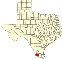
The main region is within four Texan counties: [[Starr County, Texas|Starr County]], [[Hidalgo County, Texas|Hidalgo County]], [[Willacy County, Texas|Willacy County]], and [[Cameron County, Texas|Cameron County]]. As of January 1, 2012, the U.S. Census Bureau estimated the population of the Rio Grande Valley at 1,305,782.<ref>[http://factfinder2.census.gov/faces/tableservices/jsf/pages/productview.xhtml?src=bkmk 2012 Census Estimates ]</ref> According to the [[United States Census Bureau|U.S. Census Bureau]] in 2008, 86 percent of Cameron County, 90 percent of Hidalgo County, 97 percent of Starr County, and 86 percent of Willacy County are [[Hispanic and Latino Americans|Hispanic]].<ref>[http://www.lafepolicycenter.org/documents/LRGV.SENIOR.12.09.pdf Texas Lower Rio Grande Valley Fact Sheet]</ref> |
The main region is within four Texan counties: [[Starr County, Texas|Starr County]], [[Hidalgo County, Texas|Hidalgo County]], [[Willacy County, Texas|Willacy County]], and [[Cameron County, Texas|Cameron County]]. As of January 1, 2012, the U.S. Census Bureau estimated the population of the Rio Grande Valley at 1,305,782.<ref>[http://factfinder2.census.gov/faces/tableservices/jsf/pages/productview.xhtml?src=bkmk 2012 Census Estimates ] {{webarchive|url=https://web.archive.org/web/20140815134909/http://factfinder2.census.gov/faces/tableservices/jsf/pages/productview.xhtml?src=bkmk |date=2014-08-15 }}</ref> According to the [[United States Census Bureau|U.S. Census Bureau]] in 2008, 86 percent of Cameron County, 90 percent of Hidalgo County, 97 percent of Starr County, and 86 percent of Willacy County are [[Hispanic and Latino Americans|Hispanic]].<ref>[http://www.lafepolicycenter.org/documents/LRGV.SENIOR.12.09.pdf Texas Lower Rio Grande Valley Fact Sheet]</ref> |
||
The largest city is [[Brownsville, Texas|Brownsville]] (Cameron County), followed by [[McAllen, Texas|McAllen]] (Hidalgo County). Other major cities include [[Harlingen, Texas|Harlingen]], [[Edinburg, Texas|Edinburg]], [[Mission, Texas|Mission]], [[Rio Grande City, Texas|Rio Grande City]], [[Raymondville, Texas|Raymondville]], [[Weslaco, Texas|Weslaco]], [[Hidalgo, Texas|Hidalgo]] and [[Pharr, Texas|Pharr]].<ref>[http://ea.panam.edu/disc/popestrgv.html Population Estimates for Rio Grande Valley Cities 2000-2004]</ref> |
The largest city is [[Brownsville, Texas|Brownsville]] (Cameron County), followed by [[McAllen, Texas|McAllen]] (Hidalgo County). Other major cities include [[Harlingen, Texas|Harlingen]], [[Edinburg, Texas|Edinburg]], [[Mission, Texas|Mission]], [[Rio Grande City, Texas|Rio Grande City]], [[Raymondville, Texas|Raymondville]], [[Weslaco, Texas|Weslaco]], [[Hidalgo, Texas|Hidalgo]] and [[Pharr, Texas|Pharr]].<ref>[http://ea.panam.edu/disc/popestrgv.html Population Estimates for Rio Grande Valley Cities 2000-2004]</ref> |
||
Revision as of 02:02, 22 May 2017
This article needs additional citations for verification. (November 2009) |
Template:Geobox The Rio Grande Valley (RGV), The Valley, is an area located in the southernmost tip of South Texas. It lies along the northern bank of the Rio Grande river, which separates Mexico from the United States. The four-county region, consisting of Hidalgo, Cameron, Willacy, and Starr counties, is one of the fastest growing places in the United States.[citation needed] From having about 325,000 people in 1969, to today a population over 1,300,000 in 2014. Some of the biggest cities in the region are; Brownsville, McAllen, Mission, Edinburg, Pharr, Weslaco, Harlingen, Rio Grande City, and Hidalgo.
Geography and demographics
The Rio Grande Valley is not a true valley, but a floodplain, containing many oxbow lakes or resacas formed from pinched-off meanders in earlier courses of the Rio Grande.[1] Early 20th-century land developers, attempting to capitalize on unclaimed land, utilized the name "Magic Valley" to attract settlers and appeal to investors. The Rio Grande Valley is also called El Valle, the Spanish translation of "the valley", by those who live there.[2] The residents of the Rio Grande Valley occasionally refer to the area as "El Mágico Valle del Río Grande" ("The Magical Valley of the Rio Grande"), and also simply by the initials R.G.V.
The main region is within four Texan counties: Starr County, Hidalgo County, Willacy County, and Cameron County. As of January 1, 2012, the U.S. Census Bureau estimated the population of the Rio Grande Valley at 1,305,782.[3] According to the U.S. Census Bureau in 2008, 86 percent of Cameron County, 90 percent of Hidalgo County, 97 percent of Starr County, and 86 percent of Willacy County are Hispanic.[4]
The largest city is Brownsville (Cameron County), followed by McAllen (Hidalgo County). Other major cities include Harlingen, Edinburg, Mission, Rio Grande City, Raymondville, Weslaco, Hidalgo and Pharr.[5]
Tourism
The Lower Rio Grande Valley encompasses landmarks that attract tourists, and popular destinations include: Laguna Atascosa National Wildlife Refuge, Santa Ana National Wildlife Refuge, and Bentsen-Rio Grande Valley State Park; and on the coast: South Padre Island, Brazos Island, and the Port Isabel Lighthouse.
The Valley is a popular waypoint for tourists visiting Northeast Mexico. Popular destinations across the border and Rio Grande include: Matamoros, Nuevo Progreso, Río Bravo, and Reynosa, all located in the Mexican state of Tamaulipas.
The Valley also attracts tourists from the Mexican states of Tamaulipas, Nuevo León, Coahuila, and Mexico, D.F. (México City).
Places of historical interest
- First Lift Station
- Los Ebanos Ferry, last hand-operated ferry on the Rio Grande
- La Lomita Historic District
- Fort Brown
- Palo Alto Battlefield National Historic Site
- Resaca de la Palma
- Rancho de Carricitos[6]
- USMC War Memorial original plaster working model, located on the campus of the Marine Military Academy in Harlingen
- Museum of South Texas History, originally the County Court House and Jail, built in the late 19th century
- Battle of Palmito Ranch, location of the last battle of the Civil War
- Brownsville Raid
- Battle of Resaca de la Palma
Economy
The Valley is historically reliant on agribusiness and tourism. Cotton, grapefruit, sorghum, maize, and sugarcane are its leading crops, and the region is the center of citrus production and the most important area of vegetable production in the State of Texas. Over the last several decades, the emergence of maquiladoras (factories or fabrication plants) has caused a surge of industrial development along the border, while international bridges have allowed Mexican nationals to shop, sell, and do business in the border cities along the Rio Grande. The geographic inclusion of South Padre Island also drives tourism, particularly during the Spring Break season, during which South Padre Island becomes reminiscent of New Orleans during Mardi Gras.[citation needed] During the winter months, many retirees (commonly referred to as "Winter Texans") arrive to enjoy the warm weather, access to pharmaceuticals and health care in Mexican border crossings such as Nuevo Progreso. There is a substantial health-care industry with major hospitals and many clinics and private practices in Brownsville, Harlingen, and McAllen.

Texas is the third largest producer of citrus fruit in United States, the majority of which is grown in the Rio Grande Valley. Grapefruit make up over 70% of the Valley citrus crop, which also includes orange, tangerine, tangelo and Meyer lemon production each Winter.[7]
There are two semi-professional sports teams that play in the Rio Grande Valley: The Rio Grande Valley Vipers (basketball), and The Rio Grande Valley FC Toros (soccer). Previous teams that are now defunct include: the Edinburg Roadrunners (baseball), La Fiera FC (indoor soccer), Rio Grande Valley Ocelots FC,(soccer), Rio Grande Valley WhiteWings (baseball), Rio Grande Valley Killer Bees (ice hockey), and the RGV Sol (indoor football).
One of the Valley's major tourist attractions is the semi-tropical wildlife. Birds and butterflies attract a large amount of visitors every year all throughout the entire valley. Ecotourism is a major economic force in the Rio Grande Valley.
Politics
| Year | GOP | DEM | Others |
|---|---|---|---|
| 2016 | 29.0% 81,885 | 67.6% 190,922 | 3.40% 9,544 |
| 2012 | 29.6% 68,927 | 69.3% 161,804 | 1.00% 4,433 |
| 2008 | 31.2% 69,287 | 67.8% 150,424 | 1.00% 2,033 |
| 2004 | 45.8% 90,493 | 53.8% 106,300 | 0.40% 789 |
| 2000 | 39.5% 69,801 | 59.1% 104,327 | 1.40% 2,505 |
| 1996 | 29.2%44,959 | 65.8% 101,327 | 5.00% 7,605 |
| 1992 | 30.7% 49,798 | 56.6% 91,667 | 12.7% 20,523 |
| 1988 | 37.0%56,479 | 62.5% 95,425 | 0.50% 671 |
| 1984 | 46.5% 68,602 | 53.2% 78,625 | 0.30% 435 |
| 1980 | 42.9% 51,233 | 54.9% 65,571 | 2.14% 2,559 |
| 1976 | 35.3% 37,853 | 64.0% 68,661 | 0.70% 772 |
| 1972 | 56.8% 48,442 | 42.7% 36,410 | 0.05% 390 |
| 1968 | 38.1% 28,831 | 55.1% 41,665 | 6.80% 5,147 |
| 1964 | 34.1%23,002 | 65.7% 44,374 | 0.20% 169 |
| 1960 | 40.4% 25,465 | 59.0% 37,239 | 0.60% 360 |
As of 2016, officeholders tend to be Democrat. It is common for voters to be influenced by members of their own extended families and by prominent families in their towns, so politicians often try to make friends with family groups to increase their chances of getting elected. As of 2006, about 20,000 to 30,000 people in Cameron County habitually vote in primary elections, and Presidential elections have higher turnouts. Politiqueras, women hired to help elderly people vote, are crucial in South Texas elections. Cecilia Ballí of Texas Monthly wrote that voters expect to get favors from politicians they vote for, and if they do not get these favors they become resentful of politicians as a whole.[8]
Education
Colleges and universities located in the Rio Grande Valley include:
- Texas A&M Health Science Center, School of Public Health - McAllen
- Texas A&M University - McAllen Campus (A direct branch of the main Texas A&M University campus in College Station expected to open in 2017.)
- University of Texas Rio Grande Valley — Entered into full operation in 2015 with the merger of the University of Texas at Brownsville and the University of Texas–Pan American. UTRGV will include a new medical school.
- Texas Southmost College
- Texas State Technical College
- South Texas College
- University of Texas Health Science Center - Regional Academic Health Center[9]
Hospitals
- Cornerstone Regional Hospital, Edinburg, Texas
- Edinburg Children's Hospital, Edinburg, Texas
- Edinburg Regional Medical Center, Edinburg, Texas
- Doctors Hospital at Renaissance, Edinburg, Texas
- Harlingen Medical Center, Harlingen, Texas
- McAllen Heart Hospital, McAllen, Texas
- McAllen Medical Center, McAllen, Texas
- Rio Grande Regional Hospital, McAllen, Texas
- Rio Grande State Hospital, Harlingen, Texas
- Solara Hospital, Harlingen, Texas
- VA Health Care Center at Harlingen. Harlingen, Texas
- Valley Baptist Medical Center, Harlingen, Texas
- Valley Baptist Medical Center, Brownsville, Texas
- Valley Regional Medical Center, Brownsville, Texas
- Knapp Medical Center, Weslaco, Texas
- Mission Regional Medical Center, Mission, Texas
Media
Magazines
- The Go Guide - published by Above Ground Media, LLC rgvgoguide.com
- Celebrity Group Magazines - owned by Celebrity Group Advertising Agency
- Rio Grande Magazine
- ((www.viva-el-valle.com)) owned by viva el valle magazine
- ((http:..www.tots-tweens.com - owned by J&L Publishing LLC
- RGV Drives Magazine - Published by MAT Media Solutions
Newspapers
- Valley Town Crier - owned by Gatehouse Media
- The Edinburg Review - owned by Gatehouse Media
- Valley Bargain Book - owned by Gatehouse Media
- El Periódico USA - owned by www.elperiodicousa.com
- El Extra - owned by AIM Media Texas
- El Nuevo Heraldo - owned by AIM Media Texas
- Mega Doctor News - owned by www.megadoctornews.com
- Texas Border Business - owned by www.texasborderbusiness.com
- The Brownsville Herald - owned by AIM Media Texas
- The Island Breeze - owned by AIM Media Texas
- The Mid Valley Town Crier - Owned by AIM Media Texas
- The Monitor - owned by AIM Media Texas
- Valley Morning Star - owned by AIM Media Texas
- Valleywood Magazine - owned by Valleywood Publications
- ((www.viva-el-valle.com)) - owned by Viva el Valle internet magazine
Local Blogs
- Viva South Texas - owned by White Coyote Productions[10]
- Ouch, My Ego! - Local alt news blog[11]
Television
- KGBT-TV/DT Action 4 News, CBS Affiliate
- KRGV-TV/DT Newschannel 5, ABC Affiliate
- KVEO-TV/DT News Center 23, NBC Affiliate
- KCWT-CD 21, The CW Affiliate
- KTFV-CD 32, Telefutura Affiliate
- KMBH TV/DT 38, PBS Affiliate
- KLUJ-TV/DT 44, TBN Affiliate
- KTLM-TV/DT 40, Telemundo Affiliate
- KNVO TV/DT 48, Univision Affiliate
- KFXV-LD 67, Fox 2 News, Fox Affiliate
- XERV-TDT 9.1 Televisa
- XHAB-TDT 7.1 Vallevision, Televisa
Radio
- KBFM Wild 104 (Hip Hop/Top 40)
- XEEW-FM Los 40 Principales 97.7 (Top 40 Spanish/English)
- KBTQ 96.1 Exitos (Spanish Oldies)Univision
- KCAS 91.5 FM (Christian, Teaching/Preaching/Music)
- KESO Digital 92.7 (Internacional, Spanish Top 40)
- KFRQ Q94.5 The Rock Station (Classic/Modern/Hard Rock)
- KGBT 1530 La Tremenda (Univision)
- KGBT-FM 98.5 FM (Regional Mexican) Univision
- KHKZ Kiss FM 105.5 & 106.3 (Hot Adult Contemporary)
- KIRT 1580 AM Radio Imagen (Variety, Spanish contemporary)
- KIWW (Spanish)
- KJAV 104.9 Jack FM
- KKPS La Nueva 99.5 (Regional Mexican)
- KJJF/KHID 88.9/88.1 NPR (Classical/Public Radio)
- KNVO-FM Super Estrella (Super Star) 101.1
- KQXX Kiss FM 105.5 & 106.3 (Hot Adult Contemporary, simulcast of KHKZ)
- KTEX 100.3 (Country)
- KURV 710 AM Heritage Talk Radio (part of the BMP family of stations)
- KVLY 107.9 Mix FM (Top 40)
- KVMV 96.9 FM (Christian, Contemporary Music) World Radio Network
- XHRYA-FM 90.9 Mas Music (Spanish/English Mix)
- KBUC Super Tejano102.1 (Tejano)
Notable people
A list of notable people who were born, lived, or died in the Rio Grande Valley includes:
- David V. Aguilar (Chief Border Patrol Agent, United States Border Patrol; Rio Grande Valley Station, Texas)
- Micaela Alvarez (Federal judge; Donna, Texas)
- Natalia Anciso (Contemporary Artist; Weslaco and Mercedes, Texas)
- Gloria E. Anzaldúa (Writer/Poet; Hargill, Texas)
- Cathy Baker (T.V. performer; Edinburg, Texas)
- Lloyd Bentsen (U.S. Secretary of the Treasury, U.S. Senator, U.S. Representative; Mission, Texas)
- James Carlos Blake (Novelist, Brownsville)
- Harlon Block (Iwo Jima flag raiser, died on Iwo Jima; Weslaco, Texas)
- David Bowles (Critic, author and translator; Donna, Texas)
- William S. Burroughs American writer, his time as a farmer in the valley in Pharr, Texas is briefly chronicled in his books Junky and Queer
- Rolando Cantú is a Mexican football player who used to play for the Arizona Cardinals in the U.S. and graduated from McAllen High School; McAllen, Texas.
- Raúl Castillo (Actor; McAllen, Texas)
- Thomas Haden Church (Actor; Harlingen, Texas)
- Freddy Fender (Musician/Actor lyricist; San Benito, Texas)
- Mike Fossum (Astronaut; McAllen, Texas)
- Reynaldo Guerra Garza (Judge for the United States Court of Appeals for the Fifth Circuit; Brownsville, Texas)
- Kika de la Garza (U.S. Representative; Mission, Texas)
- Roberto Garza (Professional Football Player Chicago Bears; Rio Hondo, Texas)
- Xavier Garza (Children's author and illustrator; Rio Grande City, Texas)
- Tony Garza (U.S. Ambassador to Mexico; Brownsville, Texas)
- Alfredo C. Gonzalez (Medal of Honor Recipient, U.S. Marine Veteran; Edinburg, Texas)
- Matt Gonzalez (2008 Vice Presidential candidate; former president of the Board of Supervisors of San Francisco, California; born, McAllen, Texas)
- Esteban Jordan (Accordionist; Elsa, Texas)
- Bill Haley (Musician; Harlingen, Texas)
- Catherine Hardwicke (Film director, writer, producer; McAllen, Texas)
- Rolando Hinojosa (Author; Mercedes, Texas)
- Rubén Hinojosa (U.S. Representative, Edcouch Elsa, Texas)
- Kris Kristofferson (Musician, actor, songwriter; Brownsville, Texas)
- Tom Landry (American football coach, Mission, Texas)
- Bobby Lackey (College Football Player; Weslaco, Texas)
- José M. López (Medal of Honor Recipient; Mission, Texas)
- Domingo Martinez (author; Brownsville, Texas)
- Roy Mitchell-Cárdenas (Musician in rock band MuteMath; McAllen, Texas)
- Jack Morava (Mathematician at Johns Hopkins University; Mercedes, Texas)
- Rachel McLish (Ms. Olympia, actor; Harlingen, Texas)
- Bobby Morrow (Olympic gold medalist; San Benito, Texas)
- Eduardo “Eddie” Perez (Tejano Roots Hall of Fame inductee 2005, Tejano Academy Of Musicians Legacy Award 2008, Latin Grammy winner 2013, Edinburg, Texas)
- Major Samuel Ringgold (Father of modern artillery, served at what is now Fort Ringgold; Rio Grande City, Texas)
- Charles M. Robinson III (Author; San Benito, Texas)
- Valente Rodriguez (Actor; Edcouch, Texas)
- James Nicholas "Nick" Rowe (February 8, 1938 – April 21, 1989) McAllen,TX Col, USASF Green Beret 5th Group Battalion Commander, Vietnam POW, Created modern day Survive, Evade, Resist, Escape (SERE) training for most at risk Military personnel and civilians still used today by SOCOM community
- Ricardo Sanchez (U.S. Army lieutenant general; Ground forces commander in Iraq; Rio Grande City, Texas)
- Julian Schnabel (Filmmaker; Brownsville, Texas)
- Merced Solis aka Tito Santana (Wrestler; Mission, Texas)
- Nick Stahl (Actor; Harlingen, Texas)
- Emeraude Toubia (Actress; Brownsville, Texas)
- Filemon Bartolome Vela (Federal judge; Harlingen, Texas)
- Eric Miles Williamson (Novelist/Literary Critic/Professor; McAllen, Texas)
- Cristela Alonzo(comedian/Actress/writer/producer; San Juan, Texas)
See also
Notes
References
- ^ Texas State Historical Association — Lower Rio Grande Valley
- ^ Winter Texan Resources for South Padre Island, Brownsville, Harlingen, and the Rio Grande Valley
- ^ 2012 Census Estimates Archived 2014-08-15 at the Wayback Machine
- ^ Texas Lower Rio Grande Valley Fact Sheet
- ^ Population Estimates for Rio Grande Valley Cities 2000-2004
- ^ National Park Service: Rancho de Carricitos
- ^ Rootstock and Scion Varieties by Julian W. Sauls, Professor & Extension Horticulturist, Texas AgriLife Extension
- ^ Ballí, Cecilia. "The Bad Guy With the Badge" (Archive). Texas Monthly. August 2006. Retrieved on May 25, 2016.
- ^ RAHC Vision Statement
- ^ http://www.vivasouthtexas.com/about-us.html
- ^ http://ouchmyego.com/about-ouch-my-ego/
External links
- Texas State Historical Association — Lower Rio Grande Valley
- Rio Grande Valley Partnership: Valley Chamber
- Rio Grande Valley Sports Information Center
- South Padre Island Turtle Cam
- Rgvattractions.com: Attractions in the Rio Grande Valley
- Rio Grande Valley Community Foundation
- RGVPride.com
- Los Ebanos, TX
- Wintertexaninfo.com: The Winter Texan Connection

Municipalities and communities of Hidalgo County, Texas, United States | ||
|---|---|---|
| Cities |  | |
| CDPs |
| |
| Other community | ||
Municipalities and communities of Willacy County, Texas, United States | ||
|---|---|---|
| Cities | 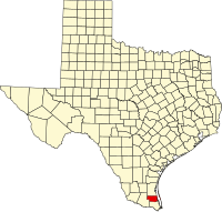 | |
| CDPs | ||
| Other communities | ||