Dodge Township, Dubuque County, Iowa
Dodge Township | |
|---|---|
 Location in Dubuque County | |
| Coordinates: 42°25′28″N 91°05′06″W / 42.42444°N 91.08500°W | |
| Country | |
| State | |
| County | Dubuque |
| Area | |
| • Total | 36.6 sq mi (94.78 km2) |
| • Land | 36.57 sq mi (94.7 km2) |
| • Water | 0.03 sq mi (0.08 km2) 0.08% |
| Elevation | 1,001 ft (305 m) |
| Population (2000) | |
| • Total | 1,204 |
| • Density | 32.9/sq mi (12.7/km2) |
| Time zone | UTC-6 (CST) |
| • Summer (DST) | UTC-5 (CDT) |
| ZIP codes | 52040, 52046, 52078 |
| GNIS feature ID | 0467717 |
Dodge Township is one of seventeen townships in Dubuque County, Iowa, USA. As of the 2000 census, its population was 1,204.[1]
Geography
According to the United States Census Bureau, Dodge Township covers an area of 36.6 square miles (94.78 square kilometers); of this, 36.57 square miles (94.7 square kilometers, 99.92 percent) is land and 0.03 square miles (0.08 square kilometers, 0.08 percent) is water.
Cities, towns, villages
- Dyersville (partial)
- Farley (partial)
- Worthington
Adjacent townships
- New Wine Township (north)
- Iowa Township (northeast)
- Taylor Township (east)
- Whitewater Township (southeast)
- Cascade Township (south)
- South Fork Township, Delaware County (southwest)
- North Fork Township, Delaware County (west)
Cemeteries
The township contains these three cemeteries: Fairview, Saint Pauls and Worthington Baptist (historical).
Major highways
School districts
- Western Dubuque Community School District
Political districts
- Iowa's 1st congressional district
- State House District 31
- State House District 32
- State Senate District 16
References
- United States Census Bureau 2007 TIGER/Line Shapefiles
- United States Board on Geographic Names (GNIS)
- United States National Atlas
External links
Municipalities and communities of Dubuque County, Iowa, United States | ||
|---|---|---|
| Cities | 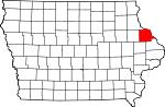 | |
| Townships | ||
| Unincorporated communities | ||
| Footnotes | ‡This populated place also has portions in an adjacent county or counties | |