Fichier:Map of kingdom of Arles.jpg
Fichier d’origine (500 × 659 pixels, taille du fichier : 112 kio, type MIME : image/jpeg)
Ce fichier et sa description proviennent de Wikimedia Commons.
Description
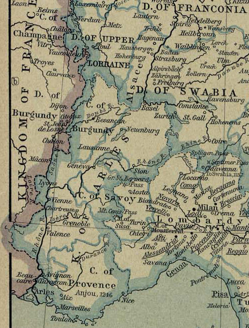
Map of Kingdom of Arles extracted from a map from the Holy Roman Empire (1138-1254)
From: Home > Finding Information > PCL Map Collection > Historical Maps of Europe - [Germany] The Holy Roman Empire under the Hohenstaufen, 1138-1254 (458K)
From The Historical Atlas by William R. Shepherd, 1926.
Initial Map modified by Poppy
Conditions d’utilisation
|
Cette œuvre est également dans le domaine public dans tous les pays pour lesquels le droit d’auteur a une durée de vie de 70 ans ou moins après la mort de l’auteur. | |
| Ce fichier a été identifié comme étant exempt de restrictions connues liées au droit d’auteur, y compris tous les droits connexes et voisins. | |
Historique du fichier
Cliquer sur une date et heure pour voir le fichier tel qu'il était à ce moment-là.
| Date et heure | Vignette | Dimensions | Utilisateur | Commentaire | |
|---|---|---|---|---|---|
| actuel | 3 janvier 2006 à 21:42 | 500 × 659 (112 kio) | Poppy | == Description == {{PD-PCL|shepherd/roman_empire_1138_1254.jpg|historical/}} Map of Kingdom of Arles extracted from a map from the Holy Roman Empire (1138-1254) From: Home > Finding Information > PCL Map Collection > Historical Maps of Europe - [German |
Utilisation du fichier
Les 8 pages suivantes utilisent ce fichier :
Usage global du fichier
Les autres wikis suivants utilisent ce fichier :
- Utilisation sur br.wikipedia.org
- Utilisation sur ca.wikipedia.org
- Utilisation sur da.wikipedia.org
- Utilisation sur de.wikipedia.org
- Utilisation sur en.wikipedia.org
- Utilisation sur eo.wikipedia.org
- Utilisation sur et.wikipedia.org
- Utilisation sur it.wikipedia.org
- Utilisation sur ko.wikipedia.org
- Utilisation sur pl.wikipedia.org
- Utilisation sur vls.wikipedia.org