வார்ப்புரு:Location map/doc: திருத்தங்களுக்கு இடையிலான வேறுபாடு
உள்ளடக்கம் நீக்கப்பட்டது உள்ளடக்கம் சேர்க்கப்பட்டது
சி The file Image:Locator_Dot.gif has been replaced by Image:Locator_Dot.png by administrator commons:User:Shizhao: ''Was in category "Duplicate", exact duplicate''. ''Translate me!'' |
சி தானியங்கிஅழிப்பு: pt:Predefinição:Posição mapa (deleted) |
||
| வரிசை 229: | வரிசை 229: | ||
[[no:Mal:Kartposisjon]] |
[[no:Mal:Kartposisjon]] |
||
[[pl:Szablon:Mapa lokalizacyjna]] |
[[pl:Szablon:Mapa lokalizacyjna]] |
||
[[pt:Predefinição:Posição mapa]] |
|||
[[ru:Шаблон:ПозКарта]] |
[[ru:Шаблон:ПозКарта]] |
||
[[sq:Stampa:Harta e pozicionit]] |
[[sq:Stampa:Harta e pozicionit]] |
||
09:01, 31 திசம்பர் 2011 இல் நிலவும் திருத்தம்
| This is a documentation subpage for வார்ப்புரு:Location map. It may contain usage information, பகுப்புகள் and other content that is not part of the original வார்ப்புரு page. |
Creates a location map as a composite image of an existing map in equirectangular projection with a marker and an optional label superimposed onto it. Note:
- Using "caption=xxx" frames the map (empty "caption=" leaves map unframed);
- The marker/label is not checked for valid latitude/longitude & could land anywhere on the article page, even beyond the bottom;
- To suppress the marker, set marksize=1 pixel wide.
- For map "width=250" omit "px" or will stretch across page.
- To place multiple markers/labels, refer below to: See also.
- To map along converging longitudes, refer to: Template:Location_map_skew.
Usage
{{Location map
|location
|label      = label text
|label_size = map font size, per cent
|position   = left or right or top or bottom or none –
               position of the label relative to the mark, defaults to right
|background = color, background color for the label, defaults to none
|lon_dir=W    longitude: W=west, E=east (default)
|lat_dir=S    latitude: S=south, N=north (default)
|lat_deg    = latitude degrees
|lat_min    = latitude minutes
|lat_sec    = latitude seconds
|lon_deg    = longitude degrees
|lon_min    = longitude minutes
|lon_sec    = longitude seconds
|lat        = latitude (decimal format; enter negative numbers for southern latitude)
|long       = longitude (decimal format; enter negative numbers for western longitude)
|mark       = marker image file name, a red dot by default
|marksize   = marker size, default=8
|border     = border color or none
|caption    = map caption; for no caption enter "caption="; if the parameter is omitted then the caption will be "Marker text (location map name)"
|float      = left or right or center or none
|width      = map width (omit "px" or will stretch across page)
|AlternativeMap = Alternative map file name (changes background map, border coordinates are determined based on the map name); this is only recommended for use in templates }}
Parameter location refers to {Template:Location map location} containing the name and coordinates of a map.
Available maps
List of templates Template:Location map location (without "Template:" prefix here):
- Location map
- Location map+
- Location map+/AlternativeMap
- Location map+/doc
- Location map+/old
- Location map+/old/width
- Location map+/overlay
- Location map+/relief
- Location map-line
- Location map-line/draw line
- Location map-line/x
- Location map-line/y
- Location map/Info
- Location map/List
- Location map/decdeg
- Location map/doc
- Location map/doc/See also infobox templates
- Location map/marker
- Location map/sandbox
- Location map Albania
- Location map Algeria
- Location map Andorra
- Location map Antigua and Barbuda
- Location map Argentina
- Location map Arizona
- Location map Armenia
- Location map Aruba2
- Location map Asia
- Location map Asia2
- Location map Australia
- Location map Australia Northern Territory
- Location map Australia Victoria complete Melbourne metropolitan area
- Location map Azerbaijan
- Location map Bahamas
- Location map Bahrain
- Location map Bangladesh
- Location map Belgium
- Location map Belize
- Location map Bolivia
- Location map Botswana
- Location map Brazil
- Location map Brazil Rio de Janeiro City
- Location map Brunei
- Location map Bulgaria
- Location map Burma
- Location map Cambodia
- Location map Canada
- Location map Canada Alberta
- Location map Canada Ontario
- Location map Canary Islands
- Location map Cape Verde
- Location map Caribbean
- Location map Caucasus mountains
- Location map Central African Republic
- Location map Chad
- Location map Chennai
- Location map China
- Location map China Heilongjiang
- Location map China Shanghai
- Location map China Tibet
- Location map China Yunnan
- Location map Colombia
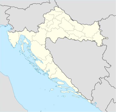
- Location map Croatia
- Location map Cyprus
- Location map Côte d'Ivoire
- Location map Denmark Faroe Islands
- Location map Djibouti
- Location map Dominica
- Location map Dominican Republic
- Location map Dubai
- Location map Earth
- Location map East Timor
- Location map Ecuador
- Location map Egypt
- Location map Egypt Sinai
- Location map El Salvador
- Location map England
- Location map Equatorial Guinea
- Location map Equatorial Guinea Bioko
- Location map Eritrea
- Location map Estonia
- Location map Ethiopia
- Location map Europe
- Location map Falkland Islands
- Location map Fiji
- Location map Finland Åland
- Location map France
- Location map France Alsace
- Location map France Basse-Normandie
- Location map France Bretagne
- Location map France Paris
- Location map France Île-de-France
- Location map Gabon
- Location map Gambia
- Location map Georgia
- Location map Germany
- Location map Germany Berlin
- Location map Germany Berlin central
- Location map Golan Heights
- Location map Greater Johannesburg
- Location map Greater London
- Location map Greece
- Location map Greenland
- Location map Guatemala
- Location map Guinea
- Location map Guinea-Bissau
- Location map Hungary
- Location map Iceland
- Location map India
- Location map India Andaman and Nicobar Islands
- Location map India Andhra Pradesh
- Location map India Arunachal Pradesh
- Location map India Assam
- Location map India Bangalore
- Location map India Bengaluru
- Location map India Bihar
- Location map India Chandigarh
- Location map India Chennai
- Location map India Chhattisgarh
- Location map India Dadra and Nagar Haveli
- Location map India Goa
- Location map India Gujarat
- Location map India Haryana
- Location map India Himachal Pradesh
- Location map India Jammu and Kashmir
- Location map India Jharkhand
- Location map India Karnataka
- Location map India Lakshadweep
- Location map India Madhya Pradesh
- Location map India Manipur
- Location map India Meghalaya
- Location map India Mizoram
- Location map India Mumbai
- Location map India Nagaland
- Location map India Odisha
- Location map India Patna
- Location map India Puducherry
- Location map India Punjab
- Location map India Rajasthan
- Location map India Sikkim
- Location map India Tamil Nadu
- Location map India Telangana
- Location map India Tripura
- Location map India Uttar Pradesh
- Location map India Uttarakhand
- Location map India West Bengal
- Location map India airport
- Location map Indian Ocean
- Location map Indonesia Borneo
- Location map Indonesia Java
- Location map Indonesia Sulawesi
- Location map Indonesia Sumatra South
- Location map Iraq
- Location map Israel
- Location map Israel ashkelon
- Location map Israel north haifa
- Location map Italy
- Location map Italy Rome Antiquity
- Location map Italy Umbria
- Location map Japan Fukushima Prefecture
- Location map Japan Ryukyu Islands
- Location map Jordan
- Location map Kashmir
- Location map Kazakhstan
- Location map Kenya
- Location map Kosovo
- Location map Kuwait
- Location map Kyrgyzstan
- Location map Lahore
- Location map Latvia
- Location map Liaoning
- Location map Liberia
- Location map Macedonia
- Location map Maharashtra
- Location map Malaysia
- Location map Malaysia West
- Location map Malaysia peninsula
- Location map Mali
- Location map Malta
- Location map Mauritius
- Location map Mesoamerica
- Location map Metro Atlanta
- Location map Mexico
- Location map Mexico City Central
- Location map Mexico Puebla
- Location map Moldova
- Location map Moldova Transnistria
- Location map Mongolia
- Location map Montenegro
- Location map Morocco
- Location map Mozambique
- Location map Myanmar
- Location map Nagorno-Karabakh Republic
- Location map Namibia
- Location map Nepal
- Location map New York City
- Location map New Zealand
- Location map Nigeria
- Location map Northern Ireland
- Location map Oceania
- Location map Old Jerusalem
- Location map Pacific Ocean
- Location map Pakistan
- Location map Pakistan Sindh
- Location map Palestinian territories
- Location map Panama
- Location map Papua New Guinea
- Location map Paraguay
- Location map Pennsylvania
- Location map Peru
- Location map Philippines
- Location map Puerto Rico
- Location map Qatar
- Location map Republic of the Congo
- Location map Russia
- Location map Russia Northwestern Federal District
- Location map Saint-Martin
- Location map Saint Vincent and the Grenadines
- Location map Samoa
- Location map San Francisco
- Location map San Marino
- Location map Saudi Arabia
- Location map Scotland Aberdeenshire
- Location map Scotland Dumfries and Galloway
- Location map Scotland Outer Hebrides
- Location map Senegal
- Location map Seychelles
- Location map Sierra Leone
- Location map Singapore
- Location map Sint Maarten
- Location map Slovenia
- Location map Solomon Islands Guadalcanal
- Location map Somaliland
- Location map South Africa
- Location map South Africa Free State
- Location map South Africa KwaZulu-Natal Greater Durban
- Location map South Africa Western Cape
- Location map South Korea
- Location map South Sudan
- Location map Spain
- Location map Spain 3
- Location map Spain Basque Country
- Location map Spain Catalonia
- Location map Spain Madrid
- Location map Sri Lanka
- Location map Sri Lanka relief
- Location map Suriname
- Location map Swaziland
- Location map Switzerland
- Location map Syria
- Location map Tajikistan
- Location map Tamil Nadu
- Location map Tanzania
- Location map Thailand
- Location map Tibetan Plateau
- Location map Togo
- Location map Tonga
- Location map Trinidad and Tobago
- Location map Tristan da Cunha
- Location map Tunisia Greater Tunis
- Location map Turkey
- Location map Turkey Istanbul
- Location map Turkmenistan
- Location map Tuvalu
- Location map UAE
- Location map UK Scotland
- Location map USA
- Location map USA American Samoa
- Location map USA Arizona
- Location map USA Florida
- Location map USA Georgia
- Location map USA New York City
- Location map USA Ohio
- Location map USA Texas
- Location map USA Virgin Islands
- Location map USA Washington
- Location map USA relief
- Location map Ukraine
- Location map Ukraine Kiev Oblast
- Location map United Kingdom
- Location map United Kingdom Brighton
- Location map United Kingdom Cayman Islands
- Location map United Kingdom Central London
- Location map United Kingdom Derbyshire
- Location map United Kingdom East Sussex
- Location map United Kingdom Jersey
- Location map United Kingdom Oxford (central)
- Location map United Kingdom Wiltshire
- Location map United States Miami
- Location map United States Virginia Alexandria
- Location map United States Washington, D.C. central
- Location map Uruguay
- Location map Uzbekistan
- Location map Vanuatu
- Location map Venezuela
- Location map Vietnam
- Location map West Bank
- Location map Western Sahara
- Location map World
- Location map end
- Location map many
- Location map marker
- Location map start
- Location map அங்கோலா
- Location map இந்தியா, மேற்குவங்கம்
- Location map இந்தியா கோவா
- Location map உசுபெகிசுத்தான்
- Location map கமரூன்
- Location map கலிபோர்னியா
- Location map கொமொரோசு
- Location map சிலி
- Location map சுவீடன்
- Location map சூடான்
See also Category:Location map templates (currently very incomplete, but useful for some subcategories).
Creating new maps
- Find an appropriate blank map in equirectangular projection.
- Create a template named Template:Location map location (copy the content of any other map template into it and enter appropriate values).
Examples
Map with the default caption (degrees/minutes)
Pag (Croatia)
{{Location map
 |Croatia | label=Pag
 |mark=<!--dot-->Green pog.svg
 |lat_deg=44|lat_min=26
 |lon_deg=15|lon_min=3
 |position=right
 |width=300
 |float=right
}}
|
 Pag Pag (குரோவாசியா) |
Map with the default caption (coordinates decimal)
Pag (Croatia)
{{Location map | Croatia
 |label=Pag
 |lat= <!--decimal form--> 44.44
 |long=15.05
 |position=right
 |width= <!--smaller--> 200
 |float=right
}}
|
 Pag Pag (குரோவாசியா) |
Marker/Label outside of Map
Pag (Croatia)
{{Location map | Croatia
 |label=Pag
 |lat=44.44
 |long=<!--outside map-->11.05
 |position=right
 |width=200
 |float=right
}}
|
Pag Pag (குரோவாசியா) |
Map with a custom caption and text background
Imotski
{{Location map
 |Croatia
 |label=Imotski
 |lat=43.44
 |long=17.21
 |position=right
 |width=300
 |float=right
 |background=#FFFFDD
 |caption=Imotski on the map of Croatia
 }}
|
Imotsky Imotski on the map of Croatia |
Map with enlarged marker and label
Pag (Croatia)
{{Location map
 |Croatia
 |label=Pag
 |label_size=200
 |lat=44.44
 |long=15.05
 |marksize=14
 |position=right
 |width=300
 |float=right
 |background=#FFFFDD
 |caption=Pag Island on the map of Croatia
 }}
|
Pag Pag Island on the map of Croatia |
Map with no caption
Brčko (Bosnia and Herzegovina)
{{Location map
 |Bosnia
 |label=Brčko
 |position=left
 |width=150
 |lat=44.87
 |long=18.81
 |float=right
 |caption=
 }}
|
Lua error in Module:Location_map at line 525: Unable to find the specified location map definition: "Module:Location map/data/Bosnia" does not exist. |
Western Hemisphere
Lockerbie (Scotland)
{{Location map
 |Scotland
 |label=Lockerbie  | marksize=9
 |mark=Blue_pog.svg
 |lat_dir=N | lat_deg=55 | lat_min=07
            | lat_sec=16
 |lon_dir=W | lon_deg=03 | lon_min=21
            | lon_sec=19
 |position=right
 |width=170
 |float=right
 |caption=Lockerbie in Scotland
}}
|
 Lockerbie Lockerbie in Scotland |
Country that crosses 180° meridian
Uelen (Russia)
{{Location map
 |Russia
 |label=Uelen  | marksize=7
 |mark=Locator_Dot.png
 |lat_deg=66|lat_min=09
 |lon_deg=169|lon_min=48|lon_dir=W
 |position=left
 |width=500
 |float=left
 |background=yellow
}}
|
 Uelen Uelen (உருசியா) |
See also
- Template:Location map many - placing multiple markers/labels.
- Template:Location map+ - placing long list of markers/labels.
- Template:Location map skew - mapping along converging longitudes (non-equirectangular).